Waitawheta Tramway
WalkWaikato
- Grade
- Intermediate
- Walking time
- 4 hr
- Distance
- 19 km
- Dogs
- No dogs
Access: read before you go
In Waihi, turn off SH 2 onto Kenny Street. Turn right into Victoria Street and follow this as it becomes Frankton Road, then Waitawheta Road. After about 9 km, turn off Waitawheta Road into Franklin Road. Take care as this is private property. Follow this to the parking area at the end.
Source: DOC Te Papa Atawhai.
Getting there
We have not checked a road end or car park for this place yet, so we do not give driving directions to it. Check how to get there before you go. Some routes cross private land and need the landowner's permission.
How to get there, on doc.govt.nzThe start of the track is about 11 km from Waihi.
In Waihi, turn off SH 2 onto Kenny Street. Turn right into Victoria Street and follow this as it becomes Frankton Road, then Waitawheta Road. After about 9 km, turn off Waitawheta Road into Franklin Road. Take care as this is private property. Follow this to the parking area at the end.
Source: DOC Te Papa Atawhai.
Map and tracks
Track lines: DOC Te Papa Atawhai. Map data © OpenStreetMap contributors. Topo map: LINZ, CC BY 4.0. 37.51334° S, 175.79369° E
About this place
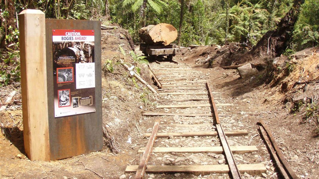
Follow an old tramline (1898 - 1928) on a relatively flat track through the spectacular Waitawheta Gorge - with interpretation panels as well, it's a great option for kids.
The route
Follow the Waitawheta Tramway, stopping at the various information signs to find out when, why and how the tramway was built. The tramway is relatively flat, and nice and wide. After about an hour and a half the track crosses a large suspension bridge to the site of a replica logging bogie (a tram cart that carried the massive logs). This is a great spot for lunch and to spend time taking photographs. A short loop track near to the logging bogie offers a detour to the site of an electricity pylon dating from around the year 1900. To complete a shorter, easier trip, return from the logging bogie back down the tramway to the car park. Alternatively, continue south along the tramline through the spectacular Waitawheta Gorge. The main track requires one river crossing but there is a bypass track that requires just a few small side stream crossings. The main track then leaves the river and through a campsite before reaching the toilet bowl waterfall, the Waitawheta Hut, and the site of the old logging mill. Return via the same track, or spend the night to explore more of the park.
Family friendly option
A shorter walk with no river crossings can be taken, just over an hour up the tramway to the site of a replica logging bogie which shows how kauri were transported down the valley. This trip takes in the lower tramway with information boards explaining the story of kauri logging here, before returning the same way to the car park. Suitable for older children.
Source: DOC Te Papa Atawhai.
Know before you go
No mountain biking
Mountain biking is not allowed on this track. Find places where you can mountain bike .
Source: DOC Te Papa Atawhai.
On this track
In walking order.


Nearby stops
Hardys Hut
Waikato • 4.5 km
Te Rereatukahia Hut
Serviced • 12 bunks • Bay of Plenty • 8.7 km
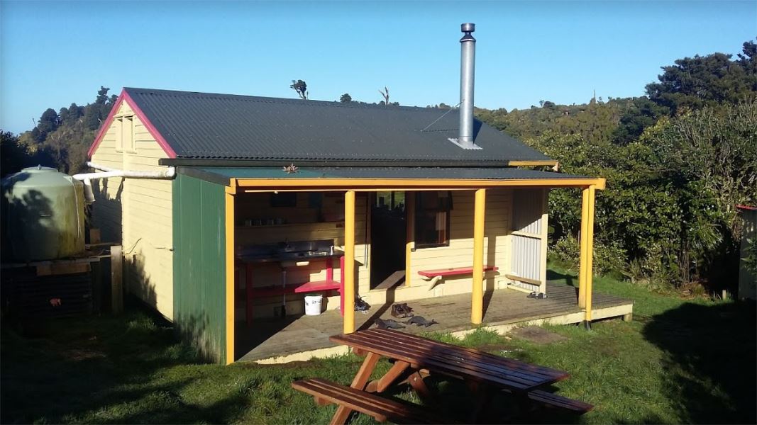
Te Rereatukahia Hut is a serviced 12-bunk hut located in the Bay of Plenty region. Bookings must be made online in advance.
Heating • Mattresses • Toilets - non-flush
Te Aroha Holiday Park
Waikato • 8.8 km
Freedom Camping for Self Contained Vehicles
Waikato • 8.9 km
This campsite in the Waikato region is designated for self-contained vehicles only. No other facilities or details are provided in the available records.
Dickey Flat Adventure Camp
Waikato • 9.3 km
Walks nearby
Daly's Clearing Loop Track
Advanced • 4 hr • 7.5 km • 3.8 km away
Waipapa Track to Waitawheta Hut
Advanced • 3 hours • 3.98 km away
High-Level Pack Track
Advanced • 2 hr 30 min • 4.3 km • 4.87 km away
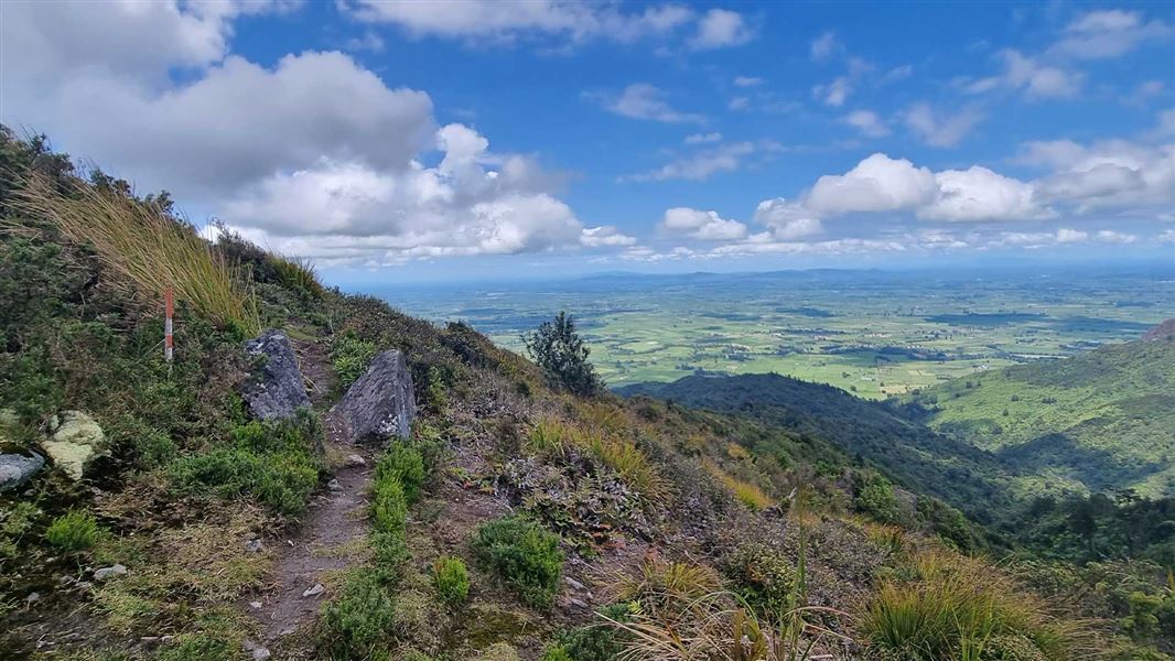
Pylon Peak Summit Loop
Advanced • 6-7 hr • 4.4 km to the summit, 13.7 km • 4.87 km away
Tui Mine Track (from Te Aroha Summit to town)
Advanced • 3 hr 30 min from summit one way • 8.4 km from summit • 5.13 km away
Notes from people who have been
No notes yet. If you have been, say what you found.
Something missing or out of date?
Closed, moved, wrong facts, or something we have missed? Travellers keep the Road Guide up to date. Tell us what you found at contribute@parkup.nz and we will check it and add it.
Ask us to take this down
A person reads every request. We do not remove a place until we have checked it.
Sources
- DOC Tracks (API) · CC BY 4.0Crown Copyright: Department of Conservation Te Papa Atawhai. Data sourced from the DOC Developer Portal (api.doc.govt.nz).