Tongariro Northern Circuit
WalkManawatū-Whanganui
- Grade
- Expert
- Walking time
- 4 days
- Distance
- 35.5 km
- Dogs
- No dogs
Access: read before you go
Overnight parking in Whakapapa Village requires a free parking permit -contact the Tongariro National Park Visitor Centre to organise this.
Flying a drone without a permit is strictly prohibited. Drone use on conservation land
Source: DOC Te Papa Atawhai.
Getting there
We have not checked a road end or car park for this place yet, so we do not give driving directions to it. Check how to get there before you go. Some routes cross private land and need the landowner's permission.
How to get there, on doc.govt.nzFor the 2026/27 Great Walk season the track starts at Mangatepopo Carpark and ends in Whakapapa Village.
Parking at Mangatepopo Carpark is limited to 4 hours during the Great Walk season. It's best to park in Whakapapa Village and take a shuttle to the start or arrange a shuttle from a nearby town. Find a shuttle provider
Overnight parking in Whakapapa Village requires a free parking permit -contact the Tongariro National Park Visitor Centre to organise this.
Bus and train services stop in Waimarino (National Park Village), 15 km from Whakapapa Village.
Source: DOC Te Papa Atawhai.
Map and tracks
Track lines: DOC Te Papa Atawhai. Map data © OpenStreetMap contributors. Topo map: LINZ, CC BY 4.0. 39.14575° S, 175.63004° E
About this place
Explore the volcanic heart of Tongariro National Park, a landscape of stark glacial contrasts and alpine views. From May to late October, conditions can be challenging – only go if you have the skills.
The route
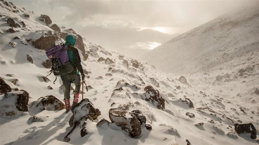
May to late October (winter season): Walking the track outside the Great Walks season should only be attempted if you have alpine skills, equipment and experience.
Walking options
The Tongariro Northern Circuit can be walked either direction. Most walkers take 4 days/3 nights or 3 days/2 nights. Very fit people can walk it in 2 days/1 night, but each day is at least 8 hours. Climbing the peaks of Mounts Ngauruhoe and Tongariro is disrespectful and unacceptable to Ngāti Tūwharetoa. Ngāti Tūwharetoa are the iwi who made the tuku/gift of these sacred peaks to Aotearoa New Zealand.
Places to stay
There are three huts with campsites nearby along the Tongariro Northern Circuit. These need to be booked year-round. Camping is not allowed within 500 m of this track. Huts have bunks, mattresses, heating, toilets, basic gas cooking facilities, solar-powered lighting and cold running water. A DOC ranger is present. The huts do not provide food, cooking utensils or showers. Outside the Great Walks season, there are not resident hut warden or gas cooking facilities.
Whakapapa Village to Mangatepopo Hut
Time: 3-5 hr, weather dependent
9.4 km This section of track is closed due to the 2025 Tongariro fire and will not be available for the 2026/27 Great Walk season. The map has been updated to show this change and the distance reduced to 35.5 km from 44.9 km. We recommend starting your walk from the Mangatepopo Carpark. Find information about parking and getting to the start of the track in the Getting there section.
Mangatepopo Carpark to Mangatepopo Hut
Time: 25 min
1.7 km It is just 25 minutes’ walk on a well-formed track from Mangatepopo car park to the hut, making it a perfect tramp for many ages and abilities. You can enjoy the incredible landscapes of Mangatepopo Valley from the hut, or on the Soda Springs Walk.
Mangatepopo Hut to Emerald Lakes
Time: 3 hr 30 min
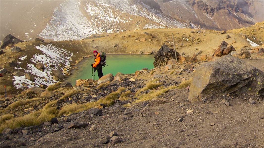
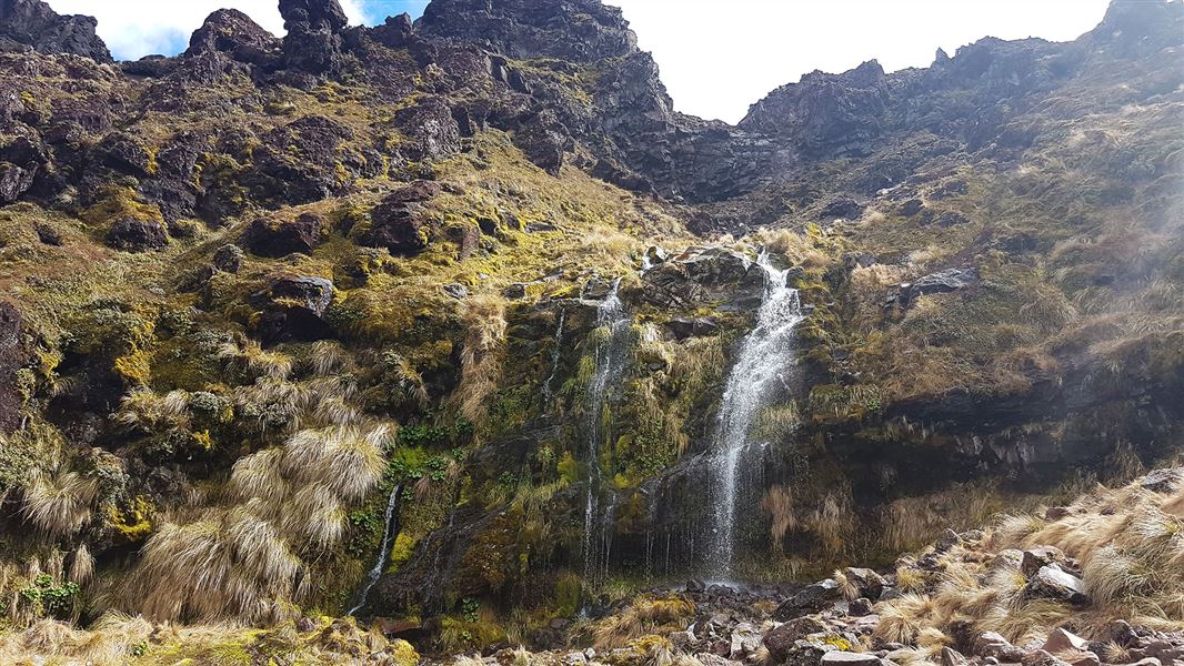
km The track follows Mangatepopo stream up the valley, climbing over a succession of old lava flows from Ngauruhoe. The youngest, very black, lava flows were erupted from Ngauruhoe in 1949 and 1954. A five minute detour at the head of the valley leads to the cold Soda Springs and waterfall, which emerge beneath an old lava flow. In spring and summer moisture loving plants such as white foxgloves and yellow buttercups thrive in the area. The steep climb required to reach the Mangatepopo Saddle rewards climbers views of the valley and if clear, Mt Taranaki to the west. From the saddle the track crosses South Crater, not a true crater but a drainage basin between the surrounding volcanic landforms. Ahead more recent lava flows can be seen spilling over from Red Crater. The climb up to Red Crater offers splendid views of Oturere Valley and Kaimanawa Ranges to the east. Loose rocks and stones on the steep slopes of Red Crater present a major slip hazard - walkers are advised to extra time and care. The main track continues on past the rim of Red Crater itself. The spectacular formation on the far side of the crater is a dike, an old magma feeding pipe to the vent of the volcano. Harder than the ash and scoria around it erosion has left it exposed on the side of the crater. North Crater is the large flat topped crater to the north. This vent once contained a lava lake which cooled to infill the crater. Blue Lake is visible from the top of Red Crater, across the Central Crater - which like South Crater is actually another drainage basin. Blue Lake has formed where cold fresh water fills an old vent. A loose, rocky ridge leads down to the spectacular Emerald Lakes, which fill old explosion pits. Their brilliant colouring is caused by minerals washed down from the thermal area of Red Crater. The Tongariro Alpine Crossing continues from Emerald Lakes to Ketetahi Road.
Emerald Lakes to Oturere Hut
Time: 1 hr 30 min
km From Emerald Lakes the track descends steeply into the Oturere Valley with views of the valley, the Kaimanawa Ranges and the Rangipo Desert. The track weaves through an endless variety of unusual jagged lava forms from early eruptions from Red Crater which filled Oturere Valley. A magical place to visit especially on a misty day. The Oturere Hut is nestled on the eastern edge of these flows. There is a pretty waterfall over the ridge from the hut.
Oturere Hut to Waihohonu Hut
Time: 3 hr
8.1 km After leaving Oturere Hut the track undulates over a number of stream valleys and open gravel fields. Plant life here has been constantly repressed by volcanic eruptions, altitude and climate. Loose gravel means that recolonisation by plants is a slow process on the open and bare countryside. The track gradually sidles around the foot hills of Ngauruhoe descending into a valley and crossing one of the branches of the Waihohonu Stream. Continue through a beech clad valley before climbing towards the ridge top. Waihohonu Hut is in the next valley.
Waihohonu Hut to Whakapapa Village
Time: 5 hr
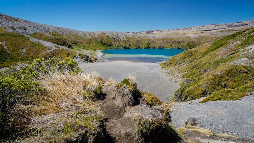
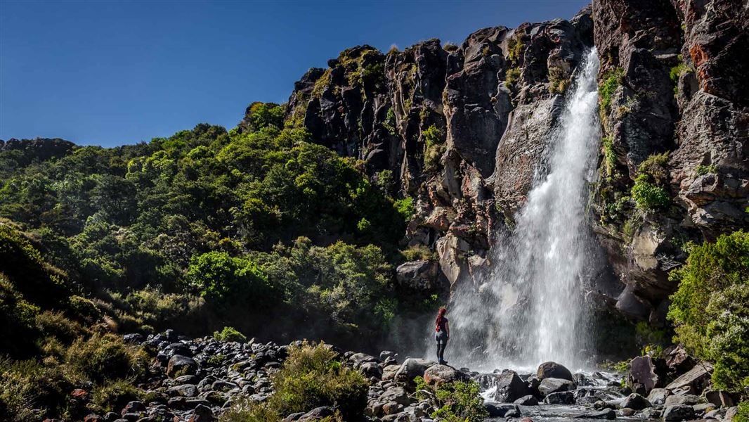
15.4 km The track follows the Waihohonu stream and gradually climbs to Tama Saddle. This area can be windy as it sits between the mountains. From the saddle there is a very worthwhile side trip to the striking Tama Lakes, two infilled explosion craters. The lower lake is only 10 minutes from the junction, while the upper lake is up a steep ridge, taking 1 hour 30 minutes return. Whakapapa Village is about two hours from the Tama Lakes junction. After the first hour the track meets the Taranaki Falls loop walk, one of the best short walks in the Park. There are two options to return to the village, both take about an hour. To view the waterfall, follow the lower section of the track down the steps to its base, then follow the Wairere stream through beautiful mountain beech forest back to the village. Alternatively take the upper section of track through open tussock and shrubland back to the village.
Side trip: Ohinepango Springs
Time: 1 hr return from Waihohonu Hut
Crystal clear cold water bubbles up from beneath the old lava flow and discharges at an enormous rate into the Ohinepango Stream. The springs are signposted on the Round the Mountain Track heading south towards Rangipo Hut.
Side trip: Historic Waihohonu Hut
Time: 20 min return from Waihohonu Hut; 10 min return from the Tongariro Northern Circuit Track
Built in 1903/04, this was the first hut built in Tongariro National Park. It's the oldest example of a typical early two-room mountain hut in New Zealand. Historic Waihohonu Hut .
Side trip: Tama Lakes
Time: 20 min return to Lower Tama from the junction, 1 hr 30 min return to Upper Tama from the junction.
Access half way between Waihohonu Hut and Whakapapa Village. Tama Lakes, two infilled explosion craters, are named after Tamatea, the high chief of the Takitimu Canoe, who explored the area six centuries ago. The lower lake (at 1200 m), is 10 minutes from the junction. Volcanic debris is slowly washing in and filling the crater. The upper lake (at 1314 m) is a further 40 minutes up a steep ridge. This beautiful lake is reputed to be very deep.
Source: DOC Te Papa Atawhai.
Know before you go
The terrain is difficult
Most of the track is open, difficult, exposed and on uneven surfaces. Track is not recommended for children under the age of 10. The track travels over exposed mountainous landscapes and often with adverse weather conditions. Extra caution is needed descending the 400 m section of the Tongariro Northern Circuit track that drops from the lowest Emerald Lake down into the Oturere Valley, towards Oturere hut. This section comprises of steep and slippery sections, with small rocks covering the hard lava surface. The rocks are often sharp and it tends to be most slippery in dry conditions.
Be prepared for all weather conditions
Weather can change suddenly, from warm and sunny to cold and wet with strong winds. Dress warmly as wind-chill can be severe. Be prepared for all conditions. Check the Tongariro National Park weather forecast (NIWA website).
There are several active volcanic vents
The Tongariro Northern Circuit traverses an active volcanic area. Although unlikely, eruptions can occur at any time. Volcanic monitoring and public safety management systems help manage risk but cannot guarantee your safety. If you are uncomfortable with this risk, choose a different track. Visit our volcanic risk page for more information.
Mobile reception varies
Mobile reception is reasonably good along the track, but there are sections with no coverage. Generally there is no or very limited mobile coverage at Waihohonu Hut.
Tongariro Alpine Crossing booking system
We recommend runners who plan to complete the circuit in a day book to use the Tongariro Alpine Crossing track. Track users with a Tongariro Northern Circuit hut or campsite booking do not need to make a booking for the Tongariro Alpine Crossing. Book to use any part of the Tongariro Alpine Crossing . Read about why a booking is needed and sustainable visitor management for Tongariro .
No drones
Flying a drone without a permit is strictly prohibited. Drone use on conservation land
Source: DOC Te Papa Atawhai.
Joins these tracks
Source: DOC Te Papa Atawhai.
On this track
In walking order.

Mangatepopo Hut
Great Walk • 20 bunks • Manawatū-Whanganui
- Toilet
- Heating
- Water

Waihohonu Hut
Great Walk • 28 bunks • Waikato
- Toilet
- Heating
- Water

Mangatepopo Campsite
Great Walk • Manawatū-Whanganui
- Toilet
- Water

Oturere Campsite
Great Walk • Waikato
- Toilet
- Water

Waihohonu Campsite
Great Walk • Waikato
- Toilet
- Water
Old Waihohonu Hut
Waikato
Nearby stops
Whakapapa Holiday Park
Serviced • Manawatū-Whanganui • 10 km
Whakapapa Holiday Park is a campsite set in a mountain beech forest beside a stream. It serves as a base for short walks within the national park, with skiing…
BBQ • Cookers/electric stove • Non-powered/tent sites
Whakapapa Holiday Park cabins and lodge
Manawatū-Whanganui • 10 km
Tongariro Holiday Park
Manawatū-Whanganui • 11.3 km
Tongariro Holiday Park is a campsite located in the Manawatū-Whanganui region. It provides basic accommodation for visitors exploring the surrounding area.
Cross X Roads
Manawatū-Whanganui • 11.6 km
Christiania Hut
Manawatū-Whanganui • 11.9 km
Christiania Hut is a basic shelter located in the Manawatū-Whanganui region. It provides a simple overnight stop for hikers and outdoor enthusiasts in the area.
Walks nearby
Tongariro Alpine Crossing
Intermediate • Nov-Apr: 7-8 hr | May-Oct: 9 hr • 20.2 km • 0.8 km away
Soda Springs Walk
Easy • 2 hr return • 6 km • 2.41 km away
Tama Lakes Track
Intermediate • 5-6 hr (to Lower Tama Lake) • 17. 6 km • 6.79 km away
Taranaki Falls Walk
Easy • 2 hr • 6 km • 9.1 km away
Ridge Track
Easy • 40 min • 1.2 km • 9.86 km away
Something missing or out of date?
Closed, moved, wrong facts, or something we have missed? Travellers keep the Road Guide up to date. Tell us what you found at contribute@parkup.nz and we will check it and add it.
Ask us to take this down
A person reads every request. We do not remove a place until we have checked it.
Sources
- DOC Tracks (API) · CC BY 4.0Crown Copyright: Department of Conservation Te Papa Atawhai. Data sourced from the DOC Developer Portal (api.doc.govt.nz).