Waihohonu Hut
Great Walk hutTongariro National Park, WaikatoOpen
- Sleeps
- 28 bunks
- Booking
- Can book
- Cost
- Fee applies
- Heating
- Yes
- Drinking water
- Boil first
- Toilet
- Non-flush
Getting there
We have not checked a road end or car park for this place yet, so we do not give driving directions to it. Check how to get there before you go. Some routes cross private land and need the landowner's permission.
How to get there, on doc.govt.nzThere are multiple ways to access this hut, but if you are going for an overnight experience, we recommend starting at Whakapapa Village.
For the first hour, follow the Taranaki Falls loop walk. Take the lower section of track to pass Taranaki Falls.
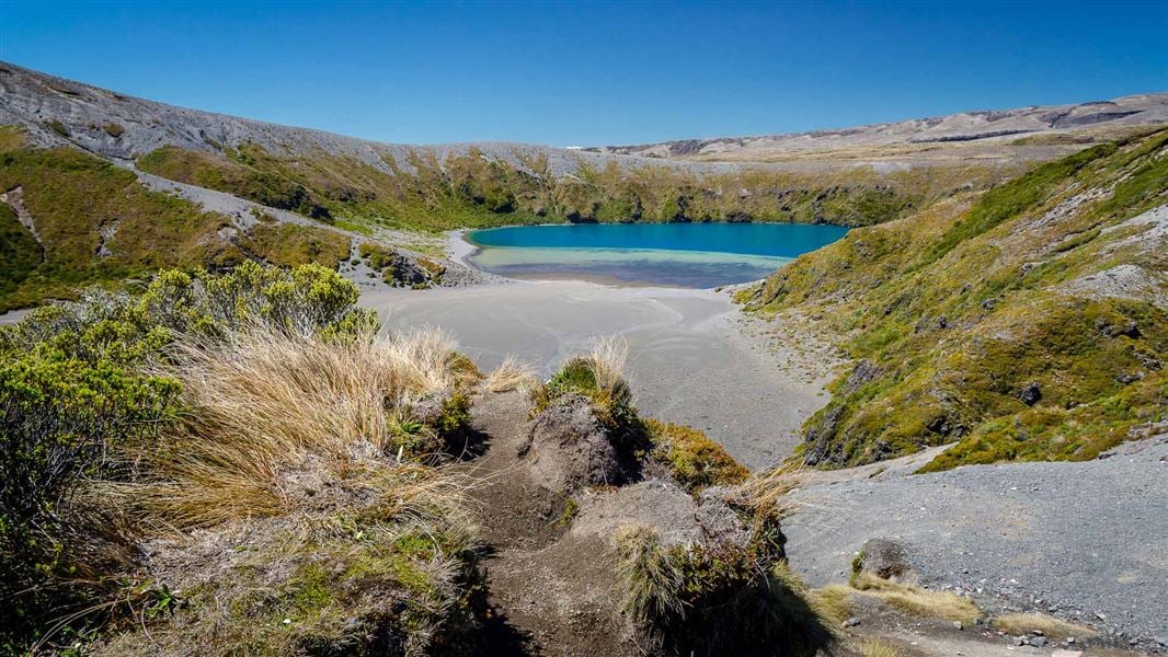
The track then climbs to Tama Saddle. This area can be windy as it sits between the mountains. You can take a short detour (20 minutes return) to see Lower Tama Lake, an explosion crater now filled with water.
The track then descends from the saddle, following Waihohonu Stream to Waihohonu Hut. Return to Whakapapa Village the way you came.
- Topo map
- Topo50 sheet BJ35
Source: DOC Te Papa Atawhai.
Map and tracks
Track lines: DOC Te Papa Atawhai. Map data © OpenStreetMap contributors. Topo map: LINZ, CC BY 4.0. 39.20949° S, 175.67988° E
About this place
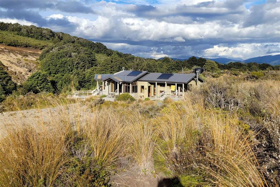
This is a 28-bunk hut located on the Tongariro Northern Circuit Great Walk.
On the way here
Round the Mountain Track · 4 - 6 days
Places to stay
There are six huts available on the Round the Mountain Track: Waihohonu, Rangipo, Mangaehuehu, Blyth, Mangaturuturu and Whakapapaiti. There is also a campsite at Waihohonu. Waihohonu Hut and Campsite require advance booking in the Great Walks season. Book all huts before you start hiking. Hut rangers are not present, although DOC rangers do periodically check facilities. There is a resident Hut Warden at Waihohonu Hut during the Great Walks season. Camping outside the designated campsites is allowed in the National Park, except:
Whakapapa Village to Waihohonu Hut
Time: 5 hr 30 min
14.3 km The track begins along Ngauruhoe Place, 100 m below Whakapapa Visitor Centre. There are two options. The Lower Taranaki Falls Track crosses tussock and shrubland before following the Wairere Stream through mountain beech forest to the base of Taranaki Falls. On leaving the falls, the track climbs a set of steps and brings you to the junction with the Upper Taranaki Falls Track (1 hr, 25 min to this point). Alternatively, the Upper Taranaki Falls track takes you over tussock and shrubland to the same point in 1 hr. After leaving the Taranaki Falls Track, it is a further 2 hr to Tama Saddle and Tama Lakes junction. From here a side trip can be made to the Tama Lakes. Tama Saddle is exposed and conditions can be windy in bad weather. From Tama Saddle the track gradually descends for 2.5 hr down the Waihohonu Stream to Waihohonu Hut. A side trip can be made from the Round the Mountain track to the historic Waihohonu Hut, about 10 minutes before you reach the new Waihohonu Hut.
Side trip: Historic Waihohonu Hut
Time: 20 min return from the new Waihohonu Hut, 10 min return from the Round the Mountain Track, 3 hr (6.3 km) return from Desert Road (State Highway 1)
Built in 1903/04, this was the first hut built in Tongariro National Park. It's the oldest example of a typical early two-room mountain hut in New Zealand. Historic Waihohonu Hut
Waihohonu Hut to Rangipo Hut
Time: 5 hr
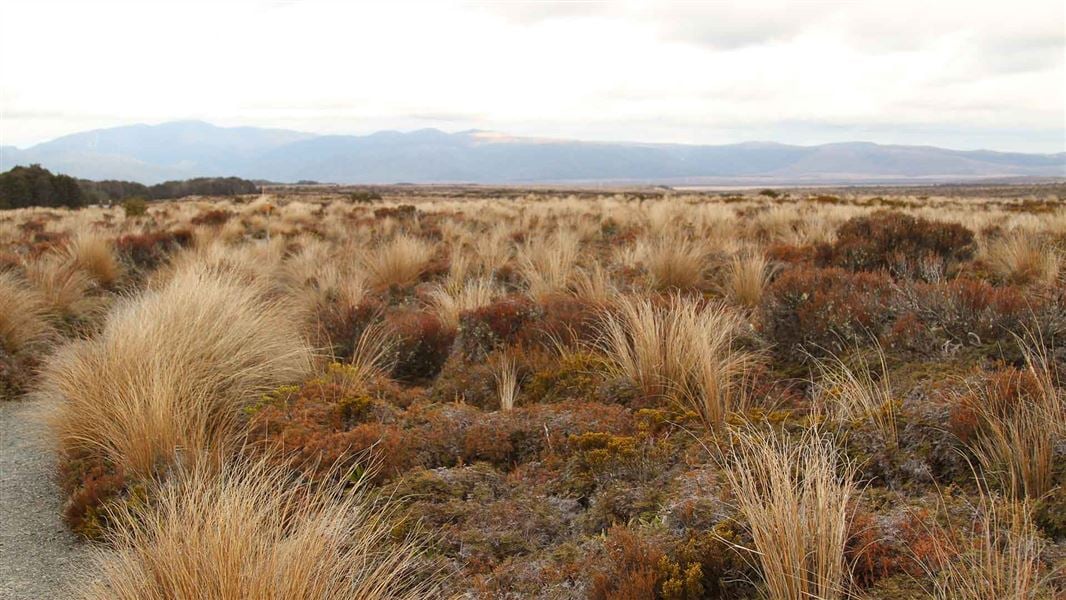
12.5 km The track from Waihohonu Hut to Rangipo Hut is in one of the most unique areas in the park. It is the only true desert landscape in the North Island, and as such, features vast plains of wind sculptured sands and volcanic rock. The Rangipo Desert is dryer than most areas in Tongariro National Park as it is sited in the rain shadow to the east of Mt Ruapehu. The track passes Ohinepango Springs then traverses the eastern side of Ruapehu, past the Tukino Mountain Road, the Whangaehu River, eventually arriving at Rangipo Hut. The hut is perched on the southern edge of the desert with views east to the Kaimanawa mountains.
Tongariro Northern Circuit · 3-4 days
Oturere Hut to Waihohonu Hut
Time: 3 hr
8.1 km After leaving Oturere Hut the track undulates over a number of stream valleys and open gravel fields. Plant life here has been constantly repressed by volcanic eruptions, altitude and climate. Loose gravel means that recolonisation by plants is a slow process on the open and bare countryside. The track gradually sidles around the foot hills of Ngauruhoe descending into a valley and crossing one of the branches of the Waihohonu Stream. Continue through a beech clad valley before climbing towards the ridge top. Waihohonu Hut is in the next valley.
Waihohonu Hut to Whakapapa Village
Time: 5 hr
15.4 km The track follows the Waihohonu stream and gradually climbs to Tama Saddle. This area can be windy as it sits between the mountains. From the saddle there is a very worthwhile side trip to the striking Tama Lakes, two infilled explosion craters. The lower lake is only 10 minutes from the junction, while the upper lake is up a steep ridge, taking 1 hour 30 minutes return. Whakapapa Village is about two hours from the Tama Lakes junction. After the first hour the track meets the Taranaki Falls loop walk, one of the best short walks in the Park. There are two options to return to the village, both take about an hour. To view the waterfall, follow the lower section of the track down the steps to its base, then follow the Wairere stream through beautiful mountain beech forest back to the village. Alternatively take the upper section of track through open tussock and shrubland back to the village.
Side trip: Historic Waihohonu Hut
Time: 20 min return from Waihohonu Hut; 10 min return from the Tongariro Northern Circuit Track
Built in 1903/04, this was the first hut built in Tongariro National Park. It's the oldest example of a typical early two-room mountain hut in New Zealand. Historic Waihohonu Hut .
Side trip: Tama Lakes
Time: 20 min return to Lower Tama from the junction, 1 hr 30 min return to Upper Tama from the junction.
Access half way between Waihohonu Hut and Whakapapa Village. Tama Lakes, two infilled explosion craters, are named after Tamatea, the high chief of the Takitimu Canoe, who explored the area six centuries ago. The lower lake (at 1200 m), is 10 minutes from the junction. Volcanic debris is slowly washing in and filling the crater. The upper lake (at 1314 m) is a further 40 minutes up a steep ridge. This beautiful lake is reputed to be very deep.
Source: DOC Te Papa Atawhai.
Trip options
Walking times come from DOC track descriptions, added up leg by leg from car-accessible trailheads. Nights and return times are ParkUp estimates, allowing about 8 hours of walking a day.
8 options · 1 to 4 nights
Whakapapa Village
Tracks used: Round the Mountain Track → Tongariro Northern Circuit
Walking in
5 hr
Walking out
5 hr 30 min to Whakapapa Village
Tracks used: Round the Mountain Track → Tongariro Northern Circuit
Walking in
5 hr 30 min
Walking out
5 hr to Whakapapa Village
Walking in
5 hr 30 min
Walking out
5 hr 30 min to Whakapapa Village
Source: DOC Te Papa Atawhai track descriptions.
Fees and bookings
In the Great Walks season, book Waihohonu Hut online or contact the Tongariro National Park Visitor Centre. In the Great Walks season: book Waihohonu Hut online , or contact the Tongariro National Park Visitor Centre. Read the terms and conditions before you book. Outside the Great Walks season, bookings are still required but are at a reduced rate and have reduced services. If no availability shows online for your dates, the hut is fully booked. No spaces are kept for visitors arriving without a booking. Phone and in person bookings made at a visitor centre incur a $10 service fee. Same day bookings are available online until 8 pm if spaces remain.
Source: DOC Te Papa Atawhai.
On these tracks
Source: DOC Te Papa Atawhai.
Nearby stops

Waihohonu Campsite
Great Walk • Waikato • 0.1 km
Waihohonu Campsite is a walk-in campsite located on the Tongariro Northern Circuit and the Round the Mountain Track in the Waikato region. Bookings are…
Non-powered/tent sites • Water from tap - not treated, boil before use • Toilets - non-flush
Old Waihohonu Hut
Waikato • 0.6 km
Old Waihohonu Hut is a hut located in the Waikato region. The available records provide no further details regarding its facilities or specific location.

Oturere Campsite
Great Walk • Waikato • 5.7 km
Oturere Campsite is a walk-in campsite on the Tongariro Northern Circuit in the Waikato region. Bookings are required during the Great Walks season.
Non-powered/tent sites • Water from tap - not treated, boil before use • Toilets - non-flush

Mangatepopo Campsite
Great Walk • Manawatū-Whanganui • 10.2 km
Mangatepopo Campsite is a walk-in campsite located on the Tongariro Northern Circuit. Bookings are required during the Great Walks season.
Water from tap - not treated, boil before use • Toilets - non-flush • Toilets

Mangatepopo Hut
Great Walk • 20 bunks • Manawatū-Whanganui • 10.2 km
Mangatepopo Hut is a 20-bunk hut located on the Tongariro Northern Circuit in Ruapehu.
Cooking • Heating • Mattresses
Walks nearby
Historic Waihohonu Hut Track
Advanced • 1 hr 40 min one way • 6.3 km • 2.64 km away
Tama Lakes Track
Intermediate • 5-6 hr (to Lower Tama Lake) • 17. 6 km • 8.1 km away
Tongariro Alpine Crossing
Intermediate • Nov-Apr: 7-8 hr | May-Oct: 9 hr • 20.2 km • 9.06 km away
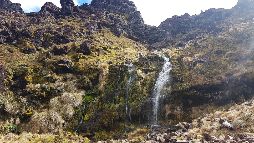
Soda Springs Walk
Easy • 2 hr return • 6 km • 9.96 km away
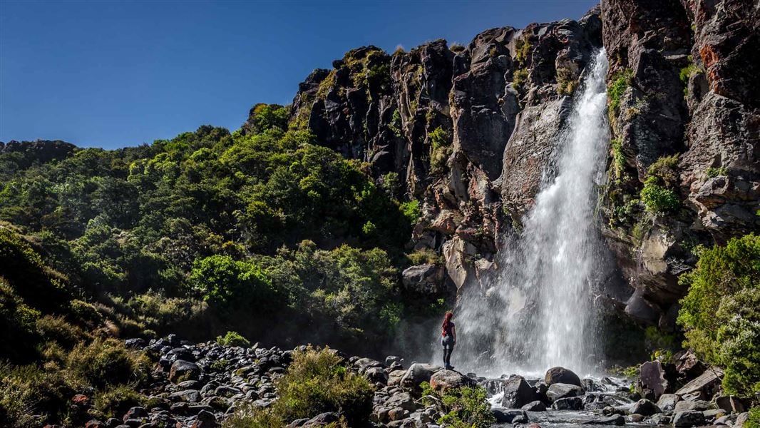
Taranaki Falls Walk
Easy • 2 hr • 6 km • 11.06 km away
Contact
Tongariro National Park Visitor Centre
Whakapapa Village, State Highway 48, Mount Ruapehu 3951
Regional DOC service centre.
Notes from people who have been
No notes yet. If you have been, say what you found.
Something missing or out of date?
Closed, moved, wrong facts, or something we have missed? Travellers keep the Road Guide up to date. Tell us what you found at contribute@parkup.nz and we will check it and add it.
Ask us to take this down
A person reads every request. We do not remove a place until we have checked it.
Sources
- OpenStreetMap Huts · ODbL (Open Database License)Contains information from OpenStreetMap, made available under the ODbL.
- DOC Huts · CC BY 4.0Data sourced from the Department of Conservation (DOC), New Zealand.
- DOC Huts (API) · CC BY 4.0Crown Copyright: Department of Conservation Te Papa Atawhai. Data sourced from the DOC Developer Portal (api.doc.govt.nz).