Maori Saddle Hut
Standard hutHaast, Paringa and Moeraki rivers area, West CoastOpen
- Sleeps
- 10 bunks
- Booking
- Not bookable
- Cost
- from $15
- Heating
- Yes
- Drinking water
- Boil first
- Toilet
- Non-flush
Getting there
We have not checked a road end or car park for this place yet, so we do not give driving directions to it. Check how to get there before you go. Some routes cross private land and need the landowner's permission.
How to get there, on doc.govt.nz- Topo map
- Topo50 sheet BY13
- Grid reference
- E1300293, N5141961
Source: DOC Te Papa Atawhai.
Map and tracks
Track lines: DOC Te Papa Atawhai. Map data © OpenStreetMap contributors. Topo map: LINZ, CC BY 4.0. 43.81428° S, 169.27424° E
About this place
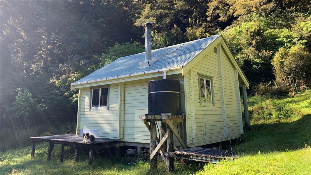
This is a standard 10-bunk hut in the South Westland area.
On the way here
Historic Haast to Paringa Cattle Track · 3 days
Blowfly Hut to Māori Saddle Hut
Time: 4 hr 30 min
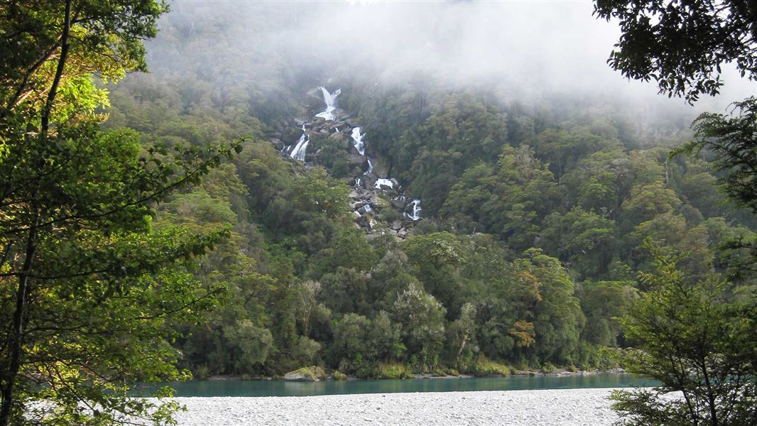
The track to Māori Saddle winds its way steadily uphill through mixed beech, rimu and kāmahi forest, typical of southern Westland. Along the way, you'll pass some good examples of stone culverts built by the mica miners. There's also a historic miner’s campsite near the helipad, 5 minutes before the Mica Mine Tops Route junction. Continuing towards Māori Saddle, sections of the track are quite rough – in heavy rain, access becomes more difficult due to the numerous stream crossings. Crossings are marked, but the rocks are very slippery, so take care. There are some diversions where slips have destroyed the original track, however, these are well marked and should not be difficult to follow. There are some very large specimens of beech trees along this section. There are also some relics of the historic ‘telegraph line’ that ran beside the track. There is a known active slip about 2 hours after Blowfly Hut, at Thompson Creek (N1301968, E5142768). This creates steep access into a fast-flowing river, so needs extreme caution to cross safely and can become impassible during heavy rain.
Source: DOC Te Papa Atawhai.
Know before you go
Stay safe when crossing rivers and streams
If you plan to cross unbridged rivers or side streams, know how to cross safely and be prepared for if you cannot cross. Do not cross if the river or stream is flooded, you cannot find safe entry and exit points or are unsure it’s safe. Turn back or wait for the river to drop. If in doubt, stay out. How to cross rivers safely NIWA river flow forecasts: View a video of national followed by regional river flows
Source: DOC Te Papa Atawhai.
Trip options
Walking times come from DOC track descriptions, added up leg by leg from car-accessible trailheads. Nights and return times are ParkUp estimates, allowing about 8 hours of walking a day.
1 option · 1 night
SH6
Walking in
6 hr (via Blowfly Hut)
Walking out
6 hr to SH6 (via Blowfly Hut)
Source: DOC Te Papa Atawhai track descriptions.
Fees and bookings
Before you go, buy Hut Tickets for each night's stay. Put these in the honesty box at the hut. Or buy a Backcountry Hut Pass that gives unlimited use at most Standard and Serviced huts for a 12 month period. Retailers that sell hut tickets and passes
Source: DOC Te Papa Atawhai.
Nearby stops
Blowfly Hut
Standard • 8 bunks • West Coast • 6.2 km
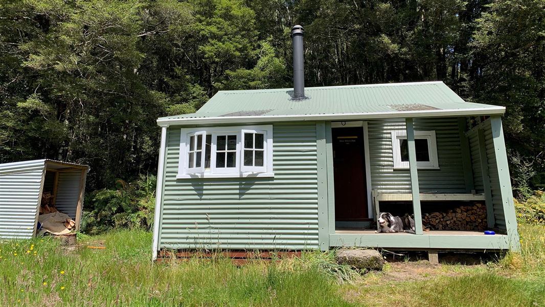
Blowfly Hut is a standard eight-bunk hut located in the South Westland Weheka Area on the West Coast.
Heating • Mattresses • Toilets - non-flush

Coppermine Creek Hut
Standard • 8 bunks • West Coast • 8.6 km
Coppermine Creek Hut is a standard eight-bunk hut located in the South Westland area of the West Coast region.
Heating • Mattresses • Toilets - non-flush
Saddle Hut
Otago • 96.4 km
Saddle Hut is a hut located in the Otago region. The provided records do not include specific details regarding its facilities or access.
Walks nearby
Contact
Awarua/Haast Visitor Centre
Regional DOC service centre.
Notes from people who have been
No notes yet. If you have been, say what you found.
Something missing or out of date?
Closed, moved, wrong facts, or something we have missed? Travellers keep the Road Guide up to date. Tell us what you found at contribute@parkup.nz and we will check it and add it.
Ask us to take this down
A person reads every request. We do not remove a place until we have checked it.
Sources
- DOC Huts · CC BY 4.0Data sourced from the Department of Conservation (DOC), New Zealand.
- DOC Huts (API) · CC BY 4.0Crown Copyright: Department of Conservation Te Papa Atawhai. Data sourced from the DOC Developer Portal (api.doc.govt.nz).
- OpenStreetMap Huts · ODbL (Open Database License)Contains information from OpenStreetMap, made available under the ODbL.