Forks Hut
Standard hutRuahine Forest Park, Manawatū-WhanganuiOpen
- Sleeps
- 6 bunks
- Booking
- Not bookable
- Cost
- from $15
- Heating
- Yes
- Drinking water
- Not drinkable
- Toilet
- Non-flush
Getting there
We have not checked a road end or car park for this place yet, so we do not give driving directions to it. Check how to get there before you go. Some routes cross private land and need the landowner's permission.
How to get there, on doc.govt.nzAccess across the farm is at the landowner's discretion, by prior arrangement only. DOC is unable to provide contact details for the landowner to members of the public wishing to access the Forest Park via the farm.
Other access options are limited. There is no public road that leads from Pohangina Valley East Road to the Forest Park.
- Topo map
- Topo50 sheet BL35
- Grid reference
- E1850495, N5555409
Source: DOC Te Papa Atawhai.
Map and tracks
Track lines: DOC Te Papa Atawhai. Map data © OpenStreetMap contributors. Topo map: LINZ, CC BY 4.0. 40.11390° S, 175.94004° E
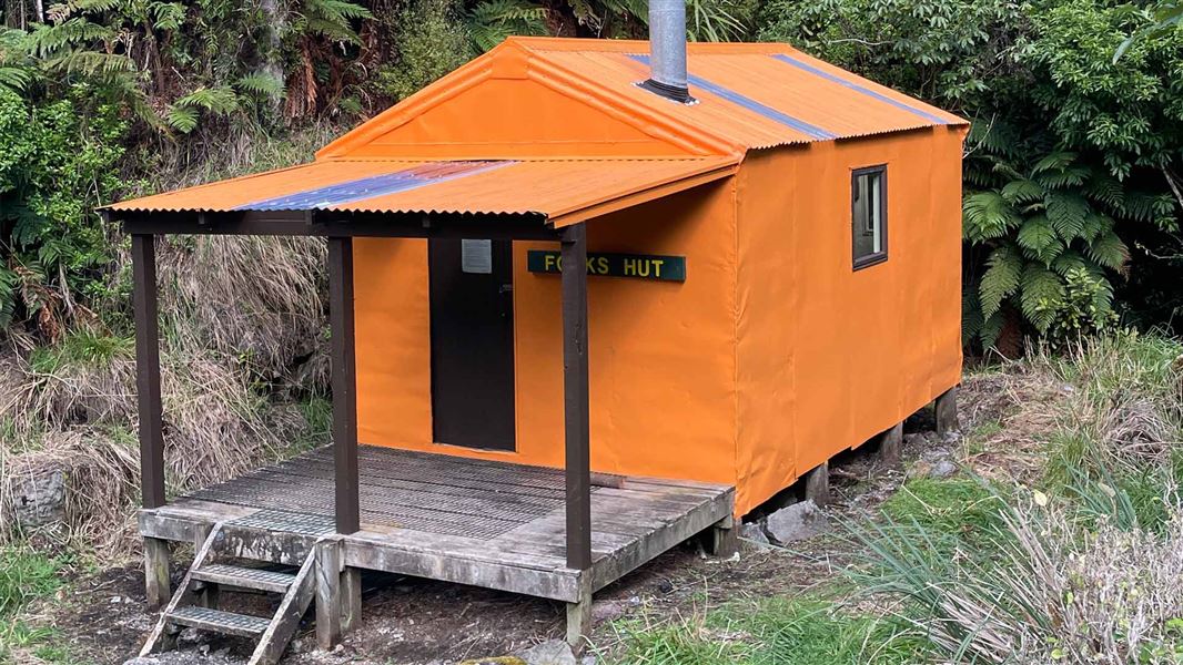
About this place
This is a standard six-bunk hut in the Manawatu.
On the way here
Wilkin Valley tracks · 4–5 days
Wilkin Road to Kerin Forks Hut
Time: 4–5 hr
km From Wilkin Road off SH6 make your way down to the Makarora River and cross with care, watching for soft sand. The Wilkin Valley Track is located on the true left of the Wilkin River. It is rough in places in the lower valley as it undulates through the forest before reaching Dans Flat and continuing up valley on open river flats. Kerin Forks Hut is located on the true right of the Wilkin, near its confluence with Siberia Stream. Trampers will need to pick a suitable point to cross the Wilkin River to the hut. Warning: Crossing the Makarora and Wilkin Rivers should only be attempted by parties with river-crossing experience. Be prepared to wait if the rivers are too high to cross. How to cross a river safely .
Kerin Forks Hut to Top Forks Hut
Time: 6 to 8 hr
km The track begins behind the Kerin Forks Hut , passing through beech/tawhai forest beside the Wilkin River and over several slips and steep-sided ravines that require care. It emerges at Wonderland flats, a good lunch stop halfway between the two huts. At the end of Wonderland flats the track re-enters the forest, then climbs and sidles above the river before descending to the Jumboland flats. From here the route is unmarked – follow the river flats to the junction of the north and south branches. When the river is low, an unmarked river route follows the true right, fording the river several times before reaching flats near the hut. If the river is high, follow track markers leading over a hill. The Top Forks Hut (600 m above sea level) is above the junction, on the true right of the river’s south branch.
Top Forks Hut to North Branch
Times: The North Branch is an excellent day trip. The track crosses the South Branch in front of the Top Forks Hut and follows the North Branch. Most of this section requires boulder hopping – slippery if wet – then crosses a small side stream that can be tricky to ford. The track enters the forest and climbs a predominant spur between the side stream and the North Branch to emerge at a small lake, the Disappearing Tarn. Five minutes further, just south of the track, Lake Diana nestles in sub alpine vegetation. Lake Lucidus, a spectacular moraine lake, is 20 minutes away across the grasslands. The track to Lake Castalia branches off the Lake Lucidus track just beyond the boardwalk. It crosses the outlet stream, then the North Branch, to climb through alpine vegetation then re-cross the North Branch to a snow grass terrace leading to Lake Castalia’s outlet. Take care scrambling over loose rock in the last 200 m.
Koranga Tawa Loop Track · 2 - 3 days
Moanui Road to Koranga Forks Hut
Time: 2–3 hr
The track to the Koranga Forks Hut runs alongside the Koranga River with opportunities for swimming. It's a good overnight tramp for families with children. The hut is situated in the fork of the Koranga and Kahunui streams. A swing bridge crosses the Koranga River 5 minutes from the hut.
Koranga Forks Hut to Tawa Hut
Time: 6–7 hr
The trip between the Koranga Forks Hut and the Tawa Hut is along the Kahunui Stream bed. The majority of the track is in the river, a large orange track marker on the true right indicates exit from the river onto the benched track that takes approximately 30 minutes to get to the Tawa Hut. The route between the two huts should not be attempted when river levels are high.
Anatoki and Historic Kill Devil Pack Tracks · 3-5 days
Road end to Anatoki Forks Hut
Time: 8 hr
km From the car park follow the markers and ford Go Ahead Creek before sidling up the hill to join onto an old benched gold miner’s track. Note: The land either side of the access track up to this point is private land – respect it and leave gates as you find them. The side creeks are deeply incised, steep and very rocky. They are not bridged and can be challenging to cross even in normal conditions – they are dangerous to cross when in flood. We strongly recommended that you do not to attempt this section in heavy rain. If you encounter a localised downpour that has caused a creek to rise, wait a short period while the level drops again (pack an emergency shelter so you can stay dry while waiting). Further on, beyond an old slip, the track passes through an area of regenerating forest before entering a mixed beech/ podocarp forest. The track then descends in a zigzag fashion to the Anatoki Bend. You are about half way to the hut. It is possible to camp here. From the Bend the track passes through many side gullies. Once at the Anatoki Forks Hut (standard hut, 6 bunks), you will see evidence of old gold workings in the area. The hut is notable for having running water and a wetback that can provide a hot shower.
Anatoki Forks Hut to Waingaro Forks Hut
Time: 7–10 hr
A short distance from the hut take the left branch at a junction to head towards Waingaro Forks Hut. (The right branch crosses the Anatoki River and climbs steeply towards Adelaide Tarn Hut.) The first 45 minutes follows the remains of water races. It is then a steady climb to the saddle, crossing and re-crossing a stream, before descending for 40 minutes to the Stanley River. Here lies a large clearing suitable for camping. Just less than one hour on from here and you reach the western end of Lake Stanley – formed in the Murchison earthquake in 1929. On the true right of the South Branch of the Stanley River, at the western end of Lake Stanley is Soper Shelter. A further hour and you reach the eastern end of the lake. The large slip here is still unstable, therefore it’s not safe to camp here. From here it is a further 3 hours – 3 hours 30 minutes onto the historic Waingaro Forks Hut. The track passes through forest and gravel flats and climbs to avoid the gorge before the junction of the Waingaro and Stanley Rivers.
Waingaro Forks Hut to road end
Time: 6–7 hr
km A 200 metre walk upstream leads to a swingbridge across the rocky gorge of the Waingaro River. The track passes through beech forest and steadily climbs, on an old pack track, up the Lockett Range. Two hours on from the hut Skeet Creek is reached. Replenish your water bottle here. Beyond here the vegetation type changes to a more open stunted shrub land. A further 20–30 minutes on, the turn-off to Riordans Hut is reached. From the turnoff it’s a further 30 minutes to Riordans Hut. Continuing on, the track passes through open vegetation providing good views along the Lockett Range. Look out for the restored Tin Hut, located in bush 60 metres below the track. The roof is visible from the track. The track then descends through regenerating bush, predominantly of gorse and bracken, in a series of zigzags, down the Kill Devil Ridge to the end of the track. Uruwhenua Road is reached and a further 3 kilometres will take you back to the State Highway near Lindsay’s Bridge.
The Old Ghost Road · 4 - 5 days
Goat Creek Hut to Mokihinui Forks Hut
Time: Mountain biking 1 - 2 hr, tramping 2 - 3 hr
km Travel through towering podacarp forest to reach the Mokihinui Forks Hut.
Mokihinui Forks Hut to Specimen Point Hut
Time: Mountain biking: 30 min - 1 hr, tramping: 1 - 1 hr 30 min
km From the Mokihinui Forks Hut turn left down into the head of the Mōkihinui River Gorge. The Mokihinui Lyell Backcountry Trust have built a hut at Specimen Point. Book by visiting the Old Ghost Road website .
Gillespie Pass Circuit · 3 - 4 days
Siberia Hut to Kerin Forks Hut
Time: 2 to 3 hr
km About 30 minutes down from Siberia Hut, travelling on the true left, the track to the Wilkin Valley enters the forest at the southern end of Siberia Flat. It sidles above the Siberia Gorge to descend in a series of zigzags to the Wilkin River (7 km, 2 to 3 hours). Kerin Forks Hut (340 m) can be seen 400 m downstream from the Siberia Stream/Wilkin River junction, at the western end of a large flat on the other side of the Wilkin. To access Kerin Forks Hut and the upper valley you must cross the Wilkin River which can be uncrossable following rain. If it has been raining or rain is in the forecast, consider how this will impact your ability to return across the Wilkin River.
Source: DOC Te Papa Atawhai.
Trip options
Walking times come from DOC track descriptions, added up leg by leg from car-accessible trailheads. Nights and return times are ParkUp estimates, allowing about 8 hours of walking a day.
13 options · 1 to 2 nights
Moanui Road
Walking in
3 hr
Walking out
3 hr to Moanui Road
Tracks used: Koranga Tawa Loop Track → Wilkin Valley tracks
Walking in
3 hr
Walking out
5 hr to Wilkin Road
Wilkin Road
Walking in
5 hr
Walking out
5 hr to Wilkin Road
Source: DOC Te Papa Atawhai track descriptions.
Fees and bookings
Before you go, buy Hut Tickets for each night's stay. Put these in the honesty box at the hut. Or buy a Backcountry Hut Pass that gives unlimited use at most Standard and Serviced huts for a 12 month period. Retailers that sell hut tickets and passes
Source: DOC Te Papa Atawhai.
On these tracks
Source: DOC Te Papa Atawhai.
Nearby stops

Kerin Forks Hut
Serviced • 10 bunks • Otago • 730.4 km
Kerin Forks Hut is a serviced 10-bunk hut located in the Wanaka/Makarora area of Otago.
Heating • Mattresses • Toilets - non-flush

Maketawa Hut
Serviced • 16 bunks • Taranaki • 182.7 km
Maketawa Hut is a DOC hut in the Taranaki region suitable for experienced trampers. It offers views of Taranaki Maunga from the deck.
Heating • Mattresses • Toilets - non-flush
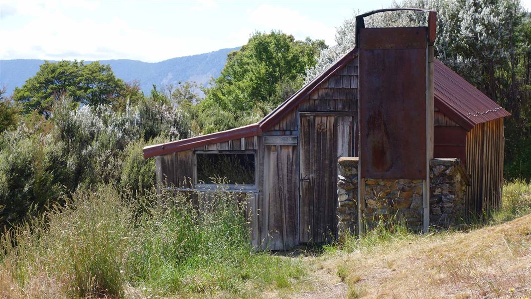
Riordans Hut
Basic/bivvies • 3 bunks • Tasman • 289.2 km
Riordans Hut is a basic 3-bunk hut located in the Golden Bay area of the Tasman region.
Heating • Mattresses • Toilets - non-flush
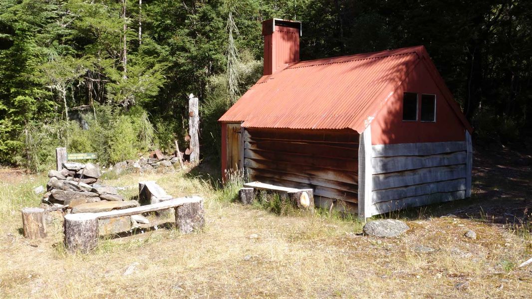
Waingaro Forks Hut
Basic/bivvies • 4 bunks • Tasman • 294.6 km
Waingaro Forks Hut is a basic 4-bunk hut located in the Golden Bay area of the Tasman region.
Heating • Mattresses • Toilets - non-flush
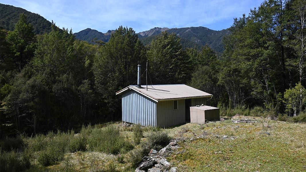
Anatoki Forks Hut
Standard • 6 bunks • Tasman • 296.2 km
Anatoki Forks Hut is a standard six-bunk hut located in the Golden Bay area of the Tasman region.
Heating • Mattresses • Toilets - non-flush
Walks nearby
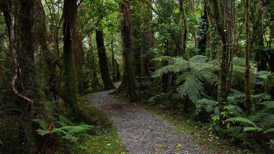
Kahikatea Walk
Easy • 20 min • 4.45 km away
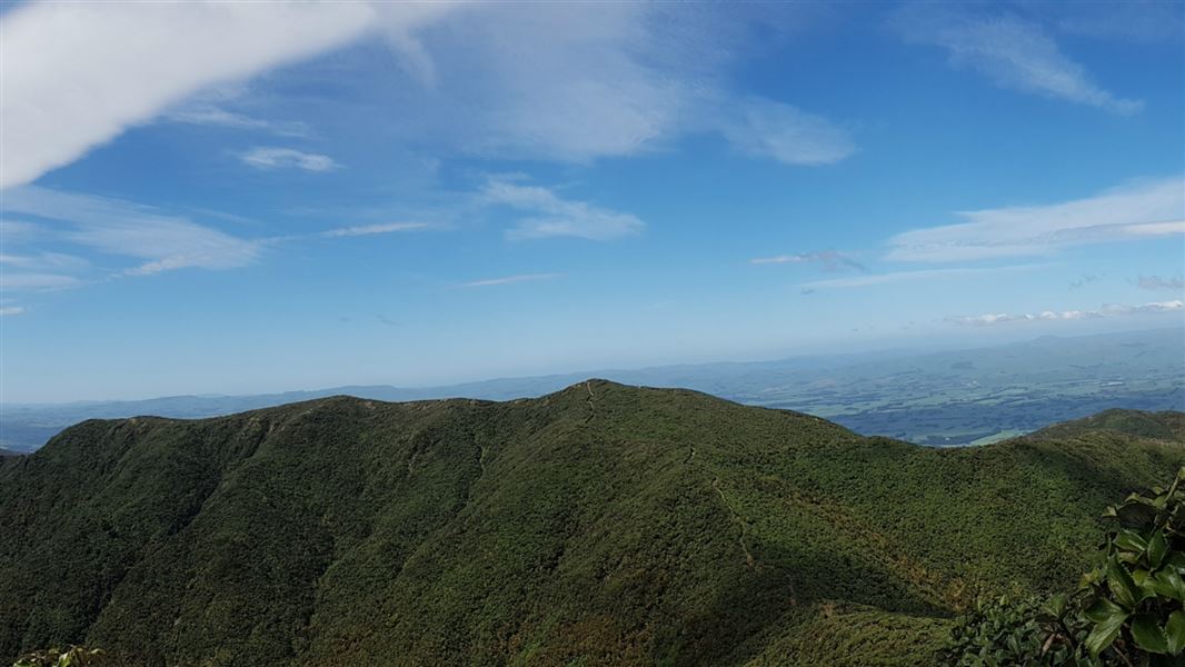
Maharahara Peak Track
Advanced • 4-6 hr • 6.72 km away
Kumeti Road end tramping tracks
Advanced • 6.83 km away
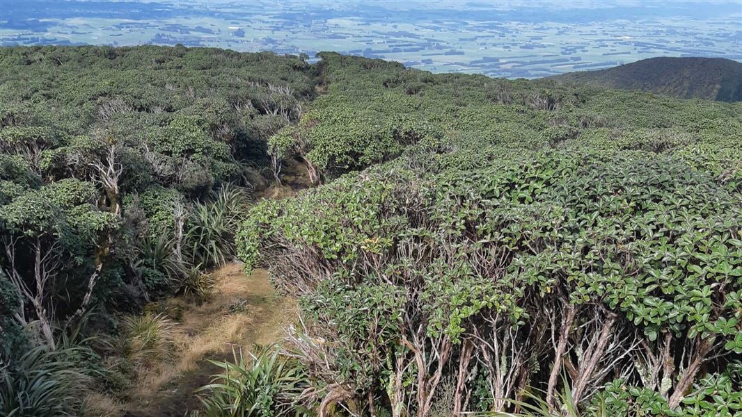
A-Frame Hut and Takapari Road Track
Advanced • 2 hr 30 min one way • 3.1 km one way • 6.88 km away
Rokaiwhana Stream Walk
Advanced • 2 hr return • 6.98 km away
Contact
DOC Customer Service Centre
Regional DOC service centre.
Notes from people who have been
No notes yet. If you have been, say what you found.
Something missing or out of date?
Closed, moved, wrong facts, or something we have missed? Travellers keep the Road Guide up to date. Tell us what you found at contribute@parkup.nz and we will check it and add it.
Ask us to take this down
A person reads every request. We do not remove a place until we have checked it.
Sources
- OpenStreetMap Huts · ODbL (Open Database License)Contains information from OpenStreetMap, made available under the ODbL.
- DOC Huts (API) · CC BY 4.0Crown Copyright: Department of Conservation Te Papa Atawhai. Data sourced from the DOC Developer Portal (api.doc.govt.nz).
- DOC Huts · CC BY 4.0Data sourced from the Department of Conservation (DOC), New Zealand.