Kerin Forks Hut
Serviced hutMount Aspiring National Park, OtagoOpen
Current advisories
Predator control for Mt Aspiring National Park
01 June 2026
A predator control operation using toxic bait containing 1080 was completed on 2 March 2026. The operation area includes Mt Aspiring National Park. It is open to the public with warning signs in place at key entrances. There may be toxic carcasses and bait (green coloured pellets) in the area. Do not touch the bait or animal carcasses. Water supply at the huts will be unaffected as tanks will be disconnected from the guttering, but as usual we recommend treating water before drinking. This operation is part of DOC's National Predator Control Programme to protect native species. First published on 16 September 2025. Last reviewed on 2 June 2026.
Source: DOC Te Papa Atawhai alerts.
- Sleeps
- 10 bunks
- Booking
- Can book
- Cost
- from $10
- Heating
- Yes
- Drinking water
- Boil first
- Toilet
- Non-flush
Getting there
We have not checked a road end or car park for this place yet, so we do not give driving directions to it. Check how to get there before you go. Some routes cross private land and need the landowner's permission.
How to get there, on doc.govt.nz- Topo map
- Topo50 sheet BZ12
- Grid reference
- E1283487, N5094022
Source: DOC Te Papa Atawhai.
Map and tracks
Track lines: DOC Te Papa Atawhai. Map data © OpenStreetMap contributors. Topo map: LINZ, CC BY 4.0. 44.23934° S, 169.03603° E
About this place
This is an serviced 10-bunk hut in the Wanaka/Makarora area.
On the way here
Gillespie Pass Circuit · 3 - 4 days
Siberia Hut to Kerin Forks Hut
Time: 2 to 3 hr
km About 30 minutes down from Siberia Hut, travelling on the true left, the track to the Wilkin Valley enters the forest at the southern end of Siberia Flat. It sidles above the Siberia Gorge to descend in a series of zigzags to the Wilkin River (7 km, 2 to 3 hours). Kerin Forks Hut (340 m) can be seen 400 m downstream from the Siberia Stream/Wilkin River junction, at the western end of a large flat on the other side of the Wilkin. To access Kerin Forks Hut and the upper valley you must cross the Wilkin River which can be uncrossable following rain. If it has been raining or rain is in the forecast, consider how this will impact your ability to return across the Wilkin River.
Wilkin Valley tracks · 4–5 days
Wilkin Road to Kerin Forks Hut
Time: 4–5 hr
km From Wilkin Road off SH6 make your way down to the Makarora River and cross with care, watching for soft sand. The Wilkin Valley Track is located on the true left of the Wilkin River. It is rough in places in the lower valley as it undulates through the forest before reaching Dans Flat and continuing up valley on open river flats. Kerin Forks Hut is located on the true right of the Wilkin, near its confluence with Siberia Stream. Trampers will need to pick a suitable point to cross the Wilkin River to the hut. Warning: Crossing the Makarora and Wilkin Rivers should only be attempted by parties with river-crossing experience. Be prepared to wait if the rivers are too high to cross. How to cross a river safely .
Kerin Forks Hut to Top Forks Hut
Time: 6 to 8 hr
km The track begins behind the Kerin Forks Hut , passing through beech/tawhai forest beside the Wilkin River and over several slips and steep-sided ravines that require care. It emerges at Wonderland flats, a good lunch stop halfway between the two huts. At the end of Wonderland flats the track re-enters the forest, then climbs and sidles above the river before descending to the Jumboland flats. From here the route is unmarked – follow the river flats to the junction of the north and south branches. When the river is low, an unmarked river route follows the true right, fording the river several times before reaching flats near the hut. If the river is high, follow track markers leading over a hill. The Top Forks Hut (600 m above sea level) is above the junction, on the true right of the river’s south branch.
Source: DOC Te Papa Atawhai.
Know before you go
No visitor centre in Makarora
Contact the Awarua/Haast or Tititea/Mount Aspiring National Park visitor centres instead.
Full huts during peak season
This hut, along with other huts in the region, is popular with trampers from December until after Easter. We recommended you carry a tent or roll mat when tramping during this period.
Source: DOC Te Papa Atawhai.
Trip options
Walking times come from DOC track descriptions, added up leg by leg from car-accessible trailheads. Nights and return times are ParkUp estimates, allowing about 8 hours of walking a day.
1 option · 1 night
Wilkin Road
Walking in
5 hr
Walking out
5 hr to Wilkin Road
Source: DOC Te Papa Atawhai track descriptions.
Fees and bookings
1 May - 30 September
1 October - 30 April
Weekdays
Weekends
1 December - 29 February
Weekdays
Weekends
Camping
Backcountry Hut Passes can be used for this hut from 1 May to 30 September. Passes won't be accepted from 1 October to 30 April. DOC Campsite Pass
Bookings are open for stays up to 30 April 2027. If no availability shows online for your dates, the hut is fully booked. No spaces are kept for visitors arriving without a booking. Phone and in‑person bookings made at a visitor centre incur a $10 service fee. Same‑day bookings are available online until 8 pm if spaces remain. 22 October – 30 April Bookings are required. Book Kerin Forks Hut online Your hut booking is for any bunk bed, not for a specific bunk bed – select your bunk bed on arrival. 1 May – 21 October Bookings are not required - first come, first served. Fees still apply. Camping outside Kerrin Forks Hut From 22 October 2026, you will need a booking to camp outside Kerin Forks Hut. Bookings for camping are now open for the 2026/2027 season. Until 22 October 2026, no bookings are required but fees still apply.
Source: DOC Te Papa Atawhai.
On these tracks
Source: DOC Te Papa Atawhai.
Nearby stops
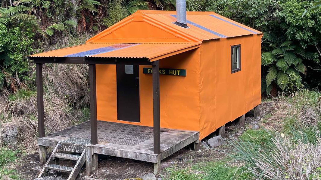
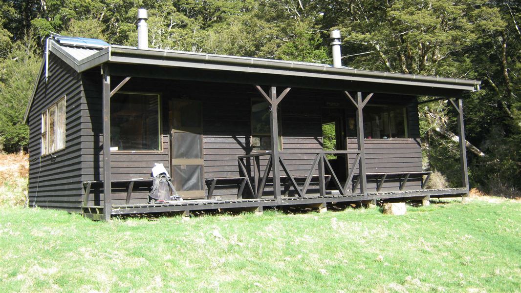
Forks Hut
Standard • 6 bunks • Manawatū-Whanganui • 730.4 km
Forks Hut is a standard six-bunk hut located in the Manawatu region.
Heating • Mattresses • Toilets - non-flush
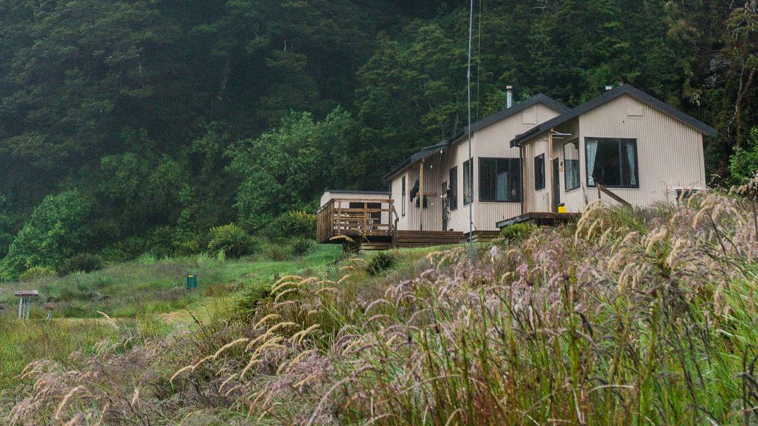
Siberia Hut
Serviced • 20 bunks • Otago • 4.3 km
Siberia Hut is a serviced 20-bunk hut located in the Wānaka/Makarora area of Otago. Booking is required for stays during the summer season and can be arranged…
Heating • Mattresses • Toilets - non-flush
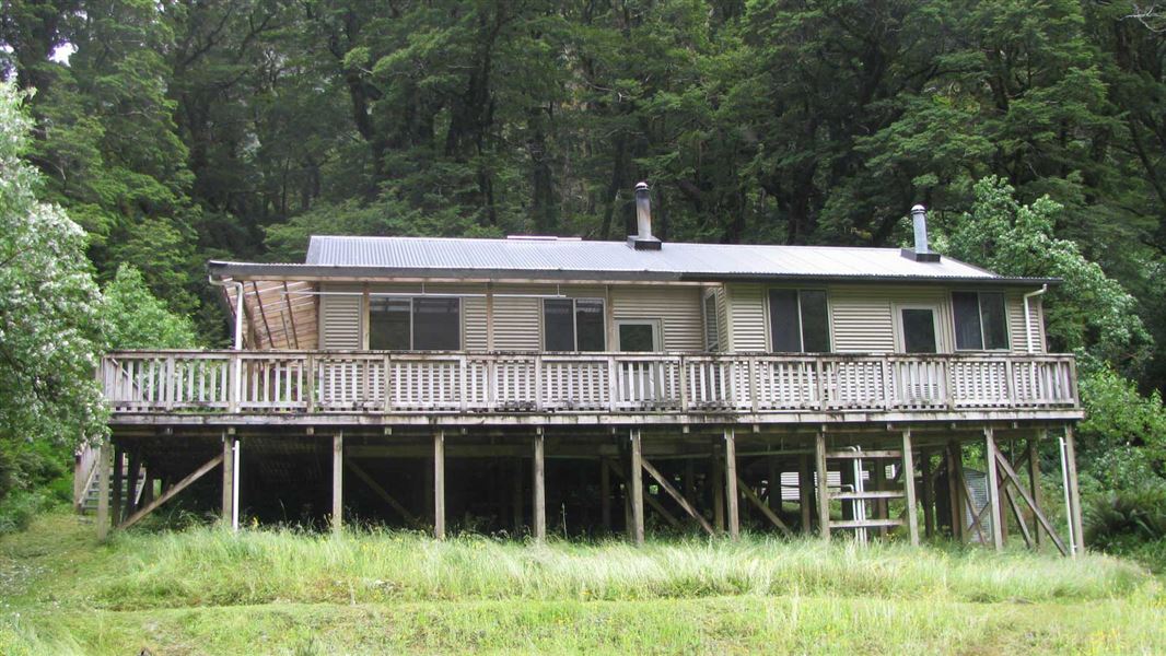
Young Hut
Serviced • 20 bunks • Otago • 8.4 km
Young Hut is a serviced 20-bunk hut located in the Wanaka and Makarora area of Otago. Bookings are required to stay at the hut during the summer season.
Heating • Mattresses • Toilets - non-flush
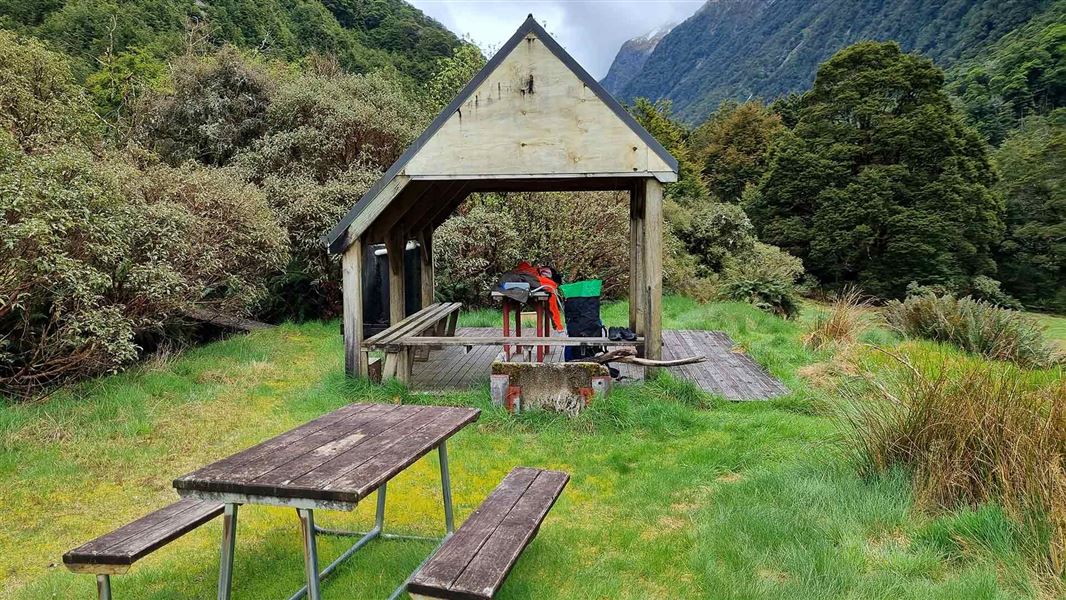
Young Forks Campsite
Backcountry • Otago • 11.4 km
Young Forks Campsite is a walk-in backcountry campsite located in the Wanaka/Makarora area of Otago. It serves as a stop on the Gillespie Pass Circuit and…
Non-powered/tent sites • Shelter for cooking • Water from stream

Top Forks Hut
Serviced • 16 bunks • Otago • 12.2 km
Top Forks Hut is a serviced 16-bunk hut located in the Wanaka/Makarora area of Otago.
Heating • Lighting • Toilets - non-flush
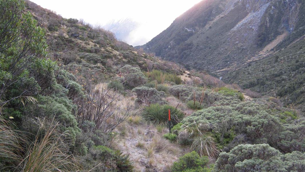
Contact
Wānaka Tititea/Mount Aspiring National Park
Regional DOC service centre.
Notes from people who have been
No notes yet. If you have been, say what you found.
Something missing or out of date?
Closed, moved, wrong facts, or something we have missed? Travellers keep the Road Guide up to date. Tell us what you found at contribute@parkup.nz and we will check it and add it.
Ask us to take this down
A person reads every request. We do not remove a place until we have checked it.
Sources
- DOC Huts (API) · CC BY 4.0Crown Copyright: Department of Conservation Te Papa Atawhai. Data sourced from the DOC Developer Portal (api.doc.govt.nz).
- OpenStreetMap Huts · ODbL (Open Database License)Contains information from OpenStreetMap, made available under the ODbL.
- DOC Huts · CC BY 4.0Data sourced from the Department of Conservation (DOC), New Zealand.