Anatoki and Historic Kill Devil Pack Tracks
WalkTasman
- Grade
- Advanced
- Walking time
- 5 days
- Dogs
- No dogs
Getting there
We have not checked a road end or car park for this place yet, so we do not give driving directions to it. Check how to get there before you go. Some routes cross private land and need the landowner's permission.
How to get there, on doc.govt.nzTurn off SH 60 1 km onto Kotinga Road, 1 km south of Tākaka Township, Follow this road until nearly the end. Turn right at the sign and follow the road 3 km to a small car park and intentions shelter.
Source: DOC Te Papa Atawhai.
Map and tracks
Track lines: DOC Te Papa Atawhai. Map data © OpenStreetMap contributors. Topo map: LINZ, CC BY 4.0. 41.02364° S, 172.73529° E
About this place
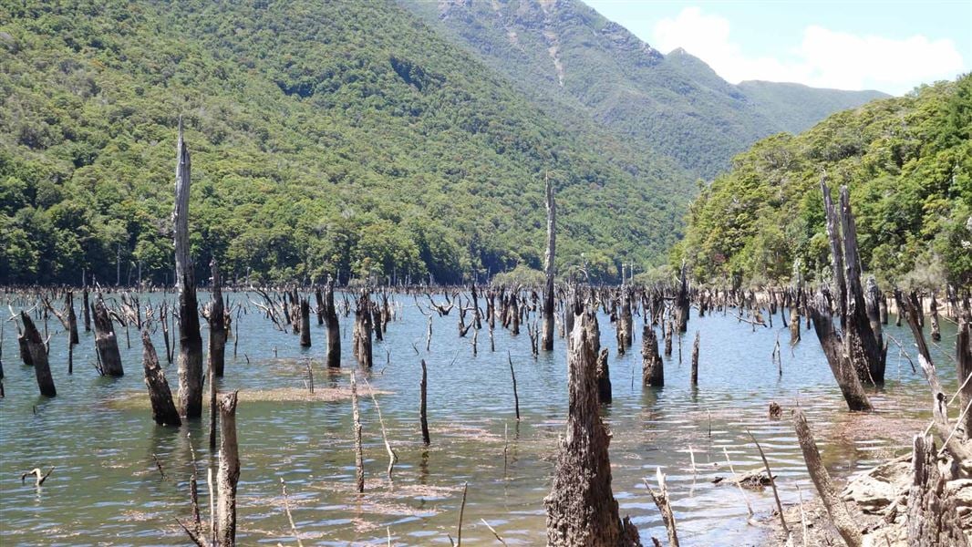
Explore beautiful beech forest, dramatic gorge scenery and rock debris dam at Lake Stanley. Trampers can also enjoy a historic hut experience in restored character huts from 1930s gold mining days.
The route
Road end to Anatoki Forks Hut
Time: 8 hr
km From the car park follow the markers and ford Go Ahead Creek before sidling up the hill to join onto an old benched gold miner’s track. Note: The land either side of the access track up to this point is private land – respect it and leave gates as you find them. The side creeks are deeply incised, steep and very rocky. They are not bridged and can be challenging to cross even in normal conditions – they are dangerous to cross when in flood. We strongly recommended that you do not to attempt this section in heavy rain. If you encounter a localised downpour that has caused a creek to rise, wait a short period while the level drops again (pack an emergency shelter so you can stay dry while waiting). Further on, beyond an old slip, the track passes through an area of regenerating forest before entering a mixed beech/ podocarp forest. The track then descends in a zigzag fashion to the Anatoki Bend. You are about half way to the hut. It is possible to camp here. From the Bend the track passes through many side gullies. Once at the Anatoki Forks Hut (standard hut, 6 bunks), you will see evidence of old gold workings in the area. The hut is notable for having running water and a wetback that can provide a hot shower.
Anatoki Forks Hut to Waingaro Forks Hut
Time: 7–10 hr
A short distance from the hut take the left branch at a junction to head towards Waingaro Forks Hut. (The right branch crosses the Anatoki River and climbs steeply towards Adelaide Tarn Hut.) The first 45 minutes follows the remains of water races. It is then a steady climb to the saddle, crossing and re-crossing a stream, before descending for 40 minutes to the Stanley River. Here lies a large clearing suitable for camping. Just less than one hour on from here and you reach the western end of Lake Stanley – formed in the Murchison earthquake in 1929. On the true right of the South Branch of the Stanley River, at the western end of Lake Stanley is Soper Shelter. A further hour and you reach the eastern end of the lake. The large slip here is still unstable, therefore it’s not safe to camp here. From here it is a further 3 hours – 3 hours 30 minutes onto the historic Waingaro Forks Hut. The track passes through forest and gravel flats and climbs to avoid the gorge before the junction of the Waingaro and Stanley Rivers.
Waingaro Forks Hut to road end
Time: 6–7 hr
km A 200 metre walk upstream leads to a swingbridge across the rocky gorge of the Waingaro River. The track passes through beech forest and steadily climbs, on an old pack track, up the Lockett Range. Two hours on from the hut Skeet Creek is reached. Replenish your water bottle here. Beyond here the vegetation type changes to a more open stunted shrub land. A further 20–30 minutes on, the turn-off to Riordans Hut is reached. From the turnoff it’s a further 30 minutes to Riordans Hut. Continuing on, the track passes through open vegetation providing good views along the Lockett Range. Look out for the restored Tin Hut, located in bush 60 metres below the track. The roof is visible from the track. The track then descends through regenerating bush, predominantly of gorse and bracken, in a series of zigzags, down the Kill Devil Ridge to the end of the track. Uruwhenua Road is reached and a further 3 kilometres will take you back to the State Highway near Lindsay’s Bridge.
Source: DOC Te Papa Atawhai.
Know before you go
Stay safe when crossing rivers and streams
If you plan to cross unbridged rivers or side streams, know how to cross safely and be prepared for if you cannot cross. Do not cross if the river or stream is flooded, you cannot find safe entry and exit points or are unsure it’s safe. Turn back or wait for the river to drop. If in doubt, stay out. How to cross rivers safely NIWA river flow forecasts: View a video of national followed by regional river flows
Source: DOC Te Papa Atawhai.
On this track
In walking order.
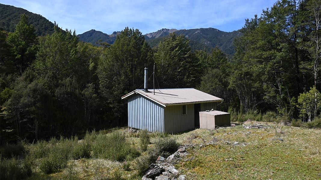
Anatoki Forks Hut
Standard • 6 bunks • Tasman
- Toilet
- Heating
- Water
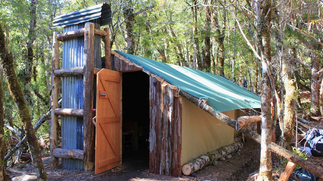
Soper Shelter
Basic/bivvies • 2 bunks • Tasman
- Toilet
- Heating
- Water
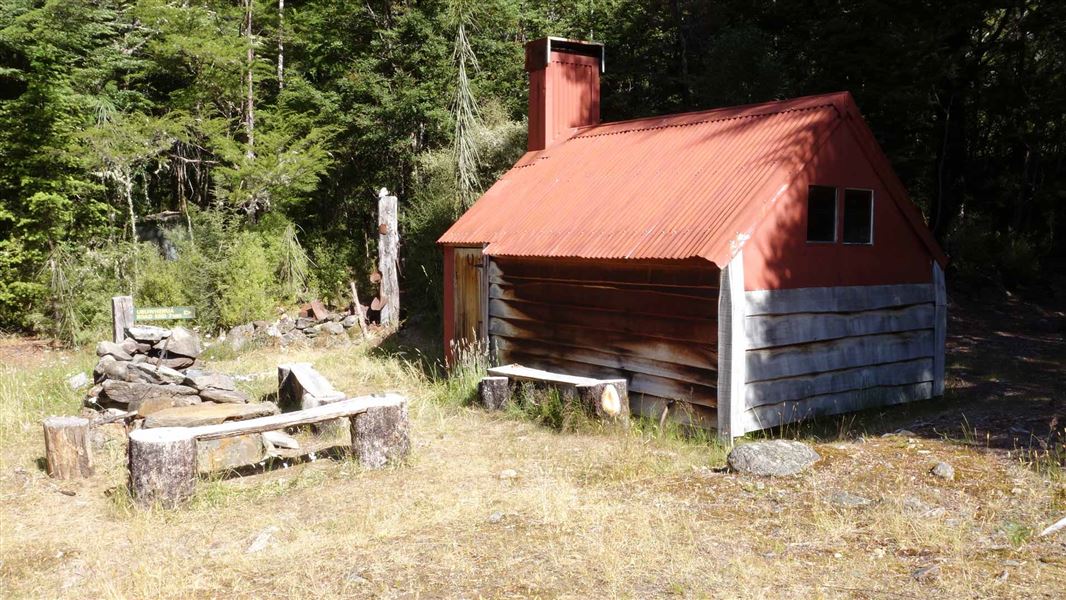
Waingaro Forks Hut
Basic/bivvies • 4 bunks • Tasman
- Toilet
- Heating
- Water
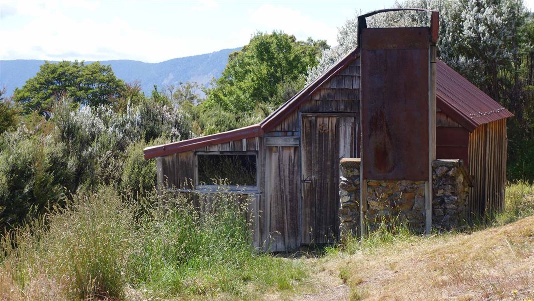
Riordans Hut
Basic/bivvies • 3 bunks • Tasman
- Toilet
- Heating
- Water
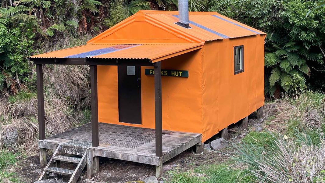
Forks Hut
Standard • 6 bunks • Manawatū-Whanganui
- Toilet
- Heating
- Water
Nearby stops
Tin Shelter Hut
Tasman • 2.3 km
Tin Shelter Hut is a basic shelter located in the Tasman region. The provided records do not list any specific facilities or amenities for this hut.
Cobb River Campsite
Tasman • 4.4 km
Cobb River Campsite is a camping area located in the Tasman region of New Zealand. The provided records do not list specific facilities or details for this…
Uruwhenua Reserve Free Camping
Tasman • 8.2 km
Uruwhenua Reserve Free Camping is a rest spot located beside the Takaka River in the Tasman region. The site offers free camping for visitors.
Cobb Hostel
Tasman • 10.2 km
Cobb Hostel is a hut situated at the bottom end of the Cobb Reservoir in the Tasman region. It is available for rent from October to April, subject to weather…
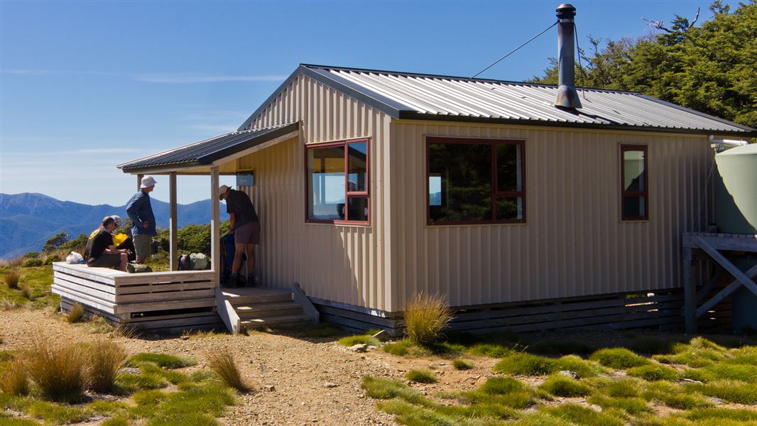
Sylvester Hut
Serviced • 12 bunks • Tasman • 11.9 km
Sylvester Hut is a serviced 12-bunk hut located in the Golden Bay area of the Tasman region.
Heating • Mattresses • Toilets - non-flush
Walks nearby
Notes from people who have been
No notes yet. If you have been, say what you found.
Something missing or out of date?
Closed, moved, wrong facts, or something we have missed? Travellers keep the Road Guide up to date. Tell us what you found at contribute@parkup.nz and we will check it and add it.
Ask us to take this down
A person reads every request. We do not remove a place until we have checked it.
Sources
- DOC Tracks (API) · CC BY 4.0Crown Copyright: Department of Conservation Te Papa Atawhai. Data sourced from the DOC Developer Portal (api.doc.govt.nz).