Top Crawford Hut
Basic/bivvies hutKokatahi River - Whitcombe River area, West CoastOpen
- Sleeps
- 4 bunks
- Booking
- Not bookable
- Cost
- Free
- Heating
- Yes
- Drinking water
- Not drinkable
- Toilet
- Non-flush
Getting there
We have not checked a road end or car park for this place yet, so we do not give driving directions to it. Check how to get there before you go. Some routes cross private land and need the landowner's permission.
How to get there, on doc.govt.nz- Topo map
- Topo50 sheet BV19
- Grid reference
- E1459530 N5244950
Source: DOC Te Papa Atawhai.
Map and tracks
Track lines: DOC Te Papa Atawhai. Map data © OpenStreetMap contributors. Topo map: LINZ, CC BY 4.0. 42.93514° S, 171.27845° E
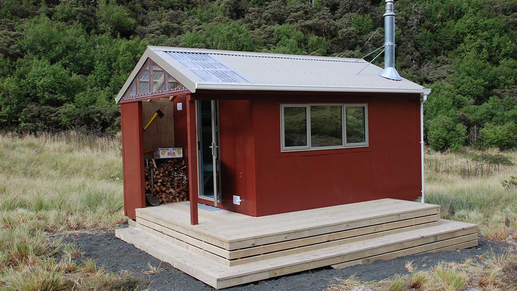
About this place
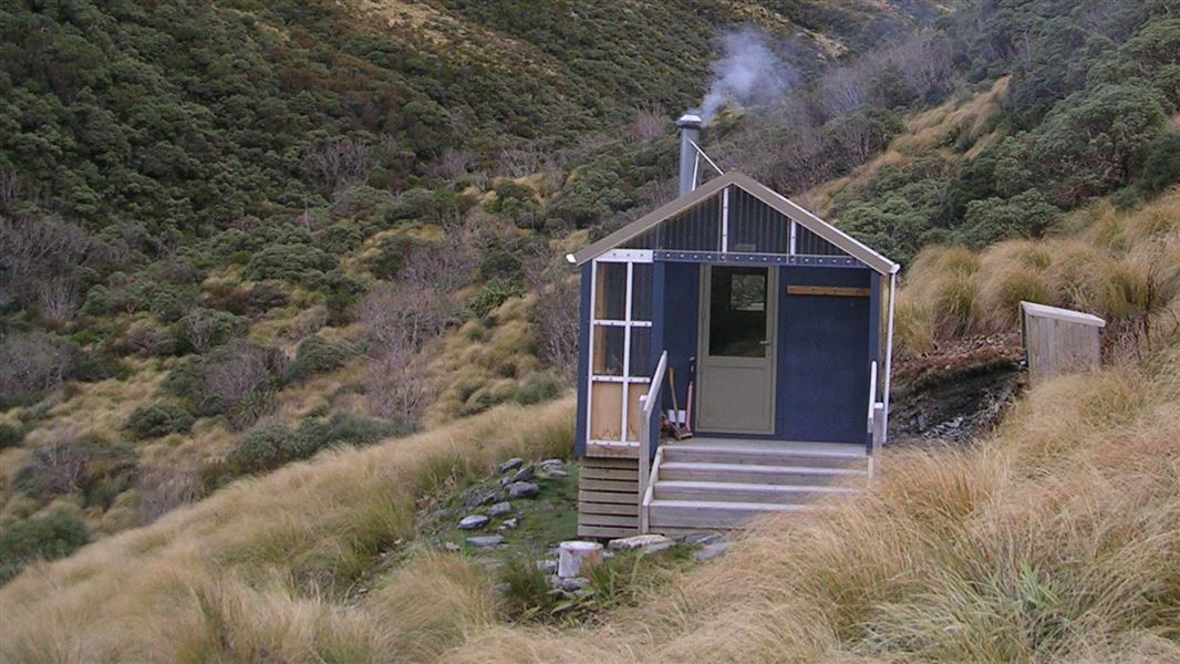
This is a basic four-bunk hut in the Hokitika area.
On the way here
Toaroha/Zit Saddle/Kokatahi/Lathrop Saddle/Styx River Route · 3-4 days
Crawford Junction Hut to Top Crawford Hut
Time: 3 hr 30 min – 4 hr
From the hut follow the track off the terrace and down to the bed of Crawford Creek. Head upstream, boulder hopping past the swing bridge, and pick up the track to Farquharson Creek. Cross Farquharson Creek and rejoin the track on the far bank. Following the track towards and then up alongside Crawford Creek before climbing out of the creek and sidling around the hillside. The track continues to sidle around the hillside until it drops down into Crawford Creek about 750 – 800 m below Top Crawford Hut. Remain on the true left of the creek all the way to the hut, which is located on a low tussock terrace a few hundred metres upstream on the true left branch of the Crawford Stream. Note: Farquharson Creek can be difficult to cross if it is running higher than normal. A good crossing place is upstream at the mouth of the gorge.
Top Crawford Hut to Browning Bivouac
Time: 3 hr 30 min – 4 hr 30 min
From the hut, travel downstream until just before the junction of the two branches of Crawford Creek. Cross to the true right bank and pick up the large orange triangle and then follow orange markers through a tussock/scrub covered gut. After a few hundred metres the track begins to climb steeply through scrub covered bluffs until it tops out on a small terrace. From here a few poles mark the route which climbs and sidles up and across steep scree slopes in a north/north-easterly direction to Lathrop Saddle. In the winter and spring these slopes are snow covered and often icy. Ice axes and crampons are essential tools at these times. Marker poles from the northern end of Lathrop Saddle lead the way down a steep spur to Browning Bivouac. It is easy to miss these poles in misty conditions.
Source: DOC Te Papa Atawhai.
Trip options
Walking times come from DOC track descriptions, added up leg by leg from car-accessible trailheads. Nights and return times are ParkUp estimates, allowing about 8 hours of walking a day.
2 options · 3 nights
Roadend
Walking in
21 hr 30 min (via Cedar Flat Hut, Top Kokatahi Hut, Crawford Junction Hut)
Walking out
7 hr to Grassy Flats Hut
Walking in
21 hr 30 min (via Cedar Flat Hut, Top Kokatahi Hut, Crawford Junction Hut)
Walking out
21 hr 30 min to Roadend (via Cedar Flat Hut, Top Kokatahi Hut, Crawford Junction Hut)
Source: DOC Te Papa Atawhai track descriptions.
Fees and bookings
Free
Source: DOC Te Papa Atawhai.
On these tracks
Source: DOC Te Papa Atawhai.
Nearby stops
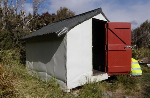
Browning Range Bivvy
Basic/bivvies • 2 bunks • West Coast • 3.2 km
The Browning Range Bivvy is a basic two-bunk hut located in the Hokitika area of the West Coast. It provides simple shelter for walkers in the region.
Mattresses • Toilets - non-flush • Water from tap - not treated, boil before use
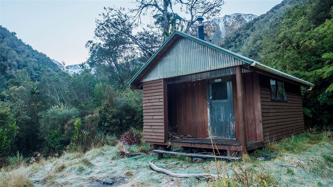
Crawford Junction Hut
Basic/bivvies • 6 bunks • West Coast • 4.6 km
Crawford Junction Hut is a basic six-bunk hut located in the Hokitika area of the West Coast. It offers simple accommodation for hikers in the region.
Heating • Mattresses • Toilets - non-flush
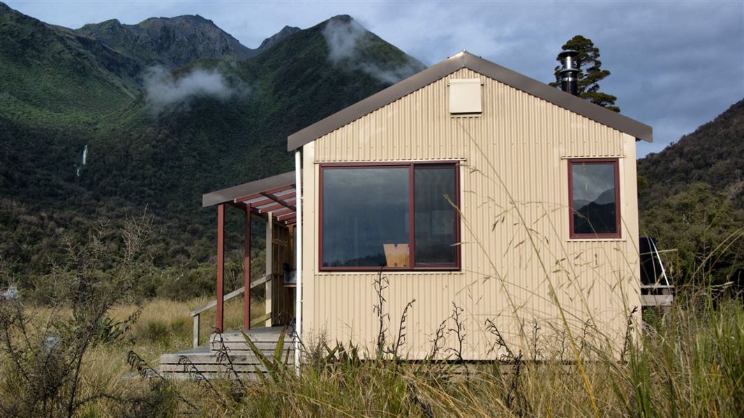
Grassy Flat Hut
Standard • 10 bunks • West Coast • 4.9 km
Grassy Flat Hut is a standard ten-bunk hut located 12 km up the Styx River in the Hokitika area of the West Coast. The site has historical significance as a…
Heating • Mattresses • Toilets - non-flush

Mid Styx Hut
Basic/bivvies • 4 bunks • West Coast • 5.2 km
Mid Styx Hut is a basic four-bunk hut located in the Hokitika area of the West Coast.
Heating • Mattresses • Water from stream
Top Kokatahi Hut
Basic/bivvies • 4 bunks • West Coast • 9 km
Top Kokatahi Hut is a basic four-bunk hut located in the Hokitika area of the West Coast.
Heating • Mattresses • Toilets - non-flush
Walks nearby
Contact
Paparoa National Park Visitor Centre
4294 Coast Road, Punakaiki, RD 1 Runanga 7873
Regional DOC service centre.
Notes from people who have been
No notes yet. If you have been, say what you found.
Something missing or out of date?
Closed, moved, wrong facts, or something we have missed? Travellers keep the Road Guide up to date. Tell us what you found at contribute@parkup.nz and we will check it and add it.
Ask us to take this down
A person reads every request. We do not remove a place until we have checked it.
Sources
- DOC Huts (API) · CC BY 4.0Crown Copyright: Department of Conservation Te Papa Atawhai. Data sourced from the DOC Developer Portal (api.doc.govt.nz).
- OpenStreetMap Huts · ODbL (Open Database License)Contains information from OpenStreetMap, made available under the ODbL.
- DOC Huts · CC BY 4.0Data sourced from the Department of Conservation (DOC), New Zealand.