Rod Donald Hut
Serviced hutBanks Peninsula area, CanterburyOpen
Current advisories
No access from Port Levy side
13 September 2026
Western Valley Road is closed between the summit and Port Levy due to a large road dropout and two slips. This is a long term closure. First published on 19 February 2026. Last reviewed on 14 September 2026.
Source: DOC Te Papa Atawhai alerts.
- Sleeps
- 9 bunks
- Booking
- Can book
- Cost
- from $30
- Heating
- Yes
- Drinking water
- Boil first
- Toilet
- Non-flush
Getting there
We have not checked a road end or car park for this place yet, so we do not give driving directions to it. Check how to get there before you go. Some routes cross private land and need the landowner's permission.
How to get there, on doc.govt.nzThe hut is a 50 minute walk from Port Levy Saddle via the Te Ara Pātaka track. Port Levy Saddle can be accessed either from the car park at the top of the Western Valley Road from Little River, or via the Te Ara Pātaka track from Montgomery Scenic Reserve.
- Topo map
- Topo50 sheet BX24
Source: DOC Te Papa Atawhai.
Map and tracks
Track lines: DOC Te Papa Atawhai. Map data © OpenStreetMap contributors. Topo map: LINZ, CC BY 4.0. 43.72038° S, 172.79761° E
About this place
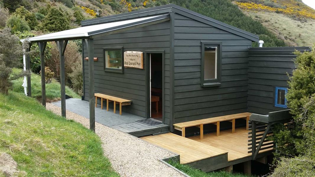
This is a serviced nine-bunk hut in the Christchurch and Banks Peninsula area.
On the way here
Mount Herbert Walkway/Te Ahu Pātiki · 6 – 8 hr return
Summit and return
The Mount Herbert/Te Ahu Pātiki summit at 920 m is the highest peak on Banks Peninsula. The summit is dominated by tussocks, with a few speargrass plants, scattered around a small antenna housing. From here you can look out over the Port Hills to the peaks of the Foothill Forests – Mount Thomas (1023 m) and Mount Grey (933 m) 66 km to the north. To the east is open ocean all the way to Chile and Patagonia. Either return the same way you came, or continue left on to the Port Levy Saddle and from there to the Rod Donald Hut in 3 hr 20 min. Alternatively you can exit right via Orton Bradley Park, Kaituna Valley or Gebbies Pass, and stay at the Packhorse Hut along the way, which is three hours walk from Mount Herbert. The summit tracks are all part of the Te Ara Pātaka/Summit Walkway .
Te Ara Pātaka/Summit Walkway · 2-3 days
Mt Herbert/Te Ahu Patiki summit to Port Levy Saddle
Time: 2 hr 30 min
5.7 km Mountain biking is not allowed on this section. From the summit of Mount Herbert, head south-east along the plateau through tussock grassland to reach the summit of ‘Little Mount Herbert’. Take great care in misty weather to follow the orange markers along the 1 km plateau between the two summits. You may encounter cattle grazing along the way. Give them space as you walk. From ‘Little Mount Herbert’, carry on south-east down a steep tussock slope, to pick up the marked farm track. This is punctuated by pine forest and old stands of remnant tōtara. It then drops to the Port Levy saddle car park on Western Valley Road. Port Levy saddle is at the top of Western Valley Road. This steep, narrow gravel road connects Little River to Port Levy. It's not suitable for campervans or towing vehicles, and can be difficult for 2WD vehicles after heavy rain There is a parking area here providing easy access to Rod Donald Hut or Mount Herbert. If you're doing the track in reverse – Port Levy Saddle to Mt Herbert/Te Ahu Patiki summit .
Port Levy saddle to Rod Donald Hut
Time: 50 min
2.5 km Port Levy saddle to Rod Donald Hut takes you through beautiful old growth tōtara forest at Waipuna Saddle and on to Rod Donald Hut. You can prebook this hut for an overnight stay or visit as a day walk. Cross Western Valley Road and follow the marked track to Waipuna Saddle. There is a beautiful old growth tōtara forest at Waipuna Saddle. This is on private land, but the landowner permits you to visit it. Respect this very special place. Rod Donald Hut is down a side track and takes about 25 min to walk to from the Waipuna Saddle. This section of the track is accessible by mountain bike, but bikes are best left at the top of the Rod Donald Hut track. The Rod Donald Hut is on private land belonging to the Rod Donald Banks Peninsula Trust and protected by a QEII National Trust covenant. As with Packhorse Hut, bunks must be pre-booked through this website, but day walkers are welcome to visit. Mountain biking is allowed on this section but bikes are best left at the top of the Rod Donald Hut Track.
Rod Donald Hut to The Hilltop via Montgomery Reserve
Time: 6 hr
14.3 km Rod Donald Hut to The Hilltop via Montgomery Reserve takes you through Montgomery Park Scenic Reserve onto Summit Road. The track crosses private farmland – respect this and keep to the track. From Rod Donald Hut, climb back up the access track to reach Waipuna Saddle. Then head east following the marked farm track through the tōtara graveyard, pasture and several DOC reserves. Mountain bikers leave the main track briefly to bypass the narrow rocky track through Mount Fitzgerald, and take an easier farm track. Soon after the Whatarangi Totara Scenic Reserve, the track diverges again. Walkers should head up to Montgomery Park Scenic Reserve and walk directly to The Hilltop. The reserve track is steep and rocky, so take care and enjoy the beautiful forest including a giant tōtara, thought to be up to 2,000 years old. The track emerges from the reserve onto Summit Road. Keep children close and take extreme care to look and listen for vehicles as you cross the road. Mountain biking is allowed on this section, but is not allowed in Montgomery Park Scenic Reserve. Follow the farm track to Pettigrews Road. Turn right at the end to reach the Summit Road, and right again to ride along the Summit Road to The Hilltop.
Rod Donald Hut to The Hilltop · 6 hr
From Rod Donald Hut, climb back up the access track to reach Waipuna Saddle. Then head east following the marked farm track through the tōtara graveyard, pasture and several DOC reserves.
Source: DOC Te Papa Atawhai.
Trip options
Walking times come from DOC track descriptions, added up leg by leg from car-accessible trailheads. Nights and return times are ParkUp estimates, allowing about 8 hours of walking a day.
2 options · 1 night
Sign of the Packhorse Hut
Walking in
6 hr 20 min
Walking out
6 hr to The Hilltop via Montgomery Reserve
Walking in
6 hr 20 min
Walking out
6 hr 20 min to Sign of the Packhorse Hut
Source: DOC Te Papa Atawhai track descriptions.
Fees and bookings
Backcountry Hut Passes and Backcountry Hut Tickets cannot be used at this hut.
Bookings are open for stays up to 30 June 2027. If no availability shows online for your dates, the hut is fully booked. No spaces are kept for visitors arriving without a booking. Phone and in‑person bookings made at a visitor centre incur a $10 service fee. Same‑day bookings are available online until 8 pm if spaces remain. Book Rod Donald Hut online Your hut booking is for any bunk bed, not for a specific bunk bed – select your bunk bed on arrival.
Source: DOC Te Papa Atawhai.
On these tracks
Source: DOC Te Papa Atawhai.
Nearby stops

Packhorse Hut
Serviced • 9 bunks • Canterbury • 8.7 km
Packhorse Hut is a bookable, serviced nine-bunk hut located in the Christchurch and Banks Peninsula area of Canterbury. It is easily accessed from the Kaituna…
Heating • Mattresses • Toilets - non-flush
Hilltop
Canterbury • 210.4 km
Hilltop is a hut located in the Canterbury region. The available records provide no further details regarding its specific facilities or features.
Little River Restricted Area
Canterbury • 4.9 km
Monument Shelter Hut
Canterbury • 5.8 km
Little River Campground
Canterbury • 7.7 km
Walks nearby
Okuti Valley Scenic Reserve walk
Easiest • 20 min return • 600 m • 7.65 km away
Hay Scenic Reserve walk
Easiest • 30 min • 900 m • 8.27 km away
Kaituna Valley Packhorse Hut Track
Intermediate • 1 hr 20 min • 4 km • 8.31 km away
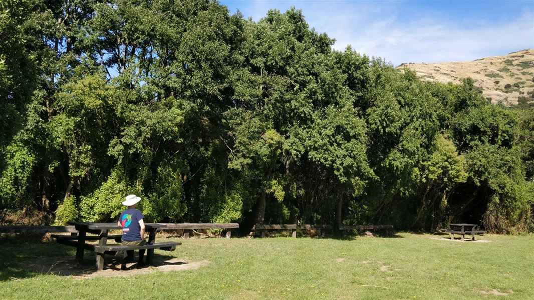
Kaituna Valley Scenic Reserve walk
Easy • 10 minutes return • 9.23 km away
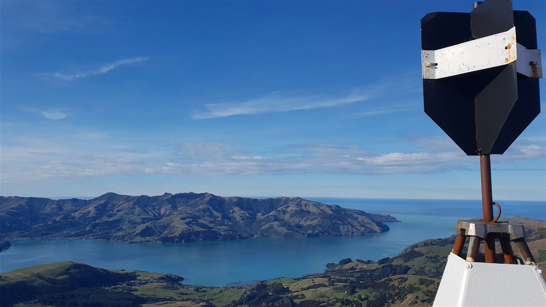
Saddle Hill Summit Track
Easy • 90 mins • 1.6 km • 10.4 km away
Contact
Arthur's Pass National Park Visitor Centre
104 West Coast Road, Arthur's Pass 7654
Regional DOC service centre.
Notes from people who have been
No notes yet. If you have been, say what you found.
Something missing or out of date?
Closed, moved, wrong facts, or something we have missed? Travellers keep the Road Guide up to date. Tell us what you found at contribute@parkup.nz and we will check it and add it.
Ask us to take this down
A person reads every request. We do not remove a place until we have checked it.
Sources
- OpenStreetMap Huts · ODbL (Open Database License)Contains information from OpenStreetMap, made available under the ODbL.
- DOC Huts · CC BY 4.0Data sourced from the Department of Conservation (DOC), New Zealand.
- DOC Huts (API) · CC BY 4.0Crown Copyright: Department of Conservation Te Papa Atawhai. Data sourced from the DOC Developer Portal (api.doc.govt.nz).