Queen Charlotte Track
WalkMarlborough
- Grade
- Intermediate
- Walking time
- 5 days
- Distance
- 73.5 km
- Dogs
- No dogs
Access: read before you go
You can walk your dog between Anakiwa and Davies Bay only. A permit is required. Contact Nelson Visitor Centre on 03 5469339. Dogs must be on a leash at all times. Dogs are not permitted elsewhere on the Queen Charlotte Track or on any of the walking and tramping tracks off it. Landowners adjacent to the track and hunters using it for access to hunting areas can apply for a dog permit for limited dog access on other parts of the track.
Source: DOC Te Papa Atawhai.
Getting there
We have not checked a road end or car park for this place yet, so we do not give driving directions to it. Check how to get there before you go. Some routes cross private land and need the landowner's permission.
How to get there, on doc.govt.nzPrivate transport
By road Anakiwa, Mistletoe Saddle, Torea Saddle and Kenepuru Saddle are all accessible by road. By boat Anakiwa, Mistletoe Bay, Torea Bay, Camp Bay, Endeavour Inlet, Resolution Bay and Meretoto/Ship Cove can be accessed by sea. Many jetties in the Sounds are privately owned. Boat owners can use them for picking up and dropping off passengers and luggage only. Do not tie up or leave your boat unattended at any jetty in the Sounds.
Transport operators
A number of companies offer boat transport to and from points along the track, including Meretoto/Ship Cove. Regular and on-demand bus services link Anakiwa with Picton.
Source: DOC Te Papa Atawhai.
Map
Map data © OpenStreetMap contributors. Topo map: LINZ, CC BY 4.0. 41.13849° S, 174.15021° E
About this place
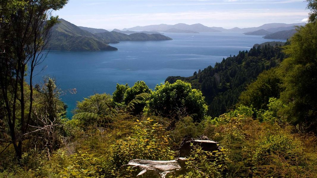
Experience the spectacular Marlborough Sounds by walking or biking the Queen Charlotte Track. The track stretches 73.5 km from historic Meretoto/Ship Cove through to Anakiwa in Queen Charlotte Sound. This track is part of Te Araroa Trail.
The route
This track is part of Te Araroa Trail .
About the track
You can walk or ride the track in either direction, but it's best to start from Meretoto/Ship Cove. If starting from Meretoto/Ship Cove, boat operators are available to carry your pack between accommodation places. You can expect to encounter tight/blind corners, steep drops near the edge of the track, and slippery clay surfaces (especially in winter). You might also have to pass fallen trees or recent slips. Sections of the track are on private land and a Queen Charlotte Track Land Cooperative (Q.C.T.L.C.) Pass is required to walk or ride the track in these sections which are between Kenepuru Saddle and Davies Bay near Anakiwa. Buy your pass .
Walking the track
The walking times mentioned below are only a guide and lean more towards a person with a slow walking speed. A day walker with a light day pack will take less time than a tramper with an overnight pack.
Mountain biking the track
Mountain biking is a great alternative to walking the Queen Charlotte Track. Allow two to three days to ride the entire track, but sections of the track make good day rides, particularly between Meretoto/Ship Cove and Kenepuru Saddle (27 km) and between Mistletoe Bay and Anakiwa (12.5 km). Approximate biking times: If you are moderately fit and experienced at mountain biking, the track is very rideable. Certain sections are steep and challenging, especially when rain has rendered it slippery and muddy. You may prefer to avoid the ridge-top sections of the central part of the track by riding along Kenepuru Road between Kenepuru Saddle and Portage. There are no facilities along the way for repairing bikes so make sure you have adequate tools and equipment and can complete your own repairs. This is a shared-use track. Follow the mountain bikers code : respect others, respect the rules, respect the track.
Meretoto/Ship Cove to Resolution Bay
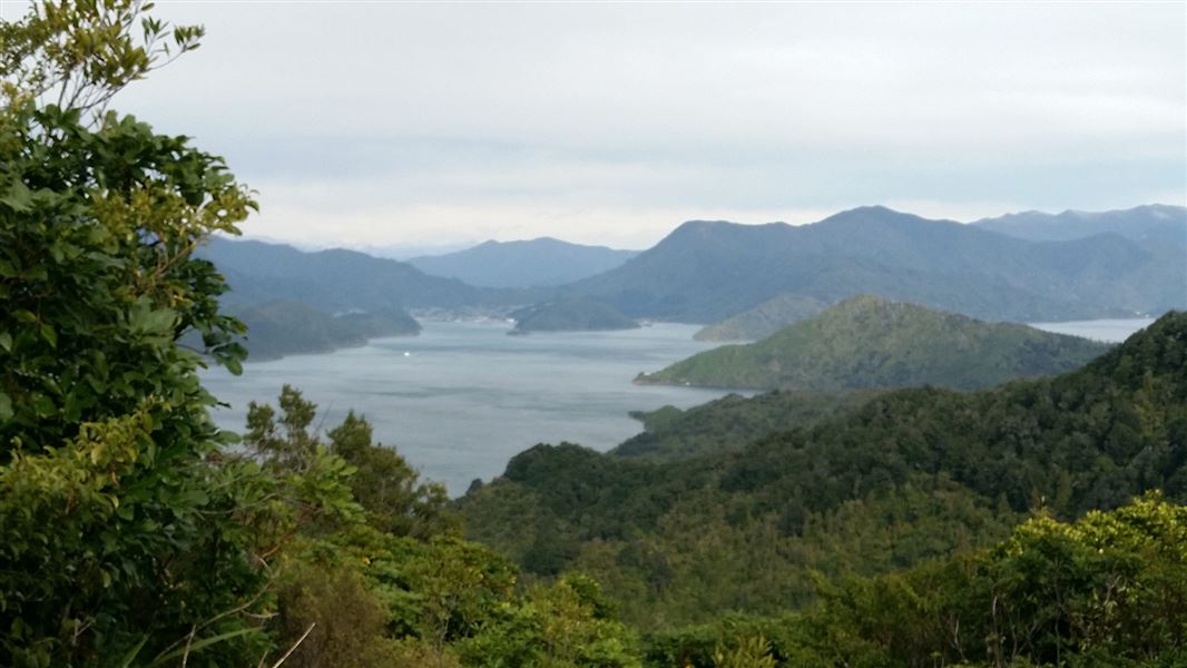
Walk time: 2 hr 4.5 km There is no road to Meretoto/Ship Cove so you will need to arrange boat transport to start your walk there. Camping is not permitted at Meretoto/Ship Cove but there are toilet facilities. Most visitors to Meretoto/Ship Cove take time to explore the historic site and enjoy reading the interpretation panels around the site. The track climbs away from the beach, passing through a largely unmodified forest, where the high canopy is complemented by a diverse understorey of shrubs and small trees. On the ridges higher up, beech trees dominate. After 50 minutes walking, you will reach a lookout point at a saddle, where you will enjoy good views of both the inner and outer Queen Charlotte Sound. Beyond the saddle, the track drops into Resolution Bay, where there is a DOC campsite at Schoolhouse Bay and further along, private cabin accommodation. Schoolhouse Bay Campsite
Resolution Bay to (the head of) Endeavour Inlet
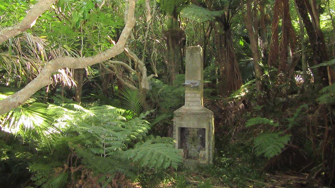
Walk time: 3 hr 10.5 km From Resolution Bay the track passes over a ridge and into Endeavour Inlet. It winds downward and follows the shoreline to the head of the inlet, where interpretation signs recall the antimony mining era. Hostel and motel accommodation are available on the way.
Endeavour Inlet to Camp Bay
Walk time: 4 hr 11.5 km From Endeavour Inlet the track stays near the shoreline and wanders through regenerating forest rich in small birds. It rounds Big Bay to Camp Bay where there is a DOC campsite and, a little further on, private accommodation. It is possible to bypass Camp Bay by using a direct track to Kenepuru Saddle. Camp Bay Campsite
Camp Bay to Torea Saddle
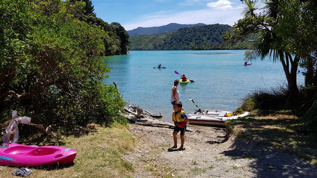
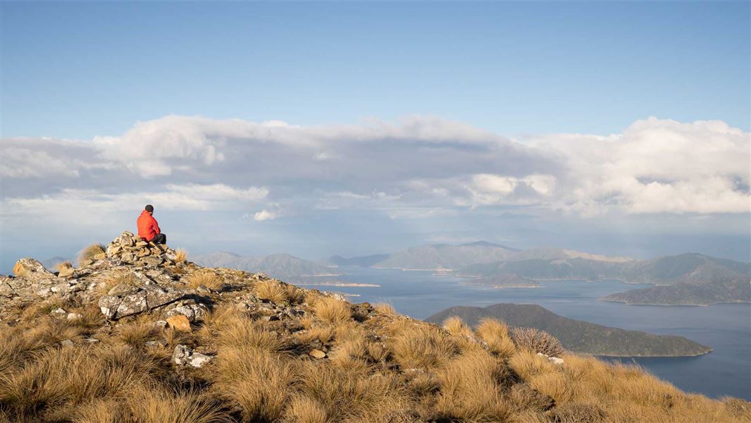
Walk time: 8 hr (3 hr to Bay of Many Coves campsite, 6 hr to Black Rock campsite) 24.5 km The track passes through private land in this section. Make sure you have your Q.C.L.T.C. Pass. This is the longest and most arduous section of the journey. Most mountain bikers will need to push their bike in various places here. From the top of the ridge you will be well rewarded with magnificent panoramas of the Sounds. Climb out of Camp Bay to Kenepuru Saddle and follow the ridge separating Queen Charlotte Sound from Kenepuru Sound. Above Bay of Many Coves and Kumutoto Bay are two DOC campsites, Bay of Many Coves and Black Rock. Eventually the track descends to Torea Saddle between Portage and Torea Bay. There is a DOC campsite at Cowshed Bay and private accommodation in Portage Bay.
Torea Saddle to Mistletoe Bay
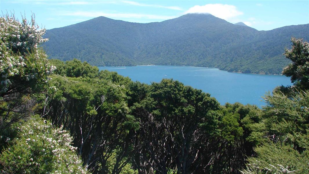
Walk time: 4 hr 7.5 km The track passes through private land in this section. Make sure you have your Q.C.L.T.C. Pass. This part of the journey also follows the ridge line. Here gorse and manuka are prolific, sheltering shrubs and trees that will one day shade the way. A side walk leads to a lookout just before the descent to Te Mahia Saddle begins. At Mistletoe Bay there are private cabins and campsites. There is also private accommodation at Te Mahia Bay.
Mistletoe Bay to Anakiwa
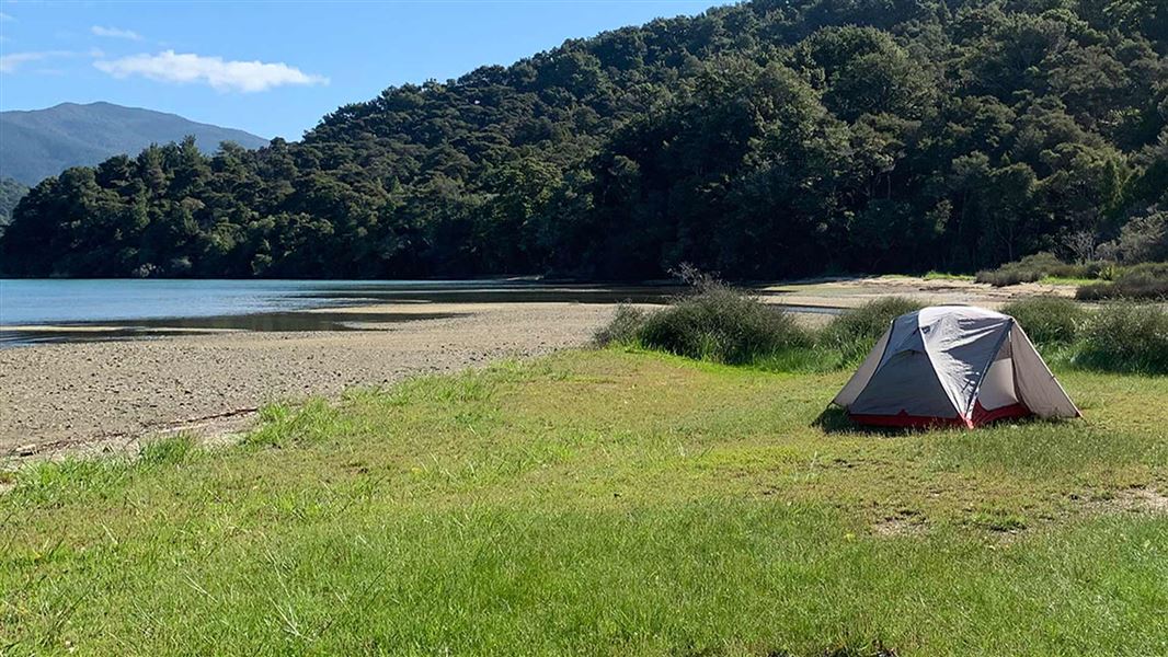
Walk time: 4 hr 12.5 km The track passes through private land in this section. Make sure you have your Q.C.L.T.C. Pass. Beginning on the road above Mistletoe Bay, this section follows old bridle paths high above the water. The track rounds an obvious point and descends to the DOC campsite at Umungata (Davies Bay). The final hour’s walking is on an easy path through mature beech forest to Anakiwa. At Anakiwa are a carpark, shelter, toilets and phone near the track end, and a public jetty opposite the Outward Bound school. Here you can catch a bus or a boat to Picton or to nearby accommodation. Davies Bay Campsite
Short walks
With such good access by road and/or sea, most sections of the track can be used for day walks. There are also several short side-trips along the way. In Mistletoe Bay, the James Vogel Nature Track allows you to explore the forest behind the picnic and camping area (45 min return). The Peninsula Walk explores the peninsula between Mistletoe and Waterfall bays (30 min return).
Accommodation/camping
There are six DOC-managed campsites on the track, each with toilets and water supply. Some also have cooking shelters and picnic tables. There are no cooking facilities at the campsite. You will need to carry your own cooker and food with you. Do not dispose of food scraps around the campsites. This causes pollution and attracts pests. There are no rubbish facilities at the campsites. Take your rubbish out with you. Several private accommodation providers offer hostel, cabin, motel and hotel lodgings, and tent sites alongside or close to the track. Some private accommodation sites may not be signposted and access tracks may be narrow, steep and slippery when wet. Make sure you get clear directions when you book.
Queen CharlotteTrack virtual guide
Watch a NZ Mountain Safety Council video.
Source: DOC Te Papa Atawhai.
Know before you go
Dogs
You can walk your dog between Anakiwa and Davies Bay only. A permit is required. Contact Nelson Visitor Centre on 03 5469339. Dogs must be on a leash at all times. Dogs are not permitted elsewhere on the Queen Charlotte Track or on any of the walking and tramping tracks off it. Landowners adjacent to the track and hunters using it for access to hunting areas can apply for a dog permit for limited dog access on other parts of the track.
Fire
No open fires are allowed along the Queen Charlotte Track. Campers need to use portable cookers. During periods of extreme drought and high fire risk, the track may be closed.
Water
Some sections have limited water, especially during drought conditions. Always carry enough water for the day with you. Giardia and other waterborne diseases may be present in the water at the campsites or in the streams. All water should be treated, filtered or boiled for 3 minutes to make it safe to drink. Don’t use soap in streams. Water taps are provided at the DOC campsites and washing sinks are provided in the cooking shelters. This water is not safe to drink. Water is limited, so use sparingly.
Wasps
Wasps are common in late summer and autumn, particularly on beech trees. Carry antihistamines if you are allergic to their stings.
Pigs and goats
You may encounter a wild pig or goat along the track. They will usually disappear into the bush when disturbed. You may also encounter hunters with dogs and or firearms hunting for these pest animals.
Pest control
The Bottle Rock Peninsula between Meretoto/Ship Cove and Resolution Bay is part of a project to prevent rats and possums reinvading an area without using predator fences. The project uses traps, some of which can be seen from the Queen Charlotte Track and toxins (including diphacinone, pindone and cyanide).
Rubbish
There are no rubbish facilities along the track. Take your rubbish away with you.
Outward Bound New Zealand
The Outward Bound School at Anakiwa has a long history with the Queen Charlotte Track. Students can be seen helping to maintain the track as well as using it as part of their course activities. The school also manages and maintains the toilet block at the Anakiwa end of the track. The Outward Bound School welcomes visitors enquiring about the school and the courses it provides.
Foreshore Reserve
Public access to most bays and beaches in the Marlborough Sounds is guaranteed by the unique Sounds Foreshore Reserve. This is an approximately 20-metre wide strip of publicly owned land above the mean high water mark. If you use this reserve, respect the rights of any nearby residents. Some landowners have riparian (private) rights to the foreshore.
Toilets
Toilet facilities are provided and maintained by DOC with help from private landowners and commercial operators. Toilets are provided on the track and at the track entrances. Most of these toilets are long drops, however some campsites have flush toilets. Use the toilets where they have been provided and avoid polluting bush margins and waterways. If you do need to go to the toilet away from a toilet facility, go at least five metres off the track and bury your toilet waste in the shallow organic layers of the topsoil, well away from any flowing water. It is important not to defecate on the track. Water safety If you plan to enjoy the water, learn how to stay safe when swimming, boating and fishing .
Water safety
If you plan to enjoy the water, learn how to stay safe when swimming, boating and fishing .
Source: DOC Te Papa Atawhai.
On this track
In walking order.
Black Rock Campsite
Backcountry • Marlborough
- Toilet
- Water

Camp Bay Campsite
Standard • Marlborough
- Toilet
- Water
Davies Bay Campsite
Backcountry • Marlborough
- Toilet
- Water

Schoolhouse Bay Campsite
Backcountry • Marlborough
- Toilet
- Water

Bay of Many Coves Campsite
Backcountry • Marlborough
- Toilet
- Water
Cowshed Bay Campsite
Standard • Marlborough
- Toilet
- Shower
- Water
Nearby stops

Kenepuru Head Campsite
Standard • Marlborough • 4.8 km
Kenepuru Head Campsite is located in the Marlborough region and serves as a base for boating, fishing, walking, and mountain biking. The site is situated near…
Non-powered/tent sites • Shelter for cooking • Shower - cold
Madsen's Camp
Marlborough • 5.1 km
Miners Camp & Farmstay
Marlborough • 6.3 km
Miners Camp & Farmstay is a campsite located in the Marlborough region. The provided data does not list specific facilities or amenities for this site.
Top of the Inlet
Marlborough • 6.4 km

Blumine Island/Ōruawairua campsite
Backcountry • Marlborough • 7.8 km
This north-facing seafront campsite is located on a pest-free island in Marlborough. A track leads to historic World War II gun emplacements, and the site…
Non-powered/tent sites • Water from tap - not treated, boil before use • Toilets - non-flush
Walks nearby
Notes from people who have been
No notes yet. If you have been, say what you found.
Something missing or out of date?
Closed, moved, wrong facts, or something we have missed? Travellers keep the Road Guide up to date. Tell us what you found at contribute@parkup.nz and we will check it and add it.
Ask us to take this down
A person reads every request. We do not remove a place until we have checked it.
Sources
- DOC Tracks (API) · CC BY 4.0Crown Copyright: Department of Conservation Te Papa Atawhai. Data sourced from the DOC Developer Portal (api.doc.govt.nz).
- OpenStreetMap Trails · ODbL (Open Database License)Contains information from OpenStreetMap, made available under the ODbL.