Makino Hut
Standard hutKaweka Forest Park, Hawke's BayOpen
- Sleeps
- 6 bunks
- Booking
- Not bookable
- Cost
- from $15
- Heating
- Yes
- Drinking water
- Boil first
- Toilet
- Non-flush
Getting there
We have not checked a road end or car park for this place yet, so we do not give driving directions to it. Check how to get there before you go. Some routes cross private land and need the landowner's permission.
How to get there, on doc.govt.nzThe hut can be accessed from 3 points on Makahu Road.
A short distance after Makahu Road enters the park it climbs to a saddle. From this point a marked track steadily climbs west for approximately 2.5 hours (5.5 kilometres).
From the end of Makahu Road a track leads up the true right of the Mohaka River to Te Puia Lodge. From the lodge a marked track climbs up a steep ridge to reach a high point at altitude 996 metres before heading west for 650 metres to reach Makino Hut (1.25 hour).
Travel to the Middle Hill carpark and then proceed up the Mangatutunui Stream before ascending a ridge to Middle Hill Hut (2.5 hours). Five minutes prior to reaching Middle Hill Hut a marked track heads in a northerly direction crossing over three steep sided tributary gullies of the Mangatutunui Stream. This is an energetic 7 kilometre tramp and could take up to 4 hours from Middle Hill Hut to Makino Hut depending on the trampers' fitness and pack size.
Makino Hut is ideally located for a day or weekend tramp. Trampers can make a semi-circular trip from Makahu Saddle via the main Kaweka range to access the Makino Hut area and walk out via Te Puia Lodge and the Mohaka River. A longer circular trip can take in Makino Hut and Whetu and return via the Middle Hill Hut out to Makahu Road. Any trip up to the main range offers extensive views of the Kaweka Forest Park and Hawke's Bay.
Mangaturutu Hut is approximately 9 kilometres (5 – 6 hours) to the west on the way to either Tira Lodge (Venison Tops) or the Te Pukeohikarua Tops. The trip from Makino Hut takes approximately 45 minutes to the Ballard track junction. It then leads steeply downhill to the Makino river (600 metres altitude) for 1 hour, before climbing steadily for 3 hours to reach the Mangaturutu Hut (1400 metres altitude).
Makahu Road is 75 km north-west of Napier. From Napier follow Puketitiri Road for 40 km before turning right into Pakaututu Road. Makahu Road is 9 km on the left.
At the very end of the road, 500 metres from the Mangatutu Hot Springs and camping area, is "The Gums" parking area and shelter. The tracks to Te Puia Lodge and Mangatainoka Hot Springs begin here.
The trip involves about 1 hr of travel on unsealed gravel roads. There is a river ford on Makahu Road 7.5 km from the road end – heavy rain and snow melt can affect the water level.
Makahu Road is steep and narrow in places. It may be slippery when wet. Take extra caution driving this road.
The road is not suitable for caravans or campervans.
Check with Hasting's District Council for road closures.
We recommend 4WD vehicles to reduce wear on the road and safe travel.
- Topo map
- Topo50 sheet BJ37
- Grid reference
- E1894314, N5656647
Source: DOC Te Papa Atawhai.
Map and tracks
Track lines: DOC Te Papa Atawhai. Map data © OpenStreetMap contributors. Topo map: LINZ, CC BY 4.0. 39.18960° S, 176.40758° E
About this place
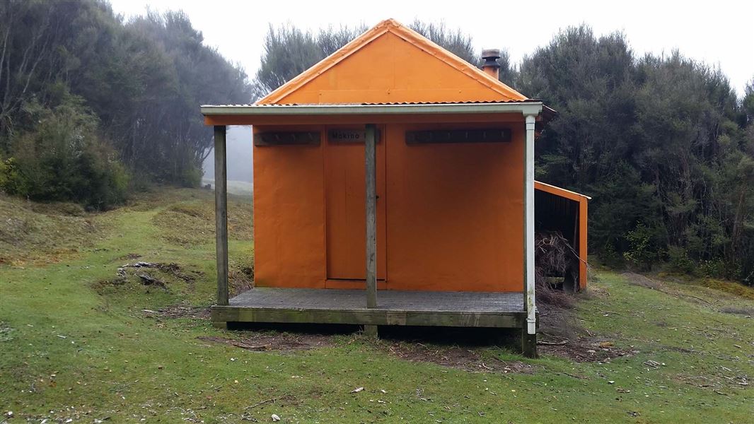
Located in the north-eastern Kaweka Forest Park, Makino Hut is situated in a flat, sheltered site where the open manuka/kanuka meet the red beech forest.
On the way here
Makahu Road Circuit (via Makino Hut and Te Puia Lodge) · 6-7 hrs
Makahu Road Circuit (via Makino Hut and Te Puia Lodge) is an interesting day or overnight trip.
Makahu Road to Makino Hut (Makino Track) or Makino-Te Puia track junction
A short distance after Makahu Road enters the park it climbs to a saddle. It is from this point the track to Makino Hut leaves the road. There is a small carpark, for about 4 vehicles, and an information panel here. The track leads up a manuka ridge for 20 minutes (plus climb) – from where there are good views of the Mohaka valley and surrounding plateau farmland. Look and listen for fernbirds in the ground level scrubland and listen for kiwi at night. The track continues along a manuka covered flat, then climbs again to a further flat section. Manuka vegetation gives way to red beech as altitude is gained. The track continues past the Middle Hill turnoff to the left, then to the right to Te Puia Lodge. If you are not planning to visit Makino Hut, then take the turnoff to Te Puia Lodge. Otherwise, continue on Makino Track. About 15 - 20 minutes from this junction, in a small clearing, is Makino Hut.
Makino Hut (or Makino-Te Puia track junction) to Te Puia Lodge
If you went to Makino Hut, return back down Makino Track until you reach the track junction to Te Puia Lodge. Take this track, which descends steeply for around 1.85 km into the Mohaka River valley. Once the track reaches the valley, it joins Te Puia Track. Follow the track downstream for a short distance, until you reach Te Puia Lodge.
Side-trip: Visit Mangatainoka Hot Springs
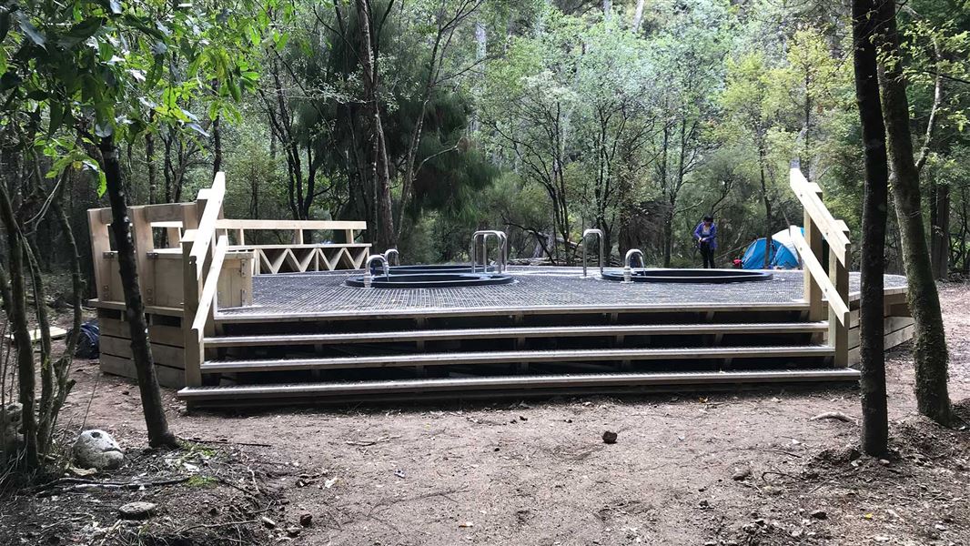
From the junction of the track from Makino Hut with Te Puia Track, you can continue upstream to visit Mangatainoka Hot Springs . The track crosses a bridge over the Makino River just above its confluence with the Mohaka River. The track then continues alongside the Mohaka, through native bush with some rolling terrain. Steep drop-offs in some sections lend nice views of the surrounding foothills. There is a final steep descent to reach the hot springs. At the hot springs, there are 3 pools surrounded by a decking area. These pools have valves to control water flow and to empty the tubs. The hot springs are on a small manuka terrace beside the Mohaka River. The Mangatainoka Hot Springs Campsite is adjacent to the pools. If you wish to travel up the river from the hot springs, it's private land and prior permission from the landowner is required.
Makino Track (Makahu Road to Makino Hut) · 2-3 hrs
A short distance after Makahu Road enters the park it climbs to a saddle. It is from this point the track to Makino Hut leaves the road.
The track leads up a manuka ridge for 20 minutes (plus climb) – from where there are good views of the Mohaka valley and surrounding plateau farmland. Look and listen for fernbirds in the ground level scrubland and listen for kiwi at night. The track continues along a manuka covered flat, then climbs again to a further flat section. Manuka vegetation gives way to red beech as altitude is gained. The track continues past the Middle Hill turnoff to the left, then to the right to the steeply descending track to Te Puia Lodge. About 15 - 20 minutes from this junction, in a small clearing, is Makino Hut.
For experienced tramping parties there is access from Makino Hut to Ballard Hut (via the main Kaweka Range) or to Mangaturutu Hut (via the upper reaches of the Makino River).
Source: DOC Te Papa Atawhai.
Fees and bookings
Before you go, buy Hut Tickets for each night's stay. Put these in the honesty box at the hut. Or buy a Backcountry Hut Pass that gives unlimited use at most Standard and Serviced huts for a 12 month period. Retailers that sell hut tickets and passes
Source: DOC Te Papa Atawhai.
On these tracks
Source: DOC Te Papa Atawhai.
Nearby stops
Te Puia Hut (Lodge)
Serviced • 24 bunks • Hawke's Bay • 1.9 km
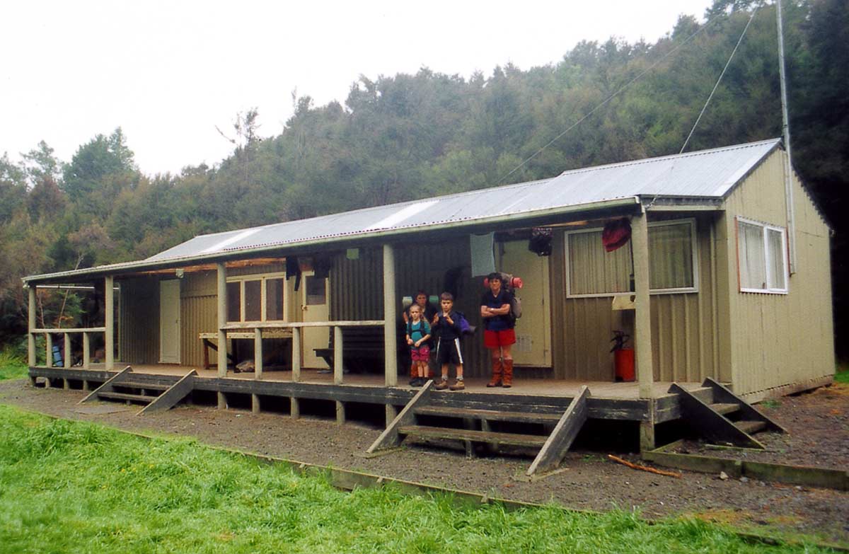
Te Puia Hut is a Department of Conservation hut located in Hawke's Bay. It is described as a suitable overnight stop for families with children or new trampers.
Heating • Mattresses • Toilets - non-flush
Mangatainoka Hot Springs
Hawke's Bay • 2.9 km
Mangatainoka Hot Springs is a campsite located in Hawke's Bay. The site is named for the natural geothermal features found in the area.
Mangatainoka Campsite
Backcountry • Hawke's Bay • 3.3 km
Mangatainoka Campsite is a popular campsite located beside the Mohaka River and the Mangatainoka Hot Pools in Hawke's Bay.
Water from stream • Toilets - non-flush • Toilets
Mangatutu Hot Springs Campsite
Basic • Hawke's Bay • 4.3 km
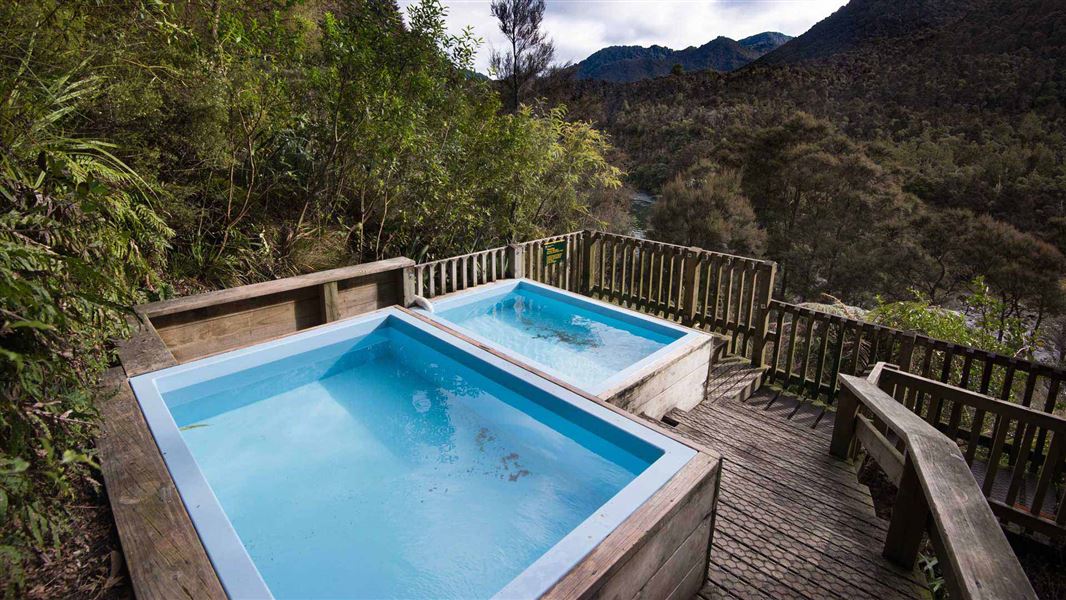
Mangatutu Hot Springs Campsite is a popular spot for camping, picnics, and fishing in Hawke's Bay. It serves as a starting point for tramping, hunting, or day…
Non-powered/tent sites • Water from stream • Toilets - non-flush

North Whetu Bivvy
Basic/bivvies • 2 bunks • Hawke's Bay • 4.4 km
North Whetu Bivvy is a hut located in Hawke's Bay. It is the former Studholme Saddle Bivvy which has moved location.
Walks nearby
Te Puia Hut Track and Mangatainoka Hot Springs
Intermediate • 1–2 days • 1.6 km away
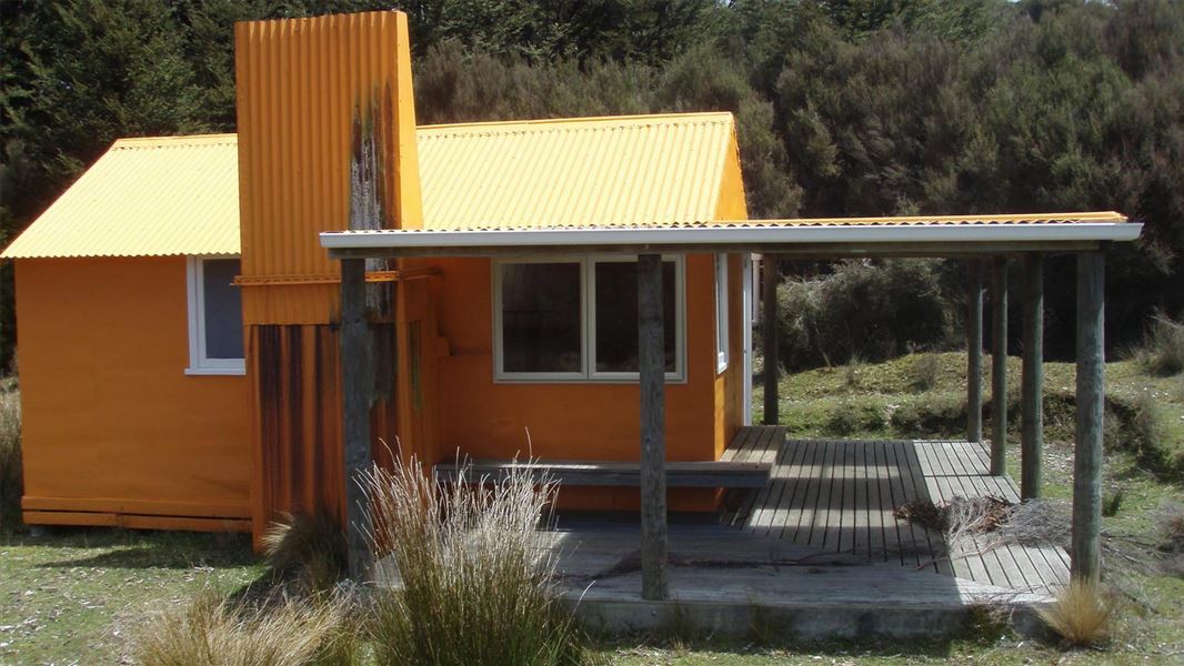
Middle Hill Track (Makahu Road to Middle Hill Hut)
Advanced • 2-3 hrs • 4.8 km • 4.03 km away
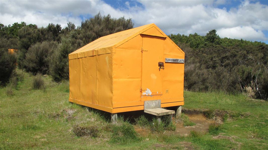
Makahu Road to Makahu Saddle (via Middle Hill Hut and Kaweka Flats)
Advanced • 5.5-7.5 hrs • 12.9 km • 4.58 km away
Dons Stream Walk
Advanced • 1 hr return • 10.99 km away
Trials Spur Track
Advanced • 2-3 hr • 10.99 km away
Contact
DOC Customer Service Centre
Regional DOC service centre.
Notes from people who have been
No notes yet. If you have been, say what you found.
Something missing or out of date?
Closed, moved, wrong facts, or something we have missed? Travellers keep the Road Guide up to date. Tell us what you found at contribute@parkup.nz and we will check it and add it.
Ask us to take this down
A person reads every request. We do not remove a place until we have checked it.
Sources
- OpenStreetMap Huts · ODbL (Open Database License)Contains information from OpenStreetMap, made available under the ODbL.
- DOC Huts · CC BY 4.0Data sourced from the Department of Conservation (DOC), New Zealand.
- DOC Huts (API) · CC BY 4.0Crown Copyright: Department of Conservation Te Papa Atawhai. Data sourced from the DOC Developer Portal (api.doc.govt.nz).