Holdsworth road end to Powell Hut/Mount Holdsworth
WalkWellington
- Grade
- Intermediate
- Walking time
- 11 hr
- Dogs
- Under control
Getting there
We have not checked a road end or car park for this place yet, so we do not give driving directions to it. Check how to get there before you go. Some routes cross private land and need the landowner's permission.
How to get there, on doc.govt.nzTurn off SH2 on to Norfolk Road, 2 km south of Masterton. This leads to Mount Holdsworth Road. Holdsworth is 15 km from SH2.
Follow the Gentle Annie Track on the Holdsworth - Kaitoke Track to Mountain House Shelter.
Source: DOC Te Papa Atawhai.
Map and tracks
Track lines: DOC Te Papa Atawhai. Map data © OpenStreetMap contributors. Topo map: LINZ, CC BY 4.0. 40.89728° S, 175.43562° E
About this place
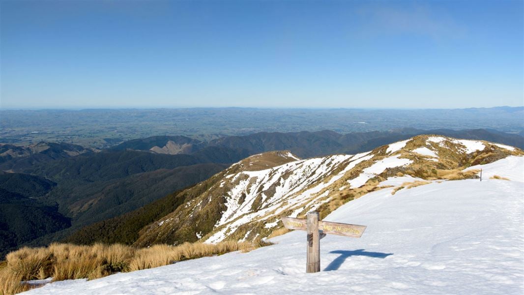
This tramp follows the Mount Holdsworth Track to Powell Hut. From the rocky outcrop below the hut you get a view of High Ridge and Totara Flats far below.
The route
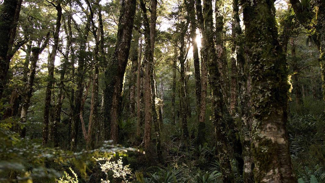
Begin on the Gentle Annie Track . For fitter visitors, the tramp beyond Mountain House Shelter follows the Mount Holdsworth Track. It climbs through beech forest that reduces as the bushline and Powell Hut is approached (1200 metres). Just below the hut, a rocky outcrop gives an excellent view of High Ridge and Totara Flats far below in the Waiohine valley. The route to the summit of Mount Holdsworth (1470 metres) is exposed to winds but otherwise straight-forward. From Mt Holdsworth Rd the one way trip to Powell Hut is 5 hr, to Mount Holdsworth is 6 hr with a tramping pack. It may be faster with a day pack. Powell Hut is a well-equipped hut on the Mt Holdsworth - Jumbo Circuit , and a popular winter destination for fitter day visitors because it is probably the quickest route to reach the snow-covered tops of the Tararua Range.
Source: DOC Te Papa Atawhai.
Know before you go
Pack for bad weather
The Tararua Forest Park is well known for wild, fast-changing and unpredictable weather. Always check the weather forecast Pack warm and waterproof clothing, even if the forecast is good. Carry emergency equipment including a torch, spare food and a distress beacon. Overnight packing list Day hike packing list If you are trail running the track, you still need to be prepared for bad weather. Mountain Safety Council trail running
Assess the weather carefully before going beyond Powell Hut
The route between Powell Hut and Mt Holdsworth experiences frequent strong winds, thick mist, freezing temperatures and rain/snow. Be prepared to encounter these conditions at any time of year, even if the weather looks nice in the morning. Low visibility conditions make navigation difficult and wind, rain and cold can cause hypothermia. Before leaving Powell Hut to tramp to Mt Holdsworth, look carefully at the weather and assess whether you have the experience and equipment for the conditions.
Source: DOC Te Papa Atawhai.
Joins these tracks
Source: DOC Te Papa Atawhai.

Nearby stops
Donnellys Flat
Wellington • 2.8 km

Atiwhakatu Hut
Standard • 26 bunks • Wellington • 3.6 km
Atiwhakatu Hut is a standard 26-bunk hut located in the Wairarapa area of the Wellington region.
Heating • Mattresses • Toilets - non-flush
Holdsworth Lodge
28 bunks • Wellington • 3.6 km
Holdsworth Lodge is a hut in the Wellington region suitable for families and groups. It also serves as a starting point for the first night of a tramp into the…

Holdsworth Campsite
Standard • Wellington • 3.9 km
Holdsworth Campsite is located at the eastern entrance of the park beneath the Tararua Ranges. The area offers opportunities for walks, fishing, and swimming,…
Fire pit/place for campfires (except in fire bans) • Non-powered/tent sites • Shelter for cooking

Jumbo Hut
Serviced • 20 bunks • Wellington • 4.8 km
Jumbo Hut is a serviced 20-bunk hut located in the Wairarapa region of Wellington.
Cooking • Heating • Mattresses
Walks nearby
Notes from people who have been
No notes yet. If you have been, say what you found.
Something missing or out of date?
Closed, moved, wrong facts, or something we have missed? Travellers keep the Road Guide up to date. Tell us what you found at contribute@parkup.nz and we will check it and add it.
Ask us to take this down
A person reads every request. We do not remove a place until we have checked it.
Sources
- DOC Tracks (API) · CC BY 4.0Crown Copyright: Department of Conservation Te Papa Atawhai. Data sourced from the DOC Developer Portal (api.doc.govt.nz).