Cascade Hut
Standard hutKaimanawa Forest Park, WaikatoOpen
- Sleeps
- 6 bunks
- Booking
- Not bookable
- Cost
- from $15
- Heating
- Yes
- Drinking water
- Boil first
- Toilet
- Non-flush
Getting there
We have not checked a road end or car park for this place yet, so we do not give driving directions to it. Check how to get there before you go. Some routes cross private land and need the landowner's permission.
How to get there, on doc.govt.nz- Topo map
- Topo50 sheet BH36
Source: DOC Te Papa Atawhai.
Map and tracks
Track lines: DOC Te Papa Atawhai. Map data © OpenStreetMap contributors. Topo map: LINZ, CC BY 4.0. 39.05795° S, 176.11167° E
About this place
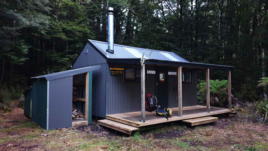
This standard six-bunk hut in the Kaimanawa Forest Park is an ideal base for hunters, or for hikers looking to enjoy the scenic Hinemaiaia track.
On the way here
Boyd, Oamaru and Cascade Hut tracks · 2 - 4 days
Boyd Hut to Cascade Hut via Maungaorangi
Time: 10 - 12 hr
km This strenuous track from Boyd Hut follows the track over Waitawhero Saddle towards Oamaru Hut. Near the confluence of the Waitawhero and Oamaru streams the route turns left onto a long, steep ridge up Maungaorangi. On the tops the route is marked with poles. It then descends to Te Waiotupuritia Saddle and on down to Cascade Hut. A map and compass are essential. GPS recommended.
Te Iringa / Oamaru Hut Track - Cascade Hut (Upper Kaipo Valley Route / Kaipo Track)
Time: 6 - 9 hr
km A marked route runs from the swingbridge on the Te Iringa/Oamaru Track to Cascade Hut. In the upper reaches of the Kaipo River there are numerous river crossings and log jams to negotiate, so be aware that this is a time-consuming section. The track then climbs to a ridge just south of Kaipo Saddle. Descend off the ridge to Cascade Stream and the track junction. The right-hand track heads downstream for another 30 minutes to Cascade Hut.
Cascade Hut to Clements Mill Road (Hinemaiaia Track)
Time: 4 - 5 hr
km The track follows the open river flats of the Tauranga-Taupo River downstream before climbing away from the river up a prominent beech-covered ridge. The track drops down to the Clements Mill roadend following the Hinemaiaia Stream and its tributaries. Heading in for a night at the Cascade Hut via the Hinemaiaia Track PHOTO: Anna Elwarth | DOC
Source: DOC Te Papa Atawhai.
Trip options
Walking times come from DOC track descriptions, added up leg by leg from car-accessible trailheads. Nights and return times are ParkUp estimates, allowing about 8 hours of walking a day.
1 option · 3 nights
Taharua Road
Walking in
22 hr (via Oamaru Hut, Boyd Hut)
Walking out
22 hr to Taharua Road (via Oamaru Hut, Boyd Hut)
Source: DOC Te Papa Atawhai track descriptions.
Fees and bookings
Before you go, buy Hut Tickets for each night's stay. Put these in the honesty box at the hut. Or buy a Backcountry Hut Pass that gives unlimited use at most Standard and Serviced huts for a 12 month period. Retailers that sell hut tickets and passes
Source: DOC Te Papa Atawhai.
Nearby stops
Boyd Hut
Standard • 16 bunks • Hawke's Bay • 11.9 km
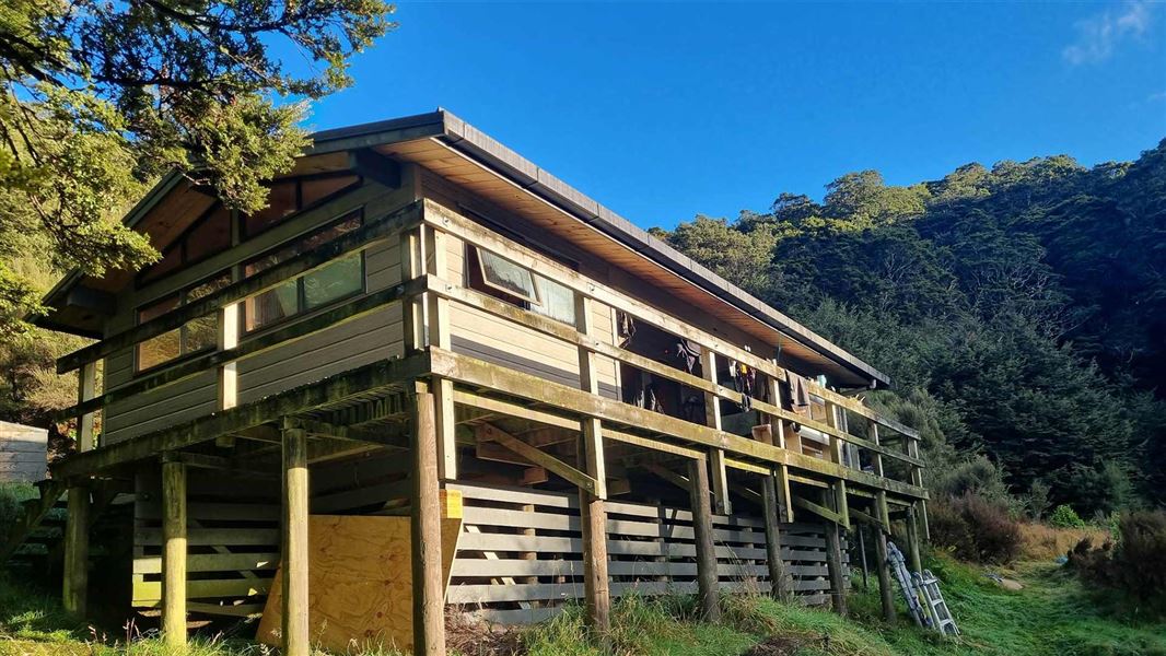
Boyd Hut is a standard 16-bunk hut located in the Kaimanawa Forest Park. It sits below the Boyd Rocks and overlooks the Ngaruroro Valley.
Heating • Mattresses • Toilets - non-flush

Oamaru Hut
Standard • 12 bunks • Hawke's Bay • 13.4 km
Oamaru Hut is a standard 12-bunk hut located in the Kaimanawa Forest Park. It serves as a base for hunting sika deer and fishing.
Heating • Mattresses • Toilets - non-flush
WTFRW Hut
Hawke's Bay • 7.9 km
Clements Road End Campsite
Waikato • 8.2 km
Clements Road End Campsite is a basic campsite located in the Tūrangi and Taupō area of the Waikato region. The site is situated at the start of the Hinemaiaia…
Te Whare Ruruhau
Hawke's Bay • 9.9 km
Te Whare Ruruhau is a hut located in the Hawke's Bay region. No further details are available in the provided records.
Walks nearby
Contact
DOC Customer Service Centre
Regional DOC service centre.
Notes from people who have been
No notes yet. If you have been, say what you found.
Something missing or out of date?
Closed, moved, wrong facts, or something we have missed? Travellers keep the Road Guide up to date. Tell us what you found at contribute@parkup.nz and we will check it and add it.
Ask us to take this down
A person reads every request. We do not remove a place until we have checked it.
Sources
- DOC Huts · CC BY 4.0Data sourced from the Department of Conservation (DOC), New Zealand.
- OpenStreetMap Huts · ODbL (Open Database License)Contains information from OpenStreetMap, made available under the ODbL.
- DOC Huts (API) · CC BY 4.0Crown Copyright: Department of Conservation Te Papa Atawhai. Data sourced from the DOC Developer Portal (api.doc.govt.nz).