Woolshed Creek Hut
Serviced hutHakatere Conservation Park, CanterburyOpen
- Sleeps
- 26 bunks
- Booking
- Can book
- Cost
- from $12.50
- Heating
- Yes
- Drinking water
- Boil first
- Toilet
- Non-flush
Getting there
We have not checked a road end or car park for this place yet, so we do not give driving directions to it. Check how to get there before you go. Some routes cross private land and need the landowner's permission.
How to get there, on doc.govt.nzWoolshed Creek Hut is on the Mount Somers Track. It can be accessed from:
- Topo map
- Topo50 sheet BX19
Source: DOC Te Papa Atawhai.
Map and tracks
Track lines: DOC Te Papa Atawhai. Map data © OpenStreetMap contributors. Topo map: LINZ, CC BY 4.0. 43.60111° S, 171.32582° E
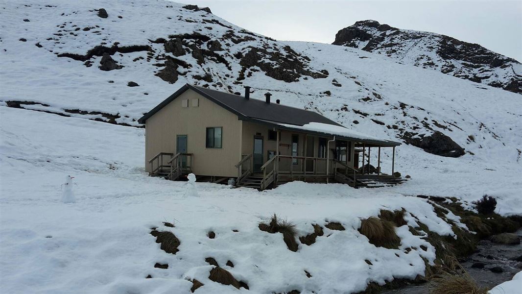
About this place
Woolshed Creek Hut provides a great overnight tramp for families with children or new trampers.
On the way here
Track to Woolshed Creek Hut · 3 hr
This track offers good overnight or day walking options. For a day walk, you can do a return walk to Woolshed Creek Hut or a shorter walk such as along the historic tramway route or to Blackburn Mine or trig R.
Road end to Woolshed Creek Hut
The track starts at Woolshed Creek car park at the end of Jig Road. Follow a historic tramway that runs beside Woolshed Creek, passing through attractive beech forest. The track then climbs steeply, running alongside a hand-built jig that transported coal from the Blackburn Mine to the railway wagons waiting below. The track flattens out at the site of the old Blackburn Mine. This is a good place to stop for a break, as there are historic relics and a reconstruction of the mine entrance. It takes around one hour to reach the mine from the track entrance. From the mine, the track climbs to a high point (trig R, 934 m) with superb views of the upper Ashburton Gorge, before descending to Woolshed Creek Hut. This track is a section of the multi-day Mount Somers Track . There can be snow and ice in winter. Always check the forecast and make sure you have the skills and gear for the conditions. There are some unbridged stream crossings on this track. Assess them carefully before crossing.
Alternative route: 4WD track
There is a turnoff onto a 4WD track between Blackburn Mine and trig R. You can follow a 4WD track to Woolshed Creek Hut. This is an easier track than walking on the main track described above, but takes about the same time.
Alternative route: Sidewinder Track
Time: 45 min
km This steep track provides an alternative route to the climb to Blackburn Mine. It begins with a short walk through a small pocket of tawhai/silver beech that survived the fires which swept through the Ashburton Gorge. The track then climbs steeply up to and through the tailings of the old Blackburn Mine, where it links with the main track to Woolshed Creek Hut. The Sidewinder Track takes longer than the main track.
Optional circuit route: Woolshed Creek Hut to Woolshed Creek car park via Bus Stop and South Face tracks
Time: 3 hr
Category: Advanced tramping track 6.4 km There is the option of making a circuit by following the Bus Stop and South Face Ttacks. These are more challenging and longer than the main track to/from Woolshed Creek Hut. From Woolshed Creek Hut, the track climbs 500 m to a local feature known as the Bus Stop Overhang. From here, the track crosses the face of Mount Somers to link with South Face Track (2 hr from the track start), which then follows a rocky ridge to Woolshed Creek car park. There is dynamic scenery with regenerating mountain beech forest/tawhairauriki within a landscape of waterfalls, deep icy pools and rocky tors. There may be snow in winter.
Mount Somers Track · 2 days
The track from Sharplin Falls car park to Pinnacles Hut is considerably more challenging than most other tramping tracks in the Te Kiekie/Mount Somers area. Take care and allow extra time. The track from Woolshed Creek car park to Woolshed Creek Hut is an easier alternative. Streams in the area, particularly Pony Stream on the way to Pinnacles Hut, can rise quickly after heavy rainfall and become dangerous and impassable.
Walking options
There are rough and rugged sections of track. View larger image (JPG, 263K) . Image: New Zealand Mountain Safety Council Mount Somers Track runs from the Sharplin Falls car park to the Woolshed Creek car park along the northern side of Mount Somers. There are two huts on the track – Woolshed Creek and Pinnacles. The track is a two-day tramp suitable for families. You can also do an overnight return tramp on the track, either from Woolshed Creek car park to Woolshed Creek Hut (an easier option) or from Sharplin Falls car park to Pinnacles Hut (a much more challenging option). You can combine Mount Somers Track with the Bus Stop Track and South Face Track to make a circuit. This circuit starts and ends at Sharplin Falls car park. This is more challenging than the main Mount Somers Track. See further information further down this page. This area gets very cold in winter and early spring. There can be snow and ice. It is best suited to experienced and well-equipped trampers at these times. Trampers with less experience are advised to choose the return overnight trip to Woolshed Creek Hut in winter, rather than the full track.
Pinnacles Hut to Woolshed Creek Hut
Time: 3 hr
6.2 km From the hut, follow markers through tussock and subalpine scrub up to the Mount Somers saddle (1170 m). It's a steady climb to the saddle where views of the Mount Somers Range and Old Man ranges dominate the scenery. On the descent towards Morgan Stream, a sign indicates a short side-trip to view some interesting boulder features referred to as ‘caves’. Follow the markers across Morgan Stream and Woolshed Creek to Woolshed Creek Hut. There are no bridges, so assess these streams carefully before crossing – they may not be safely crossable.
Woolshed Creek Hut to Woolshed Creek car park
Time: 2 hr 30 min
5.1 km From Woolshed Creek Hut, the track rises to a high point (trig R, 934 m) with superb views of the upper Ashburton Gorge, before descending to the old Blackburn Mine. The track then runs alongside the hand-built jig that transported coal from the Blackburn Mine to the railway wagons waiting below. At the bottom of the jig the track follows the route of the tramway to Woolshed Creek car park.
Alternative route: 4WD track
From Woolshed Creek Hut, you can follow a 4WD track to its junction with the Mt Somers Track below Trig R. This is an easier track but takes about the same time.
Alternative route: Sidewinder Track
Time: 45 min
km This steep hill track branches off the Mount Somers Track. It starts at Blackburn Mine, then descends steeply into Woolshed Creek valley. It ends with a short walk through a silver beech forest before rejoining Mt Somers Track. Taking the Sidewinder Track adds about 25 minutes to the time out from Woolshed Creek Hut compared to the using The Mt Somers Track the whole way.
Alternative exit route: Woolshed Creek Hut to Woolshed Creek car park via Bus Stop and South Face Tracks
Time: 3 hr
Category: Advanced tramping track 6.4 km This is an alternative route for the last day of the Mount Somers Track. It is more challenging than Mount Somers Track. From Woolshed Creek Hut, the track climbs some 500 metres to a local feature known as the Bus Stop Overhang. From here, the track crosses the face of Mount Somers to link with South Face Track (2 hr from the track start), which then follows a rocky ridge to Woolshed Creek car park. There is dynamic scenery with regenerating mountain beech forest/tawhairauriki within a landscape of waterfalls, deep icy pools and rocky tors.
Circuit option: Returning to Sharplin Falls car park via Bus Stop Track and South Face Track
You can combine the Bus Stop Track and South Face Track with Mount Somers Track to make a circuit, starting and ending at Sharplin Falls car park. This is longer and more challenging than the Mount Somers Track, and there can be persistent snow in winter and spring. For the circuit, follow Mount Somers Track to Woolshed Creek Hut, as described above. Then take the alternative route described below to loop back to Sharplin Falls car park.
Woolshed Creek Hut to Sharplin Falls car park
Time: 8 hr
Category: Advanced tramping track km From the hut, the route climbs some 500 m to a local feature known as the Bus Stop Overhang. From here the track crosses the face of Mount Somers to link with South Face Track. Continue around the southern face of Mount Somers on the South Face Track, through a mix of open grassland and forested catchments. You pass Acland Shelter, a good place to stop for a rest but not intended to be used overnight. This section of track eventually rises to its highest point (1080 m) at the junction of the Mount Somers Summit Track. The final steep downhill section is through regenerating forest areas but is open enough to continue to provide interesting views to the east. In winter, the south face of Mount Somers gets very little sunlight, making the snow hard and icy. An ice axe, crampons and some mountaineering experience are required to safely reach the summit. The summit of Mount Somers is very exposed to southerly fronts.
Source: DOC Te Papa Atawhai.
Know before you go
Expect snow in winter
There can be snow and ice in winter. Always check the forecast and make sure you have the skills and gear for the conditions. Woolshed Creek Hut weather forecast – NIWA website
Source: DOC Te Papa Atawhai.
Trip options
Walking times come from DOC track descriptions, added up leg by leg from car-accessible trailheads. Nights and return times are ParkUp estimates, allowing about 8 hours of walking a day.
2 options · 1 night
Sharplin Falls car park
Walking in
8 hr (via Pinnacles Hut)
Walking out
2 hr 30 min to Woolshed Creek car park
Walking in
8 hr (via Pinnacles Hut)
Walking out
8 hr to Sharplin Falls car park (via Pinnacles Hut)
Source: DOC Te Papa Atawhai track descriptions.
Fees and bookings
1 May - 30 September
1 October - 30 April
Weekdays
Weekends
1 December - 29 February
Weekdays
Weekends
Backcountry Hut Passes can be used at this hut. About hut tickets and passes Retailers that sell hut tickets and passes
Bookings are open for stays up to 30 June 2027. If no availability shows online for your dates, the hut is fully booked. No spaces are kept for visitors arriving without a booking. Phone and in‑person bookings made at a visitor centre incur a $10 service fee. Same‑day bookings are available online until 8 pm if spaces remain. Book Woolshed Creek Hut and campsite online Your hut booking is for any bunk bed, not for a specific bunk bed – select your bunk bed on arrival.
Source: DOC Te Papa Atawhai.
On these tracks
Source: DOC Te Papa Atawhai.
Nearby stops

Pinnacles Hut
Serviced • 19 bunks • Canterbury • 4.7 km
Pinnacles Hut is a serviced 19-bunk hut located in the Mt Somers area of Canterbury.
Heating • Mattresses • Toilets - non-flush
Acland Shelter
2 bunks • Canterbury • 4.2 km
Acland Shelter is a basic hut located in the Canterbury region. It provides simple overnight accommodation for tramping parties.
Three Creeks Hut
Canterbury • 5.8 km
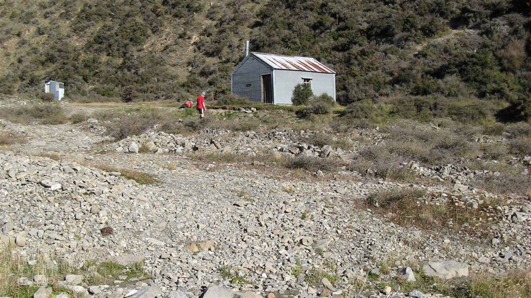
Manuka Hut
Basic/bivvies • 6 bunks • Canterbury • 9.3 km
Manuka Hut is a basic hut located in the Mid and South Canterbury backcountry. It is situated in an area that is at risk of flooding during heavy rain.
Heating • Mattresses • Toilets - non-flush
Cookshop Hut
Canterbury • 9.5 km
Cookshop Hut is a backcountry hut located in the Canterbury region of New Zealand. The provided records do not include specific details regarding its…
Walks nearby
Mount Somers Nature Walk
Easy • 30 min one way • 1 km • 3.5 km away
Te Kiekie Route
Tramping track • 2 hr • 2.7 km • 3.79 km away
South Face Track
Advanced • 7 hr • 11.6 km • 4.24 km away
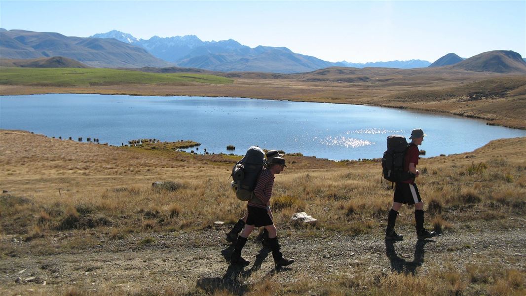
Stour Track
Intermediate • 5 hr one way • 15 km • 4.28 km away
Mount Somers summit hike
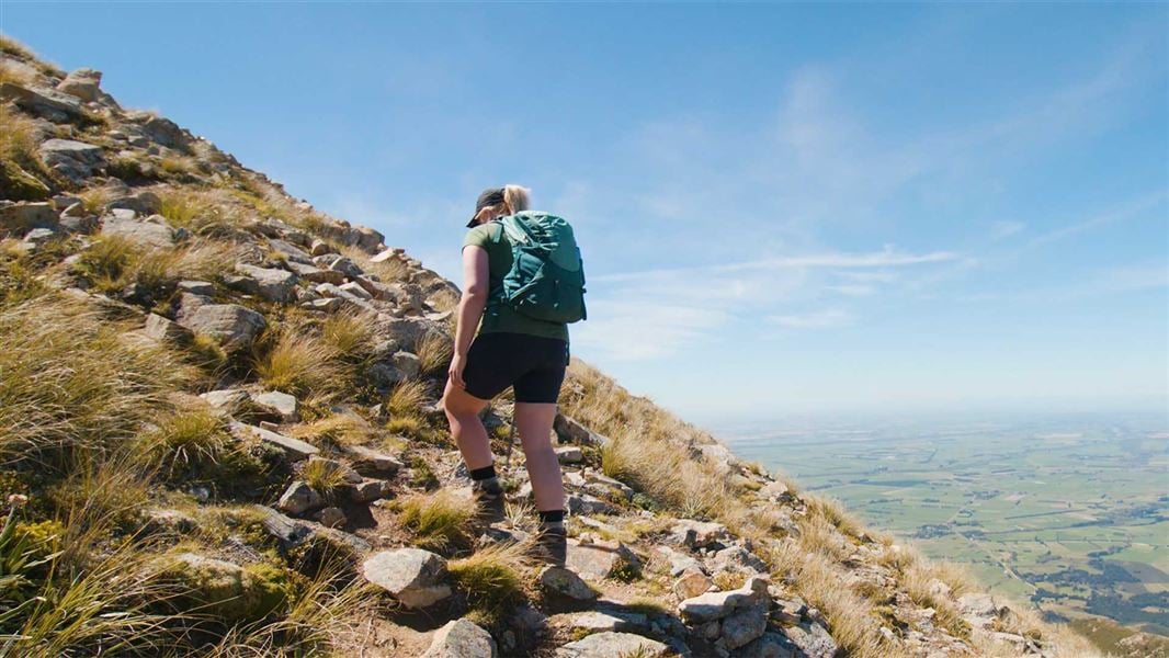
Advanced • 3 hr 30 min one way • 5.7 km one way • 6.69 km away
Contact
Hut and campsite bookings
Regional DOC service centre.
Notes from people who have been
No notes yet. If you have been, say what you found.
Something missing or out of date?
Closed, moved, wrong facts, or something we have missed? Travellers keep the Road Guide up to date. Tell us what you found at contribute@parkup.nz and we will check it and add it.
Ask us to take this down
A person reads every request. We do not remove a place until we have checked it.
Sources
- DOC Huts · CC BY 4.0Data sourced from the Department of Conservation (DOC), New Zealand.
- DOC Huts (API) · CC BY 4.0Crown Copyright: Department of Conservation Te Papa Atawhai. Data sourced from the DOC Developer Portal (api.doc.govt.nz).
- OpenStreetMap Huts · ODbL (Open Database License)Contains information from OpenStreetMap, made available under the ODbL.