Wharfedale Hut
Standard hutOxford Forest Conservation Area, CanterburyOpen
- Sleeps
- 8 bunks
- Booking
- Not bookable
- Cost
- from $15
- Heating
- Yes
- Drinking water
- Not drinkable
- Toilet
- Non-flush
Getting there
We have not checked a road end or car park for this place yet, so we do not give driving directions to it. Check how to get there before you go. Some routes cross private land and need the landowner's permission.
How to get there, on doc.govt.nzMap and tracks
Track lines: DOC Te Papa Atawhai. Map data © OpenStreetMap contributors. Topo map: LINZ, CC BY 4.0. 43.19773° S, 172.04229° E
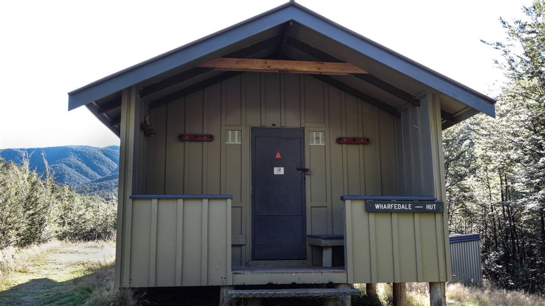
About this place
This is a standard 10-bunk hut in the North Canterbury and Arthur's Pass area.
On the way here
Wharfedale/Townshend Track · 1–2 days
View Hill car park to Wharfedale Hut
Time: 5 hr one way
km one way The track sidles and gently climbs through beech forest to the saddle. It is then mostly downhill to Wharfedale Hut, close to Dobson Stream. This track was formed originally as a stock route with the intention of eventually becoming a road linking the plains with Lees Valley. Work began in 1879 but after seven years it was abandoned as a possible road.
Townshend Track
Time: 2 hr 30 min one way
8.5 km one way Permission from Lees Valley Station is required for access to the Townshend Track as the track crosses private land. Email Lees Valley Station with at least one week's notice: themuster@grasslands-llc.com About half an hour after leaving Wharfedale Hut, the track opens out and follows a 4WD track over grazed flats coming out at Lees Valley Road. This track crosses the Townshend River twice and may be impassable if river levels are high. The Townshend Track is on unformed legal road. See Unformed legal roads for more information. The farm track varies from the unformed legal road at the beginning of this track from Lees Valley Road.
Source: DOC Te Papa Atawhai.
Trip options
Walking times come from DOC track descriptions, added up leg by leg from car-accessible trailheads. Nights and return times are ParkUp estimates, allowing about 8 hours of walking a day.
1 option · 1 night
View Hill car park
Walking in
5 hr
Walking out
5 hr to View Hill car park
Source: DOC Te Papa Atawhai track descriptions.
Fees and bookings
Before you go, buy Hut Tickets for each night's stay. Put these in the honesty box at the hut. Or buy a Backcountry Hut Pass that gives unlimited use at most Standard and Serviced huts for a 12 month period. Retailers that sell hut tickets and passes
Source: DOC Te Papa Atawhai.
On these tracks
Source: DOC Te Papa Atawhai.
Nearby stops
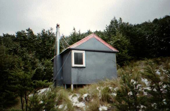
Black Hill Hut
Standard • 6 bunks • Canterbury • 3.6 km
Black Hill Hut is a standard six-bunk hut located in the North Canterbury and Arthur's Pass area.
Heating • Mattresses • Toilets - non-flush
Ryde Falls Camp
Canterbury • 5.4 km
Ryde Falls Camp is a campsite located in the Canterbury region of New Zealand. The provided data does not include specific details about facilities, access, or…

Lower Salmon Creek Bivvy
Basic/bivvies • 2 bunks • Canterbury • 6.4 km
Lower Salmon Creek Bivvy is a basic two-bunk hut located in the North Canterbury and Arthur's Pass area.
Mattresses • Toilets - non-flush • Water from stream
Walker Hut
Basic/bivvies • 4 bunks • Canterbury • 7.4 km
Walker Hut is a privately owned hut located in the Canterbury region. It is managed by the Canterbury branch of Jet Boating NZ.
Kinnebrooks Hut
Canterbury • 7.7 km
Kinnebrooks Hut is a basic shelter located in the Canterbury region of New Zealand. The provided records do not list specific facilities or amenities for this…
Walks nearby
Contact
Arthur's Pass National Park Visitor Centre
104 West Coast Road, Arthur's Pass 7654
Regional DOC service centre.
Notes from people who have been
No notes yet. If you have been, say what you found.
Something missing or out of date?
Closed, moved, wrong facts, or something we have missed? Travellers keep the Road Guide up to date. Tell us what you found at contribute@parkup.nz and we will check it and add it.
Ask us to take this down
A person reads every request. We do not remove a place until we have checked it.
Sources
- DOC Huts · CC BY 4.0Data sourced from the Department of Conservation (DOC), New Zealand.
- OpenStreetMap Huts · ODbL (Open Database License)Contains information from OpenStreetMap, made available under the ODbL.
- DOC Huts (API) · CC BY 4.0Crown Copyright: Department of Conservation Te Papa Atawhai. Data sourced from the DOC Developer Portal (api.doc.govt.nz).