Pouākai Circuit
WalkTaranaki
- Grade
- Advanced
- Walking time
- 3 days
- Distance
- 25 km
- Dogs
- No dogs
Getting there
We have not checked a road end or car park for this place yet, so we do not give driving directions to it. Check how to get there before you go. Some routes cross private land and need the landowner's permission.
How to get there, on doc.govt.nzMap and tracks
Track lines: DOC Te Papa Atawhai. Map data © OpenStreetMap contributors. Topo map: LINZ, CC BY 4.0. 39.24457° S, 174.06698° E
About this place
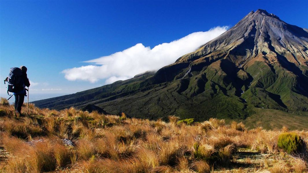
The premier 2–3 day tramp in Te Papa-Kura-o-Taranaki. It offers spectacular views of Taranaki Maunga and the surrounding countryside. The 25 km track passes through forest, alpine tussock fields and the unique Ahukawakawa.
The route
Beginning at North Taranaki Park Visitor Centre (North Egmont), the track can be walked in either direction. Two serviced backcountry huts with woodburners, toilets, water, bunks and mattresses provide overnight accommodation.
North Egmont to Holly Hut
Time: 3 - 4 hr
7.5 km The Pouākai Circuit begins on the Veronica Loop/Holly Hut Track, starting at North Egmont. Follow the boardwalk past the Camphouse. From here the track leads past Ambury Monument and climbs a long series of steps. You will pass a track junction – take the track signposted towards Holly Hut. Ten minutes past the junction, you will come to a lookout. This is the start of the alpine section of the track, so look at the weather and make sure you have the gear for the conditions. If you aren’t well-equipped enough and/or if the weather is so bad that you cannot see the maunga, then we recommend returning down the Veronica Loop Track and trying the circuit another day. From the lookout, the track climbs then sidles along the side of Taranaki. The track passes the towering lava columns of the Dieffenbach Cliffs and crosses the Boomerang Slip (watch for rockfall signs and follow their instructions). After crossing the slip, the track descends and reaches a track junction with Kōkōwai Track. If you are walking in the other direction (from Holly Hut to North Egmont), this is a key decision-point. Assess the weather and decide whether to attempt the alpine section of the track. If conditions aren’t favourable, you can return to Holly Hut or take Kōkōwai Track to Egmont Road. Once past the Kōkōwai Track turnoff, the track gradually descends to the Ahukawakawa Track junction. Turn left for a 5-minute walk to Holly Hut. Minarapa Stream just prior to the hut is unbridged and can be impassable after heavy rain. There are several springs along the track between North Egmont and Holly Hut. These are significant to iwi, hapū and whanau, so please treat them with respect and do not wash in them or walk through the springs. From the hut, a 30-minute (one way) side trip along the Bells Falls track will take you to the towering Te Rere-o-Tahurangi Falls (31 m).
Holly Hut toPouākaiHut
Time: 2 - 3 hr
4.5 km Return to the Ahukawakawa Track junction and follow the boardwalk across Ahukawakawa. This area is a wetland/swamp – while there is a boardwalk, expect water and mud on the track in places. After crossing the headwaters of the Hangatahua River, the track ascends a ridge through mountain cedar to reach the Pouākai Track. Turn left here to take a 1 hr 30 min (return) detour to PouākaiTrig (1,440 m). Turn right to follow Pouākai Track on to the Mangorei Track junction. Pouākai Hut is a 5 minute walk down the Mangorei Track. The Mangorei Track is a good exit from the circuit if weather conditions are bad (allow 2 hr to Mangorei Road end).
Pouākai Hut to North Taranaki Visitor Centre
Time: 5 - 7 hr
km Return uphill to the Pouākai Track junction and turn left to traverse open tussock lands, passing the scenic alpine tarns (pools) before skirting around Maude Peak. The track then climbs Henry Peak (1220 m) before descending Kaiauai Track, passing the Kaiauai Shelter, to cross the swingbridge over the Kai Auahi Stream. From here, the track continues through lowland forest, crossing several small streams before reaching the swingbridge across the Waiwhakaiho River. A short climb leads up to the Ram Track junction. Follow the Ram Track uphill to return to North Egmont road end.
Source: DOC Te Papa Atawhai.
Know before you go
Bookings required
All huts on the Pouākai Circuit require booking.
What to expect
The track is steep in places. The surface can be muddy and wet and has tree roots and embedded rocks. Expect snow and ice in winter conditions. Main rivers and streams are bridged apart from the Minarapa Stream just prior to Holly Hut and a couple of the smaller tributaries of the Waiwhakaiho River between Henry Peak and North Egmont. Some of these tributaries can flood at any time of the year.
Be ready for changeable weather
Taranaki Maunga has changeable and unpredictable weather. Check the forecast and carry enough clothing and equipment to ensure you are able to cope with any type of weather, at any time of the year. Te Papa-Kura-o-Taranaki weather forecast – NIWA website
Experience and equipment required
You need moderate to high levels of backcountry skills and experience. You need to be able to read a map, have undertaken tracks of a similar difficulty, have average or above fitness, and be able to traverse moderately steep slopes and rough ground.
Take care when crossing streams
The upper section of this track (between North Egmont and Holly Hut) crosses dry stream beds. These can rise quickly during heavy rain and may not be safe to cross. There are also stream crossings on the lower section of the track ( Kaiauai Track). Assess them carefully before crossing. If you have any doubt about whether you can cross safely, wait for the water levels to drop. This often happens quickly.
Be aware of rockfall risks
There are several rockfall zones on the Pouākai Circuit (including Boomerang Slip). Follow instructions on signage and cross these without stopping, one person at a time.
This track is much more difficult in winter
This is an alpine track and is far more challenging in winter. You will need an ice axe, crampons, snow gaiters and goggles for the section of track between North Egmont and Holly Hut, along with the skills to use them. There is nowhere in Taranaki to hire alpine gear. If there is snow on Taranaki Maunga , check the avalanche advisory and only tramp the track if you have the gear (avalanche transceiver, probe and snow shovel) and skills to manage the avalanche risk.
What to take
Make sure you are well equipped to walk the Pouākai Circuit. Essential gear: Waterproof raincoat and over-trousers Warm woollen or fibre pile clothing Spare dry socks Strong tramping boots Food and drink (enough for the duration plus extra for emergencies) First aid kit Sunscreen and sunglasses Sunhat and a warm hat Sleeping bag Portable fuel stove Hut tickets or annual hut pass Map and compass (and know how to use them!) Distress beacon (you can hire one at the North Taranaki Visitor Centre) Visit the Kiwi way – never miss an opportunity to use a loo and be prepared with a back-up toilet option Consider carrying: putties (gaiters) cellphone and/or mountain radio tent and bed roll in the summer months During winter and snow conditions you will need an ice axe and crampons, snow gaiters and goggles. You might want to consider carrying an avalanche transceiver, probe and snow shovel.
Source: DOC Te Papa Atawhai.
Joins these tracks
Source: DOC Te Papa Atawhai.
On this track
In walking order.

Nearby stops
Kaiauai Shelter
Taranaki • 1.6 km
Kaiauai Shelter is a hut located in the Taranaki region. The provided data does not include further details regarding its facilities or specific location.
The Camphouse
Taranaki • 3.8 km
The Camphouse is a historic hut situated on the slopes of Mount Taranaki in the Taranaki region. It serves as a base for exploring the walking tracks within…

Maketawa Hut
Serviced • 16 bunks • Taranaki • 5 km
Maketawa Hut is a DOC hut in the Taranaki region suitable for experienced trampers. It offers views of Taranaki Maunga from the deck.
Heating • Mattresses • Toilets - non-flush
Tahurangi Lodge
26 bunks • Taranaki • 5.2 km
Tahurangi Lodge is a hut located in the Taranaki region of New Zealand. The provided data does not contain further details regarding its specific facilities or…
Five Dollar Hut
Taranaki • 6.3 km
Five Dollar Hut is a basic shelter located in the Taranaki region. The provided records do not list specific facilities or details for this hut.
Walks nearby
Kōkōwai Track round trip
Advanced • 6 hr • 12 km • 2.4 km away
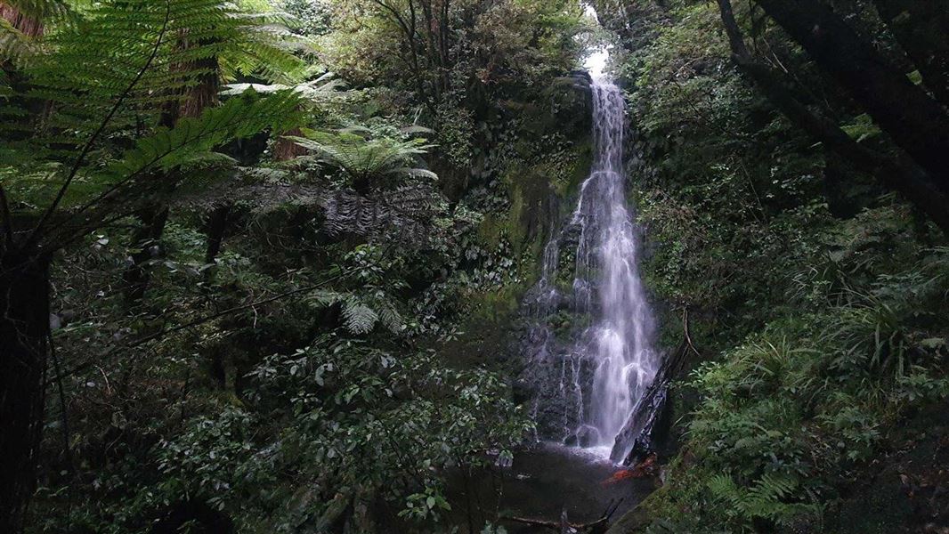
Maude Track to Mangakotukutuku Falls
Advanced • 1 hr 30 min one way • 2.8 km • 3.4 km away
Waiwhakaiho Route
Expert • 2 hr 30 min • 5 km • 3.6 km away
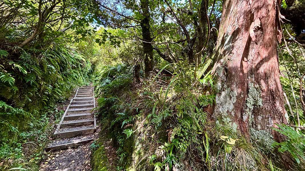
Veronica Loop Track
Easy • 1 hr 30 min- 2 hr • 3 km • 3.63 km away
Ngatoro – Waiwhakaiho Loop Track
Advanced • 6-7 hr • 10 km • 3.7 km away
Notes from people who have been
No notes yet. If you have been, say what you found.
Something missing or out of date?
Closed, moved, wrong facts, or something we have missed? Travellers keep the Road Guide up to date. Tell us what you found at contribute@parkup.nz and we will check it and add it.
Ask us to take this down
A person reads every request. We do not remove a place until we have checked it.
Sources
- OpenStreetMap Trails · ODbL (Open Database License)Contains information from OpenStreetMap, made available under the ODbL.
- DOC Tracks (API) · CC BY 4.0Crown Copyright: Department of Conservation Te Papa Atawhai. Data sourced from the DOC Developer Portal (api.doc.govt.nz).