Holly Hut
Serviced hutNorth Egmont area, TaranakiOpen
- Sleeps
- 32 bunks
- Booking
- Can book
- Cost
- from $10
- Heating
- Yes
- Drinking water
- Boil first
- Toilet
- Non-flush
Getting there
We have not checked a road end or car park for this place yet, so we do not give driving directions to it. Check how to get there before you go. Some routes cross private land and need the landowner's permission.
How to get there, on doc.govt.nzHolly Hut is around 3 - 4 hours tramp from North Taranaki Visitor Centre.
- Topo map
- Topo50 sheet BJ29
Source: DOC Te Papa Atawhai.
Map and tracks
Track lines: DOC Te Papa Atawhai. Map data © OpenStreetMap contributors. Topo map: LINZ, CC BY 4.0. 39.26541° S, 174.04593° E
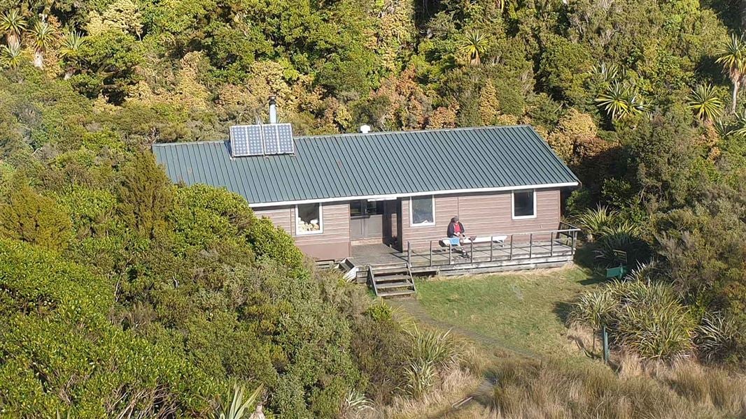
About this place
This 32-bunk serviced hut is a gateway to some of the most spectacular features of Te Papa-Kura-o-Taranaki.
On the way here
Pouākai Circuit · 2 - 3 days
North Egmont to Holly Hut
Time: 3 - 4 hr
7.5 km The Pouākai Circuit begins on the Veronica Loop/Holly Hut Track, starting at North Egmont. Follow the boardwalk past the Camphouse. From here the track leads past Ambury Monument and climbs a long series of steps. You will pass a track junction – take the track signposted towards Holly Hut. Ten minutes past the junction, you will come to a lookout. This is the start of the alpine section of the track, so look at the weather and make sure you have the gear for the conditions. If you aren’t well-equipped enough and/or if the weather is so bad that you cannot see the maunga, then we recommend returning down the Veronica Loop Track and trying the circuit another day. From the lookout, the track climbs then sidles along the side of Taranaki. The track passes the towering lava columns of the Dieffenbach Cliffs and crosses the Boomerang Slip (watch for rockfall signs and follow their instructions). After crossing the slip, the track descends and reaches a track junction with Kōkōwai Track. If you are walking in the other direction (from Holly Hut to North Egmont), this is a key decision-point. Assess the weather and decide whether to attempt the alpine section of the track. If conditions aren’t favourable, you can return to Holly Hut or take Kōkōwai Track to Egmont Road. Once past the Kōkōwai Track turnoff, the track gradually descends to the Ahukawakawa Track junction. Turn left for a 5-minute walk to Holly Hut. Minarapa Stream just prior to the hut is unbridged and can be impassable after heavy rain. There are several springs along the track between North Egmont and Holly Hut. These are significant to iwi, hapū and whanau, so please treat them with respect and do not wash in them or walk through the springs. From the hut, a 30-minute (one way) side trip along the Bells Falls track will take you to the towering Te Rere-o-Tahurangi Falls (31 m).
Holly Hut toPouākaiHut
Time: 2 - 3 hr
4.5 km Return to the Ahukawakawa Track junction and follow the boardwalk across Ahukawakawa. This area is a wetland/swamp – while there is a boardwalk, expect water and mud on the track in places. After crossing the headwaters of the Hangatahua River, the track ascends a ridge through mountain cedar to reach the Pouākai Track. Turn left here to take a 1 hr 30 min (return) detour to PouākaiTrig (1,440 m). Turn right to follow Pouākai Track on to the Mangorei Track junction. Pouākai Hut is a 5 minute walk down the Mangorei Track. The Mangorei Track is a good exit from the circuit if weather conditions are bad (allow 2 hr to Mangorei Road end).
Pouākai Crossing · 7 hr 30 min - 9 hr 30 min
North Taranaki Visitor Centre to Holly Hut
Time: 3–4 hr
The Pouākai Crossing begins on the Veronica Loop Track, starting at North Egmont. Follow the boardwalk past the Camphouse. From here the track leads past Ambury Monument and climbs a long series of steps. You will pass a track junction – take the track signposted towards Holly Hut. Ten minutes past the junction, you will come to a lookout. This is the start of the alpine section of the track, so look at the weather and make sure you have the gear for the conditions. If you aren’t well-equipped enough and/or if the weather is so bad that you cannot see the maunga, then we recommend returning down the Veronica Loop Track and trying the crossing another day. From the lookout, the track climbs then sidles along the side of Taranaki. The track passes the towering lava columns of the Dieffenbach Cliffs and crosses the Boomerang Slip (watch for rockfall signs and follow their instructions). After crossing the slip, the track descends and reaches a track junction with Kōkōwai Track. If you are walking in the other direction (from Holly Hut to North Egmont), this is a key decision-point: use it to assess the weather and decide whether to attempt the alpine section of the track. If conditions aren’t favourable, you can return to Holly Hut or take Kōkōwai Track to Egmont Road. Once past the Kōkōwai Track turnoff, the track gradually descends to the Ahukawakawa Track junction. Turn left for a 5 minute walk to Holly Hut. Minarapa Stream just prior to the hut does not have a bridge and can be impassable after heavy rain. There are several springs along the track between North Egmont and Holly Hut. These are significant to iwi, hapū and whanau, so please treat them with respect and do not wash in them or walk through the springs.
Side trip: Holly Hut toTe Rere-o-TahurangiFalls
Time: 1 hr return
It’s worth a side trip down to this mighty waterfall, one of the best in Te Papa-Kura-o-Taranaki. Over many millennia the water of the Hangatahua River has eroded a pathway through the volcanic rock of Te Umu-o-Taomanawa to form the 31 m falls.
Holly Hut toPouākaitarns
Time: 2 hr
Return to the Ahukawakawa Track junction and follow the boardwalk across Ahukawakawa, alpine swamp. This unique microclimate is home to many plant species, some usual at this altitude and others found nowhere else in the world. You can stop at the viewing platform before continuing on to cross the curved wooden bridge over the Hangatahua River . This area is a wetland. There is a boardwalk, but expect water and mud, in some places over the track. The track then climbs steeply through mountain cedar to reach the Pouākai Track junction. Turn right and continue beneath the aptly named Hump and to the Mangorei Track junction. If you are tired or running out of daylight, we recommend taking the track to Pouākai Hut and Mangorei Road End at this point, rather than continuing to the tarns. A trip to the tarns takes about an hour. If you have the time and energy, then continue to the picturesque Pouākai tarns. On a fine day, you can see a stunning reflection of Taranaki Maunga in the pools. The area around these small alpine tarns is very fragile. Keep to the boardwalks to help protect this fragile wetland area. Do not enter the pools.
Around the Mountain Circuit · 4–5 days loop
North Egmont to Holly Hut
Time: 3–4 hr
km In the upper car park at North Egmont road end, take the Holly Hut Track left of the Camphouse. The track climbs steeply to the junction with the Around the Mountain Circuit from where you turn right crossing several streams before reaching the Boomerang Slip. From here you will descend past the Kokowai Track, eventually meeting the Ahukawakawa Track. Holly Hut is 15 min further along the Around the Mountain Circuit.
Holly Hut to Waiaua Gorge Hut
Time: 7–9 hr
km From the hut, you take the Around the Mountain Circuit across Holly Flats, joining Bells Falls Track before reaching the Stony River Track. Caution is needed in the Hangatahua River area. Look carefully for flagged routes and be prepared for erosion and flooding. After crossing the river you continue downhill, across several streams before you meet the Kopoaiaia Track – look for the track entrance marker up on the bank. Turn left and climb uphill to the Puniho Track junction. Here you have two options: Low track: This section of track is often muddy, eroded and overgrown. It crosses many unbridged streams. Continue along the Kopoaiaia Track past the Kahui track junction and on to the Oaonui Track. High track: Turn left onto the Puniho Track and walk uphill 1 km to the 6 bunk Kahui Hut. From here the Kahui track descends to the junction with the Oaonui/Ihaia Tracks. Both options: Follow the Oaonui Track, eventually meeting the Ihaia/Brames Falls junction. Turn right onto the Ihaia Track and walk downhill for around 500 m to reach the short track into the Waiaua River. Walk up the riverbed to reach the small spur to Waiaua Gorge Hut. Allow up to an hour longer on your trip.
Source: DOC Te Papa Atawhai.
Trip options
Walking times come from DOC track descriptions, added up leg by leg from car-accessible trailheads. Nights and return times are ParkUp estimates, allowing about 8 hours of walking a day.
13 options · 1 to 3 nights
North Egmont
Tracks used: Around the Mountain Circuit → Pouākai Circuit
Walking in
4 hr
Walking out
4 hr to North Egmont
Tracks used: Around the Mountain Circuit → Pouākai Crossing
Walking in
4 hr
Walking out
4 hr to North Taranaki Visitor Centre
Tracks used: Around the Mountain Circuit → Pouākai Circuit
Walking in
4 hr
Walking out
7 hr to North Taranaki Visitor Centre
Source: DOC Te Papa Atawhai track descriptions.
Fees and bookings
1 May - 30 September
1 October - 30 April
Weekdays
Weekends
1 December - 29 February
Weekdays
Weekends
Camping
Backcountry Hut Passes can be used at this hut. How to pay with your Backcountry Hut Pass Before you go, buy Hut Tickets for each night's stay. Put this in the honesty box at the hut. Or buy a Backcountry Hut Pass or Campsite Pass. About hut tickets and passes About campsite passes Retailers that sell hut tickets and passes
Bookings are open for stays up to 30 June 2027. If no availability shows online for your dates, the hut is fully booked. No spaces are kept for visitors arriving without a booking. Phone and in‑person bookings made at a visitor centre incur a $10 service fee. Same‑day bookings are available online until 8 pm if spaces remain. Book Holly Hut online Your hut booking is for any bunk bed, not for a specific bunk bed – select your bunk bed on arrival.
Source: DOC Te Papa Atawhai.
On these tracks
Source: DOC Te Papa Atawhai.
Nearby stops
Pouākai Hut
16 bunks • Taranaki • 3.4 km
Heating • Mattresses • Toilets - non-flush

Kahui Hut
Standard • 6 bunks • Taranaki • 4.2 km
Kahui Hut is a Department of Conservation hut located on the western slopes of Taranaki Maunga in the Taranaki region. It sits in a small clearing surrounded…
Mattresses • Toilets - non-flush • Water from tap - not treated, boil before use

Waiaua Gorge Hut
Serviced • 16 bunks • Taranaki • 7.6 km
Waiaua Gorge Hut is a Department of Conservation hut located on the western side of Taranaki Maunga. It provides a base for day tramps or overnight stays…
Heating • Mattresses • Toilets - non-flush

Waingongoro Hut
Serviced • 16 bunks • Taranaki • 8.1 km
Waingongoro Hut is a DOC hut located in the Taranaki region. It is a suitable destination for a half day or overnight tramp, particularly for families with…
Heating • Mattresses • Toilets - non-flush
Walks nearby
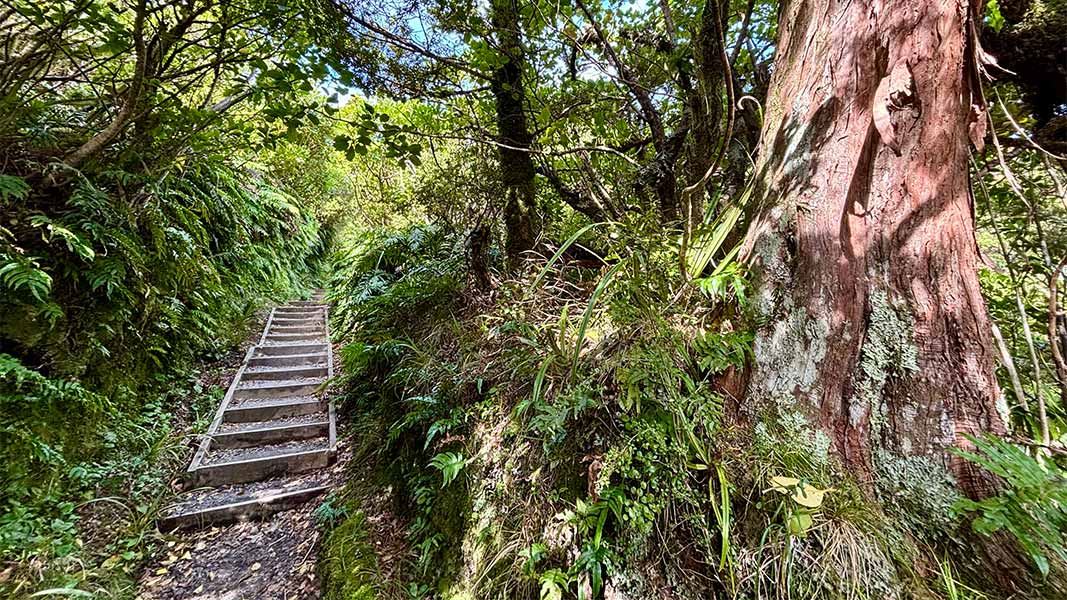
Kōkōwai Track round trip
Advanced • 6 hr • 12 km • 3.65 km away
Veronica Loop Track
Easy • 1 hr 30 min- 2 hr • 3 km • 3.81 km away
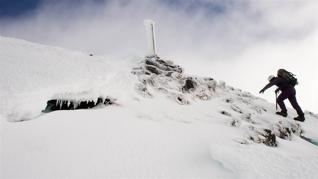
Taranaki Maunga Summit Climb
Advanced • Up 5–6 hr | down 3–4 hr • 6.3 km one way • 4.07 km away
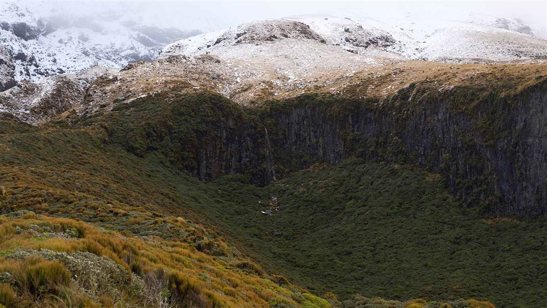
Tahurangi Translator Tower round trip
Advanced • 4 hr • 7.5 km • 4.14 km away
Nature Walk
Easiest • 25 min • 800 m • 4.25 km away
Contact
North Taranaki Visitor Centre
Regional DOC service centre.
Notes from people who have been
No notes yet. If you have been, say what you found.
Something missing or out of date?
Closed, moved, wrong facts, or something we have missed? Travellers keep the Road Guide up to date. Tell us what you found at contribute@parkup.nz and we will check it and add it.
Ask us to take this down
A person reads every request. We do not remove a place until we have checked it.
Sources
- DOC Huts (API) · CC BY 4.0Crown Copyright: Department of Conservation Te Papa Atawhai. Data sourced from the DOC Developer Portal (api.doc.govt.nz).
- DOC Huts · CC BY 4.0Data sourced from the Department of Conservation (DOC), New Zealand.
- OpenStreetMap Huts · ODbL (Open Database License)Contains information from OpenStreetMap, made available under the ODbL.