Mount Robertson tracks
WalkMarlborough
- Grade
- Advanced
- Walking time
- 12 hr
- Distance
- 6.4 or 7.1 km
- Dogs
- No dogs
Getting there
We have not checked a road end or car park for this place yet, so we do not give driving directions to it. Check how to get there before you go. Some routes cross private land and need the landowner's permission.
How to get there, on doc.govt.nzThe Mount Robertson Loop Track is well signposted from two access points on the Port Underwood Road.
The Mount Robertson Summit Route is accessed from the loop track.
Source: DOC Te Papa Atawhai.
Map
Map data © OpenStreetMap contributors. Topo map: LINZ, CC BY 4.0. 41.36722° S, 174.03764° E
About this place
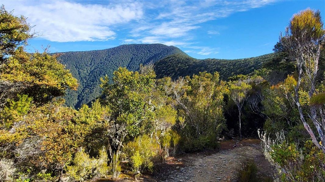
Mountain bike or walk through mature and regenerating forest, with the option to visit the Mt Robertson/Tokomaru summit.
The route
Mount Robertson Loop Track
Time: 8–9 hr
7.1 km This is a shared use track that is narrow and technical in places. You can start from either of the two access points on Port Underwood Road. Most mountain bikers do the loop in an anti-clockwise direction. The loop climbs through regenerating and mature forest, with an option to walk to the summit on the Mount Robertson Summit Route. For a longer trip starting from sea level, walk the Rarangi Bay–Whites Bay Track or walk/ride the Black Jack Track to get up to Port Underwood Road where the loop track begins. Note: Rarangi Bay – Whites Bay Track is not suitable for mountain bikes and is a walking track only.
Mountain biking
Grade: 3/Intermediate, 4/Advanced
Pukaka Valley extension
Predominantly ridden downhill as an extension to the loop track, this is extremely narrow and technical in places. Expect other users, particularly walkers coming uphill.
Mountain biking
Grade: 5/Expert
Mount Robertson Summit Route
Time: 4 hr return from Mt Robertson Loop Track junction
6.4 km return The Mount Robertson Summit Route continues from the Mt Robertson Loop Track. Follow the loop track to a junction at about 700 m altitude where the Mount Robertson Summit Route begins. From here the track follows an obvious ridge to the summit through beech forest. This section of the track takes about two hours. There is no water supply on the track so make sure you take water with you. At 1,036 m above sea level, Mt Robertson (Tokomaru) dominates the Scenic Reserve to which it gives its name.
Mountain biking
Grade: 3/Intermediate, 4/Advanced
Further mountain biking information
Visit the Marlborough Mountain Bike Club website for further details including the Double Eagle Downhill track.
Source: DOC Te Papa Atawhai.
Nearby stops

Whites Bay Campsite
Standard • Marlborough • 2.4 km
Whites Bay Campsite is a campsite in Marlborough situated near the surf beach at Pukatea/Whites Bay. The location offers access to walking, fishing, swimming,…
Non-powered/tent sites • Shower - cold • Toilets - flush

Robin Hood Bay Campsite
Basic • Marlborough • 2.9 km
Robin Hood Bay Campsite is a beachside campsite in the Marlborough region. It offers opportunities for fishing, surfing at a nearby beach, and watching for…
Non-powered/tent sites • Water from stream • Toilets - non-flush

Rarangi Campsite
Standard • Marlborough • 3 km
Rarangi Campsite is a beachside campsite located in the Marlborough region. It offers a simple setting where visitors can fish, walk, or picnic next to the…
Non-powered/tent sites • Shower - cold • Toilets - flush
Alexanders Holiday Park
Marlborough • 8 km
Alexanders Holiday Park is a campsite located in the Marlborough region. No further details are available in the provided records.
Picton Tasman Holiday Parks
Marlborough • 8.9 km
Walks nearby
Notes from people who have been
No notes yet. If you have been, say what you found.
Something missing or out of date?
Closed, moved, wrong facts, or something we have missed? Travellers keep the Road Guide up to date. Tell us what you found at contribute@parkup.nz and we will check it and add it.
Ask us to take this down
A person reads every request. We do not remove a place until we have checked it.
Sources
- DOC Tracks (API) · CC BY 4.0Crown Copyright: Department of Conservation Te Papa Atawhai. Data sourced from the DOC Developer Portal (api.doc.govt.nz).