Kauri Dam Walk
WalkNorthlandOpen
- Grade
- Easy
- Walking time
- 20 min
- Route
- Return
- Dogs
- DOC permit only
Getting there
We have not checked a road end or car park for this place yet, so we do not give driving directions to it. Check how to get there before you go. Some routes cross private land and need the landowner's permission.
How to get there, on doc.govt.nzThe track is in Tangihua Forest, halfway between Whangārei on Northland's east coast and Dargaville on the west coast. Your best access into Tangihua Forest is from Omana Road.
The Omana Road Tangihua access car park has parking for 15 cars. You will need to walk 30 minutes along a formed road to the bush line. From here, it is another 15 minutes towards Lions Lodge and the start of the track.
You will find the entrance sign near the viewing platform and turnaround area.
Source: DOC Te Papa Atawhai.
Map
Map data © OpenStreetMap contributors. Topo map: LINZ, CC BY 4.0. 35.89334° S, 174.12817° E
About this place
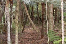
This easy walk takes you through regenerating forest to a viewing area above the remains of an old timber dam.
The route
This walk takes you to the remains of an old timber dam used to flush logs down the stream in the early 1900s. The track travels through regenerating forest along a flat terrain for the first 5 minutes. It then drops down to enter some larger canopy trees such as totara, towai and tanekaha. The last 2 minutes walk is quite steep and slippery when wet, as it drops down to a tributary of the Pikiwahine Stream. The track ends at a railing and a viewing area.
Source: DOC Te Papa Atawhai.
Nearby stops
Tangihua Lodge
50 bunks • Northland • 0.3 km
Tangihua Lodge is a hut located in the Northland region. No further details about its facilities or specific location are available in the provided records.

Tangihua Hut
Standard • 8 bunks • Northland • 5 km
Tangihua Hut is an eight-bunk standard hut located in Northland.
Mattresses • Toilets - non-flush • Water from tap - not treated, boil before use
Walks nearby
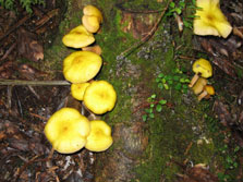
Tangihua Forest Nature Walk
Easy • 1 hr 5 min one way • 0.57 km away
Tumanako Loop Track
Easy • 1 hr • 1.4 km • 0.93 km away
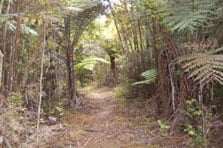
Main Ridge Track
Advanced • 2 - 3 hr one way • 1.17 km away
Horokaka Track
Advanced • 3 hr 45 min one way • 1.23 km away
Te Haua Uru Track
Advanced • 3 hr 45 min to junction one way from car park • 1.47 km away
Notes from people who have been
No notes yet. If you have been, say what you found.
Something missing or out of date?
Closed, moved, wrong facts, or something we have missed? Travellers keep the Road Guide up to date. Tell us what you found at contribute@parkup.nz and we will check it and add it.
Ask us to take this down
A person reads every request. We do not remove a place until we have checked it.
Sources
- DOC Tracks & Trails · CC BY 4.0Data sourced from the Department of Conservation (DOC), New Zealand.
- DOC Tracks (API) · CC BY 4.0Crown Copyright: Department of Conservation Te Papa Atawhai. Data sourced from the DOC Developer Portal (api.doc.govt.nz).