John Coull Hut
Great Walk hutWhanganui National Park, Manawatū-WhanganuiOpen
Current advisories
John Coull Hut closed for maintenance
09 September 2026
Maintenance work is taking place at John Coull Hut. The hut is currently closed for bookings. The works are expected to be completed by the end of September. First published on 2 July 2026. Last reviewed on 10 September 2026.
Source: DOC Te Papa Atawhai alerts.
- Sleeps
- 24 bunks
- Booking
- Can book
- Heating
- Yes
- Drinking water
- Boil first
- Toilet
- Non-flush
Getting there
We have not checked a road end or car park for this place yet, so we do not give driving directions to it. Check how to get there before you go. Some routes cross private land and need the landowner's permission.
How to get there, on doc.govt.nz- Topo map
- Topo50 sheet BJ32
- Grid reference
- E1765226, N5655601
Source: DOC Te Papa Atawhai.
Map and tracks
Track lines: DOC Te Papa Atawhai. Map data © OpenStreetMap contributors. Topo map: LINZ, CC BY 4.0. 39.23340° S, 174.91347° E
About this place
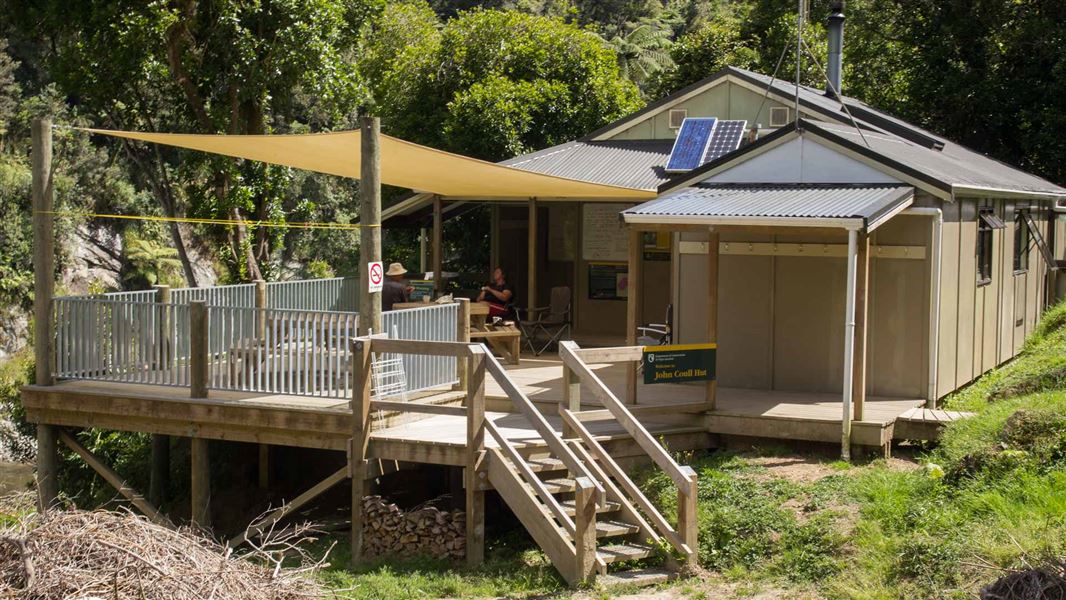
This is a 24-bunk hut located on the Whanganui Journey in the Whanganui area.
On the way here
Whanganui Journey
Whakahoro to John Coull Hut
Time: 7–9 hours
37.5 km Whakahoro is the last road access point before the end of the Whanganui Journey at Pipiriki. Many people start their trip here. You'll paddle through towering gorges, the sides dripping with moss and ferns. After heavy rain, there are numerous waterfalls. Long stretches of the river are calm and still, with mirror-like reflections, and in other sections there are rapids. Past Mangapapa Campsite, take a long loop around the Kirikiriroa Peninsula, pass the Tarepokiore (whirlpool) rapid and then the large overhang known as Tamatea's Cave. Do not enter the cave as it is wāhi tapu (a sacred place). Ōtaihanga Reach leads you to your overnight stop at John Coull Hut and Campsite. You may see long-tailed bats fluttering overhead at dusk.
John Coull Hut to Tīeke Kāinga
Time: 7–9 hours
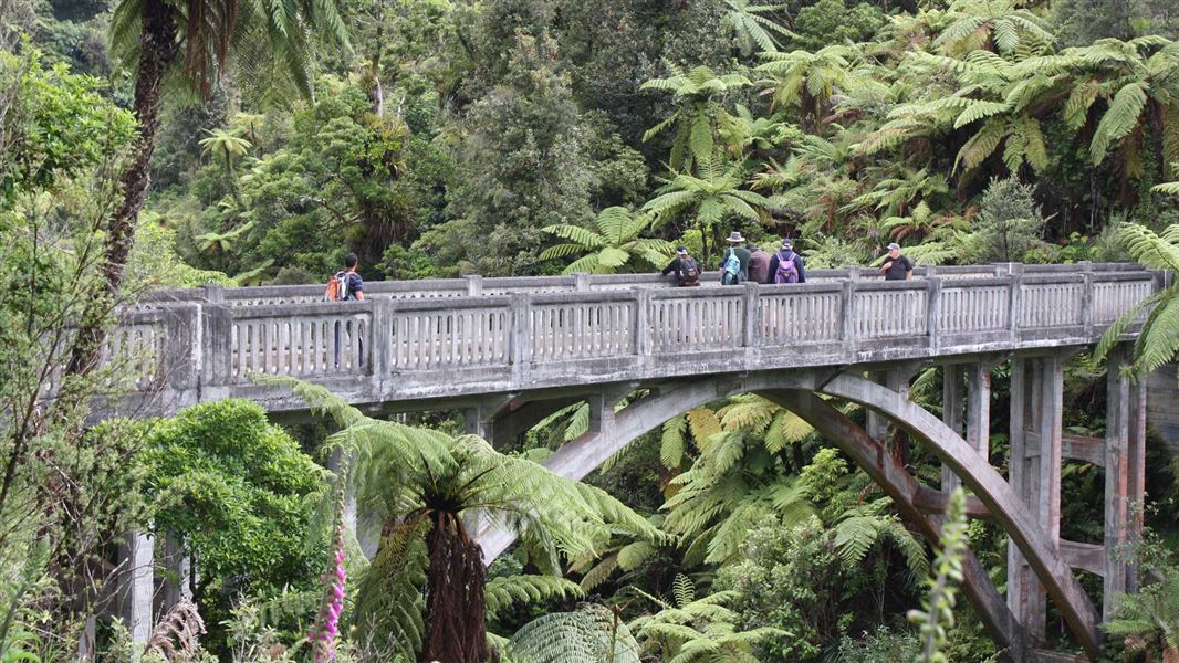
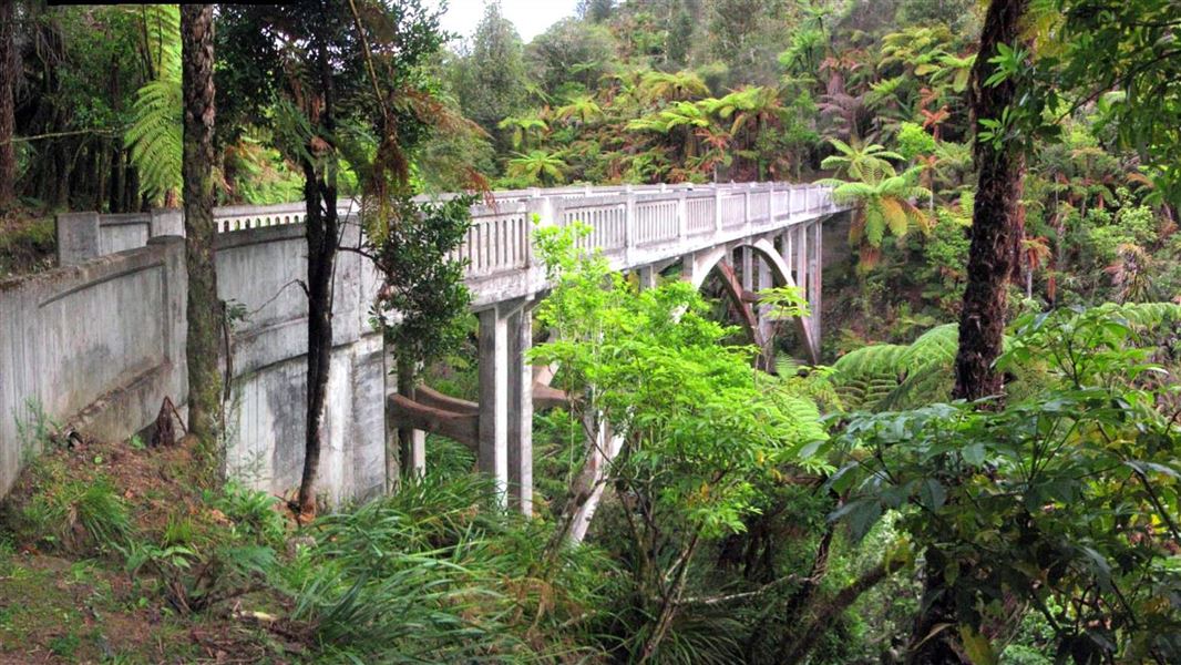
km On this section, you'll continue your journey through deep gorges and past stunning native forest. The Tāngarākau and Whangamōmona rivers join the Whanganui on this stretch. Perched high above the river, Mangawaiiti is an attractive spot to camp or stop for lunch. Continue your trip downstream past the Mangapurua Landing, where you can stop and walk to the iconic Bridge to Nowhere. The Bridge to Nowhere Walk (3km, 1 hour 30 mins return, shared use with cyclists) leads to an abandoned bridge, one of the few remainders of the Mangapurua Valley farm settlement. Be careful at Mangapurua Landing – it is very slippery when the rock is wet and can be crowded with canoes and boats. Afterwards, continue to Tīeke Kāinga, which is a functioning marae as well as a hut – read the Tīeke Kāinga information and tikanga (protocol) . This is a unique cultural experience. There is alternative hut accommodation at Puketotara Hut on the Matemateaonga Range, a 1 hour 30 min hike up a track opposite Tīeke Kāinga.
Source: DOC Te Papa Atawhai.
Know before you go
Weather forecast
John Coull Hut weather forecast – NIWA website
Source: DOC Te Papa Atawhai.
Trip options
Walking times come from DOC track descriptions, added up leg by leg from car-accessible trailheads. Nights and return times are ParkUp estimates, allowing about 8 hours of walking a day.
2 options · 3 to 4 nights
Taumarunui
Walking in
22 hr (via Ohinepane Campsite)
Walking out
15 hr to Pipiriki
Walking in
22 hr (via Ohinepane Campsite)
Walking out
22 hr to Taumarunui (via Ohinepane Campsite)
Source: DOC Te Papa Atawhai track descriptions.
Fees and bookings
Backcountry Hut Passes can be used for this hut from 1 May to 30 September. Passes won't be accepted from 1 October to 30 April. Te Araroa – The Trail Pass Te Araroa Trail Pass
Book John Coull Hut online. Read the terms and conditions before you book.
Source: DOC Te Papa Atawhai.
Nearby stops

John Coull Campsite
Great Walk • Manawatū-Whanganui • 0.1 km
John Coull Campsite is a boat-in only campsite on the Whanganui Journey. There is no drive on access.
Non-powered/tent sites • Shelter for cooking • Water from tap - not treated, boil before use

Mangawaiiti Campsite
Great Walk • Manawatū-Whanganui • 5.7 km
Mangawaiiti Campsite is a boat-in only campsite on the Whanganui Journey in the Manawatū-Whanganui region. There is no drive-on access to the site.
Non-powered/tent sites • Shelter for cooking • Water from tap - not treated, boil before use

Mangapurua Campsite
Great Walk • Manawatū-Whanganui • 7.1 km
Mangapurua Campsite is a boat-in only campsite on the Whanganui Journey in the Manawatū-Whanganui region. There is no drive-on access to the site.
Non-powered/tent sites • Shelter for cooking • Water from tap - not treated, boil before use

Ohauora Campsite
Great Walk • Manawatū-Whanganui • 7.9 km
Ohauora Campsite is a boat-in only campsite on the Whanganui Journey in the Manawatu-Whanganui region. There is no drive-on access to the site.
Non-powered/tent sites • Shelter for cooking • Water from tap - not treated, boil before use

Tīeke Marae/Kāinga
Great Walk • 20 bunks • Manawatū-Whanganui • 13.4 km
Tīeke Marae/Kāinga is a hut in the Manawatū-Whanganui region that also functions as an active marae. This combination provides visitors with a unique cultural…
Cooking • Heating • Mattresses
Walks nearby
Contact
DOC Customer Service Centre
Regional DOC service centre.
Notes from people who have been
No notes yet. If you have been, say what you found.
Something missing or out of date?
Closed, moved, wrong facts, or something we have missed? Travellers keep the Road Guide up to date. Tell us what you found at contribute@parkup.nz and we will check it and add it.
Ask us to take this down
A person reads every request. We do not remove a place until we have checked it.
Sources
- OpenStreetMap Huts · ODbL (Open Database License)Contains information from OpenStreetMap, made available under the ODbL.
- DOC Huts (API) · CC BY 4.0Crown Copyright: Department of Conservation Te Papa Atawhai. Data sourced from the DOC Developer Portal (api.doc.govt.nz).
- DOC Huts · CC BY 4.0Data sourced from the Department of Conservation (DOC), New Zealand.