Mangapurua/Kaiwhakauka Track
WalkManawatū-Whanganui
- Grade
- Advanced
- Walking time
- 3 days
- Distance
- 35.5, 40 km
- Biking time
- 1 day
- Dogs
- No dogs
Getting there
We have not checked a road end or car park for this place yet, so we do not give driving directions to it. Check how to get there before you go. Some routes cross private land and need the landowner's permission.
How to get there, on doc.govt.nzThe Mangapurua/Kaiwhakauka Track can be accessed by road from either Whakahoro or Ruatītī Road. Whakahoro is reached from State Highway 4, turning off at either Owhango or Raurimu. Ruatītī Road end is accessed from Ruatītī Road, north of Raetihi on State Highway 4.
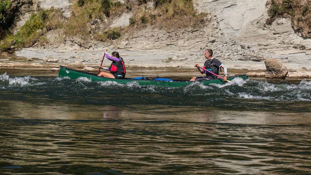
The track can also be accessed by boat from the Whanganui River at the Mangapurua Landing.
Note: River transport is necessary to and from the Mangapurua Landing and jetboats can be hired to carry your party either to Pipiriki or back to Whakahoro.
Source: DOC Te Papa Atawhai.
Map
Map data © OpenStreetMap contributors. Topo map: LINZ, CC BY 4.0. 39.20637° S, 175.05690° E
About this place
The Mangapurua and Kaiwhakauka Tracks are two stages of the Mountains to Sea Cycle Trail. There are various entry/exit options. This track is part of Te Araroa Trail.
The route
This track is part of Te Araroa Trail . The tracks can be walked or biked from either direction and when combined with a jet boat ride on the Whanganui River create a unique tramping or biking and boating circuit. The track follows old road lines with good gradient. Approximate walking times for the track are: These allow for leisurely walking. Biking times are approximately half the stated walking time, times are roughly the same if done in reverse.
Whakahoro to Whanganui National Park boundary
Time: 2 hr walking, 1 hr cycling
5.5 km Follow the Kaiwhakauka Track along a farm road through Retaruke Station (private land), following the true right of the Kaiwhakauka Stream to the large stock and pedestrian bridge. Off to the right is the original depot where deliveries from riverboats were stored for the settlers. The track leads up the valley through a mixture of regenerating bush and farmland to the Whanganui National Park boundary. Care should be taken to leave gates as found and not to disturb stock.
Whanganui National Park boundary to Mosley’s
Time: 1 hr 30 min walking,45 min cycling
4.4 km Walking from the park boundary you come to the old Mosley homestead site near the Waione Stream. The open clearing here lends itself well to camping. A shelter with water and a toilet is located here.
Mosley’s to Mangapurua/Kaiwhakauka junction
Time: 2 hr 30 min walking, 1 hr 15 min cycling
5.7 km The track continues towards Cootes’ homestead (private land), crossing many small bridged side streams with only a few small open flats. The old Tobin homestead, which is marked by an old chimney stack, can be seen on the right of the track. From here the steep climb to the junction passes through relatively undisturbed mixed tawa/podocarp forest for about 3.2 km to reach the junction of the old Kaiwhakauka and Mangapurua roads.
Ruatītī Road end to Mangapurua/Kaiwhakauka junction
Time: 4 hr 30 min walking, 2 hr cycling
10.8 km Accessed from Ruatītī Road, the track climbs gently from the gate at the road end through private farmland, regenerating scrub and pockets of native bush. As you climb into hill country there are stunning views of the Tongariro National Park to the east. A carved tōtara pou has been erected at the track junction to symbolise the ngahere (forest) and provide spiritual and cultural safety for visitors. The pou also pays tribute to the settlers of the Mangapurua and Kaiwhakauka Valleys.
Mangapurua/Kaiwhakauka junction to Mangapurua Trig
Time: 30 min walking, 15 min cycling
1.4 km Continue heading west towards the Whanganui River you'll soon reach the Mangapurua Trig sign. This area provides a lunch or camping spot, with water and toilet facilities. The water is from a spring on the inside of the road bend just past the trig and the toilets are located about 25 m off the main track on the original access road. A sidetrack leads up to a cleared viewpoint. On a fine day, there are sweeping views of Tongariro National Park to the east and Mt Taranaki to the west.
Mangapurua Trig to Johnson’s
Time: 2 hr walking, 1 hr cycling
6.8 km From the Trig the track heads steadily downhill, passing the only uncut section of forest in the Mangapurua Valley. The first swing bridge in the valley crosses Slippery Creek and a further 1.5 km along you reach Johnson’s. As you move down the valley, you cross the grassy clearings that were created by the early settlers. Many of the papa bluffs are named after settlers that farmed the surrounding land. The names of these settlers also live on in the wooden signs installed along the track marking the location of the original house sites. Common features in the valley are the rows of exotic trees that mark the road and the house sites. The large flat at Johnson’s makes a good camping spot. The campsite has a shelter, water supply and toilet. The original farmer Edward Johnson collected the mail twice a week from the Mangapurua Landing and distributed it through the valley.
Johnson’s to Bettjeman’s
Time: 1 hr walking, 30 min cycling
3.4 km The track continues down the valley road to the abandoned Tester house which was the location of the first school in the valley, started in 1926 with seven children. There are a number of large flats in the upper valley as you head towards Bettjeman’s. The other feature is the Himalayan honeysuckle. This introduced weed acts as a nursery plant for natives in much the same way as gorse.
Bettjeman’s to Hellawell’s
Time: 1 hr 30 min walking, 45 min cycling
4.6 km The Bettjeman house site is easily identified by its straight row of poplars that line the old road. The Bettjeman family was one of the first settlers to arrive and last to leave when the valley was abandoned in 1942. All that remains today is the old chimney stack and exotic plants such as holly and cotoneaster. There is good water supply from the stream near this house site and a toilet. Roughly 1.5 km from Bettjeman’s is Bartrum’s swingbridge, access for quad traffic ends at this bridge. From Bartrum’s the valley becomes narrow with the track going around a series of bluffs. Care must be taken while crossing these bluffs as the Mangapurua Stream may be as much as 70m below – mountain bikers must dismount and walk, with your bike between you and the fall hazard. Of particular note is the long bluff downstream of Cody’s house site. It's sometimes called Currant Bun Bluff because of the rounded exposed boulders located within the papa cliffs. Take extra care at this part of the track as it's narrow. A short distance further down the valley is Waterfall Creek with Hellawell's on the southern side. This was the location of many community picnics and hockey games. A 1.5 km side trip up the true left of the creek provides views of the waterfall.
Hellawell’s to Bridge to Nowhere
Time: 1 hr 30 min walking, 45 min cycling
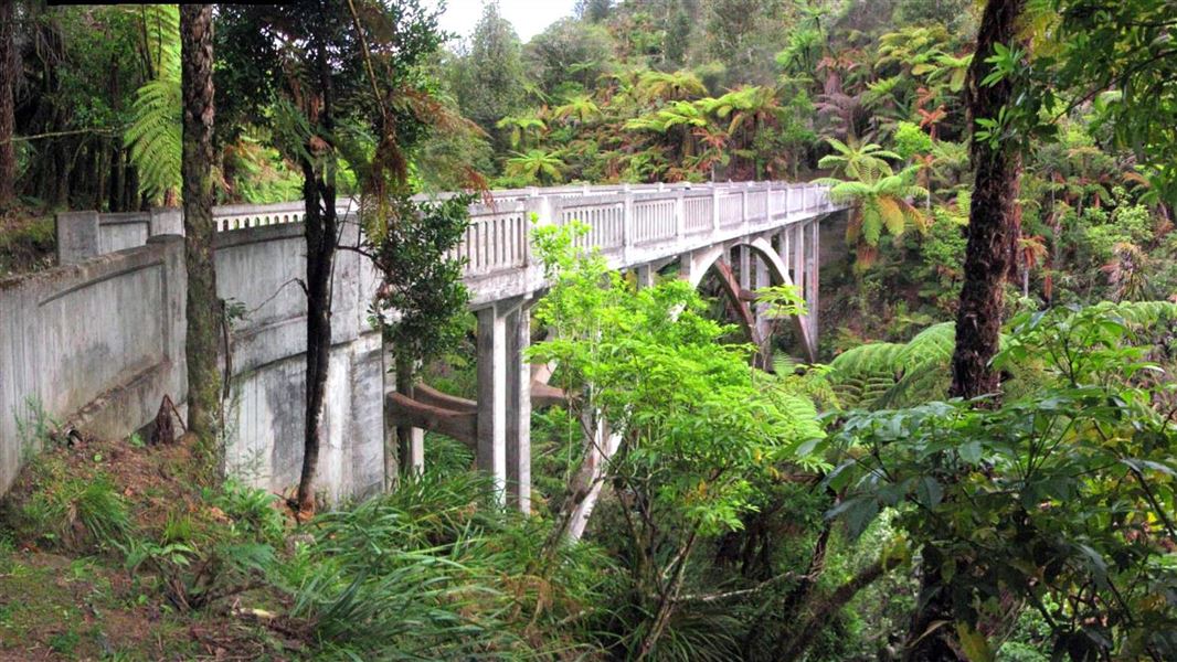
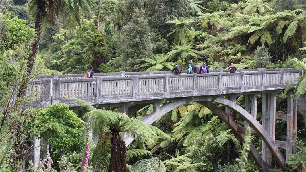
5.7 km The track continues to follow the true left of the Mangapurua Stream before descending towards the Bridge to Nowhere. About an hour from Hellawell’s is Battleship Bluff, named for a feature across the Mangapurua Stream, resembling the prow of an old battleship. The bluff posed the greatest difficulty for the early road builders. Two years were spent terracing the bluff from the top using gelignite. Continue along the narrow track which dips and climbs crossing streams and small bridges down the valley. Watch out for falling rocks while passing bluffs. Almost out of nowhere you will turn the corner onto the historic Bridge to Nowhere. From the concrete bridge, you can see the remains of the old suspension bridge used between 1920 and 1936. This old bridge and its two predecessor wire cages were vital to the initial settlers for the transport of all supplies.
Bridge to Nowhere to Mangapurua Landing
Time: 40 min walking, 20 min cycling
2.7 km This section of track is well used by visitors to the Bridge to Nowhere. This can be a very busy section of track in the warmer months. Mountain bikers need to look out for walkers and vice versa. There are toilets halfway between the bridge and the river at Hunter’s Clearing and shelter near the landing. The Mangapurua Landing was the main access point to the Mangapurua Valley during the early years of settlement when the paddle steamer provided the only transport option. The landing is now used by jet boaters and canoeists.
Mountain biking
Alternative one-day cycle options on the Mangapurua/Kaiwhakauka Track include:
Source: DOC Te Papa Atawhai.
Know before you go
Multi-use track
Mangapurua/Kaiwhakauka Track is shared by trampers, mountain bikers, and hunters with dogs using quad bikes to access the upper Mangapurua Valley from Ruatītī Road to Bartrum’s Swingbridge. Take care on downhill sections. Look out for and be considerate of others.
Fall risk
There is a risk of falling on sections of this track due to cliffs. Keep to the marked track and avoid cliff edges. Keep children within sight and do not let them near edges.
Weather conditions and slips
These tracks are recommended as dry-weather experiences. The unmetalled track surface is extremely slippery and muddy in wet conditions. Check the weather before your trip. If there's been heavy rain, we recommend waiting a couple fine days to let the track firm up. Slippery conditions may be experienced at times, particularly during winter and early spring. Areas are prone to landslides, slips and rockfalls at any time of year. Take care on the bluff sections. You may need to lift or carry your bike in places. We recommend riders travel with two or more people as it is easier to pass bikes to each other.
Fires
Fires are not permitted in the Mangapurua Valley.
Water
During dry periods, take extra water as shelters and streams may be dry or stagnant. Treat or boil all water before drinking.
Wasps
Wasps are a known hazard and are particularly common from January until May. Carry antihistamine if you are allergic to their stings.
Communications
This area is remote with no cell phone coverage. It is recommended that you carry an emergency alert device (eg PLB/Spot tracker).
Source: DOC Te Papa Atawhai.
On this track
In walking order.
Nearby stops

Johnsons Campsite
Backcountry • Manawatū-Whanganui • 2.3 km
Johnsons Campsite is a backcountry campsite on the Mangapurua Track within Whanganui National Park.
Toilets - non-flush • Toilets
Bettjemann Campsite
Backcountry • Manawatū-Whanganui • 5 km
Bettjemann Campsite is a backcountry campsite located on the Mangapurura Track in the Manawatu/Whanganui region.
Toilets - non-flush • Toilets

Ohauora Campsite
Great Walk • Manawatū-Whanganui • 9.3 km
Ohauora Campsite is a boat-in only campsite on the Whanganui Journey in the Manawatu-Whanganui region. There is no drive-on access to the site.
Non-powered/tent sites • Shelter for cooking • Water from tap - not treated, boil before use
Mangapapa Campsite
Great Walk • Manawatū-Whanganui • 9.9 km
Mangapapa Campsite is a boat-in only campsite on the Whanganui Journey. There is no drive on access to the site.
Non-powered/tent sites • Shelter for cooking • Water from tap - not treated, boil before use

Whakahoro Campsite
Great Walk • Manawatū-Whanganui • 10.9 km
Whakahoro Campsite is a large, flat, grassy area beside the river in the Whanganui area. It serves as a Great Walk campsite and is a suitable starting point or…
Boat launching • Non-powered/tent sites • Shelter for cooking
Walks nearby
Notes from people who have been
No notes yet. If you have been, say what you found.
Something missing or out of date?
Closed, moved, wrong facts, or something we have missed? Travellers keep the Road Guide up to date. Tell us what you found at contribute@parkup.nz and we will check it and add it.
Ask us to take this down
A person reads every request. We do not remove a place until we have checked it.
Sources
- DOC Tracks (API) · CC BY 4.0Crown Copyright: Department of Conservation Te Papa Atawhai. Data sourced from the DOC Developer Portal (api.doc.govt.nz).