Glentui Loop Track
WalkCanterbury
- Grade
- Easy
- Walking time
- 1 hr
- Distance
- 2 km
- Dogs
- On a lead
Access: read before you go
Possum trapping using leg-hold traps is taking place in this area. Ensure your dog is on a leash and under control on this track to keep them safe. Possum trapping is allowed by permit only. Leg-hold possum traps must be a minimum of 50 m from the track.
Source: DOC Te Papa Atawhai.
Getting there
We have not checked a road end or car park for this place yet, so we do not give driving directions to it. Check how to get there before you go. Some routes cross private land and need the landowner's permission.
How to get there, on doc.govt.nzFrom Oxford, follow Ashley Gorge Road for 13 km to Glentui. Turn into Glentui Bush Road and follow this for 6 km to the end.
Source: DOC Te Papa Atawhai.
Map
Map data © OpenStreetMap contributors. Topo map: LINZ, CC BY 4.0. 43.19868° S, 172.25040° E
About this place
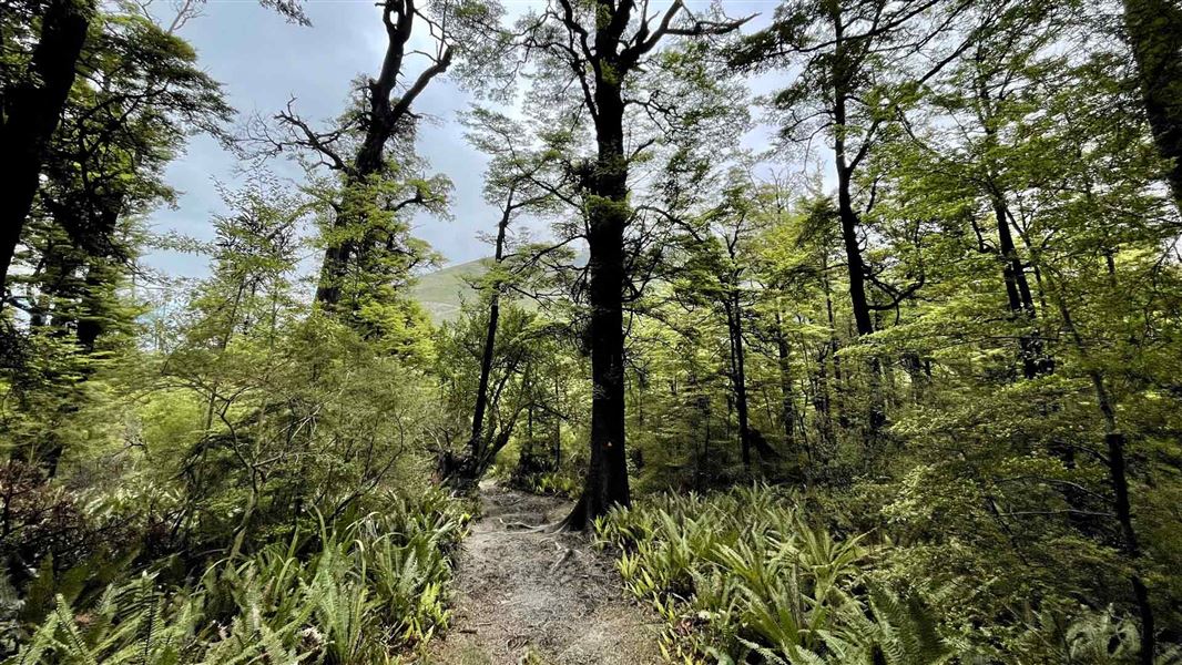
This family walk starts from the pleasant Glentui picnic area.
The route
Walking in a anti-clockwise direction from the Glentui picnic area, the track descends to a bridge over the Glentui River then climbs a ridge on the other side. The first section is steep in places and there are a few major drop-offs before reaching the ridge. The track links first with Bypass Track, then crosses a bridge. Shortly after, there is a small stream crossing. The track then links with the Richardson Track before returning to the picnic area. This is a family walk suitable for people of moderate fitness, but good footwear is required. We recommend walking in an anti-clockwise direction.
Source: DOC Te Papa Atawhai.
Know before you go
Possum trapping is taking place here
Possum trapping using leg-hold traps is taking place in this area. Ensure your dog is on a leash and under control on this track to keep them safe. Possum trapping is allowed by permit only. Leg-hold possum traps must be a minimum of 50 m from the track.
Source: DOC Te Papa Atawhai.
Nearby stops

Wooded Gully Campsite
Standard • Canterbury • 6.9 km
Wooded Gully Campsite is a campsite in Canterbury situated beside a stream. It lies below the tracks leading to Mt Thomas.
Non-powered/tent sites • Water from tap - not treated, boil before use • Wheelchair accessible with assistance

Bob's Camp Bivvy
Basic/bivvies • 2 bunks • Canterbury • 7.1 km
Bob's Camp Bivvy is a basic two-bunk hut located in the North Canterbury and Arthur's Pass area.
Mattresses • Toilets - non-flush • Water from stream

Pinchgut Hut
Standard • 7 bunks • Canterbury • 10.4 km
Pinchgut Hut is a standard seven-bunk hut located in the North Canterbury and Arthur's Pass area of Canterbury.
Heating • Mattresses • Toilets - non-flush
Adams Hut
Canterbury • 12.7 km
Adams Hut is a hut located in the Canterbury region of New Zealand. The provided data does not include specific details about its facilities or location.
West Oxford Reserve
Canterbury • 13.4 km
Walks nearby
Notes from people who have been
No notes yet. If you have been, say what you found.
Something missing or out of date?
Closed, moved, wrong facts, or something we have missed? Travellers keep the Road Guide up to date. Tell us what you found at contribute@parkup.nz and we will check it and add it.
Ask us to take this down
A person reads every request. We do not remove a place until we have checked it.
Sources
- DOC Tracks (API) · CC BY 4.0Crown Copyright: Department of Conservation Te Papa Atawhai. Data sourced from the DOC Developer Portal (api.doc.govt.nz).