Flagstaff Hill Track
WalkNorthlandOpen
- Grade
- Easy
- Walking time
- 30 min
- Distance
- 2.5 km
- Route
- Loop
- Dogs
- No dogs
Getting there
We have not checked a road end or car park for this place yet, so we do not give driving directions to it. Check how to get there before you go. Some routes cross private land and need the landowner's permission.
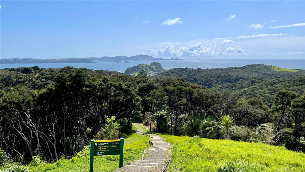
How to get there, on doc.govt.nzWalk north from the northern end of The Strand, Kororareka Bay along the beaches to Watering Bay. Turn inland along the Flagstaff Hill Loop Track. Take the left-hand fork in the track and climb through regenerating coastal forest to reach Titore Way. Turn right onto the road, walk 300 metres along this road to a sign marking the final leg of the Flagstaff Hill Loop Track. This leg takes you up through regenerating coastal scrub to the famous flagstaff, 360-degree views of the Bay of Islands and the Flagstaff Hill summit (Te Maiki).
Once at the summit, take the path down to the carpark. At the carpark, there are two options: cross the carpark and take the short track up to the sundial for more stunning views of the Bay of Islands and Russell township or turn right to continue the Flagstaff Hill Loop Track down to the top of Wellington Street and from there to Russell township.
The Flagstaff Hill Loop Track starts at the intersection of Wellington and Kent Streets, near the boatramp on The Strand in Russell. Walk approximately 300 metres up Wellington Street - look out for a sign on your left. This high tide alternative track takes you down into the Kororareka Reserve. At the intersection of the tracks in the valley turn right and follow the Flagstaff Hill Loop Track to Titore Way. See the low tide description for further route directions from here.
Note: Wellington Street is very narrow. If you are walking, watch out for vehicles; if you are driving look out for pedestrians.
At low tide
Walk north from the northern end of The Strand, Kororareka Bay along the beaches to Watering Bay. Turn inland along the Flagstaff Hill Loop Track. Take the left-hand fork in the track and climb through regenerating coastal forest to reach Titore Way. Turn right onto the road, walk 300 metres along this road to a sign marking the final leg of the Flagstaff Hill Loop Track. This leg takes you up through regenerating coastal scrub to the famous flagstaff, 360-degree views of the Bay of Islands and the Flagstaff Hill summit (Te Maiki). Once at the summit, take the path down to the carpark. At the carpark, there are two options: cross the carpark and take the short track up to the sundial for more stunning views of the Bay of Islands and Russell township or turn right to continue the Flagstaff Hill Loop Track down to the top of Wellington Street and from there to Russell township.
At high tide
The Flagstaff Hill Loop Track starts at the intersection of Wellington and Kent Streets, near the boatramp on The Strand in Russell. Walk approximately 300 metres up Wellington Street - look out for a sign on your left. This high tide alternative track takes you down into the Kororareka Reserve. At the intersection of the tracks in the valley turn right and follow the Flagstaff Hill Loop Track to Titore Way. See the low tide description for further route directions from here. Note: Wellington Street is very narrow. If you are walking, watch out for vehicles; if you are driving look out for pedestrians.
Source: DOC Te Papa Atawhai.
Map
Map data © OpenStreetMap contributors. Topo map: LINZ, CC BY 4.0. 35.25672° S, 174.11872° E
About this place
Enjoy 360 degree views of the Bay of Islands from this important historic site - the Union Jack was first flown here in 1840, then chopped down four times up till 1845 as a symbolic gesture against British rule.
The route
The Flagstaff Hill Loop Track takes you through regenerating kanuka/manuka scrub down into the Waipara/Watering Bay stream and wetland then back up to one of New Zealand’s most iconic historic sites - Te Maiki/Flagstaff Hill. On this walk you may very well come across the endangered North Island weka, which has been successfully reintroduced to the Russell Peninsula by the Russell Landcare Trust. A section of this track crosses private land – walkers are welcome. Respect the signage in place for no dogs, even on a lead, and keep to the formed track.
Source: DOC Te Papa Atawhai.
Nearby stops
Russell Top10 Holiday Park
Northland • 0.7 km
Russell Top10 Holiday Park is a campsite located in Northland. No further details are available in the provided records.
Orongo Bay Holiday Park
Northland • 3.8 km
Orongo Bay Holiday Park is a campsite located in Northland. The available records provide no further details regarding specific facilities or amenities at this…
Waitangi Holiday Park
Northland • 4.3 km
Pahia TOP10 Holiday Park
Northland • 5.1 km
Waterfalls Estate - Motel & Campground
Northland • 6.4 km
Waterfalls Estate is a campsite located in the Northland region of New Zealand. The site operates alongside a motel, providing accommodation options for…
Walks nearby
Nancy Fladgate Track
Easy • 15 min • 500 m • 0.25 km away
Tapeka Point Track
Easy • 15 min one way • 500 m one way • 1.43 km away
Toretore Island Walk
Easy • 10 min one way • 700 m one way • 3.12 km away
Paihia School Road Track
Easy • 1 hr • 1.5 km • 4.91 km away
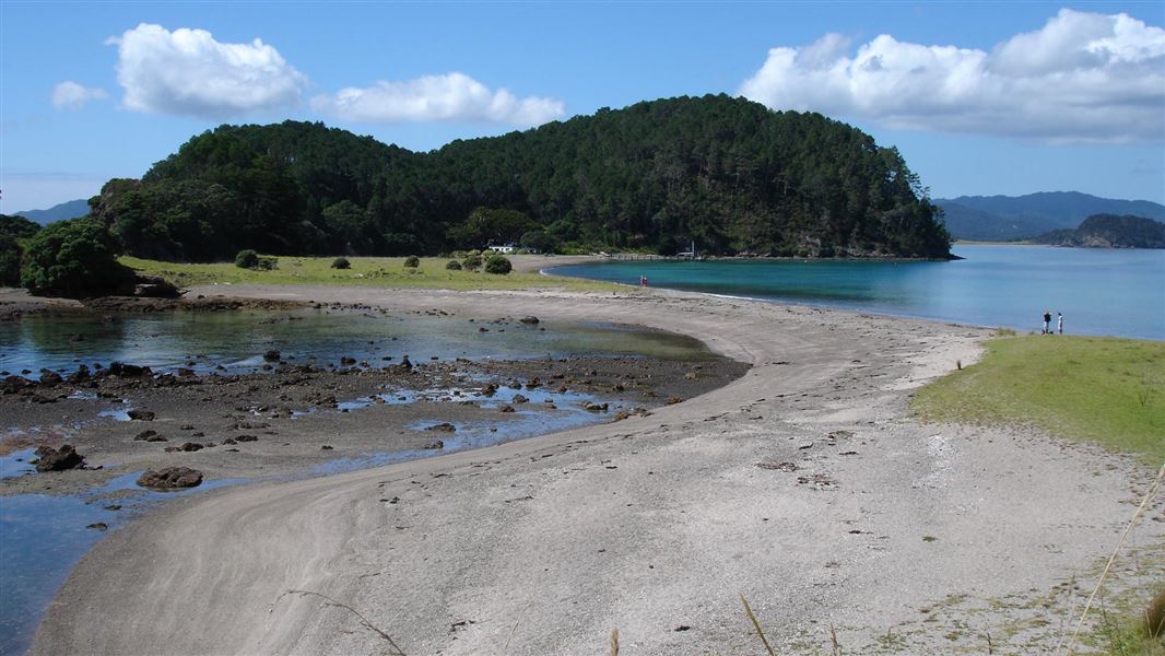
Motuarohia (Roberton) Island Track
Easy • 15 min • 350 m • 5.11 km away
Notes from people who have been
No notes yet. If you have been, say what you found.
Something missing or out of date?
Closed, moved, wrong facts, or something we have missed? Travellers keep the Road Guide up to date. Tell us what you found at contribute@parkup.nz and we will check it and add it.
Ask us to take this down
A person reads every request. We do not remove a place until we have checked it.
Sources
- DOC Tracks & Trails · CC BY 4.0Data sourced from the Department of Conservation (DOC), New Zealand.
- DOC Tracks (API) · CC BY 4.0Crown Copyright: Department of Conservation Te Papa Atawhai. Data sourced from the DOC Developer Portal (api.doc.govt.nz).