Aspiring Hut
Serviced Alpine hutMatukituki Valley area, OtagoOpen
Current advisories
Purchasing Aspiring Hut camping tickets from April to October
06 April 2026
Tititea/Mount Aspiring National Park Visitor Centre in Wānaka is closed for winter from 11 April to 12 October, 2026. We will still answer queries via phone and email - but for tickets to camp outside Aspiring Hut , you can visit Queenstown Visitor Centre or call them on +64 3 442 7935 to pay over the phone and receive an email-receipt as proof of purchase. First published on 7 April 2026.
Source: DOC Te Papa Atawhai alerts.
- Sleeps
- 32 bunks
- Booking
- Can book
- Cost
- Fee applies
- Heating
- Yes
- Drinking water
- Boil first
- Toilet
- Non-flush
Getting there
We have not checked a road end or car park for this place yet, so we do not give driving directions to it. Check how to get there before you go. Some routes cross private land and need the landowner's permission.
How to get there, on doc.govt.nz- Topo map
- Topo50 sheet CA11
- Grid reference
- E1254866, N5065962
Source: DOC Te Papa Atawhai.
Map and tracks
Track lines: DOC Te Papa Atawhai. Map data © OpenStreetMap contributors. Topo map: LINZ, CC BY 4.0. 44.47714° S, 168.66012° E
About this place
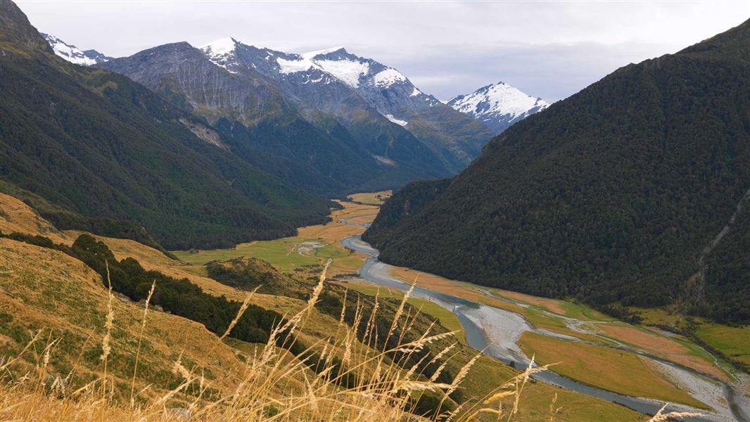
Aspiring Hut, with its historic stone walls, is a great overnight tramp in the spectacular Matukituki Valley for families with children or those new to tramping.
On the way here
Liverpool Track · 6 hr 30 min one way
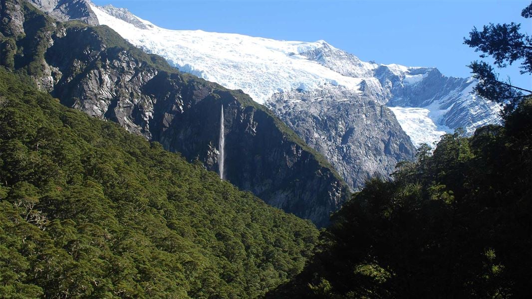
Liverpool Track is best suited to experienced hikers who are comfortable with high, exposed and technical tracks. You can expect: • A steep, long climb from the valley floor to Liverpool Hut. At times you will be climbing up rocks and tree roots, pulling yourself up with your hands. • Steep and slippery terrain where a fall could cause serious injury. • Fast-changing alpine weather. If this doesn’t sound right for you, Aspiring Hut is an easier overnight trip in Mount Aspiring National Park. It has options for side trips further up the valley or to see the Rob Roy Glacier.
Raspberry Creek car park to Aspiring Hut
Time: 2 hr – 2 hr 30 min
km The track starts at Raspberry Creek car park. Follow the West Matukituki Track up the valley to Aspiring Hut. The track is mainly through grassy farm flats, with a couple of small bluffs which give good views of the valley.
Aspiring Hut to Pearl Flat
Time: 1 hr 30 min
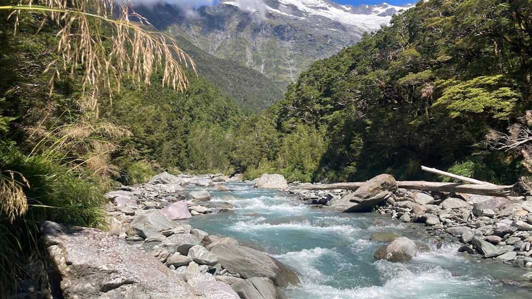
km The track enters the bush near Aspiring Hut. After 10 minutes a bridge crosses Cascade Creek, and a 1 km bush section emerges onto an open terrace leading to Shovel Flat. The track has eroded at the head of Shovel Flat. Proceed with caution and allow extra time. Follow the orange poles towards the bush, instead of following the riverbank. After 400 m, you will reach Pearl Flat. At Pearl Flat, turn off West Matukituki Track onto Liverpool Track, signposted to Liverpool Hut. Challenging avalanche terrain between Rough Creek (just beyond Aspiring Hut) and the intersection with the Liverpool Track can make travel hazardous from late autumn to early summer. Move quickly through this area and be vigilant. Avalanche debris may reach the valley floor at Shovel Flat, so do not camp there. The track has steep, rock slab terrain to navigate. Image: DOC
Cascade Saddle Route · 4-5 days one way
Raspberry Creek car park to Aspiring Hut
Time: 2 hr – 2 hr 30 min
km Follow the West Matukituki Track to Aspiring Hut.
Aspiring Hut to Cascade Saddle
Time: 4–5 hr
km Camping: Camping on the Cascade Saddle Route is only allowed near Cascade Creek where there is a toilet – this is to limit the impact on this fragile alpine area. The track is signposted from Aspiring Hut and climbs steadily up through mixed beech forest. There is a stream crossing near the top of the bush – this is unbridged, so assess it carefully and make sure it is safe to cross. It floods and becomes impassable in heavy rain. Above the bushline the track becomes a route and is marked with orange poles. Use the bush as a decision-point – look at the weather and check in on the time and how you are feeling. There is another 6-9 hours to Dart Hut through exposed terrain. If the weather is deteriorating or you aren’t sure of your ability to complete the tramp, this is the right time to turn around. The route follows a steep snow grass and tussock ridge with some rocky outcrops and ledges to negotiate. From the bushline, the route is narrow, steep and very exposed - you will need your hands to climb. There are steep drops and the rocks can be slippery, so proceed carefully. If the route is attempted in reverse (from the Dart) the pylon and orange-poled route must be located before descending into the Matukituki Valley. This section of the route is much more difficult to go down than go up. If snow is present, do not proceed without an ice axe and crampons and the skills to use them - slipping can mean falling several hundred metres off the cliffs. The route reaches the pylon at the top of the ridge (1835 m) via a steep and narrow gully that holds snow for much of the year. The final section of the climb is the most dangerous and there is no room for error. It is difficult even in good conditions and especially hazardous if there is snow or strong winds. At the top of the climb, enjoy the view and use this spot as another decision-point to assess the weather. It is still 6 hours to Dart Hut, so if conditions are poor it may be safer to turn back. After the pylon follow the poles down to Cascade Creek. Assess the creek and make sure it is safe to cross – rain or snowmelt can flood it. The route then follows to the easy slopes and flats leading to Cascade Saddle (1524 m). There's a camping site with a toilet near Cascade Creek where there’s a toilet. It's the only suitable camping site along the route. There are often kea at this camping site – kea can chew tents and steal gear.
West Matukituki Track · 6 hr one way
Raspberry Creek car park to Aspiring Hut
Time: 2 hr – 2 hr 30 min
Distance 9 km A great first overnight tramp for families with younger children, the walk to Aspiring Hut is mainly over grassed farm flats with a couple of easily negotiated small bluffs that give great views up and down the valley. The locked historic Cascade Hut managed by the New Zealand Alpine Club can be seen from the last bluff. Aspiring Hut is twenty minutes beyond this.
Aspiring Hut to Pearl Flat
Time: 1 hr 30 min
km The track has eroded at the head of Shovel Flat. Proceed with caution and allow extra time. Follow the orange poles towards the bush, instead of following the riverbank. After 400 m, you will reach Pearl Flat. At Pearl Flat, the West Matukituki Track connects with French Ridge Track and Liverpool Track . Warning: Challenging avalanche terrain between Rough Creek (just beyond Aspiring Hut) and the intersection with the Liverpool Track can make travel hazardous from late autumn to early summer. Avalanche debris may reach the valley floor at Shovel Flat, do not camp there.
French Ridge Track · 6 hr - 7 hr 30 min one way
French Ridge Track is best suited to experienced hikers who are comfortable with steep, high and technical tracks. You can expect: If this doesn't sound right for you, Aspiring Hut is an easier overnight trip in Mount Aspiring National Park, with options for side trips further up the valley or to see the Rob Roy Glacier.
Raspberry Creek car park to Aspiring Hut
Time: 2 hr – 2 hr 30 min
km The track starts at Raspberry Creek car park. Follow the West Matukituki Track up the valley to Aspiring Hut. The track is mainly through grassy farm flats, with a couple of short climbs which give good views over the valley.
Aspiring Hut to Pearl Flat
Time: 1 hr 30 min
km The track enters the bush near Aspiring Hut. After 10 minutes a bridge crosses Cascade Creek, and a 1 km bush section emerges onto an open terrace leading to Shovel Flat. The track has eroded at the head of Shovel Flat. Proceed with caution and allow extra time. Follow the orange poles towards the bush, instead of following the riverbank. After 400 m, you will reach Pearl Flat. At Pearl Flat, the West Matukituki Track connects with French Ridge Track and Liverpool Track . Challenging avalanche terrain between Rough Creek (just beyond Aspiring Hut) and the intersection with the Liverpool Track can make travel hazardous from late autumn to early summer. Move quickly through this area and be vigilant. Avalanche debris may reach the valley floor at Shovel Flat, so do not camp there. Example of the rock slabs to navigate on the track Image: DOC
Source: DOC Te Papa Atawhai.
Know before you go
Large group bookings
A single group can only book up to 50% of the hut – 16 beds. If you are a group of 10 people or more, you need to fill in a large group notification form as well as making your online booking. Contact wanakavc@doc.govt.nz at least two weeks before your departure date to ask for the form. The form is not a booking.
Landslide hazard
Aspiring Hut sits in a known landslide debris path which poses a potential hazard to people at the hut and campsite. The risk may increase following an earthquake or very heavy rainfall. A temporary closure procedure for Aspiring Hut will be activated when very heavy rainfall is forecast (>250mm in a 24h period).
Hut ranger
A hut ranger will usually be present from October to the end of April.
Source: DOC Te Papa Atawhai.
Trip options
Walking times come from DOC track descriptions, added up leg by leg from car-accessible trailheads. Nights and return times are ParkUp estimates, allowing about 8 hours of walking a day.
8 options · 1 to 2 nights
Raspberry Creek car park
Walking in
2 hr 30 min
Walking out
1 hr 30 min to Pearl Flat
Walking in
2 hr 30 min
Walking out
4 hr to Liverpool Hut
Walking in
2 hr 30 min
Walking out
5 hr to French Ridge Hut
Source: DOC Te Papa Atawhai track descriptions.
Fees and bookings
Backcountry Hut Passes and Backcountry Hut Tickets cannot be used at this hut.
Bookings are required all year. Book Aspiring Hut online Bookings are open for stays up to 30 June 2027. If no availability shows online for your dates, the hut is fully booked. No spaces are kept for visitors arriving without a booking. Phone and in‑person bookings made at a visitor centre incur a $10 service fee. Same‑day bookings are available online until 8 pm if spaces remain. A $10 service fee applies to all phone, email and in-person bookings. New Zealand Alpine Club (NZAC) members applying for their discount will not be charged this fee. Your hut booking is for any bunk bed, not for a specific bunk bed – select your bunk bed on arrival.
Source: DOC Te Papa Atawhai.
On these tracks
Source: DOC Te Papa Atawhai.
Nearby stops
Liverpool Hut
Serviced Alpine • 10 bunks • Otago • 5.1 km
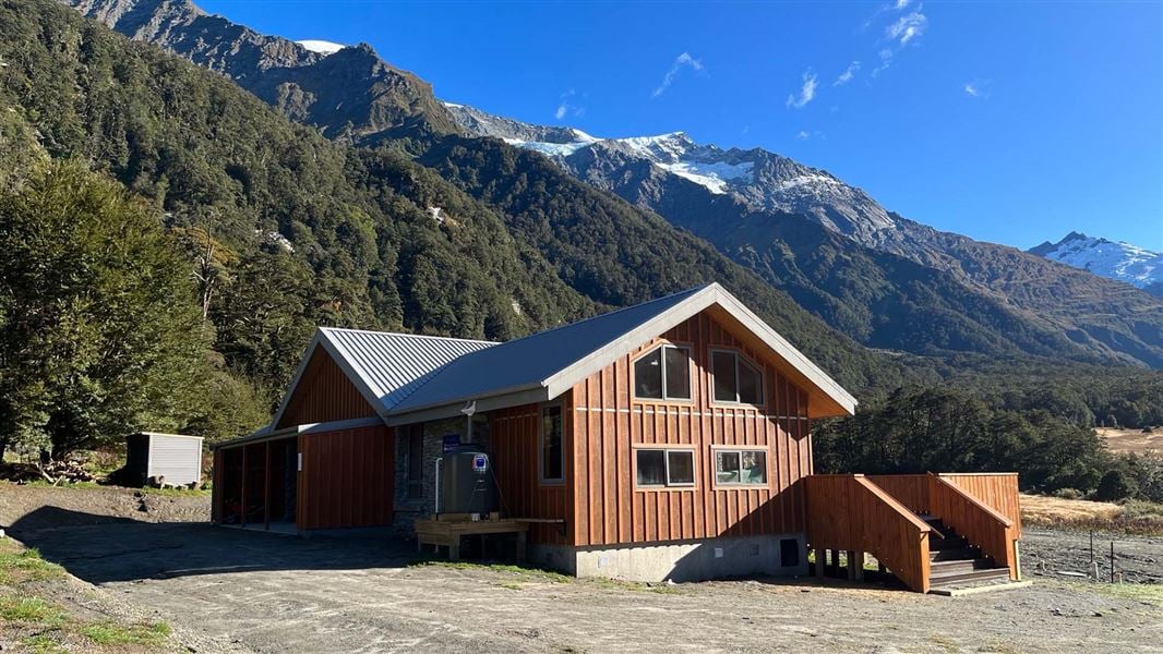
Liverpool Hut is a serviced alpine hut with 10 bunks located in the Wanaka/Makarora area of Otago. You must book online before staying at the hut during the…
Mattresses • Toilets - non-flush • Water from tap - not treated, boil before use
Aspiring Campsite
Backcountry • Otago • 0.2 km
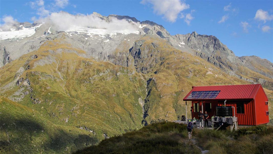
Aspiring Campsite is a campsite located in the Otago region. It is situated outside Aspiring Hut.
Water from tap - not treated, boil before use • Toilets - non-flush • Toilets

French Ridge Hut
Serviced Alpine • 20 bunks • Otago • 6 km
French Ridge Hut is a 20-bunk alpine serviced hut in the Wanaka and Makarora area of Otago. It is managed by the New Zealand Alpine Club.
Mattresses • Lighting • Toilets - non-flush
Dart Campsite
Backcountry • Otago • 9.6 km
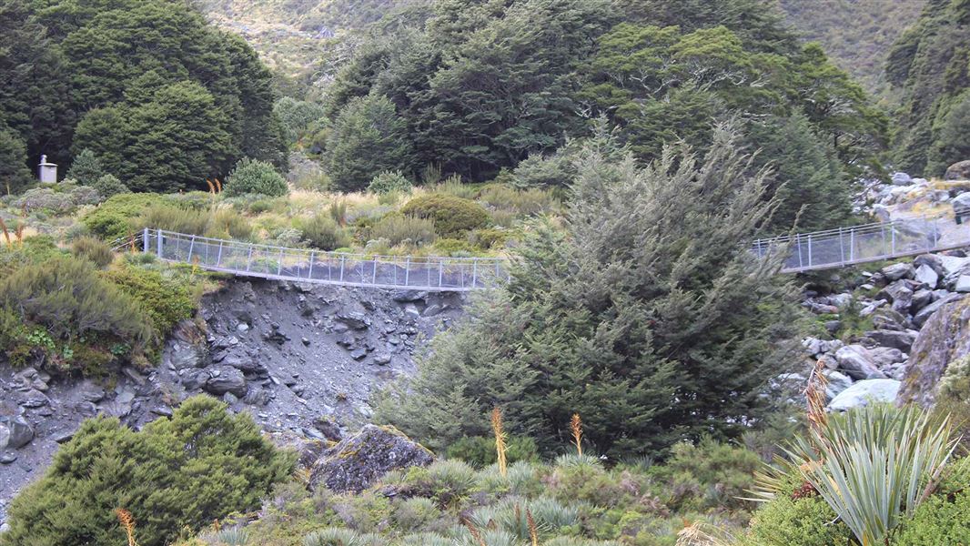
Dart Campsite is a backcountry campsite located near Dart Hut in Otago.
Toilets - flush • Water from tap - not treated, boil before use • Toilets
Dart Hut
Serviced • 32 bunks • Otago • 9.7 km
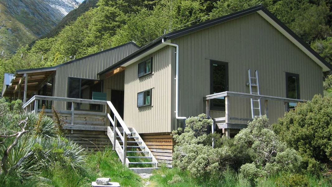
Dart Hut is a serviced 32-bunk hut located in the Queenstown/Wakatipu area of Otago. It provides accommodation for hikers in the region.
Heating • Mattresses • Toilets - flush
Walks nearby
Shotover Saddle Route
Expert • 6 hr • 4 km • 4.36 km away
Rob Roy Track
Easy • 3–4 hr • 10 km • 5.5 km away
Glacier Burn Track
Advanced • 4–6 hr • 10 km return (from Camerons Flat). 16 km return (from Otago Boys' High Bridge) • 11.73 km away
Kitchener Track to Aspiring Flats
Advanced • 8–10 hr • 24 km return (from Camerons Flat) 30 km return (from Otago Boys' High Bridge) • 12 km away
Contact
Wānaka Tititea/Mount Aspiring National Park
Regional DOC service centre.
Notes from people who have been
No notes yet. If you have been, say what you found.
Something missing or out of date?
Closed, moved, wrong facts, or something we have missed? Travellers keep the Road Guide up to date. Tell us what you found at contribute@parkup.nz and we will check it and add it.
Ask us to take this down
A person reads every request. We do not remove a place until we have checked it.
Sources
- OpenStreetMap Huts · ODbL (Open Database License)Contains information from OpenStreetMap, made available under the ODbL.
- DOC Huts (API) · CC BY 4.0Crown Copyright: Department of Conservation Te Papa Atawhai. Data sourced from the DOC Developer Portal (api.doc.govt.nz).
- DOC Huts · CC BY 4.0Data sourced from the Department of Conservation (DOC), New Zealand.