Woodside Glen Walk
WalkOtagoOpen
- Grade
- Easy
- Walking time
- 15 min
- Distance
- 700 m
- Route
- Return
- Dogs
- On a lead
Getting there
We have not checked a road end or car park for this place yet, so we do not give driving directions to it. Check how to get there before you go. Some routes cross private land and need the landowner's permission.
How to get there, on doc.govt.nzWoodside Glen Reserve is approximately 30 min from central Dunedin.
From Dunedin city, travel through Mosgiel to Outram. Drive through Outram and follow SH87/Lee Stream-Outram Rd for approximately 9 km until reaching a turn-off on the left to Woodside Rd. Drive until an intersection and then take a right turn at Ravensburn St. At the end of the street is the reserve.
There is no public transport option available for this track.
Source: DOC Te Papa Atawhai.
Map
Map data © OpenStreetMap contributors. Topo map: LINZ, CC BY 4.0. 45.85486° S, 170.17060° E
About this place
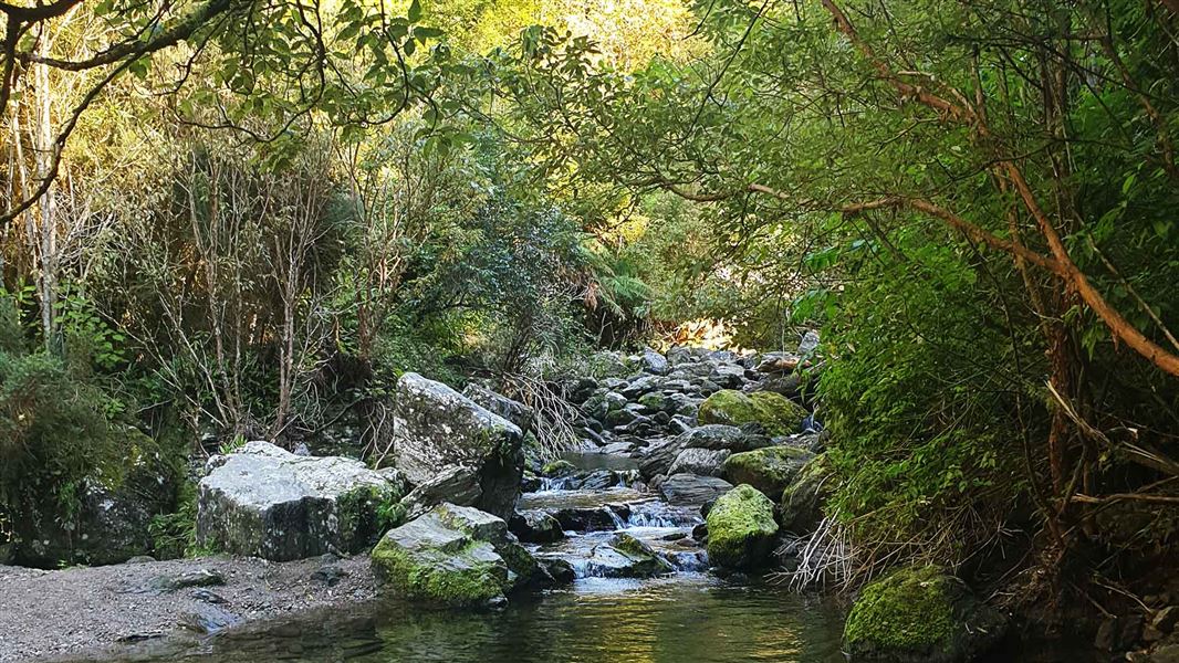
A short walk through native forest full of culture and spiritual significance.
The route
This track is at the base of Maukaatua. It offers a chance to take in the sound of birdsong and be in a culturally and spiritually important place. Winding from the carpark, the track ascends for a short distance then settles to a gentler up and down until you reach Lee Creek. Enjoy the variety of trees and boulders to explore, before wandering your way back to the reserve, an ideal spot for a picnic. The walk finishes at Lee Creek. Past this point the track transitions to a tramping track and is suitable for experienced and prepared walkers. From Lee Creek, the Maukaatua Track is a steep climb to open tussock tops.
Source: DOC Te Papa Atawhai.
Know before you go
Flooding
This track can be subject to flooding during heavy or prolonged rain nearby or inland, with no alternative routes to evacuate. Check weather forecasts and weather warnings before visiting.
Stay safe when crossing rivers and streams
If you plan to cross unbridged rivers or side streams, know how to cross safely and be prepared for if you cannot cross. Do not cross if the river or stream is flooded, you cannot find safe entry and exit points or are unsure it’s safe. Turn back or wait for the river to drop. If in doubt, stay out. How to cross rivers safely NIWA river flow forecasts: View a video of national followed by regional river flows
Source: DOC Te Papa Atawhai.
Nearby stops
Brighton Caravan Park & Boat Hire
Otago • 16.1 km
Brighton Caravan Park & Boat Hire is a campsite located in the Otago region. The facility offers boat hire services in addition to camping accommodation.
Sinclair Wetland Reserve
Otago • 16.1 km
Sinclair Wetland Reserve is a campsite located in the Otago region. The provided data does not list specific facilities or amenities for this site.
Walks nearby
Notes from people who have been
No notes yet. If you have been, say what you found.
Something missing or out of date?
Closed, moved, wrong facts, or something we have missed? Travellers keep the Road Guide up to date. Tell us what you found at contribute@parkup.nz and we will check it and add it.
Ask us to take this down
A person reads every request. We do not remove a place until we have checked it.
Sources
- DOC Tracks & Trails · CC BY 4.0Data sourced from the Department of Conservation (DOC), New Zealand.
- DOC Tracks (API) · CC BY 4.0Crown Copyright: Department of Conservation Te Papa Atawhai. Data sourced from the DOC Developer Portal (api.doc.govt.nz).