Woods Creek Track
WalkWest CoastOpen
- Grade
- Easy
- Walking time
- 45 min
- Distance
- 1.1 km
- Route
- Loop
- Dogs
- No dogs
Getting there
We have not checked a road end or car park for this place yet, so we do not give driving directions to it. Check how to get there before you go. Some routes cross private land and need the landowner's permission.
How to get there, on doc.govt.nzDrive south from Greymouth on SH6 for 8 km to Paroa, and turn left onto the road towards Shantytown. Travel down this road for 22 km east, mostly on sealed road, past both Marsden and Dunganville. The road surface changes from tar seal to gravel for the last 10 km and is not recommended for campervans.
Do not drive past Woods Creek car park as the road is not maintained and a culvert has washed out.
Woods Creek Track access road diversion in place: Maori Creek Rd has a temporary diversion in place due to mining operations in the area. The diversion starts 500 m past the 8 Mile River bridge for approximately 600 m. Woods Creek Track is accessible and open during this time.
Source: DOC Te Papa Atawhai.
Map
Map data © OpenStreetMap contributors. Topo map: LINZ, CC BY 4.0. 42.55260° S, 171.34754° E
About this place
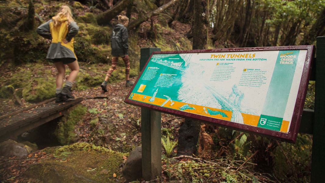
This fascinating forest track passes by tailraces and dams and through tunnels built by gold miners in the 19th century.
The route
In addition to the remnants of tunnels, races and walls of stacked stone you will pass through mature and regenerating forest. The walk can be covered in under 45 minutes but allow extra time for exploring. Sturdy walking footwear is recommended.
Source: DOC Te Papa Atawhai.
Nearby stops
Lake Brunner Motor Camp
West Coast • 10.6 km
Lake Brunner Motor Camp is a campsite located on the West Coast of New Zealand. The provided data does not include specific details regarding facilities or…
Iveagh Bay
West Coast • 14.4 km
Iveagh Bay is a campsite located on the West Coast. The provided data does not include details about specific facilities or amenities at this location.
Greymouth Kiwi Holiday Park
West Coast • 15.6 km
Greenstone Retreat
West Coast • 16.2 km
Greymouth Top 10 Holiday Park
West Coast • 16.2 km
Walks nearby
Notes from people who have been
No notes yet. If you have been, say what you found.
Something missing or out of date?
Closed, moved, wrong facts, or something we have missed? Travellers keep the Road Guide up to date. Tell us what you found at contribute@parkup.nz and we will check it and add it.
Ask us to take this down
A person reads every request. We do not remove a place until we have checked it.
Sources
- DOC Tracks (API) · CC BY 4.0Crown Copyright: Department of Conservation Te Papa Atawhai. Data sourced from the DOC Developer Portal (api.doc.govt.nz).
- DOC Tracks & Trails · CC BY 4.0Data sourced from the Department of Conservation (DOC), New Zealand.