Titri Creek Walking Track
WalkOtagoOpen
- Grade
- Easy
- Walking time
- 25 min
- Distance
- 1.5 km
- Route
- Loop
- Dogs
- No dogs
Getting there
We have not checked a road end or car park for this place yet, so we do not give driving directions to it. Check how to get there before you go. Some routes cross private land and need the landowner's permission.
How to get there, on doc.govt.nzDrive south from Dunedin on SH1. After the bridge over the Waipori River, turn off to the right onto Titri Road. The track starts at a car park partway along Titri Road.
Alternatively, if travelling along SH1 from the south, Titri Road can also be accessed via a turnoff just before the end of Waihola township.
Source: DOC Te Papa Atawhai.
Map
Map data © OpenStreetMap contributors. Topo map: LINZ, CC BY 4.0. 46.00164° S, 170.11424° E
About this place
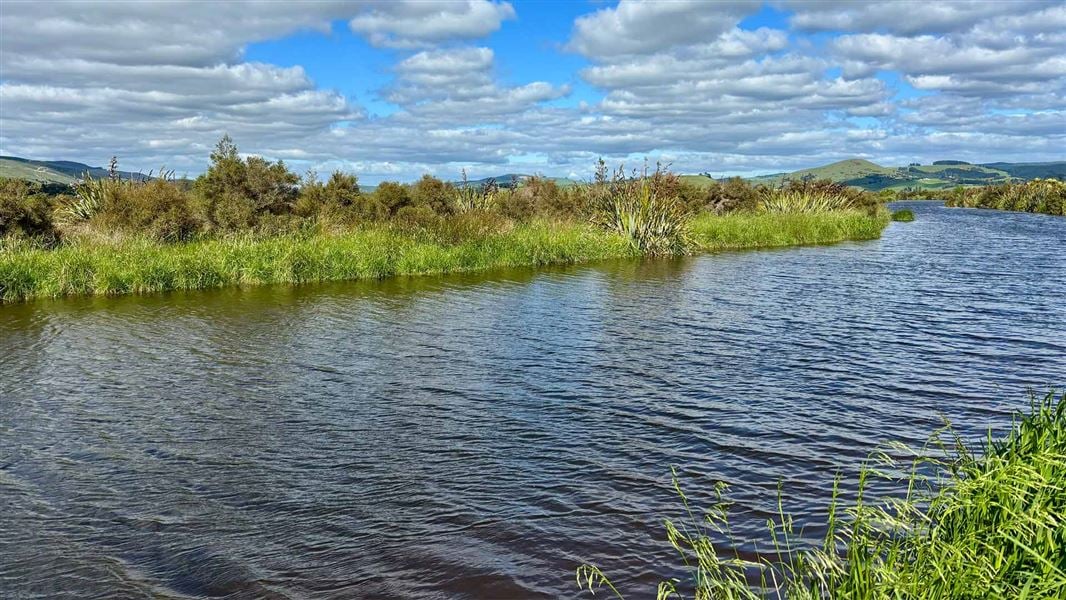
See hundreds of wading birds on this family-friendly short walk into the Titri wetands.
The route
From the car park on Titri Road, cross the railway line with care, using the marked crossing point. Follow the bridge over Titri Creek into the Titri wetlands. You can see hundreds of wading birds including marsh crake/kotoreke, fernbird/mātātā, scaup/pāpako, and grey teal/tētē. The second bridge on the track is closed and there is no access to the viewing platform. There are still good views of the wetland from the track and the first bridge. The track is surrounded by native vegetation, including the threatened wetland nettle. Stick to the track to preserve this sensitive wetland environment.
Source: DOC Te Papa Atawhai.
Know before you go
Amenities
The nearest toilets are at the Lake Waihola Domain. There are no bins on site, practice leave no trace and take all rubbish away with you.
Partial closure
The second bridge on the track is closed and there is no access to the viewing platform. There are still good views of the wetland from the track and the first bridge.
Hunting rules
No shooting within 150 m of the track. Always take care.
Flooding
This track can be subject to flooding during heavy or prolonged rain nearby or inland, with no alternative routes to evacuate. Check weather forecasts and weather warnings before visiting.
Source: DOC Te Papa Atawhai.
Nearby stops
Walks nearby
Notes from people who have been
No notes yet. If you have been, say what you found.
Something missing or out of date?
Closed, moved, wrong facts, or something we have missed? Travellers keep the Road Guide up to date. Tell us what you found at contribute@parkup.nz and we will check it and add it.
Ask us to take this down
A person reads every request. We do not remove a place until we have checked it.
Sources
- DOC Tracks & Trails · CC BY 4.0Data sourced from the Department of Conservation (DOC), New Zealand.
- DOC Tracks (API) · CC BY 4.0Crown Copyright: Department of Conservation Te Papa Atawhai. Data sourced from the DOC Developer Portal (api.doc.govt.nz).