Tīmaru River Tracks
WalkOtago
- Grade
- Advanced
- Walking time
- 3 hr
- Distance
- 10.3 km
- Dogs
- No dogs
Access: read before you go
Pick the track that fits your skills and the current weather and river conditions. Lower Tīmaru River Track: Many unbridged river and stream crossings. These should not be attempted if the river is high. Narrow and uneven, including crossing sections of scree (loose gravel) and places with a steep drop of the side of the track. A marked tramping track. Tīmaru High River Track: Mostly a 4WD track. A steep and slippery descent to Deer Spur Creek. No river crossings unless you choose to cross the river to join Lower Tīmaru River Track.
Hunters may carry unloaded firearms on these tracks, if they have a current hunting permit for lands administered by DOC. Under no circumstances should hunters discharge firearms before entering permitted hunting areas.
Source: DOC Te Papa Atawhai.
Getting there
We have not checked a road end or car park for this place yet, so we do not give driving directions to it. Check how to get there before you go. Some routes cross private land and need the landowner's permission.
How to get there, on doc.govt.nzThe carpark at the start of the Lower Tīmaru River Track is 10 km from Lake Hāwea Township, on the unsealed Tīmaru River Road. The High River Track is signposted 50 m further along the road.
Source: DOC Te Papa Atawhai.
Map
Map data © OpenStreetMap contributors. Topo map: LINZ, CC BY 4.0. 44.53515° S, 169.37499° E
About this place
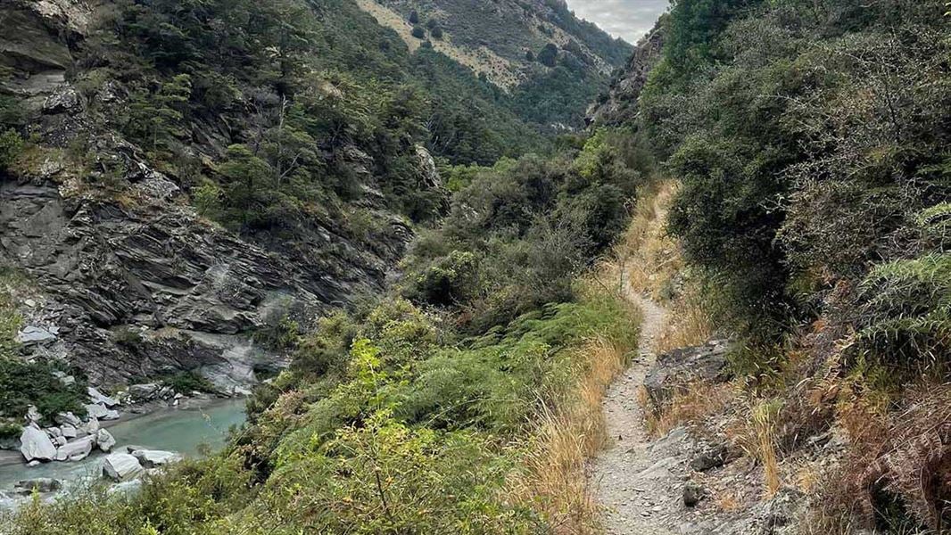
These tracks follow the lower section of Tīmaru River. They can be walked as a day loop or to access the upper Tīmaru River and Breast Hill Track.
The route
Lower Tīmaru River Track
Time: 3 hr
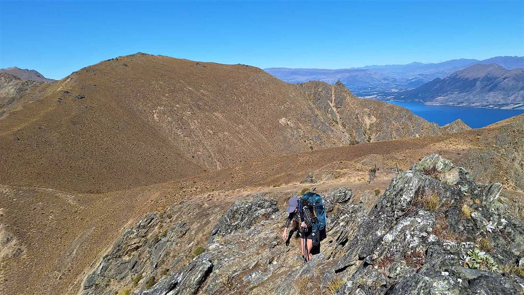
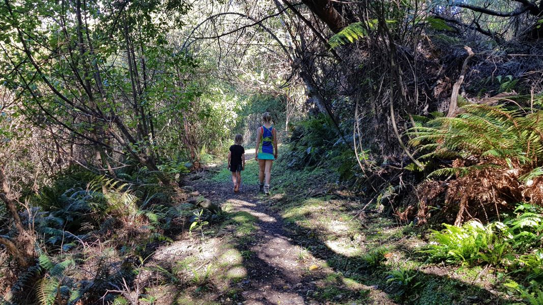
Distance:10.3 km one way Lower Tīmaru River Track to Deer Spur Creek involves numerous river crossings that should not be attempted if the river is high. There are several steep sidles which require care, other sections are rough and uneven. The marked track starts on the Tīmaru River's true left and crosses it several times during the first hour. It then crosses open flats near Junction Hut (private). The going becomes more awkward, but the track is clearly marked. It progresses through heavily gorged sections around side streams, and along scree slopes. A slip on a section of track 50 m downstream from the Tīmaru River/Breast Hill track junction requires care when crossing, as it is a bluffy section with a vertical drop on one side. Lower Tīmaru River Track ends at the junction with the Breast Hill Track (part of Te Araroa).
Tīmaru High River Track
7.3 km one way Tīmaru High River Track is signposted 50 m along the road. It goes through forest for around 500 m and then joins a 4WD track above the Tīmaru River. Follow this undulating track, passing the turnoff to Corner Peak Route . For the last 900 m of the track, descend to Deer Spur Creek near Junction Hut (1.5 km). This final section of the track is steep and slippery. From here you can return back the way you came, or cross the river and join the Lower Tīmaru River Track. Tīmaru High River Track is wider than Lower Tīmaru River Track, and if used as a there-and-back track has no crossings of the Tīmaru River.
Timaru River Loop
Time: 4 – 5 hr
You can combine these two tracks into a day hike, walking the Tīmaru High River Track then crossing Tīmaru River and returning back to the car park via Lower Tīmaru River Track.
Source: DOC Te Papa Atawhai.
Know before you go
What to expect
Pick the track that fits your skills and the current weather and river conditions. Lower Tīmaru River Track: Many unbridged river and stream crossings. These should not be attempted if the river is high. Narrow and uneven, including crossing sections of scree (loose gravel) and places with a steep drop of the side of the track. A marked tramping track. Tīmaru High River Track: Mostly a 4WD track. A steep and slippery descent to Deer Spur Creek. No river crossings unless you choose to cross the river to join Lower Tīmaru River Track.
Bad weather
The weather can change rapidly in New Zealand. Hypothermia is a real risk even in summer. Be prepared by having warm, waterproof, windproof clothing and the appropriate footwear. Whiteout conditions caused by snow or low cloud may be present. Check the Breast Hill forecast: Southern Lakes Forecast | MetService
Pack well for this tramp
You need to be well-equipped, even on a day walk. Pack plenty of warm and waterproof clothing and carry a distress beacon. Check our Day Hikes gear list and DOC multi-day tramping packing list
Access through high country stations
These tracks cross working high country stations. Respect livestock and property and stay on the marked track. Dogs are not allowed on these tracks.
Hunting
Hunters may carry unloaded firearms on these tracks, if they have a current hunting permit for lands administered by DOC. Under no circumstances should hunters discharge firearms before entering permitted hunting areas.
Stay safe when crossing rivers and streams
If you plan to cross unbridged rivers or side streams, know how to cross safely and be prepared for if you cannot cross. Do not cross if the river or stream is flooded, you cannot find safe entry and exit points or are unsure it’s safe. Turn back or wait for the river to drop. If in doubt, stay out. How to cross rivers safely NIWA river flow forecasts: View a video of national followed by regional river flows
Source: DOC Te Papa Atawhai.
Nearby stops
Junction Hut
Otago • 1.1 km
Junction Hut is a hut located in the Otago region of New Zealand. It is a basic accommodation option for hikers and outdoor enthusiasts.
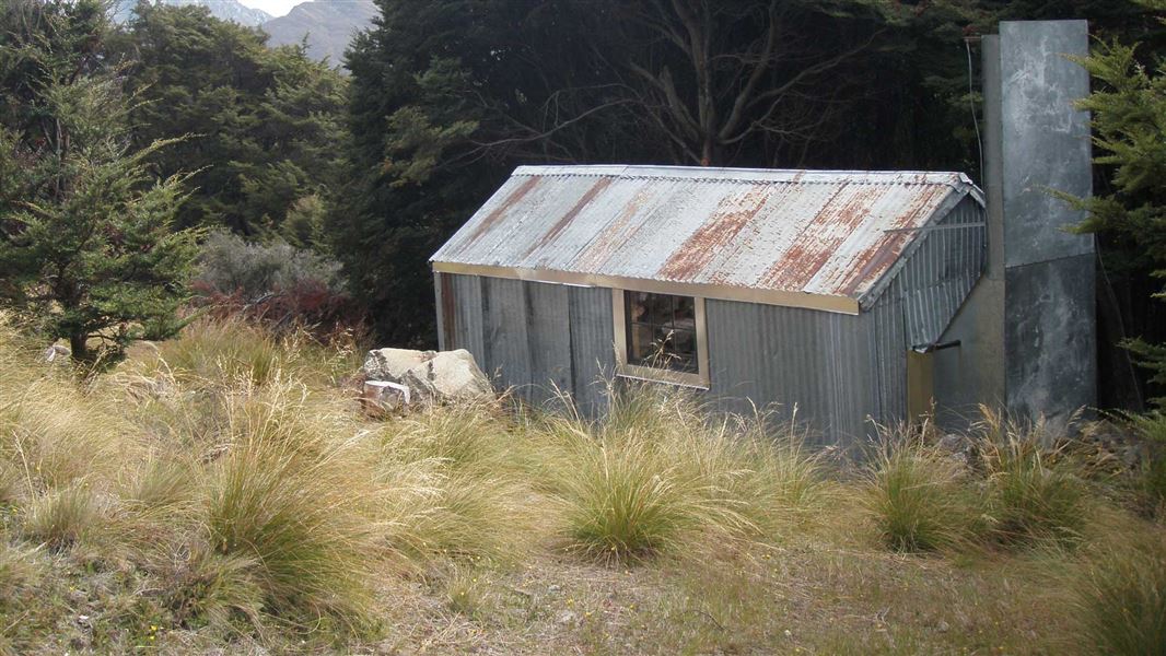
Stodys Hut
Basic/bivvies • 6 bunks • Otago • 4.9 km
Stodys Hut is a basic six-bunk hut located on the Breast Hill Track in Otago.
Heating • Mattresses • Toilets - non-flush
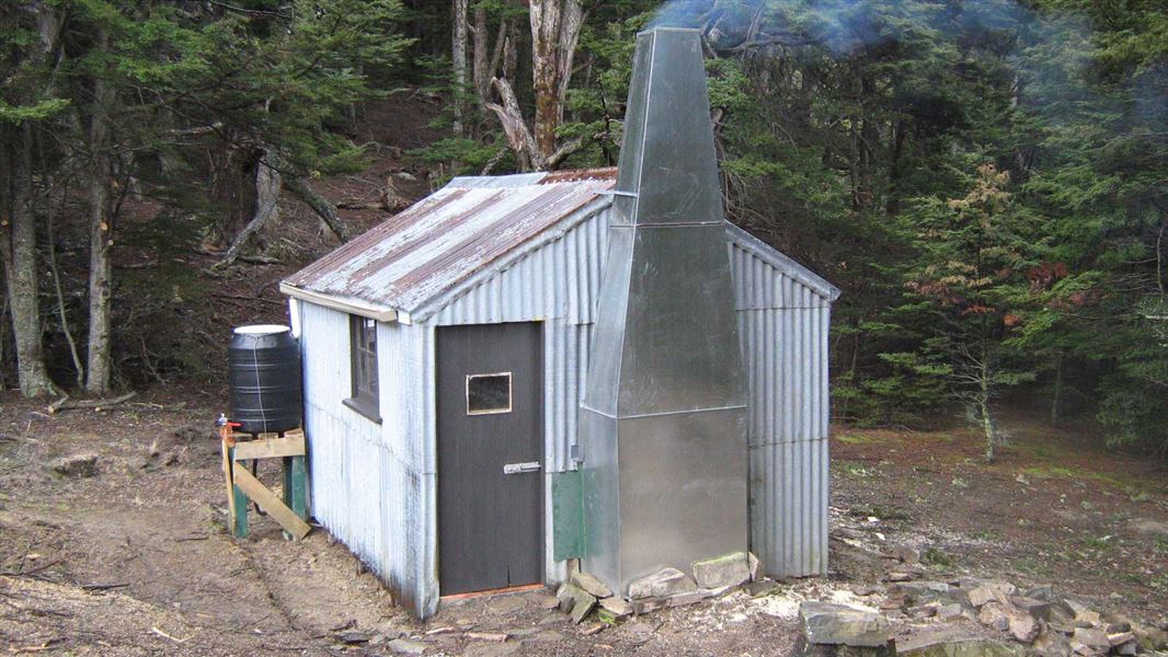
Moonlight and Roses Hut
Basic/bivvies • 4 bunks • Otago • 5 km
Moonlight and Roses Hut is a basic four-bunk hut located in the Wanaka area of Otago.
Heating • Mattresses • Toilets - non-flush
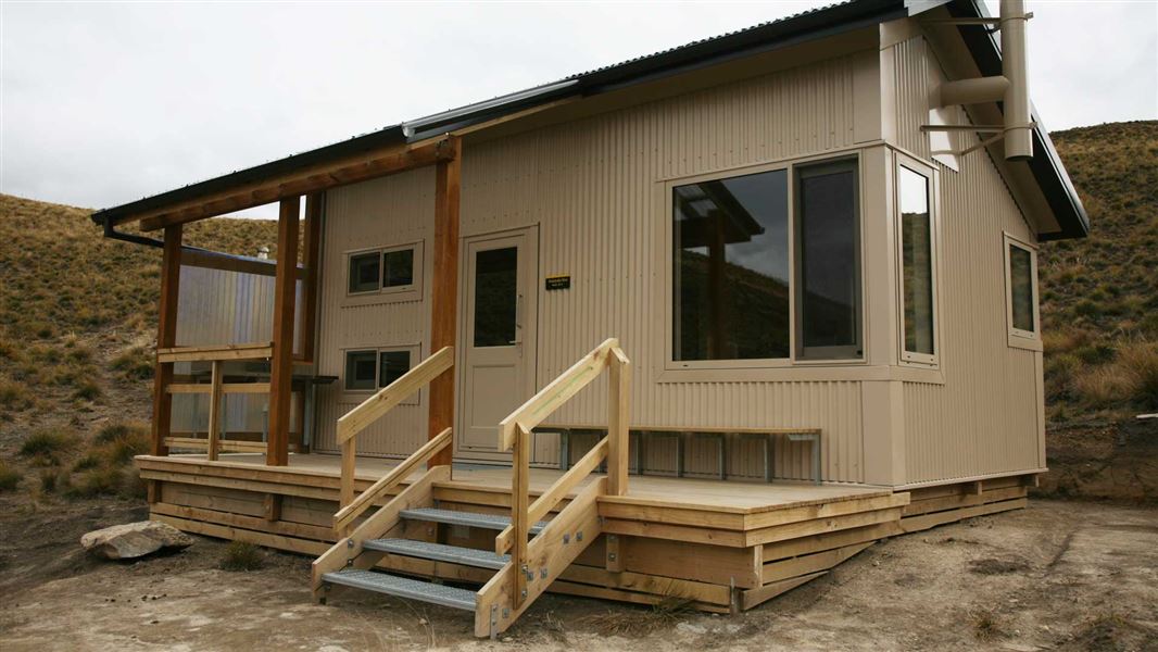
Pakituhi Hut
Standard • 8 bunks • Otago • 5.4 km
Pakituhi Hut is a standard eight-bunk hut located in the Wanaka and Makarora area of Otago. It provides basic accommodation for hikers in the region.
Mattresses • Toilets - non-flush • Water from tap - not treated, boil before use
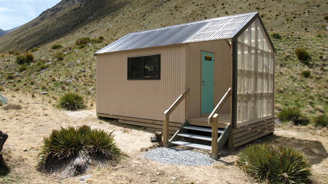
Top Tīmaru Hut
Standard • 6 bunks • Otago • 12.3 km
Top Tīmaru Hut is a standard six-bunk hut located in the Wānaka/Makarora area of Otago.
Mattresses • Toilets - non-flush • Water from stream
Walks nearby
Notes from people who have been
No notes yet. If you have been, say what you found.
Something missing or out of date?
Closed, moved, wrong facts, or something we have missed? Travellers keep the Road Guide up to date. Tell us what you found at contribute@parkup.nz and we will check it and add it.
Ask us to take this down
A person reads every request. We do not remove a place until we have checked it.
Sources
- DOC Tracks (API) · CC BY 4.0Crown Copyright: Department of Conservation Te Papa Atawhai. Data sourced from the DOC Developer Portal (api.doc.govt.nz).