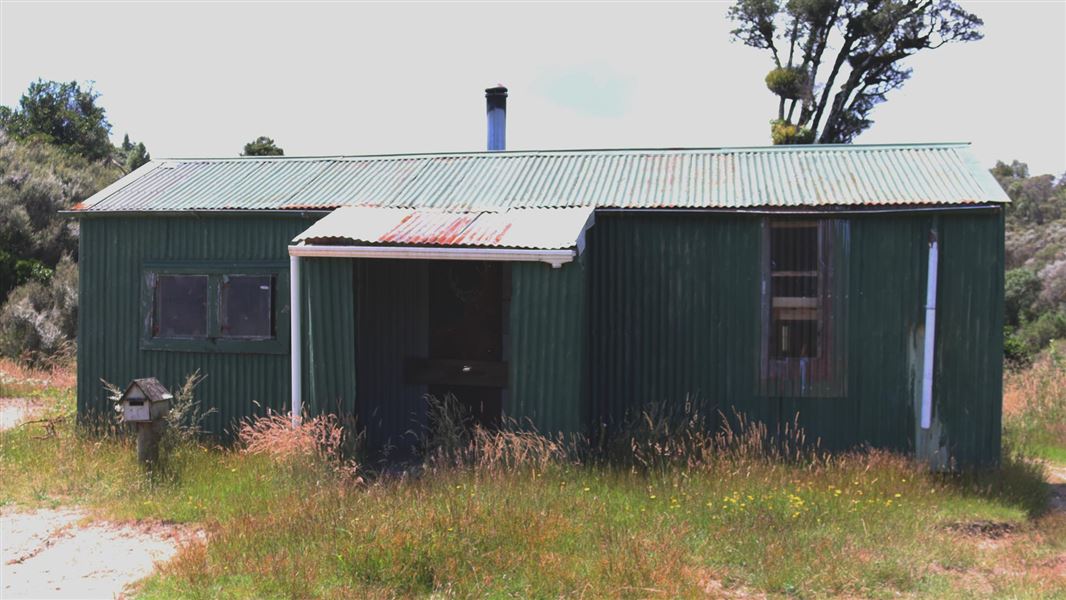
Ten Man Hut
Basic/bivvies hutTongariro Forest Conservation Area, Manawatū-WhanganuiOpen
- Sleeps
- 8 bunks
- Booking
- Not bookable
- Heating
- Yes
- Drinking water
- Boil first
- Toilet
- Non-flush
Getting there
We have not checked a road end or car park for this place yet, so we do not give driving directions to it. Check how to get there before you go. Some routes cross private land and need the landowner's permission.
How to get there, on doc.govt.nzŌwhango is a 15 min (20 km) drive north of National Park village on SH4.
In Ōwhango, turn into Omaki Street then left into Ohinetonga Road. Follow this road into the Ohinetonga Scenic Reserve to the entrance of the 42 Traverse Track. Follow the 42 Traverse Track for approximately 11 kms. Turn into Top/Clymo Track and follow this track for approximately 9 km until you reach the hut.Note: There is currently no access via the 42 Traverse Track from Kapoors Road due to a slip.
- Topo map
- Topo50 sheet BH34
Source: DOC Te Papa Atawhai.
Map
Map data © OpenStreetMap contributors. Topo map: LINZ, CC BY 4.0. 39.01668° S, 175.44765° E
About this place
This is a basic 8-bunk hut in the Tongariro Forest Conservation Area.
Know before you go
42 Traverse Track seasonal restrictions
The 42 Traverse Track has seasonal limitations for 4WD activities. 4WD activities are prohibited between 1 May and 30 November. Vehicles are not permitted off the 42 Traverse Track.
Source: DOC Te Papa Atawhai.
Fees and bookings
Free
Source: DOC Te Papa Atawhai.
Nearby stops

Pokaka Mill Campsite
Basic • Manawatū-Whanganui • 6.1 km
Pokaka Mill Campsite is a basic campsite located in the Ruapehu area.
Non-powered/tent sites • Toilets - non-flush • Toilets
Okupata Caves Carpark
Manawatū-Whanganui • 6.9 km
Okupata Caves Carpark is on Pukehinau Road in Ruapehu District, within Tongariro Conservation Area. Certified self-contained vehicles may stay up to four…
Ruapehu Christian Camp
Manawatū-Whanganui • 9.9 km
Ruapehu Christian Camp is a campsite located in the Manawatū-Whanganui region of New Zealand. The provided data does not include specific details regarding…
Tongariro Holiday Park
Manawatū-Whanganui • 13.9 km
Tongariro Holiday Park is a campsite located in the Manawatū-Whanganui region. It provides basic accommodation for visitors exploring the surrounding area.
Cross X Roads
Manawatū-Whanganui • 14.4 km
Walks nearby
Contact
Tongariro National Park Visitor Centre
Whakapapa Village, State Highway 48, Mount Ruapehu 3951
Regional DOC service centre.
Notes from people who have been
No notes yet. If you have been, say what you found.
Something missing or out of date?
Closed, moved, wrong facts, or something we have missed? Travellers keep the Road Guide up to date. Tell us what you found at contribute@parkup.nz and we will check it and add it.
Ask us to take this down
A person reads every request. We do not remove a place until we have checked it.
Sources
- OpenStreetMap Huts · ODbL (Open Database License)Contains information from OpenStreetMap, made available under the ODbL.
- DOC Huts · CC BY 4.0Data sourced from the Department of Conservation (DOC), New Zealand.
- DOC Huts (API) · CC BY 4.0Crown Copyright: Department of Conservation Te Papa Atawhai. Data sourced from the DOC Developer Portal (api.doc.govt.nz).