Stony River (Hangatahua) Walkway
WalkTaranakiOpen
- Grade
- Easy
- Walking time
- 1 hr
- Distance
- 3 km
- Route
- Return
- Dogs
- No dogs
Getting there
We have not checked a road end or car park for this place yet, so we do not give driving directions to it. Check how to get there before you go. Some routes cross private land and need the landowner's permission.
How to get there, on doc.govt.nzThe track starts from the William Corbett Reserve carpark. This is at the end of Old South Road in Ōkato. Ōkato is 25 minutes drive south of New Plymouth.
Source: DOC Te Papa Atawhai.
Map
Map data © OpenStreetMap contributors. Topo map: LINZ, CC BY 4.0. 39.19280° S, 173.87456° E
About this place
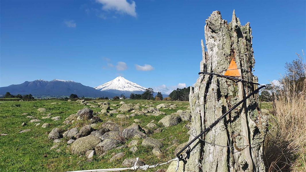
This walk takes you through lowland bush and to views of Taranaki Maunga. It can be done as either a return track or as a loop track. The loop involves crossing the unbridged Kaihihi Stream.
The route
This walk begins at the William Corbett Scenic Reserve in Ōkato. Follow the poles through lowland bush alongside the Kaihihi Stream to the end of the reserve. From here, the track passes through private property, before coming out onto private farmland. Be aware of electric fences. There is no public access across the Kaihihi Stream – the ford over the stream is a private ford not for public use. At this point you can either wade across the Kaihihi Stream or return the way you came. Be aware the Kaihihi Stream is unpassable after heavy rain. On a clear day, you'll have views of Taranaki Maunga and the Pouākai Range.
Source: DOC Te Papa Atawhai.
Nearby stops
Oakura-Petone Campground
Taranaki • 7.1 km
Pukeiti Domain Freedom Campground
Taranaki • 9.3 km
Pukeiti Domain Freedom Campground is a campsite located in the Taranaki region. The provided records do not list specific facilities or additional details for…
Cape Egmont Boat Club
Taranaki • 10.2 km
Cape Egmont Boat Club is a campsite located in the Taranaki region. The site charges ten dollars per night for accommodation.
Oakura Beach Holiday Park
Taranaki • 10.2 km
Oakura Beach Holiday Park is a campsite located in the Taranaki region. It is situated on the coast, offering a base for visitors exploring the local beaches…
Oakura Holiday Park
Taranaki • 10.3 km
Walks nearby
Boars Head Mine Track
Advanced • 1.9 km • 6.71 km away
Sefton Ridge Track
Advanced • 2 to 3 hr • 4.3 km • 7.57 km away
Waimoku Track
Advanced • 2 hr to the trig • 3.5 km • 8.36 km away
Davies Track
Advanced • 2 hr to trig • 4.2 km • 10.16 km away
Dover Route
Expert • 3 hr 30 min one way • 4.8 km • 10.93 km away
Notes from people who have been
No notes yet. If you have been, say what you found.
Something missing or out of date?
Closed, moved, wrong facts, or something we have missed? Travellers keep the Road Guide up to date. Tell us what you found at contribute@parkup.nz and we will check it and add it.
Ask us to take this down
A person reads every request. We do not remove a place until we have checked it.
Sources
- DOC Tracks (API) · CC BY 4.0Crown Copyright: Department of Conservation Te Papa Atawhai. Data sourced from the DOC Developer Portal (api.doc.govt.nz).
- DOC Tracks & Trails · CC BY 4.0Data sourced from the Department of Conservation (DOC), New Zealand.