No Man's Road area tramping tracks
WalkHawke's Bay
- Grade
- Advanced
- Dogs
- No dogs
Access: read before you go
No Man's Road is a 22 kilometre, 4WD road that climbs to the open tops of the north eastern Ruahine Range. It provides access to a varied network of huts and tracks for hunters and trampers.
Source: DOC Te Papa Atawhai.
Getting there
We have not checked a road end or car park for this place yet, so we do not give driving directions to it. Check how to get there before you go. Some routes cross private land and need the landowner's permission.
How to get there, on doc.govt.nzNo Man's Road is reached via Big Hill Road. Big Hill Road is approximately 45 km from Hastings or 60 km from Napier. Follow State Highway 50 to Maraekakaho and turn right into Kereru Road. On reaching Kereru, turn right into Big Hill Road.
No Man's Road is a 22 kilometre, 4WD road that climbs to the open tops of the north eastern Ruahine Range. It provides access to a varied network of huts and tracks for hunters and trampers.
Source: DOC Te Papa Atawhai.
Map and tracks
Track lines: DOC Te Papa Atawhai. Map data © OpenStreetMap contributors. Topo map: LINZ, CC BY 4.0. 39.55499° S, 176.32364° E
About this place
Tracks starting at No Man's Road give access to a number of backcountry huts in the Eastern Ruahine Forest Park.
The route
No Man's Road to Diane's Hut
Time: 1 hr
Five kilometres along No Man’s Road from the Ruahine Hut turnoff, the road continues south west to reach Lessong’s Monument, built by the surveyor Lessong in the 1880’s. Eight hundred metres from the monument a track heads north from the road to reach Diane’s Hut.
Dianes Hut to Taruarau Bivvy
Time: 2 hr - 2 hr 30 min
From Dianes Hut a track climbs steeply to the Taruarau Ridge (1 hour) and then to Taruarau Bivvy (a further 15 minutes). The track passes through beech forest and tussock scrub. There are views to the Kaweka Range.
No Man's Road to Dead Dog Hut
Time: 2 hr
3 kilometres from Lessong’s Monument a track leaves No Man’s Road heading east and descends steeply to Dead Dog Hut.
Dead Dog Hut to Herricks Hut
Time: 2 hr 30 min - 3 hr
To reach Herrick Hut, follow the river for approximately 3 kilometres to reach a sign which marks a side track leading to the hut (a further 3 kilometres).
Ruahine Hut to Shutes Hut track
Time: 5 - 6 hr
After travelling 5 kilometres on No Man's Road from the park boundary, a short 4WD track leads to Ruahine Hut. The track to Shutes Hut starts on the upper edge of the clearing by Ruahine Hut and heads north through regenerating manuka and kanuka and beech forest. Shutes Hut was built in 1920 and is an old rabbiters hut made of stone and held together with cement that was manually packed into the remote area. The first, and for many years the only, regular occupant was Alex Shute who led a solitary life rabbiting. He planted a small orchard nearby as well as pine and gum trees. The hut stands in a grassy clearing surrounded by pine trees. The area is popular for hunting and the nearby Taruarau river is noted for its trout fishing.
Source: DOC Te Papa Atawhai.
Joins these tracks
Source: DOC Te Papa Atawhai.
On this track
In walking order.
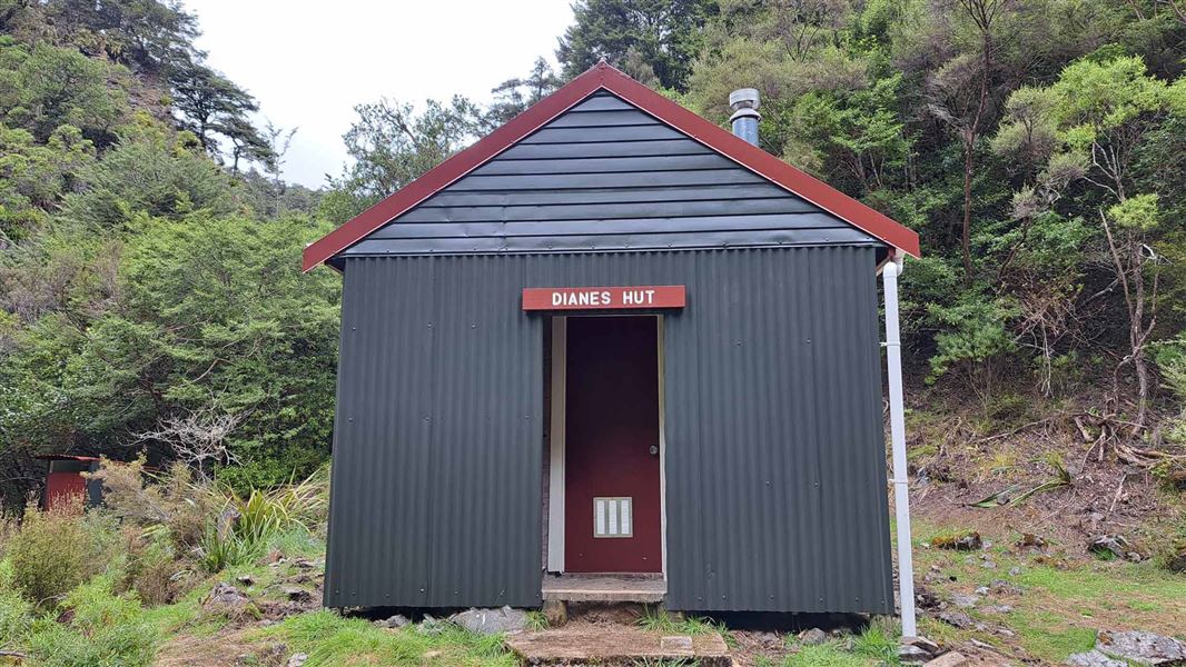
Dianes Hut
Basic/bivvies • 6 bunks • Hawke's Bay
- Toilet
- Heating
- Water

Taruarau Bivvy
Basic/bivvies • 2 bunks • Hawke's Bay
- Toilet
- Water
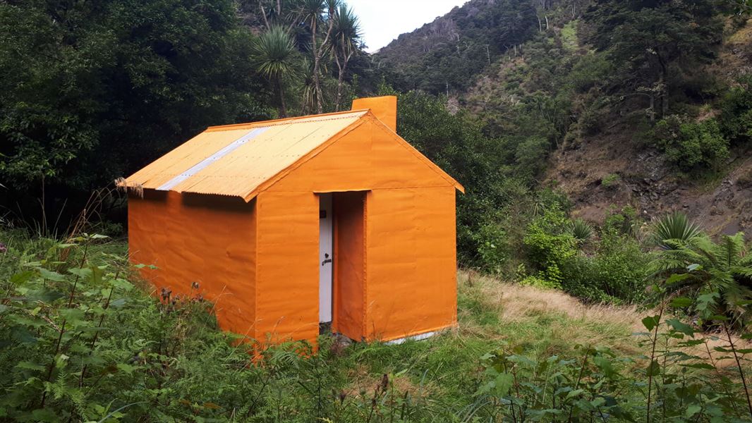
Dead Dog Hut
Standard • 6 bunks • Hawke's Bay
- Toilet
- Heating
- Water
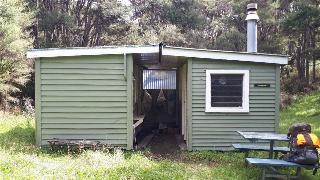
Herricks Hut
Basic/bivvies • 5 bunks • Hawke's Bay
- Toilet
- Water
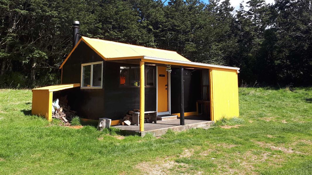
Ruahine Hut
Standard • 8 bunks • Hawke's Bay
- Toilet
- Heating
- Water

Shutes Hut
Standard • 4 bunks • Hawke's Bay
Nearby stops
No Mans Hut
Hawke's Bay • 6.2 km
Masters Shelter
Hawke's Bay • 8.2 km
Komata Hut
Hawke's Bay • 8.5 km
Komata Hut is a basic shelter located in the Hawke's Bay region of New Zealand. The provided records do not specify any additional facilities or details for…

Rockslide Hut
Basic/bivvies • 4 bunks • Hawke's Bay • 10.7 km
Rockslide Hut is a basic four-bunk hut located in the Hawke's Bay region.
Mattresses • Toilets - non-flush • Water from stream

Ikawetea Forks Hut
Standard • 7 bunks • Hawke's Bay • 11.5 km
Ikawetea Forks Hut is a standard seven-bunk hut located in the Hawke's Bay region.
Heating • Mattresses • Toilets - non-flush
Walks nearby
Notes from people who have been
No notes yet. If you have been, say what you found.
Something missing or out of date?
Closed, moved, wrong facts, or something we have missed? Travellers keep the Road Guide up to date. Tell us what you found at contribute@parkup.nz and we will check it and add it.
Ask us to take this down
A person reads every request. We do not remove a place until we have checked it.
Sources
- DOC Tracks (API) · CC BY 4.0Crown Copyright: Department of Conservation Te Papa Atawhai. Data sourced from the DOC Developer Portal (api.doc.govt.nz).