Mount Damper Falls Walk
WalkTaranakiOpen
- Grade
- Easiest
- Walking time
- 30 min
- Distance
- 1 km to the falls
- Route
- Return
- Dogs
- DOC permit only
Access: read before you go
Dogs are prohibited except where authorisation has been granted by DOC. People wishing to take a dog into this area need to get a permit from the local DOC office and have a current kiwi aversion certificate. Avian awareness and avoidance training To take dogs across private property, or tracks crossing farmland, you must get permission from the landowner.
Source: DOC Te Papa Atawhai.
Getting there
We have not checked a road end or car park for this place yet, so we do not give driving directions to it. Check how to get there before you go. Some routes cross private land and need the landowner's permission.
How to get there, on doc.govt.nzThe walk starts from Mount Damper Falls car park, on the Okau Road off SH3, 59 km north of New Plymouth.
Source: DOC Te Papa Atawhai.
Map
Map data © OpenStreetMap contributors. Topo map: LINZ, CC BY 4.0. 38.92267° S, 174.78418° E
About this place
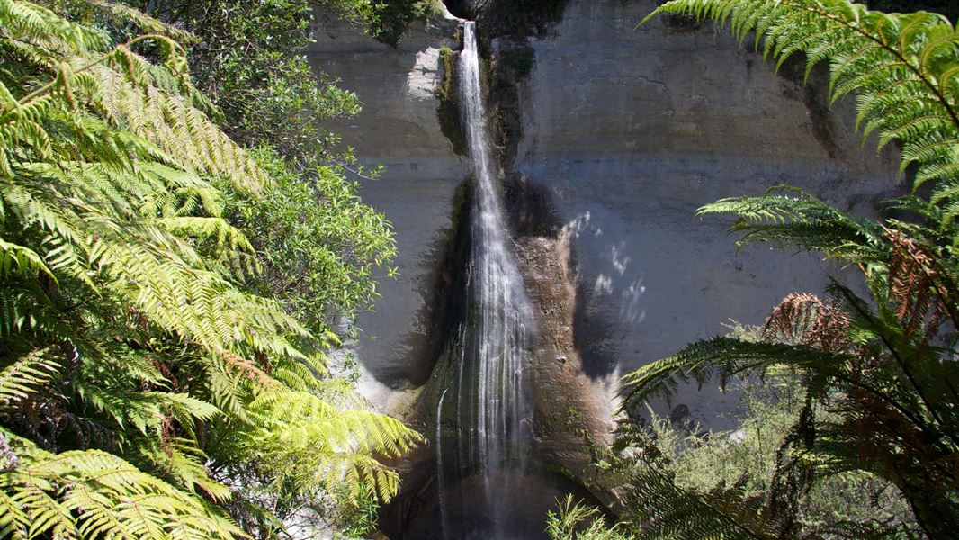
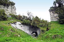
This short walk leads to Mount Damper Falls, one of the highest falls in the North Island.
The route
At 74 m high, Mount Damper Falls are one of the highest in the North Island. From the car park step over the style and walk over the formed track beside the creek. The first 10 minutes are over open farmland - respect private property, leave gates as you find them and stay on the track. Follow the track until you reach the bridge, from where the bush starts. The track descends gradually to two viewing platforms.
Source: DOC Te Papa Atawhai.
Know before you go
Dogs
Dogs are prohibited except where authorisation has been granted by DOC. People wishing to take a dog into this area need to get a permit from the local DOC office and have a current kiwi aversion certificate. Avian awareness and avoidance training To take dogs across private property, or tracks crossing farmland, you must get permission from the landowner.
Source: DOC Te Papa Atawhai.
Nearby stops

Rerekapa Hut
Basic/bivvies • 14 bunks • Taranaki • 5.6 km
Rerekapa Hut is a public hut in the Taranaki region that is owned and managed by Rerekapa Hut Supporters Incorporated. Access to the hut is available through a…
Te Rerepahupahu Hut
Manawatū-Whanganui • 7.8 km
Te Rerepahupahu Hut is a backcountry shelter located in the Manawatū-Whanganui region. The provided records do not include specific details about its…
Bushlands Campground
Manawatū-Whanganui • 12.2 km
Bushlands Campground is a campsite located in the Manawatū-Whanganui region. No additional details regarding facilities or specific amenities are available in…
Walks nearby
Mount Damper to Te Rerepahupahu Falls track
Advanced • 7 hr 30 min - 9 hr • 14 km to the falls • 4.08 km away
Rerekapa Track
Advanced • 3-4 hr • 5.5 km away
Waitaanga South Road to Te Rerepahupahu Falls Track
Advanced • 4 hr 30 min • 10 km to the falls • 7.42 km away
Moki Track
Advanced • 8 hr • 18 km • 10.62 km away
Notes from people who have been
No notes yet. If you have been, say what you found.
Something missing or out of date?
Closed, moved, wrong facts, or something we have missed? Travellers keep the Road Guide up to date. Tell us what you found at contribute@parkup.nz and we will check it and add it.
Ask us to take this down
A person reads every request. We do not remove a place until we have checked it.
Sources
- DOC Tracks (API) · CC BY 4.0Crown Copyright: Department of Conservation Te Papa Atawhai. Data sourced from the DOC Developer Portal (api.doc.govt.nz).
- DOC Tracks & Trails · CC BY 4.0Data sourced from the Department of Conservation (DOC), New Zealand.