Māhinapua short walks
WalkWest Coast
- Grade
- Easiest
- Walking time
- 40 min
- Dogs
- DOC permit only
Getting there
We have not checked a road end or car park for this place yet, so we do not give driving directions to it. Check how to get there before you go. Some routes cross private land and need the landowner's permission.
How to get there, on doc.govt.nz10 km south of Hokitika on SH6 turn left onto the Lake Māhinapua access road opposite the Lake Māhinapua Hotel, continue for about 300 m along this gravel road which opens out to the recreation area.
Access to the Mananui Tramline (Māhinapua Walkway) is from a signposted carpark approximately 8 km south of Hokitika on SH6 or from a carpark 14 km south of Hokitika on the eastern side of Lake Māhinapua on the Ross-Rimu road from Hokitika. The walk can be done from either direction.
Source: DOC Te Papa Atawhai.
Map
Map data © OpenStreetMap contributors. Topo map: LINZ, CC BY 4.0. 42.79088° S, 170.90022° E
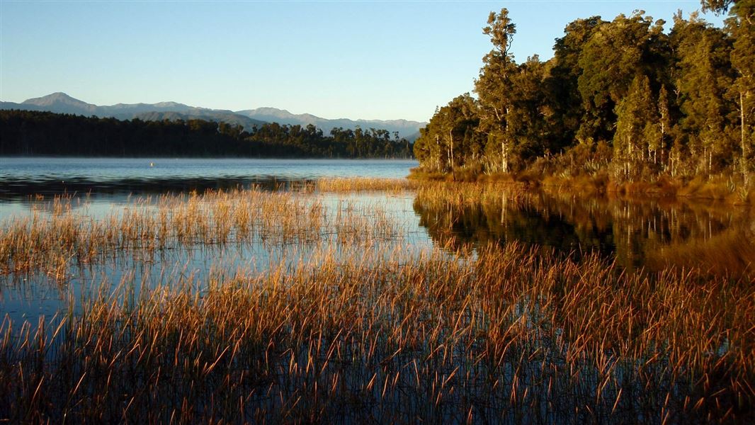
About this place
These short walks pass through dense bush to reach Lake Māhinapua - with a picnic area/campsite at one end, these walks are great for kids.
The route
Jum Michel Track
Time: 20 min one way
This easy flat walk starts from the Lake Māhinapua access road 10 km south of Hokitika, it passes through the dense bush of Lake Māhinapua Scenic Reserve to come out by the camping and recreation area next to the lake. Both ends of the track are signposted.
Bellbird Walk
Time: 10 min loop
This walk starts at the southern end of the camping area. It circles an old gold dredge pond.
Swimmers Beach Walk
Time: 30 min one way
To get to Swimmers Beach, from the northern end of the car park at the camping area, follow the sign posted gravel road through native bush and down to the lake shore.
Mananui Bush
Time: 20 min return
This walk is located 9 km south of Hokitika on the sea side of SH6, it is well signposted. Leading to the sea, this walk passes through a coastal forest remnant and comes out through flax behind the first dune. You return via the same track.
Source: DOC Te Papa Atawhai.
Nearby stops

Lake Māhinapua Campsite
Standard • West Coast • 0.4 km
Lake Māhinapua Campsite is located on the West Coast beside the lake, surrounded by forest. It serves as a popular stop for both overnight stays and day…
Boat launching • Jetty • Non-powered/tent sites
Links View Holiday Park
West Coast • 6.3 km
Woodstock Domain
West Coast • 8.8 km
STOP Caravan park
West Coast • 9.6 km
Hokitika's Kiwi Holiday Park and Motel
West Coast • 10.5 km
Something missing or out of date?
Closed, moved, wrong facts, or something we have missed? Travellers keep the Road Guide up to date. Tell us what you found at contribute@parkup.nz and we will check it and add it.
Ask us to take this down
A person reads every request. We do not remove a place until we have checked it.
Sources
- DOC Tracks (API) · CC BY 4.0Crown Copyright: Department of Conservation Te Papa Atawhai. Data sourced from the DOC Developer Portal (api.doc.govt.nz).