Lake Matiri Hut
Standard hutKahurangi National Park, TasmanOpen
- Sleeps
- 8 bunks
- Booking
- Not bookable
- Cost
- from $15
- Heating
- Yes
- Drinking water
- Boil first
- Toilet
- Non-flush
Getting there
We have not checked a road end or car park for this place yet, so we do not give driving directions to it. Check how to get there before you go. Some routes cross private land and need the landowner's permission.
How to get there, on doc.govt.nzLake Matiri Hut is accessible from the upper Matiri Valley and 1000 Acre Plateau tramping tracks.
- Topo map
- Topo50 sheet BR23
- Grid reference
- E1544130, N5388120
Source: DOC Te Papa Atawhai.
Map and tracks
Track lines: DOC Te Papa Atawhai. Map data © OpenStreetMap contributors. Topo map: LINZ, CC BY 4.0. 41.65602° S, 172.33029° E
About this place
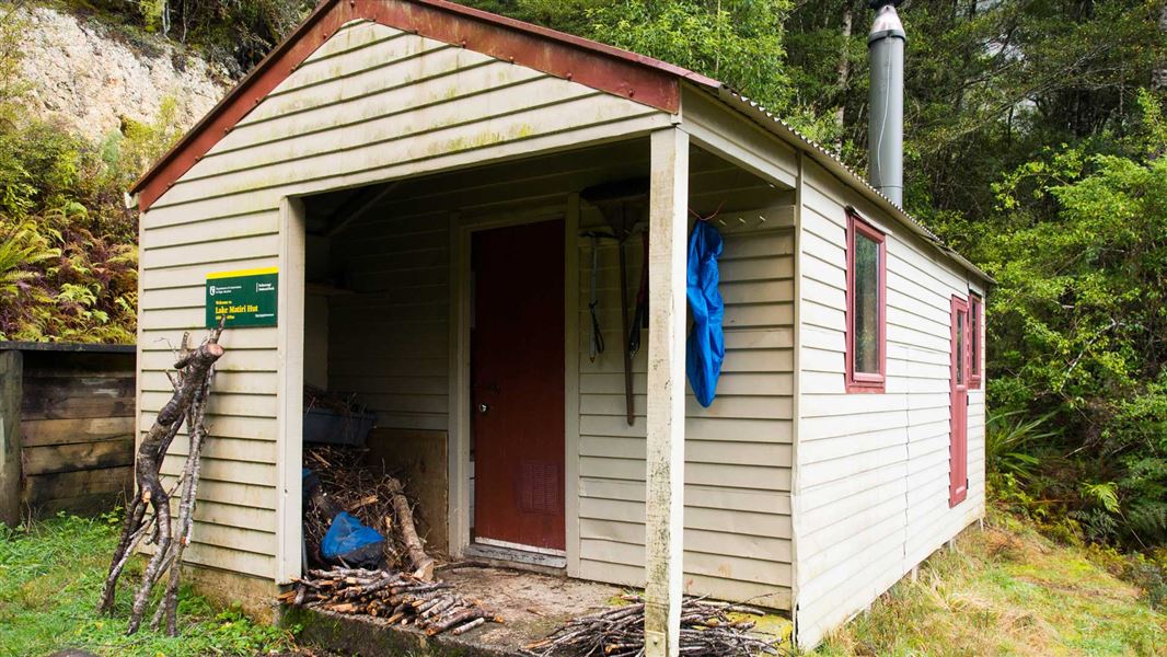
This is a standard 8-bunk hut in the Kahurangi National Park.
On the way here
Upper Matiri Valley and 1000 Acre Plateau tramping tracks
Note that some tracks take longer to walk due to fallen trees and overgrown vegetation. From the DOC carpark at Matiri roadend follow the Lake Matiri Hut Track for 1.5 hr to Lake Matiri Hut.
Lake Matiri Hut to Poor Petes Hut
Time: 3 hr
From the fork in the track just beyond Bay Creek a tramping track climbs abruptly up a spur. After about 40 minutes there is a good place for a rest and to take in the panorama of the Matiri Valley and lake below. The track continues steeply through a diverse forest of silver and mountain beech, kamahi, rata and mountain totara. The plateau rim is reached in about two hours from Lake Matiri Hut - a huge expanse of tussock land dotted with patches of stunted forest. Beyond the rim a marked route sets out across the boggy-in-places plateau to Poor Petes Hut.
Lake Matiri Hut to McConchies Hut
Time: 9 hr Note: The track now takes 9 hr to walk due to fallen trees and overgrown vegetation.
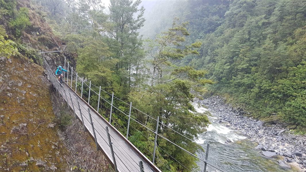
Sidle around the western shore of the lake through beautiful beech forest. Just beyond the open flats where Bay Creek flows into the lake signs indicate the track to the 1000 Acre Plateau and the upper Matiri Valley. Continue up-valley on river flats for several kilometres. Travel slows as the valley narrows, two steep climbs avoid gorge sections. McConchies Hut is about half way up Matiri Valley.
Lake Matiri Hut Track · 1 hr 30 min
Park at the Matiri roadend carpark and cross the West Branch (this was bridged in 2020 so allows all weather access). Follow the road alongside the river before entering the forest and climbing the face of a slip brought down by an ancient earthquake. The track levels out and soon reaches Lake Matiri Hut overlooking the tranquil Lake Matiri.
Continue past Lake Matiri Hut on
Source: DOC Te Papa Atawhai.
Fees and bookings
Before you go, buy Hut Tickets for each night's stay. Put these in the honesty box at the hut. Or buy a Backcountry Hut Pass that gives unlimited use at most Standard and Serviced huts for a 12 month period. Retailers that sell hut tickets and passes
Source: DOC Te Papa Atawhai.
Nearby stops

Poor Pete's Hut
Basic/bivvies • 2 bunks • Tasman • 4.7 km
Poor Pete's Hut is a basic two-bunk hut located in the Kahurangi National Park.
Mattresses • Toilets - non-flush • Water from tap - not treated, boil before use

McConchies Hut
Standard • 4 bunks • Tasman • 8.1 km
McConchies Hut is a standard four-bunk hut located in the Nelson Lakes area of the Tasman region.
Heating • Mattresses • Toilets - non-flush

Larrikin Creek Hut
Standard • 4 bunks • West Coast • 10.8 km
Larrikin Creek Hut is a standard four-bunk hut located in Kahurangi National Park.
Heating • Mattresses • Toilets - non-flush

Hurricane Hut
Standard • 4 bunks • Tasman • 17.2 km
Hurricane Hut is a basic 4-bunk hut located in the Nelson Lakes area of the Tasman region.
Heating • Mattresses • Toilets - non-flush
Contact
Nelson Lakes National Park Visitor Centre
Regional DOC service centre.
Notes from people who have been
No notes yet. If you have been, say what you found.
Something missing or out of date?
Closed, moved, wrong facts, or something we have missed? Travellers keep the Road Guide up to date. Tell us what you found at contribute@parkup.nz and we will check it and add it.
Ask us to take this down
A person reads every request. We do not remove a place until we have checked it.
Sources
- DOC Huts · CC BY 4.0Data sourced from the Department of Conservation (DOC), New Zealand.
- DOC Huts (API) · CC BY 4.0Crown Copyright: Department of Conservation Te Papa Atawhai. Data sourced from the DOC Developer Portal (api.doc.govt.nz).
- OpenStreetMap Huts · ODbL (Open Database License)Contains information from OpenStreetMap, made available under the ODbL.