Lake Kaniere short walks
WalkWest Coast
- Grade
- Easiest
- Walking time
- 17 min
- Dogs
- DOC permit only
Getting there
We have not checked a road end or car park for this place yet, so we do not give driving directions to it. Check how to get there before you go. Some routes cross private land and need the landowner's permission.
How to get there, on doc.govt.nzFrom Hokitika head east along Lake Kaniere Road for 19 km. This road meets the lake at 'The Landing'. The road forks at this point, the right road heads to 'Sunny Bight' and the other is Dorothy Falls Road which takes you around the east side of the lake past Hans Bay.
Source: DOC Te Papa Atawhai.
Map
Map data © OpenStreetMap contributors. Topo map: LINZ, CC BY 4.0. 42.80199° S, 171.14706° E
About this place
These short forest walks lead to picnic areas, waterfalls and sandy beaches ideal for swimming - plenty to keep kids interested.
The route
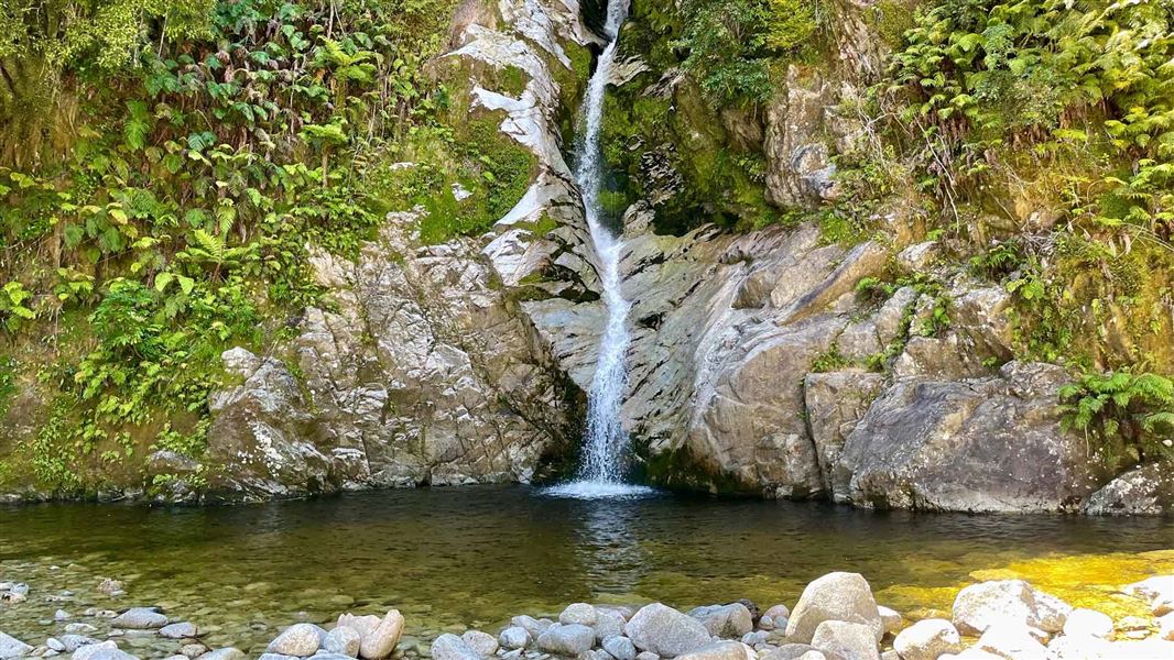
A range of short walks that lead to picnic areas, waterfalls and sandy beaches. The beach at the end of Canoe Cove Walk and Dorothy Falls are spots for swimming. Dorothy Falls is refreshing but a little chilly!
Canoe Cove Walk
Time: 15 min one way
m Canoe cove is a small inlet at the head of Lake Kaniere. It is accessed via a track which begins at the carpark opposite the Hans Bay Road/ Milltown Road junction. This walk leads through dense stands of rimu and kahikatea forest to a sheltered sandy beach suitable for picnics and swimming.
Dorothy Falls
Time: 2 min one way
About 3.5 km from Hans Bay along Dorothy Falls Road, a short walk leads to the base of Dorothy Falls - a lovely spot for a refreshing dip.
Kahikatea Forest Walk
Time: 10 min loop walk
m From the Sunny Bight picnic area this is an easy 10 minute loop walk. The walk follows Sunny Bight Creek and passes through virgin Kahikatea forest before returning to the picnic area via a boardwalk over a flax swamp.
Source: DOC Te Papa Atawhai.
Nearby stops

Hans Bay - Lake Kaniere Campsite
Standard • West Coast • 1 km
Hans Bay is a large, grassy campsite located on the shores of Lake Kaniere in the West Coast region. Visitors can fish from the jetty, boat, or swim in the…
Boat launching • Jetty • Non-powered/tent sites

Mt Brown Hut
Standard • 4 bunks • West Coast • 8.6 km
Mt Brown Hut is a DOC hut on the West Coast. The hut deck offers views overlooking Lake Kaniere, Hokitika, and the sea.
Heating • Mattresses • Toilets - non-flush
Trappers Rest
West Coast • 8.8 km
Woodstock Domain
West Coast • 12.3 km
Newton Range Bivvy
Basic/bivvies • 2 bunks • West Coast • 13 km
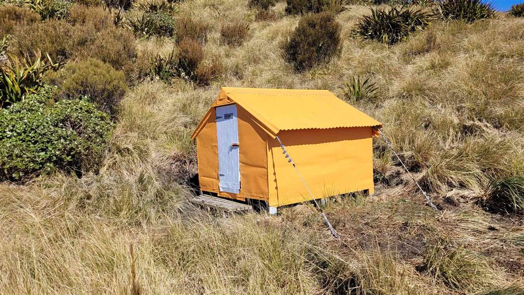
Newton Range Bivvy is a basic two-bunk hut located in the Hokitika area of the West Coast.
Toilets - non-flush • Water from stream • Water supply
Walks nearby
Something missing or out of date?
Closed, moved, wrong facts, or something we have missed? Travellers keep the Road Guide up to date. Tell us what you found at contribute@parkup.nz and we will check it and add it.
Ask us to take this down
A person reads every request. We do not remove a place until we have checked it.
Sources
- DOC Tracks (API) · CC BY 4.0Crown Copyright: Department of Conservation Te Papa Atawhai. Data sourced from the DOC Developer Portal (api.doc.govt.nz).