Kirwans Hut
Serviced hutVictoria Forest Park, West CoastOpen
Current advisories
Kirwans Track severe damage
15 July 2026
Severe storm damage has made sections of the track unsafe. Montgomerie Hut and Kirwans Hut can still be reached via the Waitahu-Murray Connecting Track, starting from the Murray Creek car park. Experienced visitors can also access the huts via the unmarked route from Gannons Road following the Waitahu River. Kirwans Hut can also be reached from Capleston (Boatman's Road). However, the Kirwans Tunnel Bridge and adjacent track are closed due to active rockfall. Highly experienced visitors with off-track navigation skills may be able to bypass the closed bridge and track via an unmarked route from this direction. This option is not recommended for those without advanced navigation and hazard awareness skills. Only the track and tunnel bridge are closed - the surrounding public conservation land remains open. First published on 27 November 2025. Last reviewed on 16 July 2026.
Source: DOC Te Papa Atawhai alerts.
- Sleeps
- 12 bunks
- Booking
- Can book
- Cost
- from $25
- Heating
- Yes
- Drinking water
- Boil first
- Toilet
- Non-flush
Getting there
We have not checked a road end or car park for this place yet, so we do not give driving directions to it. Check how to get there before you go. Some routes cross private land and need the landowner's permission.
How to get there, on doc.govt.nz- Topo map
- Topo50 sheet BS22
Source: DOC Te Papa Atawhai.
Map and tracks
Track lines: DOC Te Papa Atawhai. Map data © OpenStreetMap contributors. Topo map: LINZ, CC BY 4.0. 42.10314° S, 172.00990° E
About this place
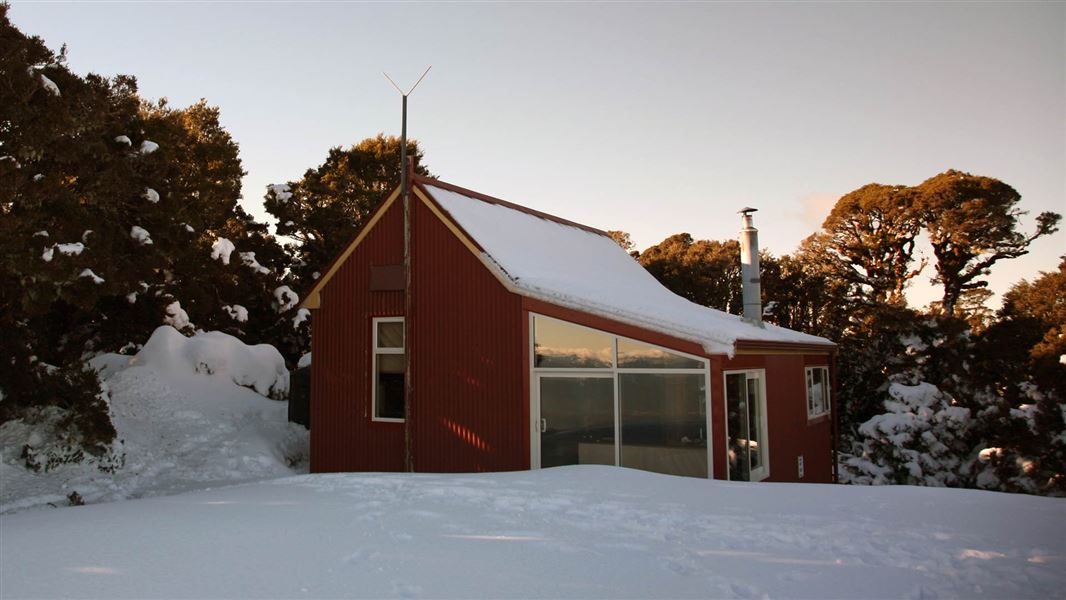
This is a serviced 12-bunk hut in the Greymouth area.
On the way here
Kirwans Track · 2-3 days
The walk up to Kirwans Hut via Montgomerie Hut is a stunning overnight tramp. Leaving from the Waitahu/ Gannons Road car park, the 11.5 km track winds its way up the Waitahu River to the 6 bunk Montgomerie Hut. Either spend the night here or carry on up the remaining 9.2 km track from Montgomerie Hut to Kirwans Hut. You will pass the Lord Brassey Historic Stamper, and then climb your way up to the beautiful Kirwans Hut. You will need to return the same way. Due to severe storm damage and a dangerous rock fall, the loop via Capleston car park is closed until further notice.
Montgomerie Hut – Kirwans Hut
Time: 3.5 hr or 9.2 km
From Montgomerie Hut, the track winds its way up to the Lord Brassey stamper battery. The battery is an impressive structure holding fifteen 500kg+ stamper rods, that were originally lifted by a water powered pelton wheel, then dropped down to crush gold bearing quartz. From here it’s a steep but steady climb up to Kirwans Hut. Kirwans Hut is built on a stunning site in an alpine clearing just above the bushline. On a clear day you can see all the way down to Aoraki/Mount Cook.
Mountain biking
The ride up to Kirwans Hut and back by the Waitahu/ Gannons Road track is a stunning, wilderness grade 4 mountain bike ride. It is a challenging ride up gaining 1000 m elevation. You are rewarded with spectacular views and a steep downhill ride back to the Lord Brassey Stamper battery, with sections of technical riding and some carrying. Another option is to take a helicopter up to the top and ride down. Mountain biking can also be done by Murray Creek to the Clematis swing bridge and back down the Waitahu Valley to create a loop ride back to Reefton. We do not recommend mountain biking up the Waitahu valley further than Station Creek. These are shared-use tracks. Follow the mountain bikers code : respect others, respect the rules, respect the track.
Source: DOC Te Papa Atawhai.
Trip options
Walking times come from DOC track descriptions, added up leg by leg from car-accessible trailheads. Nights and return times are ParkUp estimates, allowing about 8 hours of walking a day.
1 option · 2 nights
Gannons Road car park
Walking in
9 hr (via Montgomerie Hut)
Walking out
9 hr to Gannons Road car park (via Montgomerie Hut)
Source: DOC Te Papa Atawhai track descriptions.
Fees and bookings
1 May - 30 September
1 October - 30 April
Weekdays
Weekends
1 December - 29 February
Weekdays
Weekends
Backcountry Hut Passes can be used at this hut. About hut tickets and passes Retailers that sell hut tickets and passes
Bookings are open for stays up to 30 June 2027. If no availability shows online for your dates, the hut is fully booked. No spaces are kept for visitors arriving without a booking. Phone and in‑person bookings made at a visitor centre incur a $10 service fee. Same‑day bookings are available online until 8 pm if spaces remain. Book Kirwans Hut online . Your hut booking is for any bunk bed, not for a specific bunk bed – select your bunk bed on arrival.
Source: DOC Te Papa Atawhai.
On these tracks
Source: DOC Te Papa Atawhai.
Nearby stops

Montgomerie Hut
Standard • 6 bunks • West Coast • 5.3 km
Montgomerie Hut is a standard six-bunk hut located in the Greymouth area of the West Coast.
Heating • Mattresses • Toilets - non-flush
Wheel Creek Hut
Basic/bivvies • 6 bunks • Tasman • 10.7 km
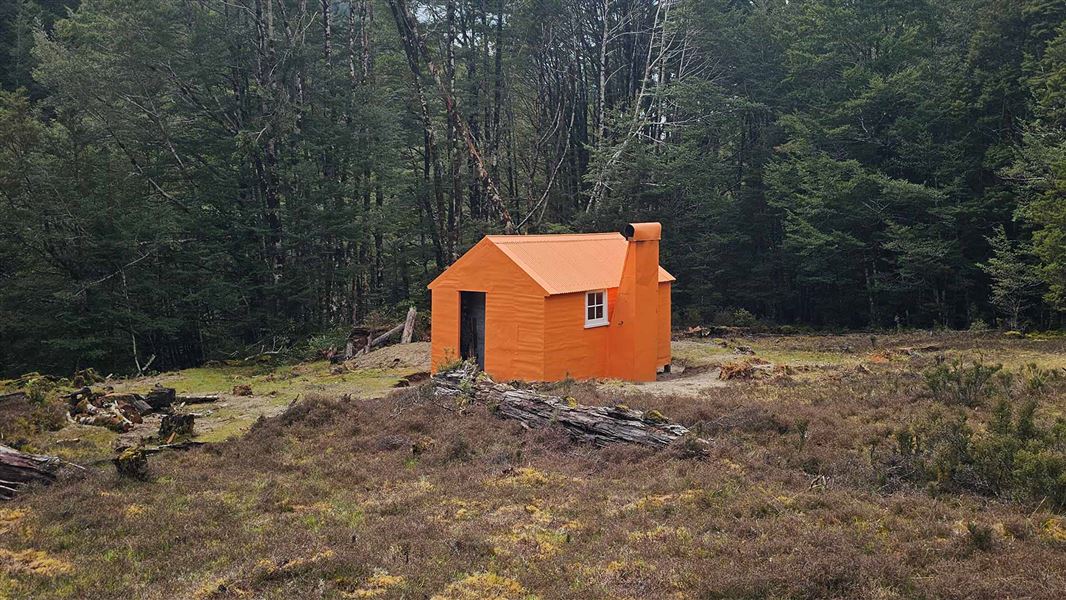
Wheel Creek Hut is a basic six-bunk hut located in the Greymouth area of the West Coast region.
Heating • Mattresses • Toilets - non-flush
Reefton Motor Camp
West Coast • 11.8 km
Top Waitahu Bivvy
Basic/bivvies • 2 bunks • West Coast • 13.9 km
Top Waitahu Bivvy is a basic two-bunk hut located in the Greymouth area of the West Coast.
Mattresses • Toilets - non-flush • Water from stream
Walks nearby
Larrys Creek Track
Easy • 1 hr 30 min • 4.8 km • 8.94 km away
Murray Creek Track
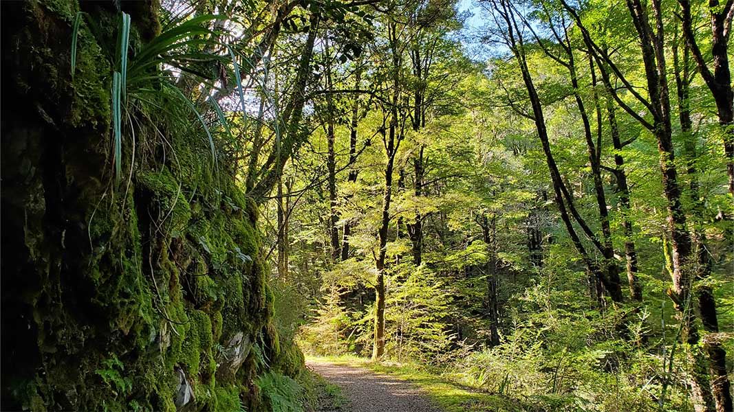
Walking track • 5 hr • 9.7 km • 9.4 km away
Lankey Creek Tram Track
Easy • 2 hr to join with Murray Creek Track • 4 km • 9.76 km away
Golden Fleece Walk
Easiest • 15 m • 550 m • 10.82 km away
Tamatahia Te Whenua Track
Easy • 30 min • 600 m • 11.66 km away
Contact
Paparoa National Park Visitor Centre
4294 Coast Road, Punakaiki, RD 1 Runanga 7873
Regional DOC service centre.
Notes from people who have been
No notes yet. If you have been, say what you found.
Something missing or out of date?
Closed, moved, wrong facts, or something we have missed? Travellers keep the Road Guide up to date. Tell us what you found at contribute@parkup.nz and we will check it and add it.
Ask us to take this down
A person reads every request. We do not remove a place until we have checked it.
Sources
- DOC Huts · CC BY 4.0Data sourced from the Department of Conservation (DOC), New Zealand.
- DOC Huts (API) · CC BY 4.0Crown Copyright: Department of Conservation Te Papa Atawhai. Data sourced from the DOC Developer Portal (api.doc.govt.nz).
- OpenStreetMap Huts · ODbL (Open Database License)Contains information from OpenStreetMap, made available under the ODbL.