Karioi Track
WalkWaikatoOpen
- Grade
- Advanced
- Walking time
- 6 hr 30 min
- Dogs
- No dogs
Getting there
We have not checked a road end or car park for this place yet, so we do not give driving directions to it. Check how to get there before you go. Some routes cross private land and need the landowner's permission.
How to get there, on doc.govt.nzStarting in Raglan:
The last 4 km of Whaanga Road are unsealed.
Source: DOC Te Papa Atawhai.
Map
Map data © OpenStreetMap contributors. Topo map: LINZ, CC BY 4.0. 37.85479° S, 174.78993° E
About this place
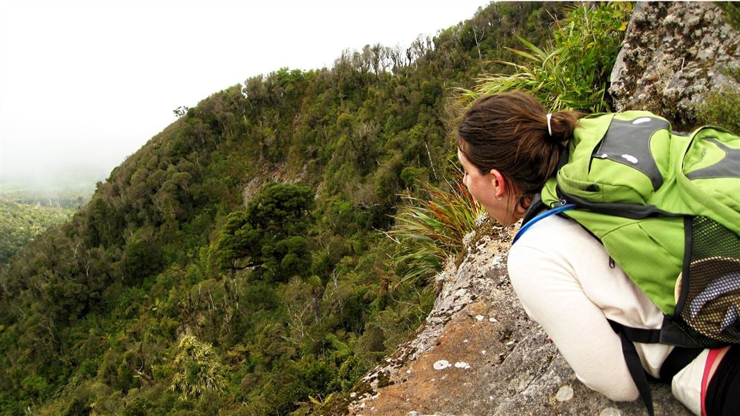
Karioi is an ancient volcano and the views from the summit are spectacular. This is the steeper but more scenic of the two summit tracks to Mt Karioi.
The route
On a fine day you can see as far south as Mt Taranaki, the Herangi Range and Pureora. There is also a good view of all the local harbours as well as Pirongia, Maungatautari and Te Aroha mountains. There are two tracks up to the summit of Karioi, this track and Wairake Track . Do a return trip on this track or combine the tracks and cross the mountain – you'll need to arrange transport from the other side of the mountain. Karioi Track is the steeper but more scenic of the two summit tracks. Once over the stile at the start of the track, it’s all up hill, but there are plenty of good vantage points to stop, catch your breath and admire the view. After passing through a grove of kānuka, the track climbs up a grassy slope before reaching the main ridge. Chains and ladders have been installed to help negotiate the occasional rocky outcrop. At a large rocky bluff the track sidles around to the north for a short distance then climbs steadily to the ridge. At this point, a short 10-minute side track takes you to a lookout providing good views across Raglan Harbour. Back on the main track it is another hour to the summit (756 m) along an undulating ridge. The vegetation along the ridge has been sculptured by the strong prevailing westerly wind. The forest changes from kohekohe at lower altitudes to tawa forest, to kamahi and tāwheowheo towards the top. Other species of note include miro, toro, horopito and Dracophyllum traversii.
Source: DOC Te Papa Atawhai.
Nearby stops
Solscape Campsite
Waikato • 4 km
Solscape Campsite is a campsite located in the Waikato region. No further details about facilities or amenities are available in the provided records.
Ruapuke Motorcamp
Waikato • 4.4 km
Ruapuke Motorcamp is a campsite located in the Waikato region. No further details are available regarding its specific facilities or amenities.
Te Kopua Whanau Camp
Waikato • 7.4 km
Raglan Kopua Holiday Park
Waikato • 8.6 km
Raglan Kopua Holiday Park is a campsite located in the Waikato region. The provided data does not include details on specific facilities or amenities for this…
Kev’s Place
Waikato • 9 km
Kev's Place is a campsite located in the Waikato region. The available records provide no further details about its facilities or amenities.
Walks nearby
Notes from people who have been
No notes yet. If you have been, say what you found.
Something missing or out of date?
Closed, moved, wrong facts, or something we have missed? Travellers keep the Road Guide up to date. Tell us what you found at contribute@parkup.nz and we will check it and add it.
Ask us to take this down
A person reads every request. We do not remove a place until we have checked it.
Sources
- DOC Tracks (API) · CC BY 4.0Crown Copyright: Department of Conservation Te Papa Atawhai. Data sourced from the DOC Developer Portal (api.doc.govt.nz).
- DOC Tracks & Trails · CC BY 4.0Data sourced from the Department of Conservation (DOC), New Zealand.