Wairēinga/Bridal Veil Falls
WalkWaikatoOpen
- Grade
- Easiest
- Walking time
- 20 min
- Route
- Return
- Dogs
- No dogs
Getting there
We have not checked a road end or car park for this place yet, so we do not give driving directions to it. Check how to get there before you go. Some routes cross private land and need the landowner's permission.
How to get there, on doc.govt.nzAccess is via Te Mata Road off the Hamilton/Raglan Highway (SH23). Turn left into Kawhia Road, 1 km past Te Mata and travel another 4 km to the car park.
Source: DOC Te Papa Atawhai.
Map
Map data © OpenStreetMap contributors. Topo map: LINZ, CC BY 4.0. 37.90772° S, 174.89901° E
About this place
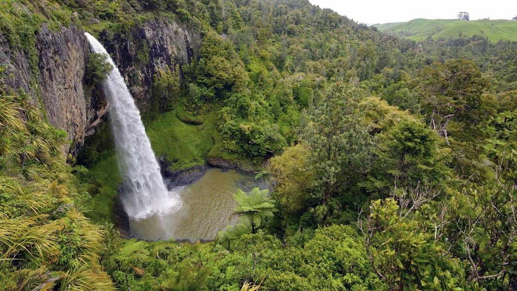
Walk to the top and down to the base of these spectacular 55 m falls.
The route
Time: 10 min one way
Car park to top of falls Top of falls to base of falls It is an attractive easy walk through native forest following the Pakoka River to the top of the Waireinga/Bridal Veil Falls. The two viewing platforms at the top of the falls provide spectacular views of the falls and surrounding countryside. From here, the track descends steeply down stairs to a midway viewpoint. The track continues down more stairs to the bottom view bridge and information shelter where there is a magnificent view directly across the pool and up at the falls.
Source: DOC Te Papa Atawhai.
Nearby stops
Hakea Retreat
Waikato • 6.1 km
Hakea Retreat is a campsite located in the Waikato region. No further details about facilities or amenities are available in the provided records.
Kev’s Place
Waikato • 9.1 km
Kev's Place is a campsite located in the Waikato region. The available records provide no further details about its facilities or amenities.
Ruapuke Motorcamp
Waikato • 11.2 km
Ruapuke Motorcamp is a campsite located in the Waikato region. No further details are available regarding its specific facilities or amenities.
Solscape Campsite
Waikato • 11.3 km
Solscape Campsite is a campsite located in the Waikato region. No further details about facilities or amenities are available in the provided records.
Te Kopua Whanau Camp
Waikato • 12 km
Walks nearby
Notes from people who have been
No notes yet. If you have been, say what you found.
Something missing or out of date?
Closed, moved, wrong facts, or something we have missed? Travellers keep the Road Guide up to date. Tell us what you found at contribute@parkup.nz and we will check it and add it.
Ask us to take this down
A person reads every request. We do not remove a place until we have checked it.
Sources
- DOC Tracks & Trails · CC BY 4.0Data sourced from the Department of Conservation (DOC), New Zealand.
- DOC Tracks (API) · CC BY 4.0Crown Copyright: Department of Conservation Te Papa Atawhai. Data sourced from the DOC Developer Portal (api.doc.govt.nz).