Dumpling Hut
Great Walk hutFiordland National Park, SouthlandOpen
- Sleeps
- 40 bunks
- Booking
- Can book
- Cost
- Fee applies
- Heating
- Yes
- Drinking water
- Boil first
- Toilet
- Yes
Getting there
We have not checked a road end or car park for this place yet, so we do not give driving directions to it. Check how to get there before you go. Some routes cross private land and need the landowner's permission.
How to get there, on doc.govt.nzThis hut is located on the Milford Track, in the Arthur Valley, Fiordland.
- Topo map
- Topo50 sheet CB08
Source: DOC Te Papa Atawhai.
Map and tracks
Track lines: DOC Te Papa Atawhai. Map data © OpenStreetMap contributors. Topo map: LINZ, CC BY 4.0. 44.76854° S, 167.76512° E
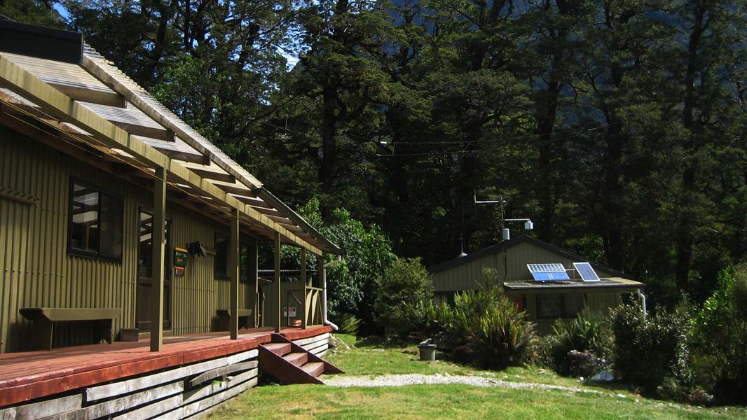
About this place
This is a 40-bunk, Great Walk hut on the Milford Track, Fiordland. Bookings required in the Great Walks season.
On the way here
Milford Track · 4 days
Day 3 – Mintaro Hut to Dumpling Hut
Time: 6–7 hr
km Climb to Omanui/McKinnon Pass and the memorial to explorer Quintin McKinnon, with exceptional views of Lake Mintaro and the Clinton Canyon along the way. The memorial is a great place to take in the awe-inspiring panoramas, before reaching the highest point of the track and Omanui/McKinnon Pass Shelter (1154 m). From here, you’ll drop steadily through an attractive alpine garden to the valley floor, passing several waterfalls along the Roaring Burn River before arriving at Quintin Shelter. On the way to Dumpling Hut take a moment to admire Sutherland Falls in the distance.
Day 4 – Dumpling Hut to Sandfly Point
Time: 5 hr 30 min – 6 hr
km From Dumpling Hut, follow Arthur River to the historic Boatshed. Further along the track, you will reach the dramatic Mackay Falls and intriguing Bell Rock. Admire the man-made rock cuttings alongside the Arthur River and Lake Ada, before spending the last 3 km on a smooth, wide track constructed by a prison labour gang between 1890 and 1892. A short boat ride from Sandfly Point will take you to your journey’s end, with world-famous views of Milford Sound/Piopiotahi along the way.
Source: DOC Te Papa Atawhai.
Trip options
Walking times come from DOC track descriptions, added up leg by leg from car-accessible trailheads. Nights and return times are ParkUp estimates, allowing about 8 hours of walking a day.
2 options · 2 nights
Glade Wharf
Walking in
14 hr 30 min (via Clinton Hut, Mintaro Hut)
Walking out
8 hr to Sandfly Point
Walking in
14 hr 30 min (via Clinton Hut, Mintaro Hut)
Walking out
14 hr 30 min to Glade Wharf (via Clinton Hut, Mintaro Hut)
Source: DOC Te Papa Atawhai track descriptions.
Fees and bookings
Backcountry Hut Passes can only be used in this hut from 1 May to 28 October. Passes cannot be used from 29 October to 30 April.
Book Dumpling Hut online.
Source: DOC Te Papa Atawhai.
Nearby stops

Mintaro Hut
Great Walk • 40 bunks • Southland • 4.5 km
Mintaro Hut is a 40-bunk Great Walk hut located on the Milford Track in Fiordland. Bookings are required during the Great Walks season.
Cooking • Heating • Mattresses

Clinton Hut
Great Walk • 40 bunks • Southland • 19 km
Clinton Hut is a 40-bunk Great Walk hut located on the Milford Track in Fiordland. Bookings are required during the Great Walks season.
Cooking • Heating • Mattresses
Quintin Lodge
Southland • 2.7 km
Quintin Lodge is a hut located in the Southland region of New Zealand. The provided records do not list any further details regarding its facilities or…
Boatshed Hut
Southland • 4.5 km
Boatshed Hut is a backcountry hut located in the Southland region of New Zealand. The provided records do not list specific facilities or additional details…
Pompolona Lodge
Southland • 8.2 km
Contact
Te Rua-o-te-moko/Fiordland National Park Visitor Centre
1 Lakefront Drive, Te Anau 9600
Regional DOC service centre.
Notes from people who have been
No notes yet. If you have been, say what you found.
Something missing or out of date?
Closed, moved, wrong facts, or something we have missed? Travellers keep the Road Guide up to date. Tell us what you found at contribute@parkup.nz and we will check it and add it.
Ask us to take this down
A person reads every request. We do not remove a place until we have checked it.
Sources
- DOC Huts (API) · CC BY 4.0Crown Copyright: Department of Conservation Te Papa Atawhai. Data sourced from the DOC Developer Portal (api.doc.govt.nz).
- OpenStreetMap Huts · ODbL (Open Database License)Contains information from OpenStreetMap, made available under the ODbL.
- DOC Huts · CC BY 4.0Data sourced from the Department of Conservation (DOC), New Zealand.