Cloudy Peak Track
WalkOtagoOpen
- Grade
- Advanced
- Walking time
- 6 hr
- Distance
- 15 km
- Biking time
- Under 4 hours
- Dogs
- No dogs
Getting there
We have not checked a road end or car park for this place yet, so we do not give driving directions to it. Check how to get there before you go. Some routes cross private land and need the landowner's permission.
How to get there, on doc.govt.nzThe car park access to Dry Creek, Cloudy Peak and Neinei i Kura is located on Ardgour Road, Tarras. Ardgour Road is a loop road with access either 2 km north or 6 km South of Tarras.
Source: DOC Te Papa Atawhai.
Map
Map data © OpenStreetMap contributors. Topo map: LINZ, CC BY 4.0. 44.91130° S, 169.47721° E
About this place
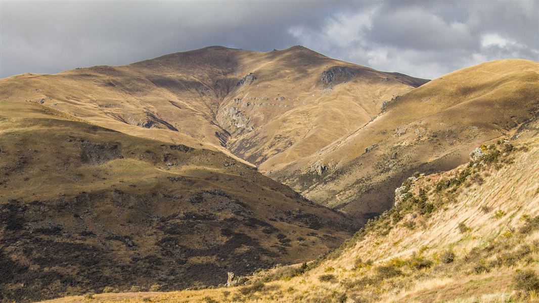
The Cloudy Peak Track from its 1526 m high point, provides fantastic views of the Upper Clutha plains and peaks of the Lindis and St Bathans ranges.
The route
A one hour walk brings you to the start of the Cloudy Peak Track where track markers lead you through the Dry Creek Conservation Area before you commence a steady climb along a 4WD ridge line track to the Neinei i kura Conservation Area. From this point an unmarked 4WD track leads to the 1526 m summit of Cloudy Peak. From Cloudy Peak a visual highlight of this sprawling landscape is wide open skies and views of the Upper Clutha plains and peaks towards St Bathans and the Lindis.
Source: DOC Te Papa Atawhai.
Nearby stops
Old stone hut
Otago • 6.6 km
Old stone hut is a basic shelter located in the Otago region. It is a simple structure suitable for overnight stays in the backcountry.

Lauder Basin Hut
Basic/bivvies • 2 bunks • Otago • 16.2 km
Lauder Basin Hut is a basic two-bunk hut located in the Central Otago region.
Mattresses • Toilets - non-flush • Water from stream
Walks nearby
Something missing or out of date?
Closed, moved, wrong facts, or something we have missed? Travellers keep the Road Guide up to date. Tell us what you found at contribute@parkup.nz and we will check it and add it.
Ask us to take this down
A person reads every request. We do not remove a place until we have checked it.
Sources
- DOC Tracks (API) · CC BY 4.0Crown Copyright: Department of Conservation Te Papa Atawhai. Data sourced from the DOC Developer Portal (api.doc.govt.nz).
- DOC Tracks & Trails · CC BY 4.0Data sourced from the Department of Conservation (DOC), New Zealand.