Avalanche Peak Route
WalkCanterbury
- Grade
- Expert
- Walking time
- 4 hr
- Distance
- 2.5 km, 1,100 m vertical climb
- Dogs
- No dogs
Getting there
We have not checked a road end or car park for this place yet, so we do not give driving directions to it. Check how to get there before you go. Some routes cross private land and need the landowner's permission.
How to get there, on doc.govt.nzMap
Map data © OpenStreetMap contributors. Topo map: LINZ, CC BY 4.0. 42.93652° S, 171.54763° E
About this place
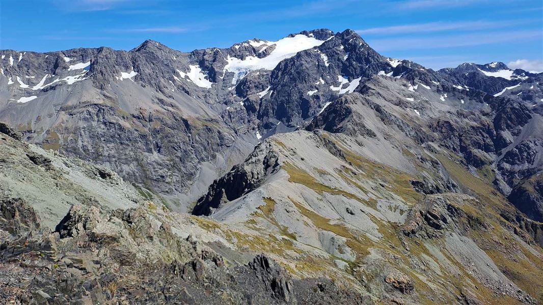
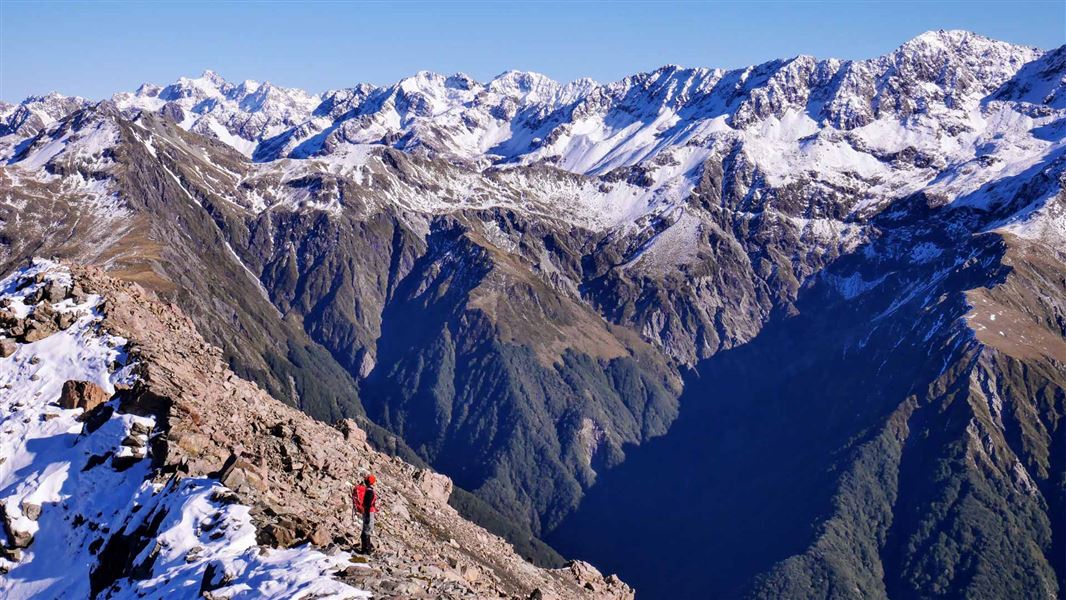
Avalanche Peak is the only peak in Arthur's Pass that is marked by a poled route to the summit. The climb is 1,100 m vertical from the village and over just 2.5 km horizontal. On a fine day, you will be rewarded with grand views of the surrounding peaks.
The route
People have died on the Avalanche Peak Route
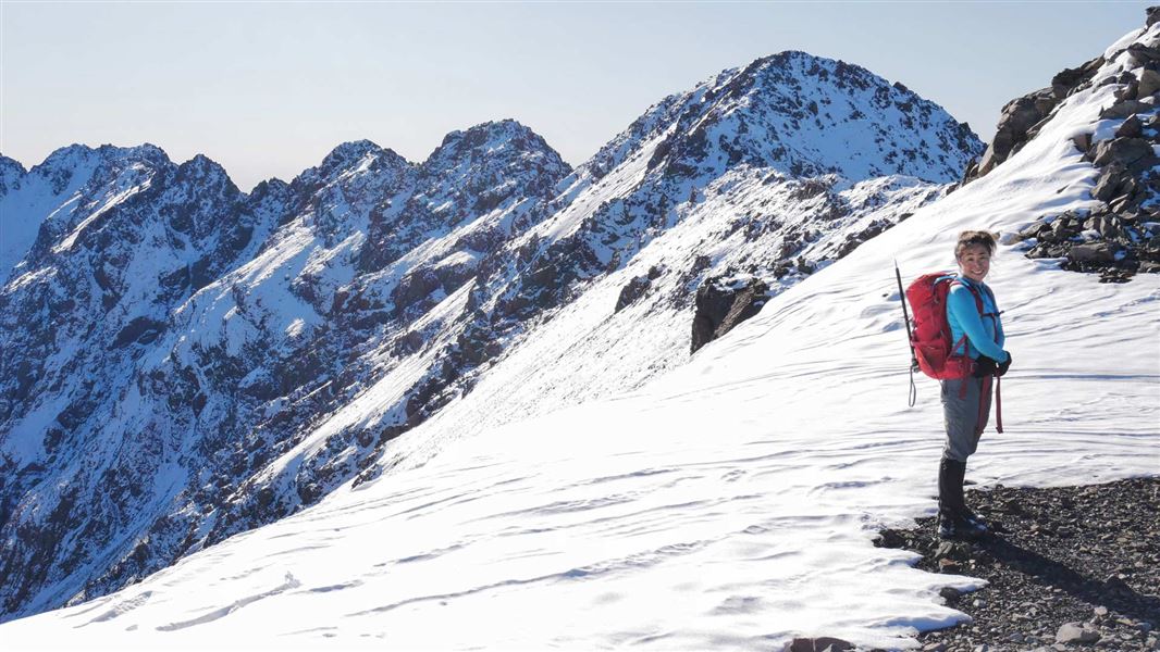
Many people have enjoyed this mountain-top trip with panoramic views of the Southern Alps/Kā Tiritiri o te Moana. However, some people have died on this extremely steep and rocky journey to the top of an 1833 m peak. Plan and prepare well so that you enjoy your trip and return safely. The tramping track/route is steep and exposed to the weather, with sheer drops in some places. It should not be attempted in poor visibility or high winds. The route to the peak is prone to avalanches in winter and spring. During heavy snow conditions do not travel this route unless sufficiently equipped and experienced enough to assess the conditions and choose a safe path through avalanche terrain.
Ascending Avalanche Peak
There are two routes up Avalanche Peak. Both start from SH73 at Arthur’s Pass village, around 700 m apart. You have the option of tramping both routes for a round trip or going up and down the same route. Both Avalanche Peak and Scotts tracks are classified as tramping tracks as far as the bushline. Beyond the bushline they become routes, marked with cairns and colour-coded snow poles:
Option 1: For a round trip
If doing the round trip, we recommend you start with the Avalanche Peak Track, which begins just behind the visitor centre.
Avalanche Peak Track
Time: 1 hour 30 minutes
From behind the visitor centre to the bushline (1200 m), follow the orange markers From Arthur's Pass Visitor Centre follow the bush edge northwards to pick up the start of the track, signposted before the Glasgow Bridge over Avalanche Creek (elevation 737 m). The track, rocky and steep in parts, climbs through mountain beech/tawhairauriki on the south side of Avalanche Creek. The creek drops over steep bluffs, creating spectacular waterfalls which you can see from the highway and occasionally from the track. The track moves away from the creek and emerges at the bushline to give good views down the Bealey valley to Cora Lynn Station, Black Range and Mount Bealey.
Avalanche Peak Route
Time: 1 hour 30 minutes – 2 hours
From the bushline to Avalanche Peak summit (1833m), follow the yellow poles. Note: If visibility is poor or if you have found the track difficult so far, you should enjoy the views and turn back here, as the going becomes more exposed. Follow the ridge that runs between Rough Creek and Avalanche Creek catchments. From the bushline a worn trail leads through tussock and subalpine vegetation. Beware of steep drop-offs as you travel along this narrow ridge. Yellow markers on stakes mark the route all the way to the summit. As you climb, the tussock-covered ridge that leads down to Scotts Track can be seen on your right and should be noted for finding the descent route. Do not leave the marked route or attempt to cross over to the other route as a hidden canyon blocks the way. Mt Rolleston (Kaimatau), with Crow Glacier on its southern side, rises majestically from behind this ridge. The final part of this ridge is mainly rock. It narrows considerably and gains height in large steps. The prominent ridge suddenly flattens out (1680 m), 20-30 minutes short of the summit. To reach the summit, follow the markers down into a basin, then climb up the scree directly to the left of the bluffs in front of you. The route winds through bluffs, climbing steeply at times. For the last 10 minutes along to the summit, the yellow and orange-coloured markers join together. This is to show that you return the same way along this section to meet Scotts Route. If it is windy or there is ice/snow on this section of ridge we recommend not going further and descending the way you came, as there are sheer bluffs either side of this razor-blade ridge.
Scotts Route
Time: 1 hour 30 minutes
From Avalanche Peak Summit to the bushline, follow the orange poles From the summit of Avalanche Peak, follow the orange and yellow poles back the way you came for a short distance. Scotts Route (orange poles) then leads off to the north-east, heading towards Mount Cassidy on the eastern side of the Bealey valley. It is important that you travel along the correct ridge. Do not go towards Mount Rolleston. You should be heading in the direction of Mount Cassidy, the mountain to the north (left) of Devils Punchbowl Falls. (This is on the other side of the Bealey valley and highway from Avalanche Peak.) Orange poles mark the ridge into the tussock where a foot-worn (and water-eroded) track should be picked up and followed. Take care, as there are steep drops into McGrath Creek. The ridge leads into a tongue of bush, and then into the bush proper (1300 m).
Scotts Track
Time: 1 hour – 1 hour 30 minutes
From the bushline to SH73, follow the orange markers. The track on the ridge between McGrath and Wardens creeks takes you almost parallel to the road for a while, before turning southwards crossing a few streams and bog patches. This track is considerably less steep than Avalanche Peak Track. The track meets the road about 700 m west from the Arthur’s Pass Visitor Centre, the track then continues across the road and ends at the Punchbowl car park. The main highway is unsafe to walk on and should not be used.
Option 2: For an up and down return trip
For those intending to go up and down the same way, we recommend Scotts Track/Route. It is not as steep as the Avalanche Peak Track/Route. Scotts Track is signposted on the main road, about 700 m west of the Arthur’s Pass Visitor Centre.
Scotts Track
Time: 1 hour 30 minutes
From the road to the bushline (1300 m) The track start is 30 m from the Punchbowl carpark. There is a large orange marker on a tree beside the creek to mark the start of the track. After crossing the highway, follow the track which zigzags through forest to the bushline. There are great views, looking north to Arthur’s Pass and Kelly Range, east to Mounts Cassidy and O’Malley, and south to Black Range. It is relatively sheltered here and is an ideal place for lunch.
Scotts Route
Time: 1 hour 30 minutes – 2 hours
From the bushline to Avalanche Peak summit From the bushline, orange poles mark the route towards the summit. Go as far as your time and the conditions allow. Take note of the route up, to enable you to return the same way. Make sure you pick up Scotts Track through the bush, as off the track it is steep and dangerous.
Cape Brett Track virtual guide
Watch a NZ Mountain Safety Council video.
Source: DOC Te Papa Atawhai.
Know before you go
If you're lost
If you are unable to find the route back to the main road, we suggest: Don’t panic – use your common sense. There is cellphone reception in most places on the tracks/routes. Phone 111. Do not attempt to enter the bush to go down unless you have found either Avalanche Peak or Scotts tracks. The bush-covered country is very steep with impassable bluffs and cliffs. Do not travel in the dark. Stay put until daybreak. Keep to the track – if you get lost then find shelter, stay calm and try to assist searchers. If you have followed the Land Safety Code and told someone where you are going, Search and Rescue procedures will be started once you are noted as overdue. Your safety is your responsibility.
Weather forecast
Avalance Peak Route weather forecast – NIWA website
There may be avalanche danger
Avalanches usually occur from May to November in Arthur’s Pass National Park. There can also be avalanches outside this period, if there is still snow coverage. Check the avalanche terrain in this area. If you are going into avalanche terrain, always: Have the relevant avalanche skills and training. Check the ATES rating and New Zealand Avalanche Advisory before you go. Go with a buddy. Both of you should carry and know how to use an avalanche transceiver, a snow shovel and a probe.
Source: DOC Te Papa Atawhai.
Nearby stops
New Zealand Alpine Club Lodge
Canterbury • 1.2 km
The New Zealand Alpine Club Lodge is a hut located in the Canterbury region. It is a facility managed by the New Zealand Alpine Club.

Avalanche Creek Shelter Campsite
Standard • Canterbury • 1.3 km
Avalanche Creek Shelter Campsite is a standard campsite located just off the main road in the Arthur’s Pass village. It sits almost directly opposite the…
Non-powered/tent sites • Shelter for cooking • Toilets - flush
Christchurch Tramping Club Lodge
Canterbury • 1.7 km
The Christchurch Tramping Club Lodge is a hut located in the Canterbury region. It is also known as Kennedy Lodge.
The West Coast Alpine Club
Canterbury • 1.7 km
The West Coast Alpine Club is a hut located in the Canterbury region. No specific facilities or details are provided in the available records.
Jacks Hut
Canterbury • 2.1 km
Walks nearby
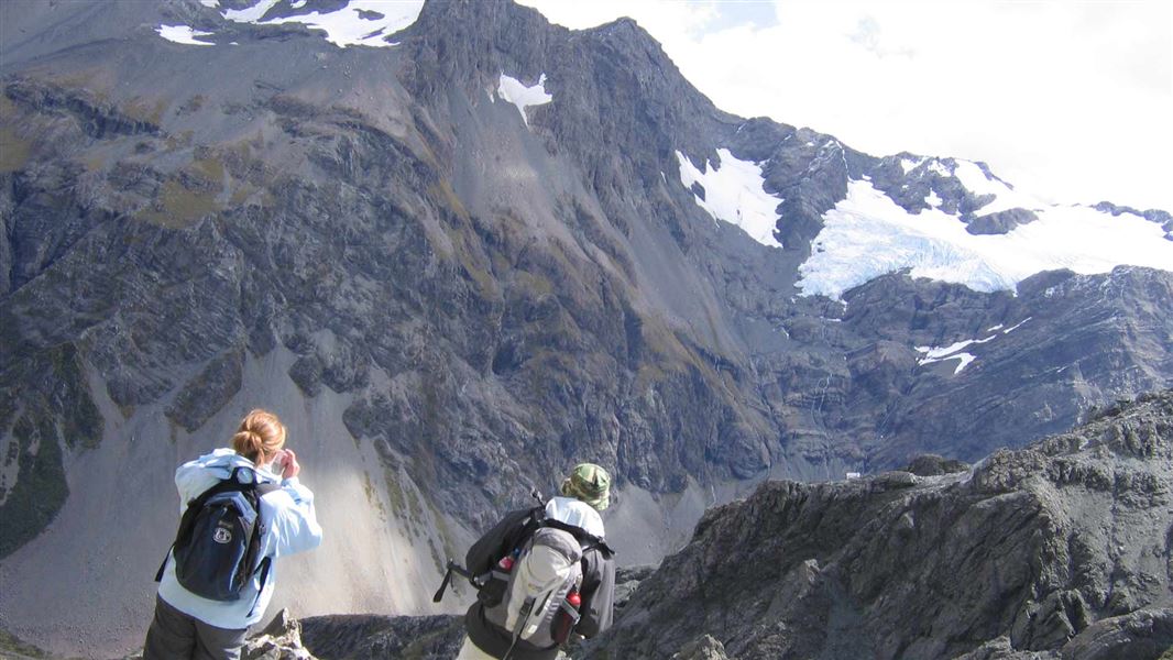
Avalanche Peak - Crow River Route
Expert • 2 days • 1.07 km away
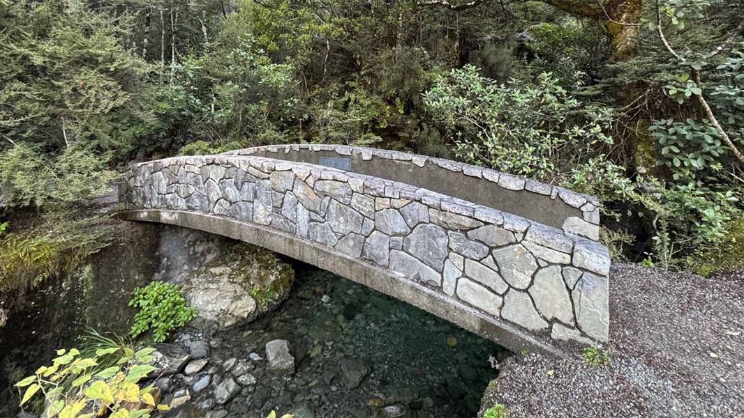
Millennium Walk
Easiest • 10 min • 350 m • 1.18 km away
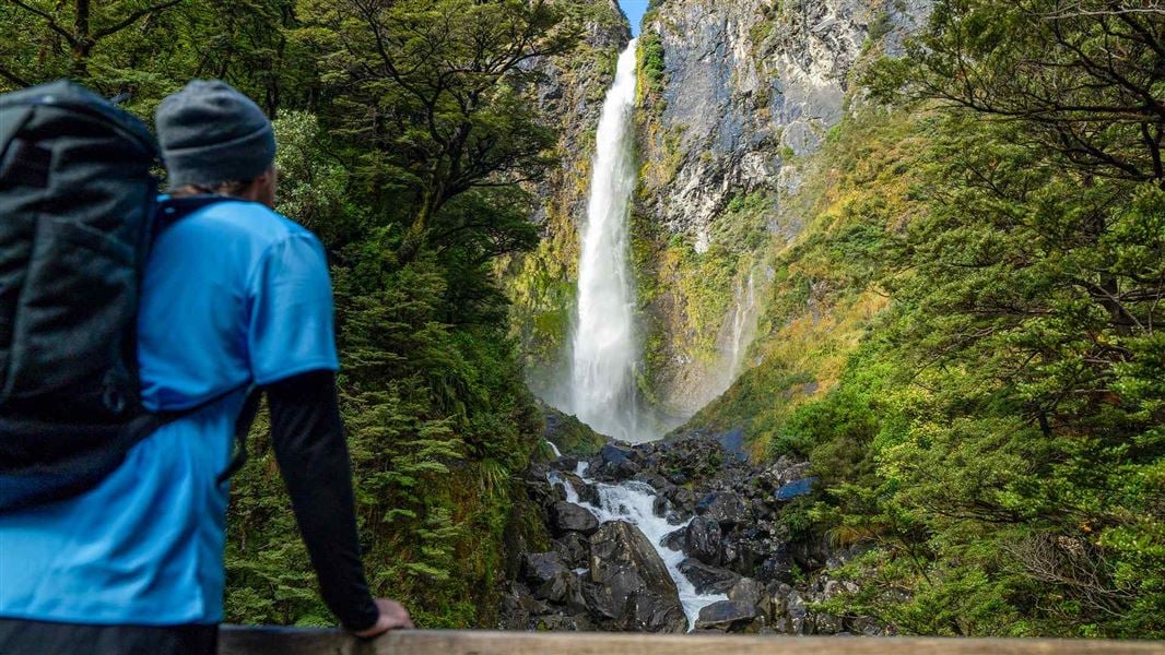
Devils Punchbowl Walking Track
Easy • 1 hr return • 2 km • 1.33 km away
Cons Track
Advanced • 2-4 hr return to the bushline • 2 km (475 m vertical climb) to the bushline • 1.63 km away
Mount Aicken Track
Advanced • 2-4 hr return to the bushline • 2.8 km (540 vertical climb) to the bushline • 1.84 km away
Notes from people who have been
No notes yet. If you have been, say what you found.
Something missing or out of date?
Closed, moved, wrong facts, or something we have missed? Travellers keep the Road Guide up to date. Tell us what you found at contribute@parkup.nz and we will check it and add it.
Ask us to take this down
A person reads every request. We do not remove a place until we have checked it.
Sources
- DOC Tracks (API) · CC BY 4.0Crown Copyright: Department of Conservation Te Papa Atawhai. Data sourced from the DOC Developer Portal (api.doc.govt.nz).