Akeake Historic Reserve Track
WalkNorthlandOpen
- Grade
- Easy
- Walking time
- 30 min
- Distance
- 1.4 km
- Route
- Return
- Dogs
- No dogs
Getting there
We have not checked a road end or car park for this place yet, so we do not give driving directions to it. Check how to get there before you go. Some routes cross private land and need the landowner's permission.
How to get there, on doc.govt.nzAkeake Historic Reserve is 13 km north east of Kerikeri. Leave Kerikeri on Landing Bay Road. Turn left onto Karipo Rd, right onto Redcliffs Rd, right into Rangitane Rd, then left into Opito Bay Rd.
Follow the road east to Opito Bay. The main entrance to the reserve is opposite the boat ramp at the eastern end of Opito Bay beach.
Look for the Akeake Historic Reserve sign on the Ake Ake Rd corner. It marks the entrance to the track, which leads between houses and enters the Akeake Historic Reserve.
Source: DOC Te Papa Atawhai.
Map
Map data © OpenStreetMap contributors. Topo map: LINZ, CC BY 4.0. 35.19224° S, 174.04527° E
About this place
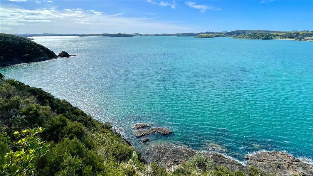
The track starts from Opito Bay and splits into a series of short, easy walks - visit a small beach in the Te Puna Inlet and a pa site on Tareha Point.
The route
The main Akeake Historic Reserve track begins at the boat-ramp end of Opito Bay beach. Look for the track sign at the start of a right-of-way located between two houses. A series of steps climb to a four-way junction. You have three choices of track at this point.
Lizzie (Lizard Bay)
Time: 15 min
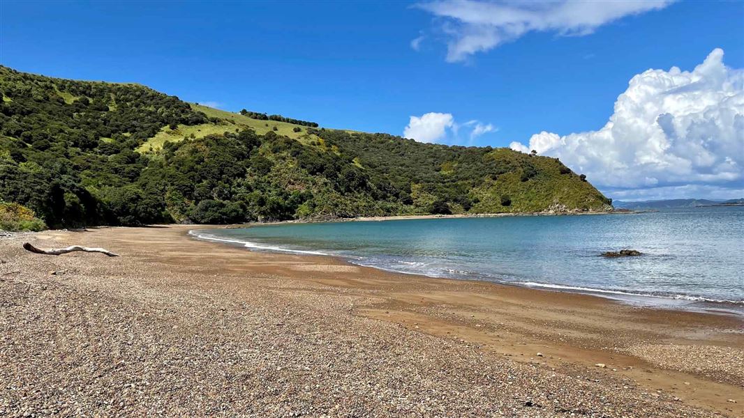
Go straight ahead to the pebble beach known locally as Lizzie (Lizard) Bay. This bay is sheltered from most winds and is a popular swimming and fishing spot.
Tareha pa
Time: 30 min
Turn right along the well-marked track over a pre-European defensive ditch to the viewing platform on Tareha pa. A great spot to watch the sun rise over the Te Puna and Kerikeri inlets, Moturoa and Cocked Hat Islands and east toward Rakaumangamanga and the Cape Brett peninsula. Before the ditch, there is another sign, which directs you to a track to your right. This short walk has great views but steep drop-offs, so care should be taken. The track then joins the top end of Opito Bay Road and drops back down to the boat ramp.
Views of Tareha Point and the Akeake Historic Reserve
Time: 30 min one way
Turn left at the junction and the track takes you westward to a seat with a view of Tareha Point and the Akeake Historic Reserve. Continue for another 5 minutes, the track exits on to a private (shared) driveway, follow this to Opito Bay Road. Turn left downhill to the beach and then back to the beginning of the Akeake Historic Reserve track by the boat ramp.
Source: DOC Te Papa Atawhai.
Nearby stops
Waitangi Holiday Park
Northland • 9.7 km
Waterfalls Estate - Motel & Campground
Northland • 9.7 km
Waterfalls Estate is a campsite located in the Northland region of New Zealand. The site operates alongside a motel, providing accommodation options for…
Gibby's Place
Northland • 10.2 km
Russell Top10 Holiday Park
Northland • 10.4 km
Russell Top10 Holiday Park is a campsite located in Northland. No further details are available in the provided records.
Bay of Islands Holiday Park
Northland • 11.1 km
Bay of Islands Holiday Park is a campsite located in the Northland region. The provided records do not list specific facilities or amenities for this site.
Walks nearby
Notes from people who have been
No notes yet. If you have been, say what you found.
Something missing or out of date?
Closed, moved, wrong facts, or something we have missed? Travellers keep the Road Guide up to date. Tell us what you found at contribute@parkup.nz and we will check it and add it.
Ask us to take this down
A person reads every request. We do not remove a place until we have checked it.
Sources
- DOC Tracks & Trails · CC BY 4.0Data sourced from the Department of Conservation (DOC), New Zealand.
- DOC Tracks (API) · CC BY 4.0Crown Copyright: Department of Conservation Te Papa Atawhai. Data sourced from the DOC Developer Portal (api.doc.govt.nz).