Waikamaka Hut
Standard hutRuahine Forest Park, Manawatū-WhanganuiOpen
- Sleeps
- 8 bunks
- Booking
- Not bookable
- Heating
- Yes
- Drinking water
- Boil first
- Toilet
- Non-flush
Getting there
We have not checked a road end or car park for this place yet, so we do not give driving directions to it. Check how to get there before you go. Some routes cross private land and need the landowner's permission.
How to get there, on doc.govt.nzNorth Block Road to Waipawa Forks hut via Sunrise Track: 1.5 – 2 hours, 4.5 kmNorth Block Road to Waipawa Forks hut via Waipawa River: 1.5 – 2 hours, 4.5 kmWaipawa Forks Hut to Waikamaka hut: 3.5 – 4 hours, 5 km
Getting to this hut contains river route. Note that it’s dangerous to cross or follow the river when the water level is high which can occur during or after heavy rain. How to cross rivers safely.
Waikamaka Hut is accessed from North Block Road. From State Highway 50, turn towards the Ranges onto Wakarara Road. After 20 km, turn left into North Block Road and continue to the road end. The last 4 km of this road is through private farmland – do not disturb stock and leave gates as you found them.
Follow Sunrise Track for approximately 1 hour, then take a left turn down towards the Waipawa River and Waipawa Forks hut. Follow the track for 45 minutes until you reach the river, then turn upriver towards Waikamaka Hut.
Proceed upriver from the carpark following an unmarked river route for 1.5 – 2 hours. Note that this river route is not a DOC managed track or route. Do not expect DOC markers or track formation.
Follow the river upstream until you reach the headwaters. From here the track climbs steeply to Waipawa Saddle, before dropping into a stream on the other side – use extreme caution here as sections of the track are steep, narrow and exposed.
Follow this stream down the valley for another 1 hour until you reach Waikamaka Hut on the true left bank, where the east and south branches of the Waikamaka River meet.
This is a backcountry hut with no DOC track access. You will need to plan your route and navigate yourself, using aids like a map, compass and GPS. Learn navigation skills.
- Topo map
- Topo50 sheet BK36
- Grid reference
- E1868296, N5588430
Source: DOC Te Papa Atawhai.
Map
Map data © OpenStreetMap contributors. Topo map: LINZ, CC BY 4.0. 39.81157° S, 176.13377° E
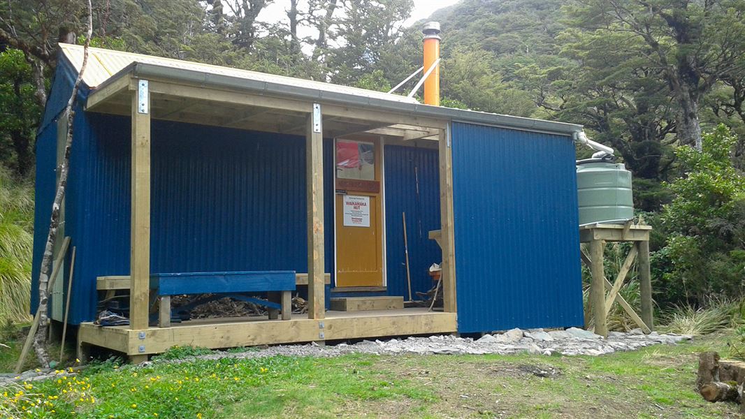
About this place
This is a standard eight-bunk hut in the Manawatu region.
Know before you go
Stay safe when crossing rivers and streams
If you plan to cross unbridged rivers or side streams, know how to cross safely and be prepared for if you cannot cross. Do not cross if the river or stream is flooded, you cannot find safe entry and exit points or are unsure it’s safe. Turn back or wait for the river to drop. If in doubt, stay out. How to cross rivers safely NIWA river flow forecasts: View a video of national followed by regional river flows
Source: DOC Te Papa Atawhai.
Nearby stops
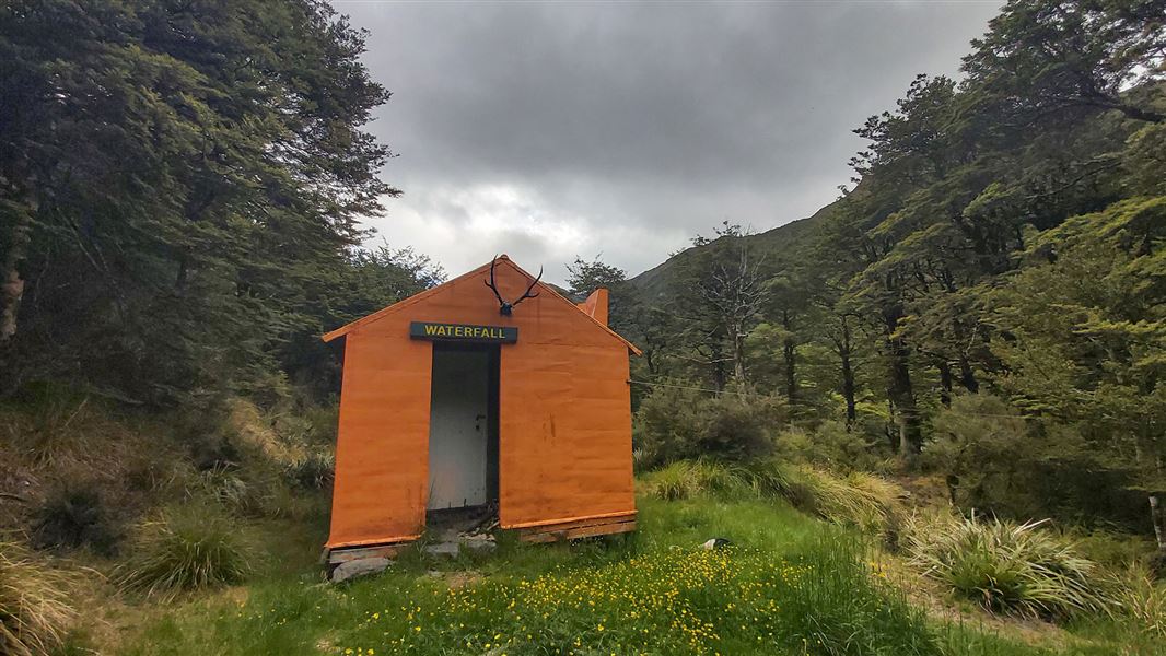
Waterfall Hut
Standard • 6 bunks • Manawatū-Whanganui • 2.6 km
Waterfall Hut is a standard six-bunk hut located in the Manawatu region.
Heating • Mattresses • Toilets - non-flush

Waipawa Forks Hut
Standard • 12 bunks • Hawke's Bay • 3.8 km
Waipawa Forks Hut is a standard 12-bunk hut located in the Hawke's Bay region.
Heating • Mattresses • Toilets - non-flush

Sunrise Hut
Serviced • 20 bunks • Hawke's Bay • 3.9 km
Sunrise Hut is a serviced twenty-bunk hut located in the Hawke's Bay region.
Heating • Mattresses • Toilets - non-flush

Top Maropea Hut
Basic/bivvies • 4 bunks • Manawatū-Whanganui • 4.6 km
Top Maropea Hut is a basic four-bunk hut located in the Manawatu region.
Heating • Mattresses • Toilets - non-flush

McKinnon Hut
Standard • 6 bunks • Manawatū-Whanganui • 4.7 km
McKinnon Hut is a standard six-bunk hut located in the Manawatu region.
Heating • Mattresses • Toilets - non-flush
Walks nearby
Contact
DOC Customer Service Centre
Regional DOC service centre.
Notes from people who have been
No notes yet. If you have been, say what you found.
Something missing or out of date?
Closed, moved, wrong facts, or something we have missed? Travellers keep the Road Guide up to date. Tell us what you found at contribute@parkup.nz and we will check it and add it.
Ask us to take this down
A person reads every request. We do not remove a place until we have checked it.
Sources
- OpenStreetMap Huts · ODbL (Open Database License)Contains information from OpenStreetMap, made available under the ODbL.
- DOC Huts (API) · CC BY 4.0Crown Copyright: Department of Conservation Te Papa Atawhai. Data sourced from the DOC Developer Portal (api.doc.govt.nz).
- DOC Huts · CC BY 4.0Data sourced from the Department of Conservation (DOC), New Zealand.