Tenahaun Conservation Area tramping tracks
WalkCanterbury
- Grade
- Advanced
- Dogs
- No dogs
Access: read before you go
Mt Tripp and Moorhouse Range: Turn off Main South Road (Highway 72) at Ealing and follow Ealing Montalto Road for 19.5 km. At the ‘T’ junction, turn left onto Hinds Gorge Road and then right onto Chapmans Road. The public access easement starts at the end of this road.
Rangitata Gorge: Turn off Arundel Rakaia Road (Highway 72) at Ealing, which is on the bank of the Rangitata River. Follow Ealing Montalto Road for 14 km and turn left on Klondyke Terrace. This road continues to the Rangitata Diversion Race intake at the Rangitata River. A public access easement starts from this point.
Mt Tripp and Moorhouse Range: Follow Arundel Rakaia Road (Highway 72) to Mayfield and then turn right onto Mayfield Klondyke Road. At Montalto turn right onto Hinds Gorge Road and follow this for 9 km. Turn right onto Chapmans Road. The public access easement starts at the end of this road.
Rangitata Gorge: Follow Arundel Rakaia Road (Highway 72) to Mayfield and then turn right onto Mayfield Klondyke Road. At Montalto turn left onto Mayfield Klondyke Road; at the crossroads go straight ahead onto Klondyke Terrace. This road continues to the Rangitata Diversion Race intake at the Rangitata River. A public access easement starts from this point.
Source: DOC Te Papa Atawhai.
Getting there
We have not checked a road end or car park for this place yet, so we do not give driving directions to it. Check how to get there before you go. Some routes cross private land and need the landowner's permission.
How to get there, on doc.govt.nzMt Tripp and Moorhouse Range: Turn off Main South Road (Highway 72) at Ealing and follow Ealing Montalto Road for 19.5 km. At the ‘T’ junction, turn left onto Hinds Gorge Road and then right onto Chapmans Road. The public access easement starts at the end of this road.
Rangitata Gorge: Turn off Arundel Rakaia Road (Highway 72) at Ealing, which is on the bank of the Rangitata River. Follow Ealing Montalto Road for 14 km and turn left on Klondyke Terrace. This road continues to the Rangitata Diversion Race intake at the Rangitata River. A public access easement starts from this point.
Mt Tripp and Moorhouse Range: Follow Arundel Rakaia Road (Highway 72) to Mayfield and then turn right onto Mayfield Klondyke Road. At Montalto turn right onto Hinds Gorge Road and follow this for 9 km. Turn right onto Chapmans Road. The public access easement starts at the end of this road.
Rangitata Gorge: Follow Arundel Rakaia Road (Highway 72) to Mayfield and then turn right onto Mayfield Klondyke Road. At Montalto turn left onto Mayfield Klondyke Road; at the crossroads go straight ahead onto Klondyke Terrace. This road continues to the Rangitata Diversion Race intake at the Rangitata River. A public access easement starts from this point.
Source: DOC Te Papa Atawhai.
Map
Map data © OpenStreetMap contributors. Topo map: LINZ, CC BY 4.0. 43.72487° S, 171.18005° E
About this place
The Tenahaun Conservation Area includes walks in the Moorhouse Range and Rangitata Gorge. The Moorhouse Range can be mountain biked along the easement only.
The route
Mt Tripp and Moorhouse Range
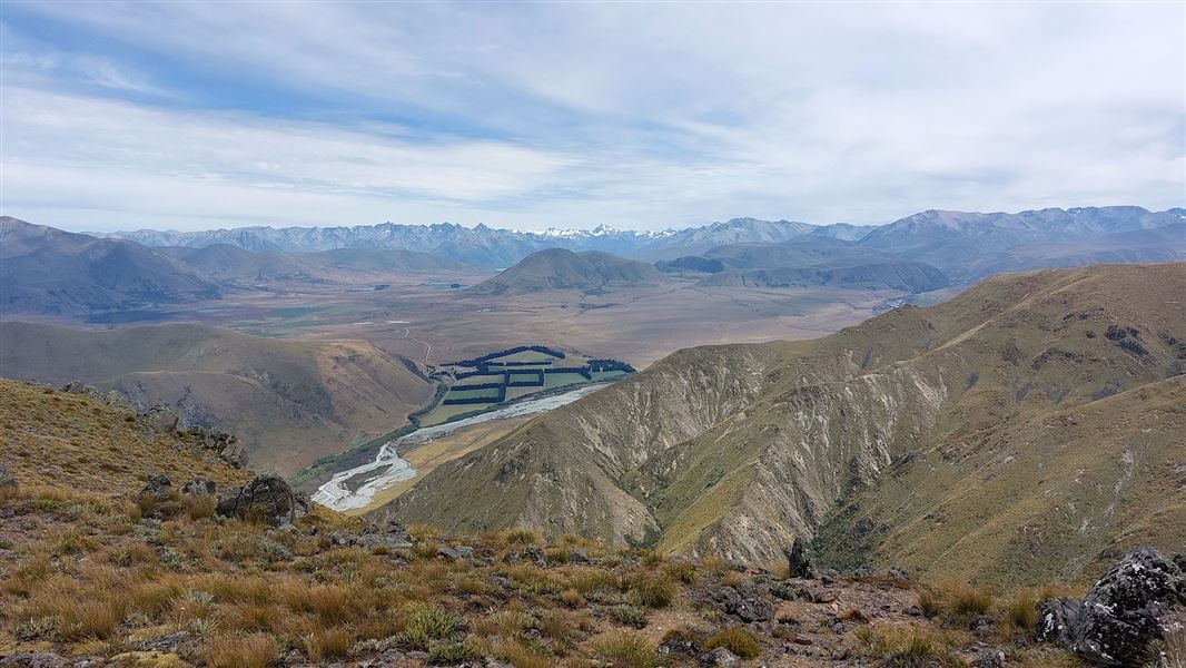
Follow the marked public access easement from the end of Chapmans Road to the Hinds River south branch. Public conservation land starts here and gives access to Moorhouse Range and Mt Tripp. Moorhouse Range can be reached by walking to the end of the public access easement and then following the ridge line, which leads to point 1095. Routes are not marked and this area is suitable for fit and experienced trampers.
Rangitata Gorge
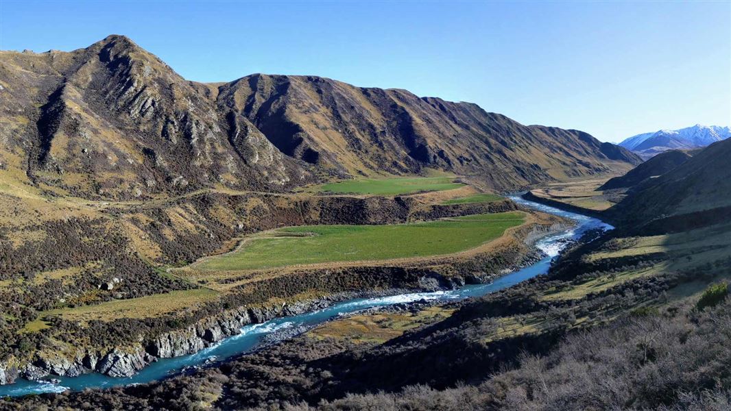
At the start of the Rangitata Diversion Race (RDR) follow the marked public access easement up the face of the terrace. Once this section has been climbed the route is relatively easy-going and gives good views down into the Rangitata Gorge. The RDR ends at Highbank Power Station.
Mountain biking
Mountain biking is possible on the Mt Tripp and Moorhouse Range route (along the easement only). Once public conservation land is reached there are no suitable tracks.
Source: DOC Te Papa Atawhai.
Nearby stops
Top Mount Peel Huts
Canterbury • 10.7 km
Top Mount Peel Huts is a hut located in the Canterbury region of New Zealand. The provided records do not include further details about its facilities or…
Lake Emma Hut
Canterbury • 11 km
Lake Emma Hut is a basic accommodation facility located in the Canterbury region of New Zealand. It serves as a shelter for hikers and outdoor enthusiasts…
Bottom Mount Peel Hut
Canterbury • 14.6 km
Bottom Mount Peel Hut is a backcountry hut located in the Canterbury region of New Zealand. The available records provide no further details regarding its…
Taffy Hut
Canterbury • 15.1 km
Taffy Hut is a backcountry hut located in the Canterbury region. It provides basic shelter for tramping and hiking parties in the area.
Freedom Camping for Self Contained Vehicles
Canterbury • 15.9 km
Freedom Camping for Self Contained Vehicles is a campsite in the Canterbury region. It provides a location for self-contained vehicles to camp.
Walks nearby
Notes from people who have been
No notes yet. If you have been, say what you found.
Something missing or out of date?
Closed, moved, wrong facts, or something we have missed? Travellers keep the Road Guide up to date. Tell us what you found at contribute@parkup.nz and we will check it and add it.
Ask us to take this down
A person reads every request. We do not remove a place until we have checked it.
Sources
- DOC Tracks (API) · CC BY 4.0Crown Copyright: Department of Conservation Te Papa Atawhai. Data sourced from the DOC Developer Portal (api.doc.govt.nz).