Te Maire Loop Track
WalkManawatū-WhanganuiOpen
- Grade
- Easy
- Walking time
- 2 hr
- Route
- Loop
- Dogs
- No dogs
Getting there
We have not checked a road end or car park for this place yet, so we do not give driving directions to it. Check how to get there before you go. Some routes cross private land and need the landowner's permission.
How to get there, on doc.govt.nzFrom Taumarunui, take State Highway 43 from the north side of the Ongarue River Bridge. The Te Maire Bridge over the Whanganui River is 12 km south of Taumarunui Hospital. Across the bridge follow Paparoa Road to Te Maire Valley Road, signposted "Whanganui National Park, Te Maire". The entrance to the track is located around 700 m along this road.
Source: DOC Te Papa Atawhai.
Map
Map data © OpenStreetMap contributors. Topo map: LINZ, CC BY 4.0. 38.95155° S, 175.19296° E
About this place
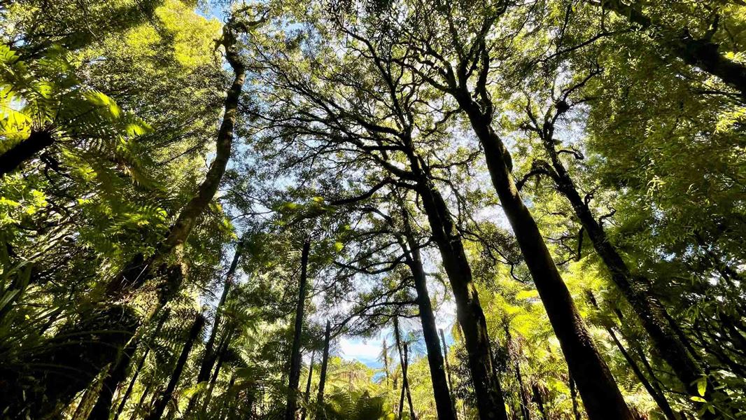
Walk through a fine example of the podocarp forest that once covered much of the central North Island. It's a suitable track for kids.
The route
The loop track takes around 2 hours and covers only a small part of the 420 ha reserve. This walk is suitable for people of all ages and has a stream crossing near the start of the track. Te Maire Stream flows through the reserve and is usually low enough to cross without getting your feet wet, but can rise rapidly with heavy rain. Take care and check the weather conditions. The track leads through stream terraces then slowly climbs through majestic old forest onto a ridgeline where it gently loops back to the stream crossing. There is a toilet near the start of the track. Sturdy walking shoes are recommended Keep your eyes and ears open for all the common forest birds including tūī, kārearea/falcon, korimako/bellbird, and toutouwai/robin.
Source: DOC Te Papa Atawhai.
Know before you go
Weather forecast
Check the weather forecast before heading out: Whanganui National Park weather forecast – NIWA website . Cold temperatures and heavy rain are common – the weather can change fast.
Track safety information
Stream crossing – Do not attempt to cross the stream in high water flow or during rain as water levels may raise rapidly. Be prepared to turn back or wait for conditions to improve. Weather conditions – track users are urged to observe the weather conditions and seek advice as wet, slippery conditions may be experienced at times, particularly during winter and early spring. Additional safety information: Fires – fires are not permitted in Whanganui National Park. Communications – this area is remote with no cell phone coverage. It is recommended that you carry an emergency alert device (e.g. PLB/Spot tracker). Dropoffs – there are multiple dropoffs on this track. Care should be taken while passing these. Windfalls – there may be windfalls on the track after weather events. Care should be taken while going around the fallen trees. Water – during hot dry periods, extra water should be carried. Treat or boil all water before drinking. Wasps – wasps are a known hazard and are particularly common from January until May. Carry antihistamine if you are allergic to their stings.
Source: DOC Te Papa Atawhai.
Nearby stops
Te Maire Carpark
Manawatū-Whanganui • 0.5 km
Te Maire Carpark is on Te Maire Valley Road at Te Maire, in Whanganui National Park. It is for self-contained vehicles only, with a maximum stay of four nights…

Ohinepane Campsite
Great Walk • Manawatū-Whanganui • 4.2 km
Ohinepane Campsite is a Great Walk campsite in the Whanganui area and serves as one of four road access points to the Whanganui Journey. Visitors can look and…
Boat launching • Non-powered/tent sites • Shelter for cooking
Poukaria Campsite
Great Walk • Manawatū-Whanganui • 7.8 km
Poukaria Campsite is a boat-in only campsite located on the Whanganui Journey in the Manawatū-Whanganui region. There is no drive-on access to the site.
Non-powered/tent sites • Shelter for cooking • Water from tap - not treated, boil before use
Taumarunui Holiday Park
Manawatū-Whanganui • 12.5 km
Ohuraiti Hut
Manawatū-Whanganui • 17.7 km
Ohuraiti Hut is a basic shelter located in the Manawatū-Whanganui region of New Zealand. The provided data does not list specific facilities or amenities for…
Notes from people who have been
No notes yet. If you have been, say what you found.
Something missing or out of date?
Closed, moved, wrong facts, or something we have missed? Travellers keep the Road Guide up to date. Tell us what you found at contribute@parkup.nz and we will check it and add it.
Ask us to take this down
A person reads every request. We do not remove a place until we have checked it.
Sources
- DOC Tracks & Trails · CC BY 4.0Data sourced from the Department of Conservation (DOC), New Zealand.
- DOC Tracks (API) · CC BY 4.0Crown Copyright: Department of Conservation Te Papa Atawhai. Data sourced from the DOC Developer Portal (api.doc.govt.nz).