Supper Cove Hut
Standard hutFiordland National Park, SouthlandOpen
- Sleeps
- 12 bunks
- Booking
- Not bookable
- Cost
- from $15
- Heating
- Yes
- Drinking water
- Boil first
- Toilet
- Non-flush
Getting there
We have not checked a road end or car park for this place yet, so we do not give driving directions to it. Check how to get there before you go. Some routes cross private land and need the landowner's permission.
How to get there, on doc.govt.nzYou can access this hut from the Dusky Track or by boat via Tamatea/Dusky Sound.
- Topo map
- Topo50 sheet CE05
Source: DOC Te Papa Atawhai.
Map and tracks
Track lines: DOC Te Papa Atawhai. Map data © OpenStreetMap contributors. Topo map: LINZ, CC BY 4.0. 45.70219° S, 166.94408° E
About this place
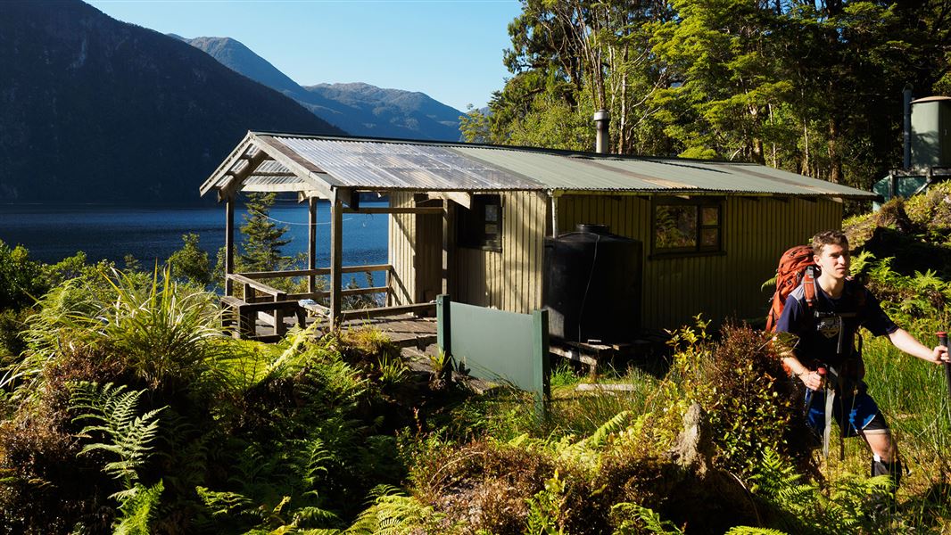
This is a standard 12-bunk hut in western Fiordland.
On the way here
Dusky Track · 8- 10 days
Loch Maree Hut to Supper Cove Hut, 6 hr - 8 hr
The track climbs around Loch Maree and then descends to the Bishop Burn. After heavy rain, low-lying parts of this section can flood. From the Bishop Burn to the Henry Burn the track is flat and follows that cut by West Coast miners in 1903. From the Henry Burn the track gets rougher as it sidles the slopes overlooking the Supper Cove. Supper Cove Hut (12 bunks) is visible on a small terrace just south of the Hilda Burn.
Source: DOC Te Papa Atawhai.
Know before you go
Requirements for taking a vessel into Fiordland Marine Area
The Fiordland Marine Pathway Plan protects the area from marine pests which can be carried in on boats. It sets out rules and standards that must be met by all vessels entering within one nautical mile of the landward boundary of the Fiordland Marine Area. If you take a vessel into Fiordland from outside the area you must: apply for a Clean Vessel Pass , and ensure that hulls are clean of marine pest species. The plan is an Environment Southland regulation. DOC has no authority below mean high tide except in marine reserves or concerning marine mammals – we do not enforce any fishing regulations. More information about the Fiordland Marine Pathway Plan . See the Fiordland by Sea: A guide to the Fiordland (Te Moana o Atawhenua) Marine Area - including maps, anchorages and fishing regulations.
Prevent the spread of didymo
Didymo is present in Lake Manapouri and the Waiau River, but is not currently in the pristine Spey River, Loch Maree, Seaforth River, Hauroko Burn or Lake Hauroko. Visitors should take precautions to prevent the spread of didymo when swimming/fishing/packrafting. Do not take water from these areas and avoid filling water bottles. More information about preventing the spread of freshwater pests in Fiordland National Park .
Source: DOC Te Papa Atawhai.
Fees and bookings
Before you go, buy Hut Tickets for each night's stay. Put these in the honesty box at the hut. Or buy a Backcountry Hut Pass that gives unlimited use at most Standard and Serviced huts for a 12 month period. Retailers that sell hut tickets and passes
Source: DOC Te Papa Atawhai.
Nearby stops

Loch Maree Hut
Standard • 12 bunks • Southland • 9.6 km
Loch Maree Hut is a standard 12-bunk hut located in western Fiordland.
Heating • Mattresses • Toilets - non-flush

Lake Roe Hut
Standard • 12 bunks • Southland • 15.5 km
Lake Roe Hut is a standard 12-bunk hut located in western Fiordland.
Heating • Mattresses • Toilets - non-flush

Kintail Hut
Standard • 12 bunks • Southland • 16.5 km
Kintail Hut is a standard 12-bunk hut located in western Fiordland.
Heating • Mattresses • Toilets - non-flush

Halfway Hut
Standard • 12 bunks • Southland • 16.7 km
Halfway Hut is a standard 12-bunk hut located in western Fiordland.
Heating • Mattresses • Toilets - non-flush

Hauroko Burn Hut
Standard • 10 bunks • Southland • 21.2 km
Hauroko Burn Hut is a standard 10-bunk hut located in western Fiordland.
Heating • Mattresses • Toilets - non-flush
Contact
Te Rua-o-te-moko/Fiordland National Park Visitor Centre
1 Lakefront Drive, Te Anau 9600
Regional DOC service centre.
Notes from people who have been
No notes yet. If you have been, say what you found.
Something missing or out of date?
Closed, moved, wrong facts, or something we have missed? Travellers keep the Road Guide up to date. Tell us what you found at contribute@parkup.nz and we will check it and add it.
Ask us to take this down
A person reads every request. We do not remove a place until we have checked it.
Sources
- DOC Huts · CC BY 4.0Data sourced from the Department of Conservation (DOC), New Zealand.
- OpenStreetMap Huts · ODbL (Open Database License)Contains information from OpenStreetMap, made available under the ODbL.
- DOC Huts (API) · CC BY 4.0Crown Copyright: Department of Conservation Te Papa Atawhai. Data sourced from the DOC Developer Portal (api.doc.govt.nz).