Rakaia Gorge Walkway
WalkCanterburyOpen
- Grade
- Easy
- Walking time
- 4 hr
- Distance
- 10.4 km
- Route
- Return
- Dogs
- No dogs
Getting there
We have not checked a road end or car park for this place yet, so we do not give driving directions to it. Check how to get there before you go. Some routes cross private land and need the landowner's permission.
How to get there, on doc.govt.nzThe track starts off State Highway 72 Inland Scenic Route on the northern edge of the Rakaia River, upstream of the Rakaia Gorge Bridge, mid-Canterbury. It is 75 km from Christchurch 75kms and 11 km from Methven – 10 mins drive.
Source: DOC Te Papa Atawhai.
Map
Map data © OpenStreetMap contributors. Topo map: LINZ, CC BY 4.0. 43.50464° S, 171.63909° E
About this place
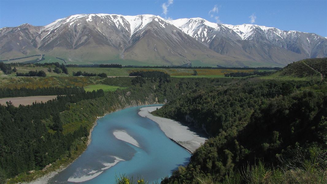
This walkway offers several geological and historic features as it traverses the edge of the Rakaia Gorge.
The route
The walkway passes through several forest and shrub communities before climbing the gorse-lined historic ferryman's track. Continue along one of several glacial and river-carved terraces to a good lookout point. This will take about 45 minutes. The walkway follows the rim of the gorge through spectacular geological areas, showing lava flows of rhyolite, pitchstone and andesite. It then descends into a gully under a canopy of montane forest and shrub, to the site of the Snowdon coal mines. The entrances to several coal mine tunnels can be seen here, and the remains of equipment used for extraction. The track then climbs out of the creek to a sign-posted junction. The walkway forms a loop from this point, with the right-hand track climbing across tussock-covered terraces directly to the lookout point. The track then passes through the bush to loop back to the junction. A side track off the loop descends to the river. This boat landing track is around 121 metres long.
Private land
This walkway goes over private farmland. Keep to the track, and do not disturb stock. Dogs or horses not allowed.
Source: DOC Te Papa Atawhai.
Nearby stops
Rakaia Gorge Camping Ground
Canterbury • 2.1 km
Rakaia Gorge Camping Ground is a campsite located in the Canterbury region. It provides a place to stay for visitors exploring the area.
Methven Camping Ground
Canterbury • 13.9 km
Methven Camping Ground is a campsite located in the Canterbury region of New Zealand. The provided data does not include specific details regarding available…
Cutty Grass Hut
Canterbury • 14.4 km
Kowhai Flat
Canterbury • 14.8 km

Tribulation Hut
Basic/bivvies • 6 bunks • Canterbury • 15.5 km
Tribulation Hut is a basic six-bunk hut located in Hakatere Conservation Park in Canterbury.
Mattresses • Toilets - non-flush • Water from stream
Walks nearby
Notes from people who have been
No notes yet. If you have been, say what you found.
Something missing or out of date?
Closed, moved, wrong facts, or something we have missed? Travellers keep the Road Guide up to date. Tell us what you found at contribute@parkup.nz and we will check it and add it.
Ask us to take this down
A person reads every request. We do not remove a place until we have checked it.
Sources
- DOC Tracks & Trails · CC BY 4.0Data sourced from the Department of Conservation (DOC), New Zealand.
- DOC Tracks (API) · CC BY 4.0Crown Copyright: Department of Conservation Te Papa Atawhai. Data sourced from the DOC Developer Portal (api.doc.govt.nz).