Pukawa Bay walks
WalkWaikato
- Grade
- Easy
- Walking time
- 1 hr 20 min
- Distance
- 1.2 or 1.4 km
- Dogs
- On a lead
Getting there
We have not checked a road end or car park for this place yet, so we do not give driving directions to it. Check how to get there before you go. Some routes cross private land and need the landowner's permission.
How to get there, on doc.govt.nzPukawa village is a 15 minute drive west of Tūrangi, signposted to the right off SH41. Public parking and toilets are available on the waterfront reserve.
Source: DOC Te Papa Atawhai.
Map
Map data © OpenStreetMap contributors. Topo map: LINZ, CC BY 4.0. 38.91037° S, 175.75367° E
About this place
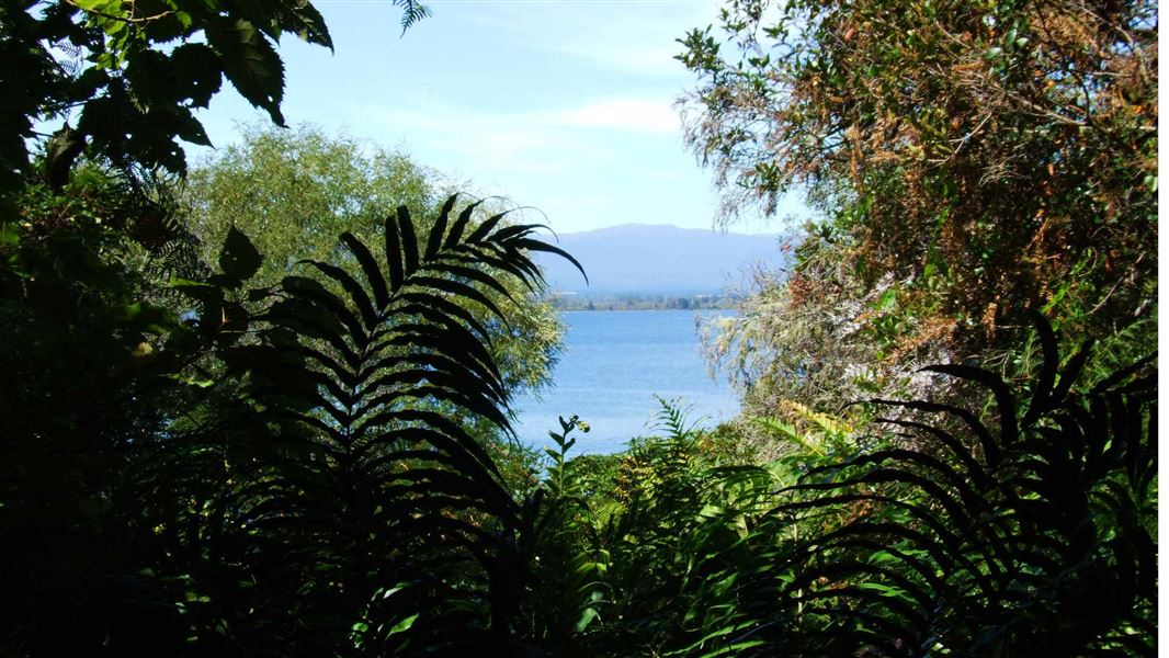
Walk through ancient forest, experience spectacular lake vistas and enjoy constant birdsong on a variety of walks on the southwestern shores of Lake Taupō.
The route
Pukawa to Omori
Time: 1 hr 20 min one way
1.4 km Begins at the end of Kaiuru Avenue in Pukawa village. The track wanders through the bush along the edge of Lake Taupō on an easy gradient. Bellbird and tūī are often seen in the trees above, and from time to time glimpses of nearby Lake Taupō. The track emerges at Omori Reserve on the edge of the lake where there is a picnic area, toilet and shingle beach. The reserve is notable for the kōwhai trees which create a splash of bright yellow when flowering. Aluminium bands have been placed around some kohuhu trees to prevent possums from climbing up to eat the palatable native mistletoe. The track continues on over the Omori Stream where in winter spawning trout may be seen. It's another 10 minutes to the end of the track at the Omori boat ramp. Popular with dog owners, be sure to pay attention to the local signs regarding dogs on council land around the lake.
Pukawa Bush Walk
Time: 45 min loop
1.2 km Begins on Hauraki Terrace, off Pukawa Road. The track entrance is just past Rereao Lane. The track is usually walked in an anti-clockwise direction. It climbs up through Pukawa Bush above the village on a well graded route. A short way up there is a lookout with views over the village and lake. The lush podocarp forest contains large rimu, mataī and tōtara trees. Birdlife is a feature of this area and in particular bellbird and tūī which frequent this part of the bush. The bush gradually changes to a rewarewa/kamahi forest and near the top opens out to a magnificent view of Lake Taupō and the surrounding countryside. Descending again, the last part of the track follows the route of the old Pukawa Road. The track ends on Rereao Lane, which you can follow back to your starting point.
Upper Pukawa Walk
This is a safe alternative to walking down the main Pukawa Road into the village. The track starts off at the top of Hauraki Terrace, then goes onto Rereao Lane - follow Taupō District Council signs on to the water tank road. At the top, veer to your left and follow the track through the bush to the top of the Pukawa Road and SH41.
Using Rereao Lane
Rereao Lane, which is used when walking the Pukawa Bush Walk and the Upper Pukawa Walk, is private property. Its use by walkers is at the discretion of the owners. Walkers must follow direction signs back down to Hauraki Terrace, respect the privacy of the owners and keep dogs on a leash at all time.
Source: DOC Te Papa Atawhai.
Nearby stops
Turangi Kiwi Holiday Park
Waikato • 10 km
Tongariro Junction Accommodation
Waikato • 10.1 km
Turangi NZMCA Park
Waikato • 10.2 km
Motuoapa Bay Holiday Park
Waikato • 10.4 km
Motuoapa Bay Holiday Park is a campsite located in the Waikato region. The provided records do not include specific details about its facilities or amenities.
Cross X Roads
Manawatū-Whanganui • 19.2 km
Walks nearby
Notes from people who have been
No notes yet. If you have been, say what you found.
Something missing or out of date?
Closed, moved, wrong facts, or something we have missed? Travellers keep the Road Guide up to date. Tell us what you found at contribute@parkup.nz and we will check it and add it.
Ask us to take this down
A person reads every request. We do not remove a place until we have checked it.
Sources
- DOC Tracks (API) · CC BY 4.0Crown Copyright: Department of Conservation Te Papa Atawhai. Data sourced from the DOC Developer Portal (api.doc.govt.nz).