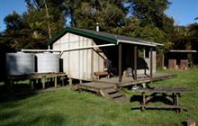
Pouri Hut
HutWhanganui National Park, Manawatū-Whanganui
Current advisories
Pouri Hut destroyed by fire
29 March 2026
Pouri Hut has been destroyed by a fire. If you are hiking the Matemateāonga Track or hunting in the area, you will need to bring alternative shelter (a tent or bivvy) and your own water supply. This is a long term alert. First published on 12 December 2025. Last reviewed on 30 March 2026.
Source: DOC Te Papa Atawhai alerts.
- Booking
- Not bookable
- Heating
- Yes
- Drinking water
- Boil first
- Toilet
- Non-flush
Getting there
We have not checked a road end or car park for this place yet, so we do not give driving directions to it. Check how to get there before you go. Some routes cross private land and need the landowner's permission.
How to get there, on doc.govt.nzMap and tracks
Track lines: DOC Te Papa Atawhai. Map data © OpenStreetMap contributors. Topo map: LINZ, CC BY 4.0. 39.33741° S, 174.85126° E
On the way here
Matemateāonga Track · 3 - 5 days
Omaru Hut to Pouri Hut
Time: 5 hr
13.3 km The track continues along the top of the Matemateāonga Range, initially through dense bush on the south western side of the range and then crossing to the northern flank. On a clear day there are occasional glimpses of the volcanoes of Tongariro National Park. About 3 hours 30 minutes from Omaru Hut, a signposted track branches off the main track to the summit of Whakaihuwaka Maunga (732 m).T his side trip of 1 hours 30 minutes return offers a sweeping view of three national parks – Whanganui, Te Papa-Kura-o-Taranaki/Egmont and Tongariro. Back on the main track, Humphries’ Clearing is a further 30 minute walk. Pouri Hut is one hour further along the track.
Pouri Hut to Ngapurua Hut
Time: 3 hr 15 min
10.4 km The track continues to be an easy walk. It stays on the gentle crest of the range.
Source: DOC Te Papa Atawhai.
Trip options
Walking times come from DOC track descriptions, added up leg by leg from car-accessible trailheads. Nights and return times are ParkUp estimates, allowing about 8 hours of walking a day.
2 options · 1 night
Kohi Saddle
Walking in
6 hr 30 min (via Omaru Hut)
Walking out
6 hr 30 min to Kohi Saddle (via Omaru Hut)
Walking in
6 hr 30 min (via Omaru Hut)
Walking out
7 hr 30 min to Omaru Hut (via Puketotara Hut)
Source: DOC Te Papa Atawhai track descriptions.
Nearby stops

Ngapurua Hut
Serviced • 10 bunks • Manawatū-Whanganui • 6.2 km
Ngapurua Hut is a serviced 10 bunk hut located in the Manawatu-Whanganui region.
Heating • Mattresses • Toilets - non-flush

Omaru Hut
Serviced • 8 bunks • Manawatū-Whanganui • 8.6 km
Omaru Hut is a serviced eight-bunk hut located in the Manawatu-Whanganui region.
Heating • Mattresses • Toilets - non-flush

Puketotara Hut
Serviced • 8 bunks • Manawatū-Whanganui • 10.9 km
Puketotara Hut is a serviced eight-bunk hut located in the Manawatū-Whanganui region.
Heating • Mattresses • Toilets - non-flush
Whanganui River Top 10 Holiday Park
Manawatū-Whanganui • 65.3 km
Whanganui River Top 10 Holiday Park is a campsite located in the Manawatū-Whanganui region. The provided records do not list specific facilities or amenities…
Mangapouri Hut
Bay of Plenty • 193.1 km
Heating • Mattresses • Toilets - non-flush
Notes from people who have been
No notes yet. If you have been, say what you found.
Something missing or out of date?
Closed, moved, wrong facts, or something we have missed? Travellers keep the Road Guide up to date. Tell us what you found at contribute@parkup.nz and we will check it and add it.
Ask us to take this down
A person reads every request. We do not remove a place until we have checked it.
Sources
- DOC Huts · CC BY 4.0Data sourced from the Department of Conservation (DOC), New Zealand.
- OpenStreetMap Huts · ODbL (Open Database License)Contains information from OpenStreetMap, made available under the ODbL.