Otoko Walkway
WalkGisborne
- Grade
- Easy
- Walking time
- 2 hr 30 min
- Distance
- 5 km
- Dogs
- No dogs
Getting there
We have not checked a road end or car park for this place yet, so we do not give driving directions to it. Check how to get there before you go. Some routes cross private land and need the landowner's permission.
How to get there, on doc.govt.nzThe Otoko Walkway is located off SH2 (Matawai Road) about 50 km north-west of Gisborne.
There are two entry/exit points (it is not a loop track). The first is located at the Mahaki railway tunnel 9 km east of the Otoko School and the other is opposite the Otoko Hall.
Although the walk can be walked in either direction it is recommended that you commence from the Mahaki Tunnel entrance. The uphill climb from this direction is barely noticeable due to the very easy gradient designed for the railway.
A car park, picnic tables and rubbish bins are located at the rest area at the entry adjacent to the old Mahaki Railway tunnel.
Source: DOC Te Papa Atawhai.
Map
Map data © OpenStreetMap contributors. Topo map: LINZ, CC BY 4.0. 38.46870° S, 177.70005° E
About this place
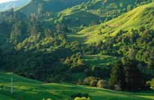
The Otoko Walkway is 50 km north-west of Gisborne. It traverses 5 km of the old Gisborne/Moutohora railway line. This track is not maintained.
The route
The walk commences at the left of a highway rest area and descends a set of steps to the tunnel entrance (walkers are not advised to enter the tunnel as the old concrete structure is now in an unsound condition). From this point the walk follows the clearly visible railway formation across open farm land for 2 km before crossing the Waihuka river alongside the concrete piers of an old railway bridge. The walk from here continues through the hill cuttings and benchings made with pick and shovel by the railway workers some 80 years ago. Wooden culverts, large concrete sumps, fish plates and spikes can be seen along the walk. After passing through the light bush on the edge of the Otoko Scenic Reserve, where spectacular yellow-flowering kowhai can be seen in the spring, the walkway leaves the railway formation. The tracks turns left down a farm vehicle track, follows the Waihuka river for a short distance and finishes at the State Highway opposite the Otoko Hall. Before making the turn down the farm track a short walk along the railway line offers views of a small picturesque waterfall set among native bush.
Source: DOC Te Papa Atawhai.
Notes from people who have been
No notes yet. If you have been, say what you found.
Something missing or out of date?
Closed, moved, wrong facts, or something we have missed? Travellers keep the Road Guide up to date. Tell us what you found at contribute@parkup.nz and we will check it and add it.
Ask us to take this down
A person reads every request. We do not remove a place until we have checked it.
Sources
- DOC Tracks (API) · CC BY 4.0Crown Copyright: Department of Conservation Te Papa Atawhai. Data sourced from the DOC Developer Portal (api.doc.govt.nz).